National Register of Historic Places listings in Williamsburg, Virginia
This is a list of the National Register of Historic Places listings in Williamsburg, Virginia.
Location of Williamsburg in Virginia
This is intended to be a complete list of the properties and districts on the National Register of Historic Places in the independent city of Williamsburg, Virginia, United States. The locations of National Register properties and districts for which the latitude and longitude coordinates are included below, may be seen in an online map.[1]
There are 12 properties and districts listed on the National Register in the city, including 6 National Historic Landmarks.
- This National Park Service list is complete through NPS recent listings posted June 26, 2020.[2]
Current listings
| [3] | Name on the Register[4] | Image | Date listed[5] | Location | Description |
|---|---|---|---|---|---|
| 1 | Bruton Parish Church | 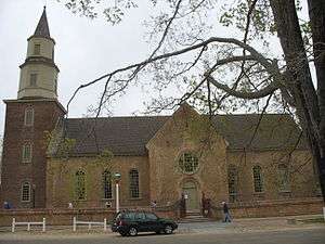 Bruton Parish Church |
May 10, 1970 (#70000861) |
Duke of Gloucester St. 37°16′17″N 76°42′09″W |
|
| 2 | Chandler Court and Pollard Park Historic District | 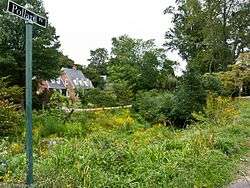 Chandler Court and Pollard Park Historic District |
October 3, 1996 (#96001075) |
Roughly bounded by Jamestown Rd., Griffin Ave., Pollard Park, and the College of William and Mary maintenance yard 37°16′06″N 76°42′37″W |
|
| 3 | College Landing | 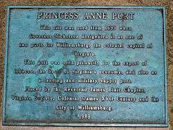 College Landing |
July 12, 1978 (#78003188) |
Confluence of College and Paper Mill Creeks[6] 37°15′09″N 76°42′36″W |
Site of Williamsburg's main port in the 18th century |
| 4 | First Baptist Church | 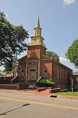 First Baptist Church |
June 5, 2017 (#100001050) |
727 Scotland St. 37°16′27″N 76°42′40″W |
|
| 5 | Merchants Square and Resort Historic District | 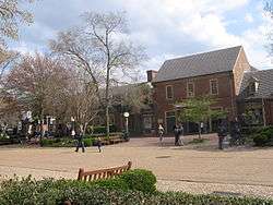 Merchants Square and Resort Historic District |
May 3, 2006 (#06000365) |
Boundary St., Duke of Gloucester St., S. England St., Francis St., Henry St., and Prince George St. 37°16′15″N 76°42′24″W |
|
| 6 | Peyton Randolph House | 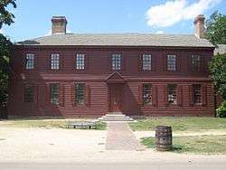 Peyton Randolph House |
April 15, 1970 (#70000863) |
Corner of Nicholson and N. England Sts. 37°16′21″N 76°42′00″W |
|
| 7 | James Semple House | .jpg) James Semple House |
April 15, 1970 (#70000864) |
Southern side of Frances St. between Blair and Walker Sts. 37°16′14″N 76°41′34″W |
|
| 8 | Matthew Whaley School | Matthew Whaley School |
August 13, 2004 (#04000857) |
301 Scotland St. 37°16′26″N 76°42′15″W |
|
| 9 | Williamsburg Historic District | 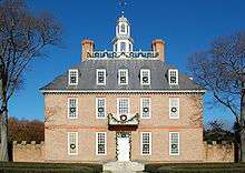 Williamsburg Historic District |
October 15, 1966 (#66000925) |
Bounded by Francis, Waller, Nicholson, N. England, Lafayette, and Nassau Sts. 37°16′27″N 76°43′20″W |
|
| 10 | Williamsburg Inn |  Williamsburg Inn |
June 4, 1997 (#97000480) |
136 E. Francis St. 37°16′08″N 76°41′51″W |
|
| 11 | Wren Building, College of William and Mary | 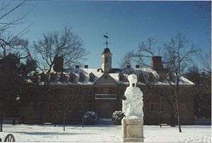 Wren Building, College of William and Mary |
October 15, 1966 (#66000929) |
College of William and Mary campus 37°16′15″N 76°42′32″W |
|
| 12 | Wythe House | 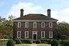 Wythe House |
April 15, 1970 (#70000866) |
Western side of the Palace Green 37°16′19″N 76°42′09″W |
See also
| Wikimedia Commons has media related to National Register of Historic Places in Williamsburg, Virginia. |
References
- The latitude and longitude information provided in this table was derived originally from the National Register Information System, which has been found to be fairly accurate for about 99% of listings. Some locations in this table may have been corrected to current GPS standards.
- "National Register of Historic Places: Weekly List Actions". National Park Service, United States Department of the Interior. Retrieved on June 26, 2020.
- Numbers represent an ordering by significant words. Various colorings, defined here, differentiate National Historic Landmarks and historic districts from other NRHP buildings, structures, sites or objects.
- "National Register Information System". National Register of Historic Places. National Park Service. April 24, 2008.
- The eight-digit number below each date is the number assigned to each location in the National Register Information System database, which can be viewed by clicking the number.
- Hudgins, Carter. National Register of Historic Places Inventory/Nomination: College Landing. National Park Service, 1976-12-10, 2.

This article is issued from Wikipedia. The text is licensed under Creative Commons - Attribution - Sharealike. Additional terms may apply for the media files.