National Register of Historic Places listings in Pulaski County, Virginia
This is a list of the National Register of Historic Places listings in Pulaski County, Virginia.
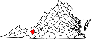
Location of Pulaski County in Virginia
This is intended to be a complete list of the properties and districts on the National Register of Historic Places in Pulaski County, Virginia, United States. The locations of National Register properties and districts for which the latitude and longitude coordinates are included below, may be seen in an online map.[1]
There are 21 properties and districts listed on the National Register in the county. Another property was once listed but has been removed.
- This National Park Service list is complete through NPS recent listings posted June 19, 2020.[2]
Current listings
| [3] | Name on the Register[4] | Image | Date listed[5] | Location | City or town | Description |
|---|---|---|---|---|---|---|
| 1 | Back Creek Farm | 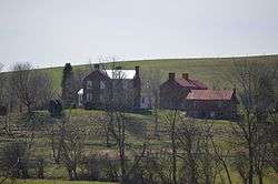 Back Creek Farm |
May 21, 1975 (#75002032) |
Northwest of Dublin off State Route 100 37°09′53″N 80°42′30″W |
Dublin | |
| 2 | Belle-Hampton |  Belle-Hampton |
November 13, 1989 (#89001911) |
Highland Rd., 0.3 miles north of Neck Creek Rd. 37°10′41″N 80°39′38″W |
Dublin | |
| 3 | Calfee Athletic Field | 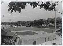 Calfee Athletic Field |
November 22, 2000 (#00001432) |
Washington and Pierce Aves., SE. 37°02′22″N 80°46′33″W |
Pulaski | |
| 4 | Dalton Theatre Building | 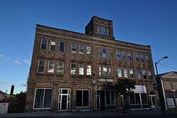 Dalton Theatre Building |
May 7, 1979 (#79003074) |
Washington Ave. 37°02′49″N 80°46′47″W |
Pulaski | |
| 5 | Draper Historic District | February 21, 2020 (#100004991) |
Greenbriar Rd./Old Baltimore Rd. and adjacent 37°00′12″N 80°44′43″W |
Draper | ||
| 6 | Dublin Historic District | Dublin Historic District |
October 15, 1992 (#92001369) |
Roughly Giles Ave. from Long to Main Sts., Church St. from Giles to Linkous Ave., and E. Main from Giles to Ziegler St. 37°06′29″N 80°41′16″W |
Dublin | |
| 7 | Fairview District Home | 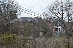 Fairview District Home |
August 29, 1997 (#97001073) |
Western side of Cougar Trail Rd. 37°05′43″N 80°43′10″W |
Dublin | |
| 8 | John Hoge House |  John Hoge House |
August 25, 1988 (#88001320) |
Northwestern side of Neck Creek Rd. 37°10′40″N 80°37′44″W |
Belspring | |
| 9 | Haven B. Howe House | _(2).jpg) Haven B. Howe House |
April 15, 2008 (#08000321) |
4400 State Park Rd. 37°03′26″N 80°37′13″W |
Dublin | |
| 10 | Ingles Ferry | 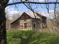 Ingles Ferry |
November 25, 1969 (#69000275) |
Wilderness Rd. 37°06′05″N 80°35′29″W |
Radford | |
| 11 | New Dublin Presbyterian Church | New Dublin Presbyterian Church |
November 26, 2004 (#04001272) |
New Dublin Church Rd. 37°07′23″N 80°41′17″W |
Dublin | |
| 12 | Newbern Historic District | 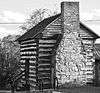 Newbern Historic District |
June 4, 1979 (#79003073) |
Newbern Rd. 37°04′24″N 80°41′30″W |
Newbern | |
| 13 | Pulaski County Courthouse |  Pulaski County Courthouse |
July 8, 1982 (#82004582) |
Main St. 37°02′54″N 80°46′53″W |
Pulaski | |
| 14 | Pulaski Historic Commercial District | 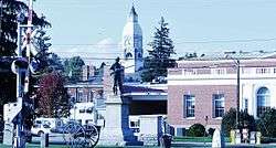 Pulaski Historic Commercial District |
March 13, 1986 (#86000405) |
Roughly bounded by 3rd St., Madison Ave., the Norfolk Southern railroad tracks, and Randolph Ave. 37°02′51″N 80°46′52″W |
Pulaski | |
| 15 | Pulaski Historic Residential District | 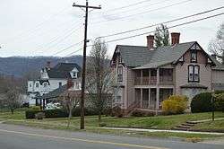 Pulaski Historic Residential District |
August 11, 1988 (#88001216) |
Roughly bounded by 11th St., Prospect, Madison, and Washington Aves., 2nd St., and Henry Ave. 37°03′10″N 80°46′56″W |
Pulaski | |
| 16 | Pulaski South Historic Residential and Industrial District | 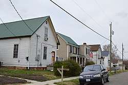 Pulaski South Historic Residential and Industrial District |
October 29, 1991 (#91001580) |
Roughly bounded by Bertha St., Commerce St., Pierce Ave., 5th St., and Pulaski St. 37°02′31″N 80°47′06″W |
Pulaski | |
| 17 | Rockwood | 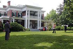 Rockwood |
May 26, 2005 (#05000473) |
5189 Rockwood Dr. 37°06′47″N 80°42′09″W |
Dublin | |
| 18 | St. Albans Hospital | January 24, 2020 (#100004653) |
6248 University Park Dr. 37°08′27″N 80°34′41″W |
Fairlawn | ||
| 19 | Snowville Christian Church |  Snowville Christian Church |
April 2, 1987 (#87000563) |
Lead Mine Rd. 37°02′04″N 80°33′36″W |
Snowville | |
| 20 | Snowville Historic District | Snowville Historic District |
January 7, 1987 (#86003650) |
Lead Mine Rd. 37°02′06″N 80°33′35″W |
Snowville | |
| 21 | Spring Dale | 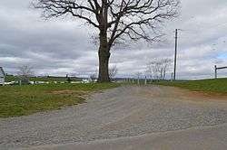 Spring Dale |
October 23, 2003 (#03001087) |
Off Ruebush Rd., north of Dublin[6] 37°09′11″N 80°39′59″W |
Dublin |
Former listing
| [3] | Name on the Register | Image | Date listed | Date removed | Location | City or town | Summary |
|---|---|---|---|---|---|---|---|
| 1 | Nathaniel Burwell Harvey House | February 13, 1986 (#86000250) | March 19, 2001 | Off VA 812 |
Dublin | Demolished |
See also
| Wikimedia Commons has media related to National Register of Historic Places in Pulaski County, Virginia. |
References
- The latitude and longitude information provided in this table was derived originally from the National Register Information System, which has been found to be fairly accurate for about 99% of listings. Some locations in this table may have been corrected to current GPS standards.
- "National Register of Historic Places: Weekly List Actions". National Park Service, United States Department of the Interior. Retrieved on June 19, 2020.
- Numbers represent an ordering by significant words. Various colorings, defined here, differentiate National Historic Landmarks and historic districts from other NRHP buildings, structures, sites or objects.
- "National Register Information System". National Register of Historic Places. National Park Service. April 24, 2008.
- The eight-digit number below each date is the number assigned to each location in the National Register Information System database, which can be viewed by clicking the number.
- Pulice, Michael J. National Register of Historic Places Inventory/Nomination: Spring Dale. National Park Service, 2003-03, 31.

Municipalities and communities of Pulaski County, Virginia, United States | ||
|---|---|---|
| Towns | Map of Virginia highlighting Pulaski County | |
| CDPs | ||
| Unincorporated communities | ||
This article is issued from Wikipedia. The text is licensed under Creative Commons - Attribution - Sharealike. Additional terms may apply for the media files.