Herndon, Virginia
Herndon is a town in Fairfax County, Virginia, in the Washington, D.C. metropolitan area of the United States. The population was 23,292 at the 2010 census, which makes it the largest of three incorporated towns in the county.[5]
Herndon, Virginia | |
|---|---|
| Town of Herndon | |
_at_Station_Street_and_Spring_Street_in_Herndon%2C_Fairfax_County%2C_Virginia.jpg) Central Herndon | |
 Seal | |
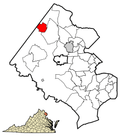 Location within Fairfax county | |
 Herndon, Virginia Location within Fairfax county  Herndon, Virginia Herndon, Virginia (Virginia)  Herndon, Virginia Herndon, Virginia (the United States) | |
| Coordinates: 38°58′17″N 77°23′19″W | |
| Country | |
| State | |
| County | |
| Government | |
| • Type | Town |
| • Mayor | Lisa Merkel |
| Area | |
| • Total | 4.29 sq mi (11.12 km2) |
| • Land | 4.29 sq mi (11.10 km2) |
| • Water | 0.01 sq mi (0.02 km2) |
| Elevation | 361 ft (110 m) |
| Population (2010) | |
| • Total | 23,292 |
| • Estimate (2019)[2] | 24,601 |
| • Density | 5,725.45/sq mi (2,210.73/km2) |
| Time zone | UTC−5 (Eastern (EST)) |
| • Summer (DST) | UTC−4 (EDT) |
| ZIP code | 20170 |
| Area code(s) | 703, 571 |
| FIPS code | 51-36648[3] |
| GNIS feature ID | 1495675[4] |
| Website | http://www.herndon-va.gov |
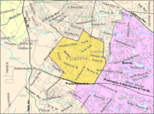
The actual dimensions of the town of Herndon are fairly small. However, the United States Post Office treats nearby unincorporated communities in northwestern Fairfax County as part of a Greater Herndon region, including Dranesville, Floris, Franklin Farm, McNair, and Oak Hill. The information below pertains generally only to the town of Herndon itself. See the associated articles for locations outside the town limits.
History
Herndon was named for Commander William Lewis Herndon, American naval explorer and author of Exploration of the Valley of the Amazon. Commander Herndon captained the ill-fated steamer SS Central America, going down with his ship while helping to save over 150 of its passengers and crew. The settlement was named Herndon in 1858. In the 1870s, many Northern soldiers and their families came to settle in the area, taking advantage of moderate climate and low land prices.[6]
Originally part of the rural surroundings of the Washington, D.C. area, the town of Herndon developed into a hub of dairy farming and vacationing for area residents, aided by its presence along the Alexandria, Loudoun and Hampshire Railroad (later to become the Washington and Old Dominion (W&OD) Railroad).[6] When the railroad was converted into a hike-and-bike trail, Herndon capitalized on history and small-town feel (in a major metropolitan region) by converting its train station into a museum and visitors center and by relocating a Norfolk Southern Railway caboose to a nearby site and repainting it in W&OD livery.[7]
The caboose was originally acquired in 1989 by Herndon Historical Society member, George Moore, to whose memory the caboose was dedicated after his death in 2003.[8][7] Although the caboose itself never traveled through Herndon, it remains an iconic part of the downtown area that both locals and tourists visit daily.[7] The caboose and station offer a glimpse of the original downtown's historic charm, which residents are passionate about preserving.[7]
On January 14, 2004, the Town of Herndon commemorated its 125th anniversary.[9]
The town of Herndon was part of a nationally reported controversy involving illegal immigration beginning in 2005.[10] The controversy revolved around a day labor center called the Herndon Official Worker Center (HOW Center), operated by Reston Interfaith's Project Hope and Harmony under a grant from surrounding Fairfax County.[11] The HOW Center was created on March 23, 2006 in response to daily gatherings of Hispanic workers at a local 7-Eleven store.[10][12]
The 2006 election for Mayor and Town Council revolved mainly around the issue, and resulted in unseating the pro-center Mayor and two councilmembers.[13] The center closed after less than two years of operation, in September 2007.
The Herndon Historic District is listed on the National Register of Historic Places.
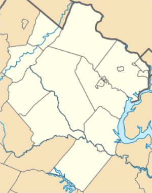
Geography
Herndon is located at 38°58′17″N 77°23′19″W (38.971478, −77.388675).[14]
According to the United States Census Bureau, the town has a total area of 4.2 square miles (10.9 km²), all of it land. Just over two acres of land in the town are technically in Loudoun County.[15]
Demographics
| Historical population | |||
|---|---|---|---|
| Census | Pop. | %± | |
| 1880 | 422 | — | |
| 1890 | 795 | 88.4% | |
| 1900 | 692 | −13.0% | |
| 1910 | 802 | 15.9% | |
| 1920 | 953 | 18.8% | |
| 1930 | 887 | −6.9% | |
| 1940 | 1,046 | 17.9% | |
| 1950 | 1,461 | 39.7% | |
| 1960 | 1,960 | 34.2% | |
| 1970 | 4,301 | 119.4% | |
| 1980 | 11,449 | 166.2% | |
| 1990 | 16,139 | 41.0% | |
| 2000 | 21,655 | 34.2% | |
| 2010 | 23,292 | 7.6% | |
| Est. 2019 | 24,601 | [2] | 5.6% |
| U.S. Decennial Census | |||
As of the census[3] of 2010, there were 23,292 people, 7,472 households, and 5,357 families residing in the town. The population density was 5,129.9 people per square mile (1,981.3/km²). There were 7,190 housing units at an average density of 1,703.3 per square mile (657.8/km²). The racial makeup of the town was 50.7% White, 9.5% Black, 0.7% Native American, 17.9% Asian (8.5% Indian, 1.6% Vietnamese, 1.5% Chinese, 1.2% Filipino, 0.7% Korean, 0.1% Japanese, 4.2% Other Asian), 0.0% Pacific Islander, 16.0% from other races, and 5.2% from two or more races. Hispanic or Latino of any race were 33.6% of the population.
There were 6,962 households, of which 41.7% had children under the age of 18 living with them, 56.8% were married couples living together, 9.4% had a female householder with no husband present, and 28.6% were non-families. 20.6% of all households were made up of individuals and 2.8% had someone living alone who was 65 years of age or older. The average household size was 3.11 and the average family size was 3.54.
In the town, the population was spread out with 27.1% under the age of 18, 10.2% from 18 to 24, 38.3% from 25 to 44, 20.5% from 45 to 64, and 3.9% who were 65 years of age or older. The median age was 32 years. For every 100 females, there were 111.4 males. For every 100 females age 18 and over, there were 111.0 males.
The median income for a household in the town was $72,912, and the median income for a family was $79,140 (these figures had risen to $92,947 and $108,446 respectively as of a 2007 estimate[16]). Males had a median income of $44,197 versus $35,548 for females. The per capita income for the town was $26,941. About 4.7% of families and 8.1% of the population were below the poverty line, including 9.1% of those under age 18 and 5.5% of those age 65 or over.
Economy
Herndon is part of the Dulles Technology Corridor, which Fortune magazine named the "Netplex" because of the presence of the headquarters of such companies as AOL, XO Communications, K12 (company), Verizon Business (formerly MCI, formerly WorldCom, originally UUNET), and Network Solutions, which began as the INTERNIC – the registry where every domain name was once administered.
Some of those companies are within Herndon. Others have Herndon mailing addresses, but are located in unincorporated Fairfax or Loudoun counties; for example, south of the Dulles Toll Road. These include Deltek and K12.
Top employers
According to the Town's 2017 Comprehensive Annual Financial Report, the principal employers in the Town are:[18]
| # | Employer | # of Employees |
|---|---|---|
| 1 | Amazon Corporation LLC | Over 500 |
| 2 | Booz Allen Hamilton, Inc. | Over 500 |
| 3 | Fannie Mae | Over 500 |
| 4 | Harris Corporation | Over 500 |
| 5 | Northwest Federal Union | 249–499 |
| 6 | Navy Federal Credit Union | 249-499 |
| 7 | Town of Herndon | 249-499 |
| 8 | Airline Pilots Association | 100–250 |
| 9 | Medical Transportation Service | 100–250 |
| 10 | Boeing Corporation | 100–250 |
Prior year's CAFRS are also available.[19]
Government
The town is organized as an incorporated town by the Commonwealth of Virginia,[20][21] and is governed by an elected Mayor and Town Council[22] who serve on a part-time basis. The current Mayor is Lisa C. Merkel, who was first elected to Council in 2010 and served as Vice Mayor until her election as Mayor in 2012. The Mayor chairs the Council and heads the executive branch of the town government. The Police Department, independent of the county police department, is headed by Colonel Maggie DeBoard. and consists of 56 sworn officers along with the assistance of the Herndon Police Citizen Support Team. The Herndon Police Department achieved national recognition on November 8, 1986 by becoming the 7th police agency in Virginia and the 42nd police agency in the United States to be accredited by the Commission on Accreditation for Law Enforcement Agencies.[23]
Attractions
Herndon boasts a wide variety of diversions and celebrations year round. Among the community events are:
| May | Friday Night Live! (free concerts May–August), Farmers' Market (May–October), Towne Square Singers, Big Truck Days, Public Works Forest and Meadow Wildflower Walk |
|---|---|
| June | Herndon Festival, held for four days |
| July | Fourth of July celebrations and fireworks |
| September | Labor Day Jazz Festival, Annual Motorcycle Poker Run (Fraternal Order of Police), Annual NatureFest Celebration, HerndonHalf Marathon, 12k, and 5k |
Herndon contains the Herndon Depot Museum, the site of "Mosby's Raid on Herndon Station", which was a Civil War skirmish that took place on St. Patrick's Day, 1863. Also within the town is The Herndon Centennial Golf Course, the Herndon ArtSpace (a community art gallery), community center with basketball and racquetball courts and multiple baseball fields, and an aquatic center. Adjacent to the community center is Bready Park, with indoor tennis courts. Additionally, every residence within the town borders is within a mile or less of a public park. Herndon is home to a professional live theatre, NextStop Theatre, which produces a variety of plays, musicals, concerts, and educational theatre programming each season.[24]
Nearby attractions include the Steven F. Udvar-Hazy Center of the National Air and Space Museum (which houses the Enola Gay B-29 Superfortress, a Concorde supersonic passenger airplane, an SR-71A Blackbird plane and the Space Shuttle Discovery), Frying Pan Farm Park, Sully Plantation, Reston Town Center, Mount Vernon, Wolf Trap National Park for the Performing Arts, Colvin Run Mill, Aldie Mill, Oatlands Plantation, Manassas National Battlefield Park and the Washington and Old Dominion Trail (which runs through the town).
Education
Primary and secondary schools
Herndon is within the Fairfax County Public Schools district.
Public schools serving students within the Herndon town limits are:[25][26][27]
- Clearview Elementary School
- Dranesville Elementary School
- Herndon Elementary School
- Hutchison Elementary School
- Herndon Middle School
- Herndon High School
Private school options include: Temple Baptist, St Joseph's Elementary and several Montessori schools.
Private schools south of Herndon, in nearby Floris:[28]
- King Abdullah Academy[29]
- Nysmith School (PK-8)[30]
Public libraries
Fairfax County Public Library operates the Herndon Fortnightly Library in Herndon.[31]
Transportation
_at_Crestview_Drive_in_Herndon%2C_Fairfax_County%2C_Virginia.jpg)
The primary highway serving Herndon is Virginia State Route 228 and its truck route. SR 228 heads directly through the center of town via Elden Street, Monroe Street, Park Avenue and Dranesville Road. SR 228 Truck diverges from Elden Street southwest of downtown on Herndon Parkway, following that road northwestward, northward and northeastward around central Herndon, finally reaching Dranesville Road north of downtown. At the south end of town, SR 228 meets Virginia State Route 267, a high speed, high-capacity toll road which provides access to Washington, D.C. (via Interstate 66) and Washington Dulles International Airport.
Climate
The climate in this area is characterized by hot, humid summers and generally mild to cool winters. According to the Köppen Climate Classification system, Herndon has a humid subtropical climate, abbreviated "Cfa" on climate maps.[32]
Notable people
- Jeremy Barlow, professional soccer player
- Neil Barlow, professional soccer player
- Jon Carman, former professional American football player
- Jerome Cornfield, statistician
- Albert Scott Crossfield, American naval officer and test pilot
- Jay A. DeLoach, American naval officer
- Ronnie Dove, pop and country musician
- Wesley L. Fox, USMC Colonel Retired, Medal of Honor recipient, and former Deputy Commandant Virginia Tech Corps of Cadets
- Romain Gall, professional soccer player
- Angie Goff, broadcast journalist
- Brandon Guyer, professional American baseball player
- Joe Snively, professional Washington Capitals ice hockey player
- Ferenc Nagy, former Prime Minister of Hungary
- Štefan Osuský, Slovak politician and diplomat
- Sean Parker, founder of Napster and former president of Facebook
- Scottie Reynolds, former Villanova Wildcats basketball player
- Thomas Davis Rust, Virginia Delegate and former Mayor of Herndon
- Brendan Shapiro, gym teacher and Survivor contestant
- Chris Smith, Congressman NJ District 4[33]
- Tasos Georgiou Vatikiotis, former professional footballer
Sister cities
Its sister city is Runnymede, Surrey, England, United Kingdom.[34]
See also
- Northern Virginia
- Reston, Virginia
- Washington Dulles International Airport
- Washington Metropolitan Area
References
- "2018 U.S. Gazetteer Files". United States Census Bureau. Retrieved Feb 16, 2020.
- "Population and Housing Unit Estimates". Retrieved May 21, 2020.
- "U.S. Census website". United States Census Bureau. Retrieved 2008-01-31.
- "US Board on Geographic Names". United States Geological Survey. 2007-10-25. Retrieved 2008-01-31.
- "Virginia by Place – GCT-PH1. Population, Housing Units, Area, and Density: 2010". US Census Bureau. April 1, 2010. Archived from the original on January 2, 2012. Retrieved January 30, 2012.
- "Herndon History". Town of Herndon, Virginia. January 18, 2006. Archived from the original on September 26, 2006. Retrieved October 7, 2006.
- Munro, Charles V. (October 19, 2005). "A history of Herndon through the Washington & Old Dominion Trail". Herndon Connection. Alexandria, Virginia: Connectionnewspapers.com. Retrieved December 27, 2009.
- "The Herndon Historical Society". Herndon Historical Society. Retrieved 21 September 2016.
- "HOUSE JOINT RESOLUTION NO. 327". Virginia Legislative Assembly. January 29, 2004.
- Brush, Silla (October 24, 2005). "Local Labor Pains: America's immigration debate lands on Main Street". US News & World Report. Retrieved February 10, 2008.
- Project Hope and Harmony (archived 2006-09-07; 2006-12-29; 2007-04-15; 2007-06-11) Archived January 13, 2016, at the Wayback Machine
- Gilbert, Daniel (15 December 2005). "Day laborer center opens in Herndon". Potomac News. Media General.
- "'Minutemen' Open New Front in Fight Against Illegal Immigration: Citizen Group Targets Illegal Laborers Where They Work". ABC News. November 2, 2005. Retrieved February 10, 2008.
- "US Gazetteer files: 2010, 2000, and 1990". United States Census Bureau. 2011-02-12. Retrieved 2011-04-23.
- "'Sliver' of Herndon Now in Loudoun County". Herndon Patch. September 2, 2015. Retrieved April 25, 2017.
- "Herndon town, Virginia – Fact Sheet – American FactFinder". Factfinder.census.gov. Archived from the original on 2009-03-21. Retrieved 2012-05-14.
- http://www.cit.org/cit-complex/history/
- "Town of Herndon CAFR". Retrieved 2019-11-13.
- https://www.herndon-va.gov/departments/finance
- "Code of Ordinances – Town of Herndon, Virginia; Charter, Chapter 2, Powers". Town of Herndon. Retrieved October 7, 2006.
- "Code of Virginia, Title 15.2 – Counties, Cities and Towns, Chapter 11 – Powers of Cities and Towns". Commonwealth of Virginia. Retrieved October 7, 2006.
- "Code of Ordinances – Town of Herndon, Virginia; Charter, Chapter 3, Mayor and Council". Town of Herndon. Retrieved October 7, 2006.
- "Special News Release" (Microsoft Word) (Press release). Herndon Police Department. February 22, 2005. Retrieved October 7, 2006.
- http://www.nextstoptheatre.org
- "Schools and Centers Directory". Fairfax County Public Schools. Archived from the original on 27 May 2010. Retrieved 7 May 2010.
- "About Herndon >> Herndon Public Schools". Town of Herndon. January 18, 2006. Archived from the original on September 26, 2006. Retrieved January 19, 2008.
- "Coates Elementary School". Fairfax County Public Schools. June 22, 2009. Retrieved July 4, 2009.
- "2010 CENSUS - CENSUS BLOCK MAP: Floris CDP, VA" (Archive). U.S. Census Bureau. Retrieved on July 25, 2016.
- Overview." King Abdullah Academy. Retrieved on July 25, 2016. "2949 Education Drive, Off: 13818 McLearen Road, Herndon, VA 20171"
- "Contact Us." Nysmith School. Retrieved on July 25, 2016. "13625 EDS Drive Herndon, VA 20171"
- "Library Branches." Fairfax County Public Library. Retrieved on October 21, 2009.
- Climate Summary for Herndon, Virginia
- "SMITH, Christopher Henry - Biographical Information". Biographical Directory of the United States Congress. Retrieved 2019-11-30.
- "Runnymede's Town Twinning Association". Runnymede Borough Council. Archived from the original on February 12, 2006. Retrieved October 4, 2006.
External links
| Wikimedia Commons has media related to Herndon, Virginia. |
| Wikivoyage has a travel guide for Herndon. |
- Official website
- U.S. Census Bureau: American Fact-Finder: Herndon,
- ArtSpace Herndon
- Herndon Council for the Arts
- Elden Street Players
- List of Restaurants in Herndon (A wide variety, sorted by ethnicity and location)
- Wolf Trap National Park for the Performing Arts
- Udvar-Hazy Air and Space Museum (Smithsonian Annex)
- Friends of the W&OD Trail
- Herndon Historical Society
- May 2, 2006 election results
- Final Voyage of the SS Central America Klare, Normand – Historian The Final Voyage of the Central America. Exhaustive research documentation of the tragedy from actual accounts by the survivors of the Central America. A further indepth biography of William Lewis Herndon' s life and US naval career.
- Herndon and Gibbon, Lieutenants, United States Navy Klare, Normand – Historian Herndon and Gibbon. The First North American Explorers of the Amazon Valley. Lieutenant William Lewis Herndon's and Lieutenant Lardner Gibbon's expedition to map the Amazon river from its source to the Atlantic Ocean. Stories from their actual reports to Secretary of the Navy John P. Kennedy, President Millard Fillmore and the House of Representatives of the United States.
- Herndon, William Lewis; Lardner Gibbon (1854). Exploration of the valley of the Amazon. Washington: United States Navy.


| Authority control |
|
|---|