Madison, Virginia
Madison is a town in Madison County, Virginia, United States. The population was 229 at the 2010 census. It is the county seat of Madison County.[5]
Madison, Virginia | |
|---|---|
%2C_Madison%2C_Virginia.jpg) Madison County Courthouse (built 1829) | |
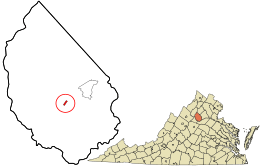 Location in Madison County and the state of Virginia. | |
| Coordinates: 38°22′51″N 78°15′29″W | |
| Country | United States |
| State | Virginia |
| County | Madison |
| Area | |
| • Total | 0.24 sq mi (0.61 km2) |
| • Land | 0.24 sq mi (0.61 km2) |
| • Water | 0.00 sq mi (0.00 km2) |
| Elevation | 604 ft (184 m) |
| Population (2010) | |
| • Total | 229 |
| • Estimate (2018)[2] | 243 |
| • Density | 1,029.66/sq mi (396.98/km2) |
| Time zone | UTC−5 (Eastern (EST)) |
| • Summer (DST) | UTC−4 (EDT) |
| ZIP codes | 22719, 22727 |
| Area code(s) | 540 |
| FIPS code | 51-48488[3] |
| GNIS feature ID | 1498511[4] |
| Website | www |
History
The Hebron Lutheran Church, The Homeplace, James City Historic District, Madison County Courthouse, Madison County Courthouse Historic District, and Woodbourne are listed on the National Register of Historic Places.[6]
Geography
According to the United States Census Bureau, the town has a total area of 0.2 square miles (0.6 km²), all of it land.
_just_north_of_Fairground_Road_(Virginia_State_Route_687)_in_Madison%2C_Madison_County%2C_Virginia.jpg)
Transportation
The main highways serving Madison are U.S. Route 29 Business and Virginia State Route 231. Through the entirety of their trip through the town, both highways follow Main Street. US 29 Bus is the old alignment of U.S. Route 29, which now bypasses the town just to the southeast. US 29 extends southwest towards Charlottesville and northeast towards Washington, D.C. SR 231 extends southeast towards Orange and northwest towards Sperryville.
Demographics
| Historical population | |||
|---|---|---|---|
| Census | Pop. | %± | |
| 1880 | 461 | — | |
| 1890 | 353 | −23.4% | |
| 1940 | 281 | — | |
| 1950 | 308 | 9.6% | |
| 1960 | 301 | −2.3% | |
| 1970 | 299 | −0.7% | |
| 1980 | 267 | −10.7% | |
| 1990 | 307 | 15.0% | |
| 2000 | 210 | −31.6% | |
| 2010 | 229 | 9.0% | |
| Est. 2018 | 243 | [2] | 6.1% |
| U.S. Decennial Census[7] | |||
At the 2000 census there were 210 people, 109 households, and 57 families living in the town. The population density was 961.4 people per square mile (368.6/km²). There were 115 housing units at an average density of 526.5 per square mile (201.8/km²). The racial makeup of the town was 71.90% White and 28.10% African American.[3] Of the 109 households 22.9% had children under the age of 18 living with them, 36.7% were married couples living together, 11.9% had a female householder with no husband present, and 47.7% were non-families. 44.0% of households were one person and 21.1% were one person aged 65 or older. The average household size was 1.93 and the average family size was 2.65.
The age distribution was 18.6% under the age of 18, 7.1% from 18 to 24, 25.2% from 25 to 44, 22.4% from 45 to 64, and 26.7% 65 or older. The median age was 45 years. For every 100 females, there were 89.2 males. For every 100 females age 18 and over, there were 76.3 males.
The median household income was $32,188 and the median family income was $43,750. Males had a median income of $34,500 versus $18,958 for females. The per capita income for the town was $21,445. About 4.5% of families and 8.1% of the population were below the poverty line, including 9.1% of those under the age of eighteen and 5.1% of those sixty five or over.
Notable people
- Peter Early, U.S. Representative from and Governor of Georgia
- Robert Mallory, U.S. Representative from Kentucky
References
- "2018 U.S. Gazetteer Files". United States Census Bureau. Retrieved Feb 16, 2020.
- "Population and Housing Unit Estimates". Retrieved June 4, 2019.
- "U.S. Census website". United States Census Bureau. Retrieved 2008-01-31.
- "US Board on Geographic Names". United States Geological Survey. 2007-10-25. Retrieved 2008-01-31.
- "Find a County". National Association of Counties. Retrieved 2011-06-07.
- "National Register Information System". National Register of Historic Places. National Park Service. July 9, 2010.
- "Census of Population and Housing". Census.gov. Retrieved June 4, 2015.
External links
Municipalities and communities of Madison County, Virginia, United States | ||
|---|---|---|
| Town | 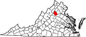 Map of Virginia highlighting Madison County | |
| CDPs | ||
| Unincorporated communities |
| |
| Authority control |
|
|---|