Cumberland County, Virginia
Cumberland County is a county located in the Commonwealth of Virginia, United States. As of the 2010 census, the population was 10,052.[1] Its county seat is Cumberland.[2]
Cumberland County | |
|---|---|
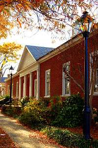 Cumberland County Courthouse | |
 Seal | |
 Location within the U.S. state of Virginia | |
 Virginia's location within the U.S. | |
| Coordinates: 37°31′N 78°14′W | |
| Country | |
| State | |
| Founded | 1749 |
| Named for | William Augustus, Duke of Cumberland |
| Seat | Cumberland |
| Largest town | Farmville |
| Area | |
| • Total | 300 sq mi (800 km2) |
| • Land | 297 sq mi (770 km2) |
| • Water | 2.3 sq mi (6 km2) 0.8% |
| Population (2010) | |
| • Total | 10,052 |
| • Estimate (2018) | 9,809 |
| • Density | 34/sq mi (13/km2) |
| Time zone | UTC−5 (Eastern) |
| • Summer (DST) | UTC−4 (EDT) |
| Congressional district | 5th |
| Website | cumberlandcounty .virginia.gov |
History
Cumberland County was established in 1749 from Goochland County. The county is named for William Augustus, Duke of Cumberland, second son of King George II of Great Britain. Cumberland County was also home to the Fleming family, which included Judge John Fleming and his son Judge William Fleming.
From 1749 until the eastern portion was detached to form Powhatan County in 1777, Mosby Tavern served as the county courthouse. The tavern subsequently became known as "Old Cumberland Courthouse." In 1778 the narrow triangular area bordering the southern bank of the James River was annexed from Buckingham County.
Geography
According to the U.S. Census Bureau, the county has a total area of 300 square miles (780 km2), of which 297 sq mi (770 km2) is land and 2.3 sq mi (6.0 km2) (0.8%) is water.[3]
Adjacent Counties
- Goochland County – northeast
- Powhatan County – east
- Amelia County – southeast
- Prince Edward County – south
- Buckingham County – west
- Fluvanna County – northwest
Demographics
This rural county suffered a long decline in population from 1880 to 1970, as the number of workers needed for agriculture was reduced through mechanization. Since then its population has grown, reaching a peak in 2010 nearly equal to its 19th-century high.
| Historical population | |||
|---|---|---|---|
| Census | Pop. | %± | |
| 1790 | 8,153 | — | |
| 1800 | 9,839 | 20.7% | |
| 1810 | 9,992 | 1.6% | |
| 1820 | 11,023 | 10.3% | |
| 1830 | 11,690 | 6.1% | |
| 1840 | 10,399 | −11.0% | |
| 1850 | 9,751 | −6.2% | |
| 1860 | 9,961 | 2.2% | |
| 1870 | 8,142 | −18.3% | |
| 1880 | 10,540 | 29.5% | |
| 1890 | 9,482 | −10.0% | |
| 1900 | 8,996 | −5.1% | |
| 1910 | 9,195 | 2.2% | |
| 1920 | 9,111 | −0.9% | |
| 1930 | 7,535 | −17.3% | |
| 1940 | 7,505 | −0.4% | |
| 1950 | 7,252 | −3.4% | |
| 1960 | 6,360 | −12.3% | |
| 1970 | 6,179 | −2.8% | |
| 1980 | 7,881 | 27.5% | |
| 1990 | 7,825 | −0.7% | |
| 2000 | 9,017 | 15.2% | |
| 2010 | 10,052 | 11.5% | |
| Est. 2018 | 9,809 | [4] | −2.4% |
| U.S. Decennial Census[5] 1790-1960[6] 1900-1990[7] 1990-2000[8] 2010-2012[1] | |||
As of the census[9] of 2000, there were 9,017 people, 3,528 households, and 2,487 families residing in the county. The population density was 30 people per square mile (12/km²). There were 4,085 housing units at an average density of 14 per square mile (5/km²). The racial makeup of the county was 60.37% White, 37.44% Black or African American, 0.18% Native American, 0.35% Asian, 0.59% from other races, and 1.06% from two or more races. 1.66% of the population were Hispanic or Latino of any race.
There were 3,528 households out of which 30.00% had children under the age of 18 living with them, 51.60% were married couples living together, 14.30% had a female householder with no husband present, and 29.50% were non-families. 24.80% of all households were made up of individuals and 10.70% had someone living alone who was 65 years of age or older. The average household size was 2.55 and the average family size was 3.03.
In the county, the population was spread out with 24.70% under the age of 18, 7.30% from 18 to 24, 28.00% from 25 to 44, 25.10% from 45 to 64, and 14.80% who were 65 years of age or older. The median age was 38 years. For every 100 females there were 91.00 males. For every 100 females age 18 and over, there were 88.20 males.
The median income for a household in the county was $31,816, and the median income for a family was $37,965. Males had a median income of $28,846 versus $22,521 for females. The per capita income for the county was $15,103. 15.10% of the population and 11.90% of families were below the poverty line. Out of the total people living in poverty, 19.60% are under the age of 18 and 16.10% are 65 or older.
Government
Board of Supervisors
- District 1: William F. Osl, Jr. (R)
- District 2: Lloyd Banks, Jr., Chairman (I)
- District 3: Kevin Ingle (I)
- District 4: David Meinhard (R)
- District 5: Parker Wheeler (I)
Constitutional officers
- Clerk of the Circuit Court: Deidra Martin (I)
- Commissioner of the Revenue: Julie A. Phillips (I)
- Commonwealth's Attorney: Patricia Scales (D)
- Sheriff: Darrell Hodges (I)
- Treasurer: L.O. Pfeiffer, Jr. (I)
Cumberland County is represented by Republican Mark Peake in the Virginia Senate, Republican Thomas C. Wright, Jr. in the Virginia House of Delegates, and Republican Denver Riggleman in the U.S. House of Representatives.
| Year | Republican | Democratic | Third parties |
|---|---|---|---|
| 2016 | 55.0% 2,697 | 41.5% 2,036 | 3.5% 173 |
| 2012 | 50.3% 2,538 | 48.0% 2,422 | 1.7% 88 |
| 2008 | 51.2% 2,418 | 47.7% 2,255 | 1.1% 51 |
| 2004 | 57.6% 2,377 | 41.7% 1,721 | 0.7% 28 |
| 2000 | 56.3% 1,974 | 40.1% 1,405 | 3.7% 128 |
| 1996 | 48.4% 1,544 | 40.9% 1,303 | 10.8% 343 |
| 1992 | 48.6% 1,643 | 37.9% 1,284 | 13.5% 457 |
| 1988 | 62.6% 1,978 | 35.8% 1,132 | 1.6% 49 |
| 1984 | 60.9% 2,027 | 37.2% 1,237 | 2.0% 65 |
| 1980 | 50.1% 1,515 | 44.8% 1,355 | 5.1% 154 |
| 1976 | 46.6% 1,284 | 47.2% 1,302 | 6.2% 171 |
| 1972 | 57.8% 1,371 | 40.8% 969 | 1.4% 34 |
| 1968 | 34.7% 844 | 40.2% 978 | 25.1% 610 |
| 1964 | 55.6% 1,099 | 44.1% 871 | 0.4% 7 |
| 1960 | 54.8% 691 | 44.3% 559 | 1.0% 12 |
| 1956 | 42.9% 566 | 25.1% 331 | 32.0% 422 |
| 1952 | 54.4% 695 | 45.0% 574 | 0.6% 8 |
| 1948 | 26.9% 219 | 52.2% 424 | 20.9% 170 |
| 1944 | 31.8% 218 | 67.6% 463 | 0.6% 4 |
| 1940 | 28.1% 157 | 70.8% 396 | 1.1% 6 |
| 1936 | 22.1% 136 | 77.3% 476 | 0.7% 4 |
| 1932 | 13.8% 84 | 84.1% 511 | 2.1% 13 |
| 1928 | 32.5% 213 | 67.5% 442 | |
| 1924 | 12.5% 61 | 81.7% 398 | 5.8% 28 |
| 1920 | 21.5% 114 | 77.8% 413 | 0.8% 4 |
| 1916 | 14.1% 73 | 85.9% 446 | |
| 1912 | 2.5% 10 | 89.6% 362 | 7.9% 32 |
Communities
Town
Unincorporated communities
Attractions and events
Bear Creek Lake State Park is located 4.5 miles (7.2 km) northwest of the town of Cumberland. Bear Creek Lake features overnight cabins, a lodge, permanent camp sites, and picnic shelters. Swimming and boating are allowed at the lake, and boat rentals are available. The park also has trails for hiking and running.
The 16,233-acre (65.69 km2) Cumberland State Forest is north of U.S. Route 60, west of State Route 45 and bordered on the west by the Willis River. The Forest has multiple purposes, including watershed protection, recreation, timber production, hunting, fishing, and applied forest research. There are two self-guided trails at Cumberland State Forest that are open for walking, hiking, horses, and mountain bikes. These are the Cumberland Multi-Use Trail (14 miles) and the Willis River Hiking Trail (16 miles). White-tailed deer, wild turkey, and bobcats are common residents of this natural area. The State forest also features five lakes which may be fished from with a Virginia State fishing license, including: Oak Hill Lake, Bear Creek Lake, Winston Lake, Arrowhead Lake, and Bonbrook Lake.
Notable people
- Justice Paul Carrington (1733–1818), second member appointed of the Virginia Supreme Court. Born at "Boston Hill".
- Lena Trent Gordon (1885-1935), Philadelphia-based political organizer, poet, born in Cumberland.
References
- "State & County QuickFacts". United States Census Bureau. Retrieved January 1, 2014.
- "Find a County". National Association of Counties. Archived from the original on 2011-05-31. Retrieved 2011-06-07.
- "US Gazetteer files: 2010, 2000, and 1990". United States Census Bureau. 2011-02-12. Retrieved 2011-04-23.
- "Population and Housing Unit Estimates". Retrieved July 14, 2019.
- "U.S. Decennial Census". United States Census Bureau. Retrieved January 1, 2014.
- "Historical Census Browser". University of Virginia Library. Retrieved January 1, 2014.
- "Population of Counties by Decennial Census: 1900 to 1990". United States Census Bureau. Retrieved January 1, 2014.
- "Census 2000 PHC-T-4. Ranking Tables for Counties: 1990 and 2000" (PDF). United States Census Bureau. Retrieved January 1, 2014.
- "U.S. Census website". United States Census Bureau. Retrieved 2011-05-14.
- Leip, David. "Dave Leip's Atlas of U.S. Presidential Elections". uselectionatlas.org.
External links
- Cumberland County's Official Website
- http://www.cucps.k12.va.us/ (Cumberland County Public Schools)
Places adjacent to Cumberland County, Virginia | ||||||||||
|---|---|---|---|---|---|---|---|---|---|---|
| ||||||||||
Municipalities and communities of Cumberland County, Virginia, United States | ||
|---|---|---|
| Town | Map of Virginia highlighting Cumberland County | |
| CDP | ||
| Unincorporated communities | ||
| Footnotes | ‡This populated place also has portions in an adjacent county or counties | |

| Authority control |
|
|---|