Bluefield, Virginia
Bluefield is a town in Tazewell County, Virginia, United States, located along the Bluestone River. The population was 5,444 at the 2010 census. It is part of the Bluefield WV-VA micropolitan area which has a population of 107,342. The micropolitan area is the 350th largest statistical population area in the United States.
Town of Bluefield, Virginia | |
|---|---|
 Virginia Avenue (US 19) | |
 Seal | |
| Nickname(s): Virginia's Tallest Town | |
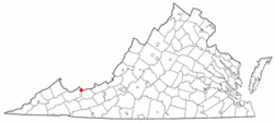 Location in the Commonwealth of Virginia | |
| Coordinates: 37°14′39″N 81°16′30″W | |
| Country | United States |
| State | Virginia |
| County | Tazewell |
| Founded | 1860s |
| Incorporated | 1883 |
| Government | |
| • Mayor | Don Harris |
| Area | |
| • Town | 9.50 sq mi (24.60 km2) |
| • Land | 9.49 sq mi (24.59 km2) |
| • Water | 0.01 sq mi (0.01 km2) |
| Elevation | 2,389 ft (728 m) |
| Population | |
| • Town | 5,444 |
| • Estimate (2018)[3] | 4,882 |
| • Density | 514.17/sq mi (198.52/km2) |
| • Metro | 107,342 (Bluefield Micropolitan Area) |
| Time zone | UTC−5 (EST) |
| • Summer (DST) | UTC−4 (EDT) |
| ZIP code | 24605 |
| Area code(s) | 276 Exchanges: 322,326 |
| FIPS code | 51-08152[4] |
| GNIS feature ID | 1481874[5] |
| Website | http://www.bluefieldva.org/ |
Geography
Bluefield is located at 37°14′39″N 81°16′30″W (37.244195, −81.274926).[6]
According to the United States Census Bureau, the town has a total area of 8.0 square miles (19.6 km²), all land.
Demographics
| Historical population | |||
|---|---|---|---|
| Census | Pop. | %± | |
| 1890 | 1,021 | — | |
| 1900 | 1,554 | 52.2% | |
| 1910 | 1,917 | 23.4% | |
| 1920 | 2,752 | 43.6% | |
| 1930 | 3,906 | 41.9% | |
| 1940 | 3,921 | 0.4% | |
| 1950 | 4,212 | 7.4% | |
| 1960 | 4,235 | 0.5% | |
| 1970 | 5,286 | 24.8% | |
| 1980 | 5,946 | 12.5% | |
| 1990 | 5,363 | −9.8% | |
| 2000 | 5,078 | −5.3% | |
| 2010 | 5,444 | 7.2% | |
| Est. 2018 | 4,882 | [3] | −10.3% |
| U.S. Decennial Census | |||
As of the census[4] of 2000, there were 5,078 people, 2,134 households, and 1,423 families residing in the town. The population density was 669.9 people per square mile (258.7/km²). There were 2,349 housing units at an average density of 309.9 per square mile (119.7/km²). The racial makeup of the town was 92.30% White, 4.86% African American, 0.32% Native American, 1.42% Asian, 0.12% from other races, and 0.98% from two or more races. Hispanic or Latino of any race were 0.41% of the population.
There were 2,134 households out of which 21.8% had children under the age of 18 living with them, 56.3% were married couples living together, 8.4% had a female householder with no husband present, and 33.3% were non-families. 30.3% of all households were made up of individuals and 16.5% had someone living alone who was 65 years of age or older. The average household size was 2.23 and the average family size was 2.77.
In the town, the population was spread out with 18.0% under the age of 18, 10.2% from 18 to 24, 22.2% from 25 to 44, 27.3% from 45 to 64, and 22.3% who were 65 years of age or older. The median age was 45 years. For every 100 females, there were 86.1 males. For every 100 females age 18 and over, there were 81.5 males.
The median income for a household in the town was $32,157, and the median income for a family was $44,000. Males had a median income of $34,167 versus $18,875 for females. The per capita income for the town was $21,755. About 3.9% of families and 7.6% of the population were below the poverty line, including 9.6% of those under age 18 and 8.8% of those age 65 or over.
History
Bluefield has not always borne the name Bluefield. The town developed around a small post office named "Pin Hook" in the 1860s, named for a small creek that ran through the community.[7] For a brief time it was known as the community of Harman, named after a Civil War hero from the area who had been shot during the Battle of Cloyd's Mountain in Pulaski County, Virginia.
Later, after coal was discovered and a company was formed to build a railroad to the Pocahontas Coalfields, the community's name was changed again to "Graham" to honor Col. Thomas Graham, a Philadelphia capitalist. The town was first chartered by the Commonwealth of Virginia as the town of Graham in 1884. The Norfolk and Western railroad chose Bluefield, West Virginia over Graham as the place to build its regional headquarters and main docking yards for the Pocahontas region. As a result, Bluefield, West Virginia grew at a much faster rate than did Graham.
Graham operated under that name until a referendum on June 10, 1924, voted to change its name to Bluefield, Virginia. The name change was celebrated in a mock marriage ceremony held in the city park between officials of Bluefield, Virginia, and Bluefield, West Virginia, to celebrate the renaming of Graham. Its community had borders then that are roughly the same as the downtown area alongside the railroad of today's Bluefield, Virginia.
Graham continued to hope for development as a major city in the region; it tried to attract a steel refining industry alongside the railyards. The Great Depression of the 1930s caused development in the region to come to a halt. The current Bluefield did not start to expand beyond the downtown area until the 1950s, when it annexed the small town of West Graham, Virginia to the west. It also began to develop land in the more open rural foothills to the south of the city.
As the largest town in Tazewell County, Virginia, Bluefield has expanded since the 1990s and the first decade of the new millennium. After a series of devastating floods in the early 21st century, the town has relocated its town council chambers and police department from the flood-prone historic downtown area to the southernmost point in the city at the foot of East River Mountain. The area has been developed with a Wal-Mart, the headquarters of First Community Bank, strip malls, and a medical center operating along U.S. Route 460.
Bluefield's most prominent residents are Bill Dudley, an NFL Hall of Famer; New York Giants RB Ahmad Bradshaw; and the widow of actor Lorne Greene, who previously lived in a mansion atop a hill overlooking the Sanders house. This is considered one of the most significant historic homes in the city.
The Walter McDonald Sanders House and Alexander St. Clair House are listed on the National Register of Historic Places.[8]
Representation in other media
- The town was chosen by Hollywood film producers as the site for the 1994 remake of the classic movie, Lassie.
- It has been mentioned by musicians in numerous songs, including Blessed Union of Souls' "Oh Virginia".
Education
Educational institutions include Graham High School and Bluefield College.
Sports
The Bluefield Blue Jays, a minor league baseball team, play their home games at Bowen Field, a stadium in the city park that serves both Bluefield and its neighbor of the same name in West Virginia. Although the park is operated by the West Virginia city, the stadium lies entirely within Virginia.
Bluefield College hosts many sports programs, including basketball, soccer, baseball, and now football.
Graham High School's football team won the Virginia High School League's Class 2 State Football Championship in 2018. The G-Men defeated Goochland High School 31-9 on December 8 at Salem City Stadium for the state crown. Previous state football titles were won in 1962, 1989, and 1995.
References
- "2018 U.S. Gazetteer Files". United States Census Bureau. Retrieved Feb 16, 2020.
- "2010 Census Redistricting Data (Public Law 94-171) Summary File". American FactFinder. United States Census Bureau. Retrieved 13 March 2012.
- "Population and Housing Unit Estimates". Retrieved June 4, 2019.
- "U.S. Census website". United States Census Bureau. Retrieved 2008-01-31.
- "US Board on Geographic Names". United States Geological Survey. 2007-10-25. Retrieved 2008-01-31.
- "US Gazetteer files: 2010, 2000, and 1990". United States Census Bureau. 2011-02-12. Retrieved 2011-04-23.
- Hotchkiss, Jedidiah, in The Virginias: A Mining, Industrial, and Scientific Journal, published in Staunton, Virginia, 1881, Vol. II
- "National Register Information System". National Register of Historic Places. National Park Service. July 9, 2010.
External links
| Wikimedia Commons has media related to Bluefield, Virginia. |
- Bluefield, Virginia
- Bluefield, West Virginia
- Bluefield
- Bluefield College
- Graham High School
- Graham High School Alumni
Municipalities and communities of Tazewell County, Virginia, United States | ||
|---|---|---|
| Towns | 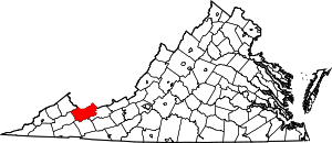 Map of Virginia highlighting Tazewell County | |
| CDPs | ||
| Unincorporated communities | ||
| Footnotes | ‡This populated place also has portions in an adjacent county or counties | |

| Authority control |
|
|---|