Bath County, Virginia
Bath County is a United States county located on the central western border of the Commonwealth of Virginia, on the West Virginia state line. As of the 2010 census, the population was 4,731;[1] in 2018, the population was estimated at 4,292,[2] it the second-least populous county in Virginia. Bath's county seat is Warm Springs.[3]
Bath County | |
|---|---|
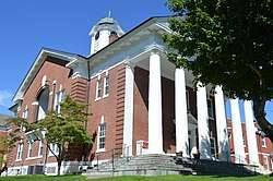 Bath County Courthouse in Warm Springs | |
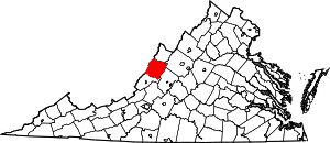 Location within the U.S. state of Virginia | |
 Virginia's location within the U.S. | |
| Coordinates: 38°04′N 79°44′W | |
| Country | |
| State | |
| Founded | 1790 |
| Named for | Bath, England |
| Seat | Warm Springs |
| Largest community | Hot Springs |
| Area | |
| • Total | 535 sq mi (1,390 km2) |
| • Land | 529 sq mi (1,370 km2) |
| • Water | 5 sq mi (10 km2) 1.0% |
| Population (2010) | |
| • Total | 4,470 |
| • Estimate (2018) | 4,292 |
| • Density | 8.4/sq mi (3.2/km2) |
| Time zone | UTC−5 (Eastern) |
| • Summer (DST) | UTC−4 (EDT) |
| Congressional district | 6th |
| Website | www |
History
Bath County was created on December 14, 1790 from parts of Augusta, Botetourt, and Greenbrier counties. Due to the many mineral springs found in the area, the county was named for the English spa and resort city of Bath.[4] Like its namesake, Bath County's economy is focused on tourism and recreation. The county's major employer is The Omni Homestead, a resort and historical hotel located in Hot Springs, Virginia. Additional recreational opportunities are provided by camping and fishing at Lake Moomaw in the southern part of the county.
The county is represented in the Virginia General Assembly by Senator Creigh Deeds and Delegate Ronnie Campbell. The area's economy has focused on tourism and travel since the 1700s, particularly when The Homestead Resort was built in 1766.[5] Located along the western central border with West Virginia, Bath County comprises a number of villages, including Hot Springs, Warm Springs, Millboro and Mountain Grove. Hot Springs and Warm Springs are the most well known of the villages, given their natural mineral springs. Bath County is one of the few counties in Virginia without a traffic signal. (Mathews County, and Rappahannock County are the others.)
Geography
According to the U.S. Census Bureau, the county has a total area of 535 square miles (1,390 km2), of which 529 square miles (1,370 km2) is land and 5 square miles (13 km2) (1.0%) is water.[6] 89% of Bath County is forest, with 51% national forest and 6% state park. The Nature Conservancy owns more than 9,000 acres (36 km2) of forest habitat.[5]
Adjacent counties
- Highland County – north
- Augusta County – northeast
- Rockbridge County – east
- Alleghany County – south
- Greenbrier County, West Virginia – southwest
- Pocahontas County, West Virginia – west
National protected areas
- George Washington National Forest (part)
- United States National Radio Quiet Zone (part)
Demographics
| Historical population | |||
|---|---|---|---|
| Census | Pop. | %± | |
| 1800 | 5,508 | — | |
| 1810 | 4,837 | −12.2% | |
| 1820 | 5,237 | 8.3% | |
| 1830 | 4,002 | −23.6% | |
| 1840 | 4,300 | 7.4% | |
| 1850 | 3,486 | −18.9% | |
| 1860 | 3,676 | 5.5% | |
| 1870 | 3,795 | 3.2% | |
| 1880 | 4,482 | 18.1% | |
| 1890 | 4,587 | 2.3% | |
| 1900 | 5,595 | 22.0% | |
| 1910 | 6,538 | 16.9% | |
| 1920 | 6,389 | −2.3% | |
| 1930 | 8,137 | 27.4% | |
| 1940 | 7,191 | −11.6% | |
| 1950 | 6,296 | −12.4% | |
| 1960 | 5,335 | −15.3% | |
| 1970 | 5,192 | −2.7% | |
| 1980 | 5,860 | 12.9% | |
| 1990 | 4,799 | −18.1% | |
| 2000 | 5,048 | 5.2% | |
| 2010 | 4,731 | −6.3% | |
| Est. 2018 | 4,292 | [2] | −9.3% |
| U.S. Decennial Census[7] 1790-1960[8] 1900-1990[9] 1990-2000[10] 2010-2013[1] | |||
As of the census[11] of 2000, there were 5,048 people, 2,053 households, and 1,451 families residing in the county. The population density was 10 people per square mile (4/km²). There were 2,896 housing units at an average density of 5 per square mile (2/km²). The racial makeup of the county was 92.29% White, 6.28% Black or African American, 0.22% Native American, 0.38% Asian, 0.06% Pacific Islander, 0.10% from other races, and 0.67% from two or more races. 0.36% of the population were Hispanic or Latino of any race.
There were 2,053 households out of which 28.00% had children under the age of 18 living with them, 58.60% were married couples living together, 7.80% had a female householder with no husband present, and 29.30% were non-families. 26.30% of all households were made up of individuals and 12.10% had someone living alone who was 65 years of age or older. The average household size was 2.34 and the average family size was 2.80.
In the county, the population was spread out with 21.00% under the age of 18, 5.50% from 18 to 24, 28.20% from 25 to 44, 28.50% from 45 to 64, and 16.70% who were 65 years of age or older. The median age was 42 years. For every 100 females there were 100.60 males. For every 100 females age 18 and over, there were 99.20 males.
The median income for a household in the county was $35,013, and the median income for a family was $41,276. Males had a median income of $30,238 versus $21,974 for females. The per capita income for the county was $23,092. 7.80% of the population and 5.80% of families were below the poverty line. Out of the total people living in poverty, 5.40% are under the age of 18 and 12.90% are 65 or older.
Government
Board of Supervisors
- Cedar Creek district: Ron Shifflett (I)
- Millboro district: Eddy T. Hicklin (I)
- Valley Springs district: Richard B. Byrd (I)
- Warm Springs district: Bart Perdue (I)
- Williamsville district: Stuart L. Hall (I)
Constitutional officers
- Clerk of the Circuit Court: Annette T. Loan (I)
- Commissioner of the Revenue: Angel M. Grimm (I)
- Commonwealth's Attorney: John C. Singleton (I)
- Sheriff: Robert W. Plecker (I)
- Treasurer: Pam Webb (I)
Bath County is represented by Democrat Creigh Deeds in the Virginia Senate, Republican Ronnie R. Campbell in the Virginia House of Delegates, and Republican Ben Cline in the U.S. House of Representatives.
Politics
| Year | Republican | Democratic | Third parties |
|---|---|---|---|
| 2016 | 68.7% 1,548 | 26.8% 603 | 4.5% 102 |
| 2012 | 57.3% 1,274 | 40.2% 894 | 2.5% 55 |
| 2008 | 55.5% 1,349 | 42.9% 1,043 | 1.6% 40 |
| 2004 | 62.8% 1,432 | 36.3% 828 | 1.0% 22 |
| 2000 | 59.3% 1,311 | 37.2% 822 | 3.5% 77 |
| 1996 | 41.3% 847 | 45.0% 922 | 13.8% 282 |
| 1992 | 46.1% 1,075 | 36.7% 855 | 17.2% 400 |
| 1988 | 58.7% 1,273 | 40.7% 881 | 0.6% 13 |
| 1984 | 65.9% 1,434 | 33.4% 727 | 0.6% 14 |
| 1980 | 45.9% 921 | 49.8% 999 | 4.3% 87 |
| 1976 | 46.0% 888 | 53.3% 1,029 | 0.8% 15 |
| 1972 | 68.9% 1,127 | 28.2% 462 | 2.9% 47 |
| 1968 | 46.0% 872 | 26.0% 494 | 28.0% 531 |
| 1964 | 40.1% 516 | 59.9% 770 | |
| 1960 | 50.6% 646 | 49.3% 629 | 0.2% 2 |
| 1956 | 58.5% 739 | 37.9% 479 | 3.6% 46 |
| 1952 | 62.7% 765 | 36.9% 451 | 0.4% 5 |
| 1948 | 52.0% 488 | 40.0% 375 | 8.0% 75 |
| 1944 | 46.3% 504 | 53.4% 581 | 0.4% 4 |
| 1940 | 45.3% 527 | 54.2% 630 | 0.5% 6 |
| 1936 | 45.5% 514 | 54.3% 614 | 0.2% 2 |
| 1932 | 38.7% 384 | 59.9% 594 | 1.4% 14 |
| 1928 | 64.1% 731 | 35.9% 409 | |
| 1924 | 48.7% 407 | 48.4% 404 | 2.9% 24 |
| 1920 | 51.0% 362 | 48.3% 343 | 0.7% 5 |
| 1916 | 35.8% 219 | 63.2% 387 | 1.0% 6 |
| 1912 | 29.2% 159 | 60.5% 329 | 10.3% 56 |
Economy
Tourism and recreation has been the focus of the economy from the time the county was established.[5] The Omni Homestead, a luxury mountain resort in Hot Springs, is the county's major employer.
The resort grew around the area's mineral springs, such as the Jefferson Pools. (As of July 1, 2018 the Jefferson Pools have been closed by The Omni Homestead Resort. The pools are anticipated to reopen once the safety of their surrounding structures is verified.)
Bath County is also home to the Bath County Pumped Storage Station, a pumped storage hydroelectric power plant.
Education
The county has two elementary schools (serving students from pre-kindergarten to seventh grade) and one high school (serving students in grades 8 through 12). Around 555 students are enrolled in the school system.[13]
Communities
Census-designated places
Other unincorporated communities
Notable people
- C. E. Byrd, American Educator
- Creigh Deeds, Virginia Senator (25th District)
- Jailyn Ford, NPF Pitcher
- Dan Ingalls, Computer Scientist, President of the Homestead[14][15]
- John Phillips, NFL Tight End
- Sam Snead, Professional Golfer
References
- "State & County QuickFacts". United States Census Bureau. Retrieved January 1, 2015.
- "Population and Housing Unit Estimates". Retrieved July 14, 2019.
- "Find a County". National Association of Counties. Archived from the original on 2012-07-12. Retrieved 2011-06-07.
- Salmon, edited by Emily J.; Jr, Edward D.C. Campbell (1994). The Hornbook of Virginia History : a ready-reference guide to the Old Dominion's people, places, and past (4th ed.). Richmond: Library of Virginia. p. 161. ISBN 0884901777.CS1 maint: extra text: authors list (link)
- "About Bath County". County of Bath, Virginia. Retrieved 1 August 2014.
- "US Gazetteer files: 2010, 2000, and 1990". United States Census Bureau. 2011-02-12. Retrieved 2011-04-23.
- "U.S. Decennial Census". United States Census Bureau. Retrieved January 1, 2014.
- "Historical Census Browser". University of Virginia Library. Retrieved January 1, 2014.
- "Population of Counties by Decennial Census: 1900 to 1990". United States Census Bureau. Retrieved January 1, 2014.
- "Census 2000 PHC-T-4. Ranking Tables for Counties: 1990 and 2000" (PDF). United States Census Bureau. Retrieved January 1, 2014.
- "U.S. Census website". United States Census Bureau. Retrieved 2011-05-14.
- Leip, David. "Dave Leip's Atlas of U.S. Presidential Elections". uselectionatlas.org. Retrieved 10 April 2018.
- Virginia Department of Education. "Fall Membership Data". Archived from the original on 29 August 2018. Retrieved 28 August 2018.
- Layman, Sara (1987-10-22). "Homestead's New President Plans Emphasis on Tradition, Service". The Recorder. Retrieved 2019-02-02.
- Oxendine, Margo (1993-12-17). "Growing up at The Homestead". The Recorder. Retrieved 2019-02-02.
External links
Places adjacent to Bath County, Virginia | |
|---|---|
Municipalities and communities of Bath County, Virginia, United States | ||
|---|---|---|
| CDPs | Map of Virginia highlighting Bath County | |
| Unincorporated communities |
| |
| Footnotes | ‡This populated place also has portions in an adjacent county or counties | |

| Authority control |
|
|---|