Wakefield, Virginia
Wakefield is an incorporated town in Sussex County, Virginia, United States. The population was 927 at the 2010 census.
Wakefield, Virginia | |
|---|---|
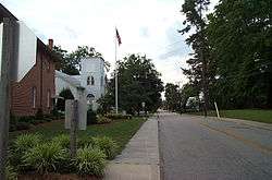 West Church Street in Wakefield | |
 Location of Wakefield, Virginia | |
| Coordinates: 36°58′13″N 76°59′18″W | |
| Country | United States |
| State | Virginia |
| County | Sussex |
| Government | |
| • Mayor | Brian Laine[1] |
| Area | |
| • Total | 1.29 sq mi (3.3 km2) |
| • Land | 1.25 sq mi (3.2 km2) |
| • Water | 0.04 sq mi (0.1 km2) |
| Elevation | 98 ft (30 m) |
| Population (2010) | |
| • Total | 927 |
| • Estimate (2018)[3] | 830 |
| • Density | 720/sq mi (280/km2) |
| Time zone | UTC−5 (Eastern (EST)) |
| • Summer (DST) | UTC−4 (EDT) |
| ZIP code | 23888 |
| Area code(s) | 757, 948 (planned) |
| FIPS code | 51-82384[4] |
| GNIS feature ID | 1496365[5] |
Wakefield is widely known for the Virginia Diner, the Airfield Conference and 4-H Educational Center and the National Weather Service Weather Forecast Office for Eastern Virginia, which issues weather alerts for the region, though the latter two are actually located outside the town limits.
Wakefield also hosts the Virginia Shad Planking.
Geography
Wakefield is located at 36°58′13″N 76°59′18″W (36.970219, −76.988461).[6]
According to the United States Census Bureau, the town has a total area of 1.3 square miles (3.3 km2), of which, 1.2 square miles (3.2 km2) of it is land and 0.04 square miles (0.1 km2) of it (3.10%) is water.
History
Wakefield, one of several stops along the Norfolk and Petersburg Railroad in pre-civil war Virginia, is thought to have been named by William Mahone(1826-1895), then president of the N&P, and his wife Otelia Butler Mahone as they traveled the newly completed railroad in 1858. According to local lore, the name came from the Sir Walter Scott novel Ivanhoe, which Mrs. Mahone was reading at the time. The towns of Windsor and Waverly are said to have received their names the same way.
Demographics
| Historical population | |||
|---|---|---|---|
| Census | Pop. | %± | |
| 1910 | 570 | — | |
| 1920 | 784 | 37.5% | |
| 1930 | 881 | 12.4% | |
| 1940 | 687 | −22.0% | |
| 1950 | 949 | 38.1% | |
| 1960 | 1,015 | 7.0% | |
| 1970 | 942 | −7.2% | |
| 1980 | 1,355 | 43.8% | |
| 1990 | 1,070 | −21.0% | |
| 2000 | 1,038 | −3.0% | |
| 2010 | 927 | −10.7% | |
| Est. 2018 | 830 | [3] | −10.5% |
| U.S. Decennial Census[7] | |||
At the 2010 census, there were 927 people living in the city. The racial makeup of the town was 50.6% Black, 46.1% White, 0.3% Native American, 1.5% Asian and 0.6% from two or more races. 0.9% were Hispanic or Latino of any race.
At the 2000 census there were 1,038 people, 423 households, and 285 families living in the town. The population density was 833.2 people per square mile (320.6/km2). There were 485 housing units at an average density of 389.3 per square mile (149.8/km2). The racial makeup of the town was 47.50% White, 51.25% African American, 0.19% Native American, and 1.06% from two or more races. Hispanic or Latino of any race were 0.39%.[4]
Of the 423 households 27.2% had children under the age of 18 living with them, 48.5% were married couples living together, 16.3% had a female householder with no husband present, and 32.6% were non-families. 30.0% of households were one person and 17.5% were one person aged 65 or older. The average household size was 2.45 and the average family size was 3.05.
The age distribution was 24.9% under the age of 18, 6.2% from 18 to 24, 26.0% from 25 to 44, 24.6% from 45 to 64, and 18.4% 65 or older. The median age was 40 years. For every 100 females, there were 86.7 males. For every 100 females age 18 and over, there were 79.3 males.
The median household income was $28,500 and the median family income was $34,539. Males had a median income of $26,429 versus $21,595 for females. The per capita income for the town was $15,290. About 9.9% of families and 13.4% of the population were below the poverty line, including 26.1% of those under age 18 and 17.3% of those age 65 or over.
References
- "2018 May Town General". Virginia Department of Elections. Retrieved 2018-05-25.
- "2018 U.S. Gazetteer Files". United States Census Bureau. Retrieved Feb 16, 2020.
- "Population and Housing Unit Estimates". Retrieved June 4, 2019.
- "U.S. Census website". United States Census Bureau. Retrieved 2008-01-31.
- "US Board on Geographic Names". United States Geological Survey. 2007-10-25. Retrieved 2008-01-31.
- "US Gazetteer files: 2010, 2000, and 1990". United States Census Bureau. 2011-02-12. Retrieved 2011-04-23.
- "Census of Population and Housing". Census.gov. Retrieved June 4, 2015.
Municipalities and communities of Sussex County, Virginia, United States | ||
|---|---|---|
| Towns | 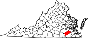 Map of Virginia highlighting Sussex County | |
| CDP | ||
| Unincorporated communities | ||
| Footnotes | ‡This populated place also has portions in an adjacent county or counties | |