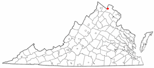
Round Hill, Loudoun County, Virginia
Round Hill is a town in Loudoun County, Virginia, United States. Its population was estimated at 539 in 2010 by the U.S. Census Bureau.[3] The town is located at the crossroads of Virginia routes 7 and 719 (Woodgrove Road), approximately 50 miles northwest of Washington, D.C. It was named "Round Hill" for being located two miles northeast of a 910-foot hill used during the American Civil War as a signal post by both Confederate and Union troops.
Round Hill, Loudoun County, Virginia | |
|---|---|
Town | |
| Town of Round Hill | |
 Round Hill United Methodist Church, established 1889 in Round Hill, Virginia. | |
 Round Hill  Round Hill  Round Hill | |
| Coordinates: 39°8′1″N 77°46′13″W | |
| Country | |
| State | |
| County | |
| Incorporated | 1900 |
| Government | |
| • Mayor | Scott T. Ramsey |
| Area | |
| • Total | 0.37 sq mi (0.96 km2) |
| • Land | 0.37 sq mi (0.95 km2) |
| • Water | 0.00 sq mi (0.01 km2) |
| Elevation | 548 ft (167 m) |
| Population (2010) | |
| • Total | 539 |
| • Estimate (2018)[2] | 664 |
| • Density | 1,809.26/sq mi (699.31/km2) |
| Time zone | UTC−5 (EST) |
| • Summer (DST) | UTC−4 (EDT) |
| FIPS code | 51-69168 |
| Website | http://www.roundhillva.org/ |
History
Round Hill was incorporated on February 5, 1900. From 1874 to 1900, the settlement had been the terminus of a Washington and Ohio rail line that ultimately became the Washington and Old Dominion Railroad.[4] The railway allowed agricultural products to be brought into Washington, D.C., and allowed the residents of the District to escape to the surrounding countryside for holidays. Many of the town's older residences were originally boarding houses, inns, and taverns where people would go upon arrival. The town was considered a convenient destination as it lies close to the Shenandoah River (7 miles distant), the Shenandoah National Park (30 miles), the Appalachian Trail (4 miles), Harpers Ferry (15 miles), the Chesapeake & Ohio Canal Tow Path (used currently as a bike trail) (12 miles), and the paved Washington & Old Dominion Railroad Trail (3 miles).
The town has recently been ringed by fast-growing suburbs of Washington, D.C., that have brought thousands of residents to just outside the town. The town's water and sewer infrastructure is used to serve many of these new developments. The town has a Hometown Festival every year on Memorial Day complete with a parade and many activities to do in the town park as well as outside of it.
The Ketoctin Baptist Church, Round Hill Historic District, and Woodgrove are listed on the National Register of Historic Places.[5]
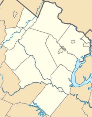
Geography
Round Hill is located at 39°8′1″N 77°46′13″W (39.133625, −77.770217).[6]
According to the United States Census Bureau, the town has a total area of 0.2 square miles (0.52 km2), all of it land.
Demographics
| Historical population | |||
|---|---|---|---|
| Census | Pop. | %± | |
| 1890 | 207 | — | |
| 1900 | 318 | 53.6% | |
| 1910 | 379 | 19.2% | |
| 1920 | 359 | −5.3% | |
| 1930 | 359 | 0.0% | |
| 1940 | 337 | −6.1% | |
| 1950 | 403 | 19.6% | |
| 1960 | 430 | 6.7% | |
| 1970 | 581 | 35.1% | |
| 1980 | 510 | −12.2% | |
| 1990 | 514 | 0.8% | |
| 2000 | 500 | −2.7% | |
| 2010 | 539 | 7.8% | |
| Est. 2018 | 664 | [2] | 23.2% |
| U.S. Decennial Census[7] | |||
As of the census[3] of 2010, 539 people in 202 households and 155 families resided in the town. The population density was 2,695 people per square mile (1040.5/km²). There were 218 housing units at an average density of 1090 per square mile (420.9/km²). Of that population, 93.32% was White; 2.78%, African American; 1.11%, Asian; and 0.93% of the population was mixed-race. Hispanics or Latinos of any race constituted 3.53% of the population.
There were 202 households out of which 40.6% had children under the age of 18 living with them, 59.9% were married couples living together, 12.9% had a female householder with no husband present, 4.0% had a male householder with no wife present, and 23.3% were non-families. 19.8% of all households were made up of individuals and 5.5% had someone living alone who was 65 years of age or older. The average household size was 2.67 and the average family size was 3.06.[3]
In the town, the population was spread out with 30.7% under the age of 20, 5.5% from 20 to 29, 20.2% from 30 to 44, 34.0% from 45 to 64 (up from 23% in 2005), and 9.7% who were 65 years of age or older. The median age was 40.5 years (up from 36 years in 2005). For every 100 females, there were 94.6 males. For every 100 females age 18 and over, there were 89.1 males.[3]
The median estimated income for a household in the town in 2010 was $92,292, and the median estimated income for a family in 2010 was $93,750. Males had a median income of $79,000 versus $55,208 for females. The per capita income for the town was $39,380.[8] In 2005, about 4.2% of families and 5.4% of the population were below the poverty line, including 3.5% of those under age 18 and 15.7% of those age 65 or over. Poverty level data was not provided for 2010.
_just_west_of_New_Cut_Road_(Virginia_State_Route_719)_in_Round_Hill%2C_Loudoun_County%2C_Virginia.jpg)
Transportation
The primary highway serving Round Hill is Virginia State Route 7. SR 7 extends eastward to Leesburg and beyond, eventually terminating in Alexandria, with interchanges at Interstate 495, Interstate 66 and Interstate 395. Towards the west, SR 7 passes Berryville before terminating at Winchester, where it interchanges with Interstate 81. The currently alignment of SR 7 through Round Hill is actually a bypass of the original road through the middle of Round Hill, which now comprises SR 7 Business.
Education and public service
No public schools lie within the town limits, though Round Hill Elementary School lies just outside, within the "Villages of Round Hill" subdivision. As of January, 2013, the school listed 544 enrolled students.[9] Secondary students are served by the Loudoun County Public School system, including Woodgrove High School in Purcellville.
Police protection is provided by the Loudoun County Sheriff's department. Fire protection and emergency medical services are provided by the Round Hill Volunteer Fire Department 4; the fire company and the rescue squad are volunteer organizations supplemented with staffing from the Loudoun County Fire and Rescue Department on a twenty-four-hour, seven-day-a-week basis.
The town maintains its own water and sewer system, which developers' proffers have supplemented in recent years.
Newspapers
The Washington Post, Washington Times, and Winchester Star all offer paid daily circulation in Round Hill. Weekly paid circulation is provided from Leesburg by the Loudoun Times-Mirror. Residents also receive the free weekly shopper publications Blue Ridge Leader and Purcellville Gazette, which contain mainly advertising.
Churches
Four churches are located in the town: Round Hill Baptist Church, Round Hill United Methodist Church, Mount Zion Baptist Church, and Western Loudoun Community Church (though WLCC moved to Hillsboro in February 2018).[10] The Ketoctin Baptist Church, also known as the Short Hill Church, whose cemetery dates to 1777, is located approximately two miles north of Route 7, at the junction of Allder School Rd. and Ketoctin Church Rd.
Notable people
- Lyndon LaRouche[11]
- William E. Dodd
- Steve Czaban
References
- "2018 U.S. Gazetteer Files". United States Census Bureau. Retrieved February 16, 2020.
- "Population and Housing Unit Estimates". Retrieved June 4, 2019.
- U.S. Census Bureau (2010). "2010 Census". Retrieved January 3, 2013.
- "Town of Round Hill Website". Archived from the original on September 20, 2007. Retrieved April 7, 2008.
- "National Register Information System". National Register of Historic Places. National Park Service. July 9, 2010.
- "US Gazetteer files: 2010, 2000, and 1990". United States Census Bureau. February 12, 2011. Retrieved April 23, 2011.
- "Census of Population and Housing". Census.gov. Retrieved June 4, 2015.
- U.S. Census Bureau (2010). "2006-2010 American Community Survey 5-Year Estimates". Archived from the original on February 12, 2020. Retrieved January 3, 2013.
- "Round Hill Elementary School Website". Archived from the original on March 4, 2016. Retrieved January 3, 2013.
- "Western Loudoun Community Church". www.facebook.com. Retrieved May 25, 2018.
- No Joke - The Washington Post Archived April 28, 2018, at the Wayback Machine Retrieved May 7, 2018.
External links
| Wikimedia Commons has media related to Round Hill, Loudoun County, Virginia. |
Municipalities and communities of Loudoun County, Virginia, United States | ||
|---|---|---|
| Towns | 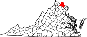 Map of Virginia highlighting Loudoun County | |
| CDPs | ||
| Unincorporated communities |
| |
| Former | ||