Brunswick County, Virginia
Brunswick County is a United States county located on the southern border of the Commonwealth of Virginia. This rural county is known as one the claimants to be the namesake of Brunswick stew.
Brunswick County | |
|---|---|
.jpg) Brunswick County Courthouse in Lawrenceville | |
 Seal | |
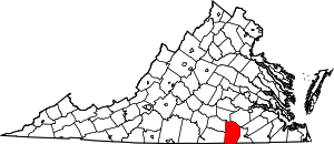 Location within the U.S. state of Virginia | |
 Virginia's location within the U.S. | |
| Coordinates: 36°46′N 77°52′W | |
| Country | |
| State | |
| Founded | 1720 |
| Named for | Duchy of Brunswick-Lunenburg |
| Seat | Lawrenceville |
| Largest town | Lawrenceville |
| Area | |
| • Total | 569 sq mi (1,470 km2) |
| • Land | 566 sq mi (1,470 km2) |
| • Water | 3.2 sq mi (8 km2) 0.6% |
| Population (2010) | |
| • Total | 17,434 |
| • Estimate (2018) | 16,384 |
| • Density | 31/sq mi (12/km2) |
| Time zone | UTC−5 (Eastern) |
| • Summer (DST) | UTC−4 (EDT) |
| Congressional district | 5th |
| Website | www |
Brunswick County was created in 1720, and its lands were taken from parts of Prince George, Surry and Isle of Wight counties. The county was named for the former Duchy of Brunswick-Lunenburg, which was a British possession in the 18th century.
As of the 2010 census, the county population was 17,434, which represents a decrease of more than five percent from the 18,419 reported in the 2000 census.[1] The Brunswick county seat is Lawrenceville.[2]
History
The first English settlers, in what was to become Brunswick County, swarmed into the relatively protected lands near Fort Christanna during its 4 years of operation (1714–1718). Among them were indentured servants, including men deported from Scotland in 1716 after being convicted by the Crown in the Jacobite rising of 1715. They were required to work under indenture to pay the Crown back for their ship passage. Gradually the colonists pushed many of the Native Americans out of the area.
An example of such a Scots rebel who started in the colony as a convict was James Pittillo. He survived his indenture and in 1726 was granted 242 acres (1.0 km2) on Wagua Creek. He gradually became a major landowner in the area. He was appointed as a tobacco inspector in Bristol Parish in 1728 and that year served with William Byrd II on his spring and fall expeditions to survey the border between Virginia and North Carolina. Taking advantage of land grants due to headrights, for people whose passage he paid to the colony, and outright purchases, Pittillo ultimately owned more than 4,000 acres (16 km2) in the area of Prince George County, Brunswick, and Dinwiddie counties in Southside Virginia.
Brunswick County was established in 1720 from Prince George County. The county is named for the former Duchy of Brunswick-Lunenburg in Germany. One of the titles carried by Britain's Hanoverian kings was Duke of Brunswick-Lunenburg. In 1732 the county received more land from parts of Surry and Isle of Wight counties. Brunswick County reached the Blue Ridge Mountains until 1745, when increasing population in the region resulted in the formation of a series of new counties, and Brunswick's current western border was established.
In 1780, during the American Revolutionary War, Greensville County was formed from part of Brunswick's eastern side. In 1787 the county's eastern border was finalized with a minor adjustment.[3]
Today Brunswick County is bisected by Interstate 85, U.S. 1 and U.S. Highway 58. Planters originally cultivated the land for tobacco by slave labor in colonial times. As tobacco exhausted the soil and the markets changed, planters and smaller farmers diversified the mostly rural economy by raising mixed crops and harvesting lumber before the American Civil War. As a result of these changes, slaveholders in the Upper South had surplus slaves; many sold them in the domestic slave trade. It fed the development of cotton plantations in the Deep South. Altogether, more than one million enslaved African Americans were sold South in the antebellum years in this forced migration, which broke up many families.
Saint Paul's College, Virginia was established in this county in association with the church; it continues in operation. In 1914 the school boasted that "The location of the school in the heart of the Black Belt of Virginia, with a Negro population of 100,000 almost at its very doors, is most favorable for the prosecution of uplift work."[4]
In the early 21st century, the county has a campus of Southside Virginia Community College. The Fort Pickett Army National Guard base is partly in the county.
Geography
According to the U.S. Census Bureau, the county has a total area of 569 square miles (1,470 km2), of which 566 square miles (1,470 km2) is land and 3.2 square miles (8.3 km2) (0.6%) is water.[5]
Adjacent counties
- Mecklenburg County – west
- Lunenburg County – west
- Nottoway County – northwest
- Dinwiddie County – north
- Greensville County – east
- Northampton County, North Carolina – south
Demographics
| Historical population | |||
|---|---|---|---|
| Census | Pop. | %± | |
| 1790 | 12,827 | — | |
| 1800 | 16,339 | 27.4% | |
| 1810 | 15,411 | −5.7% | |
| 1820 | 16,687 | 8.3% | |
| 1830 | 15,767 | −5.5% | |
| 1840 | 14,346 | −9.0% | |
| 1850 | 13,894 | −3.2% | |
| 1860 | 14,809 | 6.6% | |
| 1870 | 13,427 | −9.3% | |
| 1880 | 16,707 | 24.4% | |
| 1890 | 17,245 | 3.2% | |
| 1900 | 18,217 | 5.6% | |
| 1910 | 19,244 | 5.6% | |
| 1920 | 21,025 | 9.3% | |
| 1930 | 20,486 | −2.6% | |
| 1940 | 19,575 | −4.4% | |
| 1950 | 20,136 | 2.9% | |
| 1960 | 17,779 | −11.7% | |
| 1970 | 16,172 | −9.0% | |
| 1980 | 15,632 | −3.3% | |
| 1990 | 15,987 | 2.3% | |
| 2000 | 18,419 | 15.2% | |
| 2010 | 17,434 | −5.3% | |
| Est. 2018 | 16,384 | [6] | −6.0% |
| U.S. Decennial Census[7] 1790–1960[8] 1900–1990[9] 1990–2000[10] 2010–2015[1] | |||
As of the 2010 United States Census, there were 17,434 people living in the county. 57.3% were Black or African American, 40.4% White, 0.3% Asian, 0.2% Native American, 0.8% of some other race and 0.9% of two or more races. 1.7% were Hispanic or Latino (of any race).
As of the census[11] of 2000, there were 18,419 people, 6,277 households, and 4,312 families living in the county. The population density was 32 people per square mile (13/km²). There were 7,541 housing units at an average density of 13 per square mile (5/km²). The racial makeup of the county was 41.99% White, 56.85% Black or African American, 0.09% Native American, 0.22% Asian, 0.01% Pacific Islander, 0.34% from other races, and 0.51% from two or more races. 1.25% of the population were Hispanic or Latino of any race.
There were 6,277 households out of which 27.40% had children under the age of 18 living with them, 46.90% were married couples living together, 16.60% had a female householder with no husband present, and 31.30% were non-families. 27.60% of all households were made up of individuals and 13.30% had someone living alone who was 65 years of age or older. The average household size was 2.47 and the average family size was 3.00.
In the county, the age distribution of the population shows 20.50% under the age of 18, 9.90% from 18 to 24, 30.70% from 25 to 44, 24.40% from 45 to 64, and 14.50% who were 65 years of age or older. The median age was 38 years. For every 100 females there were 113.10 males. For every 100 females age 18 and over, there were 115.40 males.
The median income for a household in the county was $31,288, and the median income for a family was $38,354. Males had a median income of $26,924 versus $20,550 for females. The per capita income for the county was $14,890. About 13.20% of families and 16.50% of the population were below the poverty line, including 20.10% of those under age 18 and 19.50% of those age 65 or over.
Government
Board of Supervisors
- Meherrin district: John Zubrod (Vice Chairman)(I)
- Powellton district: Welton Tyler (I)
- Red Oak district: Bernard L. Jones, Sr. (I)
- Sturgeon district: Dr. Alfonzo R. Seward (I)
- Totaro district: Dr. Barbara Jarrett-Harris (Chairwoman) (I)
Constitutional officers
- Clerk of the Circuit Court: Jacqueline Seward-Morgan (I)
- Commissioner of the Revenue: Wanda J. Beville (I)
- Commonwealth's Attorney: Lezlie S. Green (I)
- Sheriff: Brian Roberts (V)
- Treasurer: Jackie Mangrum (I)
Brunswick County is represented by Republican Frank M. Ruff, Jr. and Democrat L. Louise Lucas in the Virginia Senate, Democrat Roslyn C. Tyler in the Virginia House of Delegates, and Republican Denver Riggleman in the U.S. House of Representatives.
| Year | Republican | Democratic | Third parties |
|---|---|---|---|
| 2016 | 39.7% 3,046 | 58.4% 4,481 | 1.9% 142 |
| 2012 | 36.9% 2,968 | 62.1% 4,994 | 0.9% 75 |
| 2008 | 36.4% 2,877 | 62.8% 4,973 | 0.8% 64 |
| 2004 | 41.2% 2,852 | 58.7% 4,062 | 0.2% 12 |
| 2000 | 42.7% 2,561 | 56.5% 3,387 | 0.8% 49 |
| 1996 | 34.8% 2,059 | 58.2% 3,442 | 7.1% 417 |
| 1992 | 36.9% 2,480 | 54.9% 3,687 | 8.2% 551 |
| 1988 | 46.6% 2,742 | 52.2% 3,070 | 1.2% 72 |
| 1984 | 48.6% 2,950 | 50.1% 3,040 | 1.4% 83 |
| 1980 | 39.4% 2,310 | 58.5% 3,430 | 2.1% 124 |
| 1976 | 42.1% 2,387 | 54.2% 3,071 | 3.7% 210 |
| 1972 | 58.2% 3,072 | 40.3% 2,130 | 1.5% 79 |
| 1968 | 22.1% 1,139 | 37.1% 1,910 | 40.8% 2,098 |
| 1964 | 57.6% 2,560 | 42.4% 1,883 | 0.1% 3 |
| 1960 | 31.6% 926 | 66.2% 1,942 | 2.2% 64 |
| 1956 | 25.3% 799 | 42.9% 1,357 | 31.8% 1,004 |
| 1952 | 40.0% 1,098 | 59.5% 1,635 | 0.5% 14 |
| 1948 | 10.4% 229 | 48.5% 1,067 | 41.1% 906 |
| 1944 | 14.4% 208 | 85.6% 1,239 | |
| 1940 | 11.3% 164 | 88.5% 1,288 | 0.3% 4 |
| 1936 | 4.4% 60 | 95.5% 1,303 | 0.2% 2 |
| 1932 | 3.7% 52 | 95.6% 1,361 | 0.8% 11 |
| 1928 | 21.0% 245 | 79.0% 922 | |
| 1924 | 6.6% 65 | 90.3% 887 | 3.1% 30 |
| 1920 | 12.6% 125 | 87.0% 866 | 0.4% 4 |
| 1916 | 9.6% 82 | 90.4% 772 | |
| 1912 | 8.8% 67 | 84.2% 643 | 7.1% 54 |
County government
The Virginia Department of Corrections Brunswick Correctional Center was in an unincorporated area near Lawrenceville.[13]
Economy & Brunswick stew
Brunswick County is best known as the origin place for Brunswick stew. The original Brunswick stew, according to Brunswick County historians, was created in 1828 by an African-American chef, Mr. Jimmy Matthews, also referred to as "Uncle" by some locals. As the story goes, Dr. Creed Haskins of Mount Donum on the Nottoway River, a member of the Virginia State Legislature, took several friends on a hunting expedition. While the group hunted, Mr. Matthews, Haskin's enslaved camp cook, hunted squirrel for the evening meal. Mr. Matthews slowly stewed the squirrels in butter, with onions, stale bread and seasoning in a large iron pot. When the hunting party returned, they were reluctant to try the new, thick concoction, but one taste convinced them to ask for more.
Since that time, Brunswick stew has been prepared by many different "stew masters." It is often associated with the harvest season in the fall and completion of tobacco processing. Cooks produce large batches of the "Virginia ambrosia" for church functions, local fund raisers, family reunions, and political rallies. Each cook and generation adds its variations to Jimmy Matthews's recipe for Brunswick stew: chicken has been substituted for squirrel and vegetables have been added.
During 1987, the Brunswick Industrial Development Commission and a committee of the Brunswick Chamber of Commerce, with the aid of a professional advertising agency, began a program to develop balanced economic growth in Brunswick County. They decided to capitalize on the county's home-grown Brunswick stew as a brand. On February 22, 1988, at the State Capitol in Richmond, Brunswick County officially kicked off a campaign to increase awareness of its economic development opportunities. The Brunswick Chamber of Commerce and the County of Brunswick hosted a Brunswick Stew-Fest on the Capitol grounds to celebrate the General Assembly's passing of a resolution proclaiming Brunswick County, Virginia, as "The Original Home of Brunswick Stew". The proclamation contains a tongue-in-cheek jab at Brunswick, Georgia, which claims to have created the traditional Southern dish, setting off what has been coined as "The Stew Wars."
One of the many traditional recipes, which requires 6 to 7 hours to cook, was renamed Brunswick Proclamation Stew for the occasion. A good Brunswick stew must be cooked down slowly, according to stew masters for the Capitol Square event, "Until the stirring paddle stands up straight in the stew."[14] When the paddle stood, Brunswick stew was served to the legislators and hundreds of Virginians who turned out for the event to "Get a Taste of Brunswick."[14]
With the help of the Fearnow Brothers, the County got its own stew label, approved by the U.S. Department of Agriculture (USDA). Their company also produces small quantities of canned Brunswick stew for the Chamber of Commerce to store and use. The cans bear the label "Virginia's Own – 1828-Brunswick County Stew".
A sample of Brunswick stew, along with information on the County's assets, was included in the County's promotional packages and sent to business and industry prospects. The stew and County are tied together with the campaign's theme: "Since 1828 when Ol’ Jimmy Matthews created Brunswick stew, we’ve been doing things a special way. A little slow, but right."[14]
Communities
Towns
- Alberta
- Brodnax (partial)
- Lawrenceville (county seat)
- Freeman
- Dolphin
Unincorporated communities
Notable people
- Aaron Brown (1795–1859), Governor of Tennessee
- Albertis Harrison (1907–1995) Governor of Virginia
- George Jackson (1850–1900), American politician
- Hon. Cleo Powell (1957- ), Justice on the Supreme Court of Virginia
- Peter Starke (1813–1888), politician and Confederate general
References
- "State & County QuickFacts". United States Census Bureau. Retrieved January 1, 2014.
- "Find a County". National Association of Counties. Archived from the original on 2011-05-31. Retrieved 2011-06-07.
- Margaret Jefferys Hobart, Then and now (1914) p 51.
- "US Gazetteer files: 2010, 2000, and 1990". United States Census Bureau. 2011-02-12. Retrieved 2011-04-23.
- "Population and Housing Unit Estimates". Retrieved July 14, 2019.
- "U.S. Decennial Census". United States Census Bureau. Retrieved January 1, 2014.
- "Historical Census Browser". University of Virginia Library. Retrieved January 1, 2014.
- "Population of Counties by Decennial Census: 1900 to 1990". United States Census Bureau. Retrieved January 1, 2014.
- "Census 2000 PHC-T-4. Ranking Tables for Counties: 1990 and 2000" (PDF). United States Census Bureau. Retrieved January 1, 2014.
- "U.S. Census website". United States Census Bureau. Retrieved 2011-05-14.
- Leip, David. "Dave Leip's Atlas of U.S. Presidential Elections". uselectionatlas.org. Retrieved 10 April 2018.
- "Brunswick." Virginia Department of Corrections. Retrieved on October 7, 2018. "1147 Planters Road [...] Lawrenceville, VA 23868"
- "Brunswick Stew" campaign Archived July 8, 2011, at the Wayback Machine, Brunswick County Chamber of Commerce
External links
Places adjacent to Brunswick County, Virginia | ||||||||||
|---|---|---|---|---|---|---|---|---|---|---|
| ||||||||||
Municipalities and communities of Brunswick County, Virginia, United States | ||
|---|---|---|
| Towns | Map of Virginia highlighting Brunswick County | |
| CDPs | ||
| Unincorporated communities |
| |
| Footnotes | ‡This populated place also has portions in an adjacent county or counties | |

| Authority control |
|
|---|