Lovettsville, Virginia
Lovettsville is a town in Loudoun County, located near the very northern tip of the Commonwealth of Virginia, United States. Settled primarily by German immigrants, the town was originally established in 1836.
Lovettsville, Virginia | |
|---|---|
| Town of Lovettsville | |
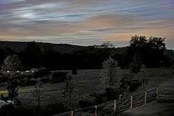 Lovettsville in September 2008 | |
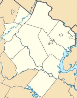 Lovettsville  Lovettsville  Lovettsville | |
| Coordinates: 39°16.4′N 77°38.4′W | |
| Country | |
| State | |
| County | |
| Government | |
| • Mayor | Nathaniel O. Fontaine[1] |
| • Vice Mayor | James McIntyre[1] |
| Area | |
| • Total | 0.85 sq mi (2.20 km2) |
| • Land | 0.84 sq mi (2.19 km2) |
| • Water | 0.00 sq mi (0.01 km2) |
| Elevation | 505 ft (154 m) |
| Population (2010) | |
| • Total | 1,613 |
| • Estimate (2018)[3] | 2,106 |
| • Density | 2,495.26/sq mi (963.02/km2) |
| Time zone | UTC-5 (Eastern (EST)) |
| • Summer (DST) | UTC-4 (EDT) |
| ZIP code | 20180 |
| Area code(s) | 540 |
| FIPS code | 51-47208[4] |
| GNIS feature ID | 1495879[5] |
| Website | LovettsvilleVA.gov |
The population was 1,613 at the 2010 census. The 2018 population estimated the population at 2,106.
History
Following the 1722 Treaty of St. Albans which established the Blue Ridge Mountains as the buffer between Native Americans and white settlers, German immigrants began arriving in the northern Loudoun Valley to farm the rich topsoil. They established several villages, many constructed of log and wooden buildings, and began to expand their land holdings. Lovettsville was then called The German Settlement.
In 1820 David Lovett subdivided his property into quarter-acre "city lots." As a result of the ensuing construction boom, the town was called Newtown. In 1828, the town was again renamed Lovettsville. In 1836 the Virginia General Assembly established Lovettsville as a town, but the town was not fully incorporated until 1876.
During the Civil War, Lovettsville was an important transportation stop for Union troops crossing the Potomac River.[6] Lovettsville was also among the few communities in Loudoun County to vote against secession.[7]
In 1940, Lovettsville was the site of a crash of a DC-3. It was the worst in US history at that time, killing 25 people including U.S. Senator Ernest Lundeen, and became known as the Lovettsville air disaster.
The Lovettsville Historic District was listed on the National Register of Historic Places in 2012.[8]
In 2018, after the NHL's Washington Capitals advanced to the Stanley Cup Finals for the second time in franchise history, the town's council voted to temporarily rename Lovettsville to "Capitals-ville" for the duration of the Finals.[9]
Geography
Lovettsville is located at 39°16.4′N 77°38.4′W (39.2728, -77.6399).[10]
According to the United States Census Bureau, the town has a total area of 0.9 square miles (2.3 km²), all of it land.
Government
Lovettsville is governed by a Council/Manager Form of Government:
Town Council:
Nathaniel O. Fontaine, Mayor
James McIntyre, Vice Mayor
Mike Dunlap
Renee Edmonston
Christopher Hornbaker
Matthew Schilling
Michael Senate
Administration:
Sam Finz, Town Manager
Planning Commission Members-----Term Expires
Tom Ciolkosz, Chairman 06/30/20
Bob Custard, Vice Chair 06/30/19
Stacey Evans 06/30/17
Vacant 06/30/17
Vacant 06/30/17
Shiva Schilling 06/30/20
Christopher Hornbaker 06/30/18
Demographics
| Historical population | |||
|---|---|---|---|
| Census | Pop. | %± | |
| 1870 | 155 | — | |
| 1880 | 92 | −40.6% | |
| 1900 | 97 | — | |
| 1910 | 192 | 97.9% | |
| 1920 | 167 | −13.0% | |
| 1930 | 239 | 43.1% | |
| 1940 | 248 | 3.8% | |
| 1950 | 341 | 37.5% | |
| 1960 | 217 | −36.4% | |
| 1970 | 185 | −14.7% | |
| 1980 | 613 | 231.4% | |
| 1990 | 749 | 22.2% | |
| 2000 | 853 | 13.9% | |
| 2010 | 1,613 | 89.1% | |
| Est. 2018 | 2,106 | [3] | 30.6% |
| U.S. Decennial Census[11] | |||
As of the census[4] of 2010, there were 1613 people, 566 households, and 424 families residing in the town. The population density was 1832.9 people per square mile (701.3/km²). There were 599 housing units at an average density of 680.7 per square mile (260.4/km²). The racial makeup of the town was 87.0% White, 6.0% African American, 0.3% Native American, 1.7% Asian, 0.1% Pacific Islands American, 1.9% from other races, and 3% from two or more races. Hispanic or Latino of any race were 7.3% of the population.
There were 566 households out of which 46.6% had children under the age of 18 living with them, 59.4% were married couples living together, 4.4% had a male householder with no wife present, 11.1% had a female householder with no husband present, and 25.1% were non-families. 18.6% of all households were made up of individuals and 6.5% had someone living alone who was 65 years of age or older. The average household size was 2.85 and the average family size was 3.3.
In the town, the population was spread out with 32.4% under the age of 18, 4.3% from 18 to 24, 33.4% from 25 to 44, 22.1% from 45 to 64, and 7.6% who were 65 years of age or older. The median age was 33.5 years. For every 100 females there were 92.4 males.
The median income for a household in the town was $100,288, and the median income for a family was $109,808. Males had a median income of $72,661 versus $51,438 for females. The per capita income for the town was $33,212. None of the families and .6% of the population were living below the poverty line, including no under eighteens and 9.1% of those over 64.
_at_Broad_Way_in_Lovettsville%2C_Loudoun_County%2C_Virginia.jpg)
Transportation
The only primary highway directly serving Lovettsville is Virginia State Route 287. SR 287 extends southward to Virginia State Route 7 at Purcellville. It also continues north to the Potomac River, where a bridge connects the north end of SR 287 to Brunswick, Maryland.
Events
- Lovettsville Oktoberfest typically takes place on the last full weekend of September.[12]
- Over Memorial Day Weekend, Lovettsville hosts Mayfest, billed as Lovettsville's All-American town picnic.[13]
- Over the first weekend of December, the Loudoun Valley German Society hosts the acclaimed annual Christkindlmarkt (traditional German Christmas market).[14]
- On New Year's Day, Lovettsville hosts Bezerkle on the Squirkle, a 5K fun run around oddly-arranged traffic square at the center of town.[15]
- The town also hosts Movies and Concerts on the Green at the Walker Pavilion monthly during the warm weather months.[16]
Notable people
- Warren T. Brookes, newspaper columnist
- Rob Jones, United States Marine
- Hal Douglas, voiceover recording artist
References
- "Mayor and Town Council". The Town of Lovettsville. Lovettsville, Virginia. Retrieved October 25, 2018.
- "2018 U.S. Gazetteer Files". United States Census Bureau. Retrieved Feb 16, 2020.
- "Population and Housing Unit Estimates". Retrieved June 4, 2019.
- "U.S. Census website". United States Census Bureau. Retrieved 2011-05-14.
- "US Board on Geographic Names". United States Geological Survey. 2007-10-25. Retrieved 2008-01-31.
- "Second Civil War Trail Dedicated In Lovettsville". Leesburg Today. 7 May 2013. Retrieved 16 May 2015.
- Meserve, Steve F. "The Civil War in Loudoun County". visitloudoun.org. Loudoun Convention & Visitors Association. Retrieved 10 October 2015.
- "National Register of Historic Places Listings". Weekly List of Actions Taken on Properties: 8/06/12 through 8/10/12. National Park Service. 2012-08-17.
- Leshan, Bruce. "SPORTS Lovettsville, Va. changes name to Capitalsville". WUSA-9. Retrieved 26 May 2018.
- "US Gazetteer files: 2010, 2000, and 1990". United States Census Bureau. 2011-02-12. Retrieved 2011-04-23.
- "Census of Population and Housing". Census.gov. Retrieved June 4, 2015.
- "Lovettsville Oktoberfest: Visit". Lovettsville Oktoberfest. Retrieved 16 May 2015.
- http://lovettsvillevamayfest.com
- "11 Of The Most Magical German Christmas Markets Across The U.S". BuzzFeed.
- "Annual Beserkle on the Squirkle". Town of Lovettsville. Retrieved 16 May 2015.
- "MayFest - Lovettsville's All-American Town Picnic". Town of Lovettsville.
External links
| Wikimedia Commons has media related to Lovettsville, Virginia. |
- Town website
- Community history
- Lovettsville Business Association
- Purcellville Gazette - weekly newspaper whose delivery area includes Lovettsville
Municipalities and communities of Loudoun County, Virginia, United States | ||
|---|---|---|
| Towns | 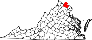 Map of Virginia highlighting Loudoun County | |
| CDPs | ||
| Unincorporated communities |
| |
| Former | ||