Branchville, Virginia
Branchville is a town in Southampton County, Virginia, United States. The population was 123 at the 2000 census.
Branchville, Virginia | |
|---|---|
 Location of Branchville, Virginia | |
| Coordinates: 36°34′9″N 77°14′56″W | |
| Country | United States |
| State | Virginia |
| County | Southampton |
| Area | |
| • Total | 0.43 sq mi (1.1 km2) |
| • Land | 0.43 sq mi (1.1 km2) |
| • Water | 0.00 sq mi (0.0 km2) |
| Elevation | 43 ft (13 m) |
| Population (2010) | |
| • Total | 114 |
| • Estimate (2018)[2] | 114 |
| • Density | 270/sq mi (100/km2) |
| Time zone | UTC−5 (Eastern (EST)) |
| • Summer (DST) | UTC−4 (EDT) |
| ZIP code | 23828 |
| Area code(s) | 757, 948 (planned) |
| FIPS code | 51-09208[3] |
| GNIS feature ID | 1463757[4] |
Geography
Branchville is located at 36°34′9″N 77°14′56″W (36.569266, −77.248997).[5]
According to the United States Census Bureau, the town has a total area of 0.4 square miles (1.1 km²), all of it land.
Demographics
| Historical population | |||
|---|---|---|---|
| Census | Pop. | %± | |
| 1910 | 239 | — | |
| 1920 | 148 | −38.1% | |
| 1930 | 161 | 8.8% | |
| 1940 | 153 | −5.0% | |
| 1950 | 169 | 10.5% | |
| 1960 | 158 | −6.5% | |
| 1970 | 189 | 19.6% | |
| 1980 | 174 | −7.9% | |
| 1990 | 55 | −68.4% | |
| 2000 | 123 | 123.6% | |
| 2010 | 114 | −7.3% | |
| Est. 2018 | 114 | [2] | 0.0% |
| U.S. Decennial Census[6] | |||
At the 2000 census there were 123 people, 50 households, and 36 families living in the town. The population density was 281.9 people per square mile (107.9/km²). There were 56 housing units at an average density of 128.4 per square mile (49.1/km²). The racial makeup of the town was 67.48% White, 30.89% African American, 0.81% Asian, and 0.81% from two or more races.[3] Of the 50 households 32.0% had children under the age of 18 living with them, 52.0% were married couples living together, 20.0% had a female householder with no husband present, and 28.0% were non-families. 26.0% of households were one person and 24.0% were one person aged 65 or older. The average household size was 2.46 and the average family size was 2.97.
The age distribution was 24.4% under the age of 18, 5.7% from 18 to 24, 23.6% from 25 to 44, 23.6% from 45 to 64, and 22.8% 65 or older. The median age was 44 years. For every 100 females, there were 75.7 males. For every 100 females age 18 and over, there were 63.2 males.
The median household income was $24,844 and the median family income was $32,917. Males had a median income of $21,250 versus $19,583 for females. The per capita income for the town was $11,985. There were no families and 4.6% of the population living below the poverty line, including no under eighteens and 15.8% of those over 64.
References
- "2018 U.S. Gazetteer Files". United States Census Bureau. Retrieved Feb 16, 2020.
- "Population and Housing Unit Estimates". Retrieved June 4, 2019.
- "U.S. Census website". United States Census Bureau. Retrieved 2008-01-31.
- "US Board on Geographic Names". United States Geological Survey. 2007-10-25. Retrieved 2008-01-31.
- "US Gazetteer files: 2010, 2000, and 1990". United States Census Bureau. 2011-02-12. Retrieved 2011-04-23.
- "Census of Population and Housing". Census.gov. Retrieved June 4, 2015.
Municipalities and communities of Southampton County, Virginia, United States | ||
|---|---|---|
| Towns | 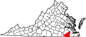 Map of Virginia highlighting Southampton County | |
| CDPs | ||
| Unincorporated communities | ||