Botetourt County, Virginia
Botetourt County (/ˈbɒtətɒt/ BOT-ə-tot) is a United States county that lies in the Roanoke Region of the Commonwealth of Virginia. Located in the mountainous portion of the state, the county is bordered by two major ranges, the Blue Ridge Mountains and the Appalachian Mountains.
Botetourt County | |
|---|---|
_(2).jpg) Botetourt County Courthouse | |
 Seal | |
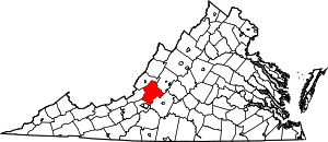 Location within the U.S. state of Virginia | |
 Virginia's location within the U.S. | |
| Coordinates: 37°33′N 79°48′W | |
| Country | |
| State | |
| Founded | 1770 |
| Named for | Lord Botetourt |
| Seat | Fincastle |
| Largest place | Cloverdale |
| Area | |
| • Total | 546 sq mi (1,410 km2) |
| • Land | 541 sq mi (1,400 km2) |
| • Water | 4.7 sq mi (12 km2) 0.9% |
| Population (2010) | |
| • Total | 33,148 |
| • Estimate (2018) | 33,192 |
| • Density | 61/sq mi (23/km2) |
| Time zone | UTC−5 (Eastern) |
| • Summer (DST) | UTC−4 (EDT) |
| Congressional district | 6th |
| Website | www |
Botetourt County was created in 1770 from part of Augusta County, and was named for Norborne Berkeley, known as Lord Botetourt. Like Augusta County, Botetourt County originally comprised a vast area; part of its land was later removed to form the entire state of Kentucky.
Botetourt County is part of the Roanoke Virginia Metropolitan Statistical Area, and the county seat is the town of Fincastle.[1] As of the 2010 census, the county population was 33,148. The area has seen growth in recent decades, with the population increasing more than thirty percent since the 1990 census.[2]
History

First proposed in the House of Burgesses in 1767, Botetourt County was created in 1770 from Augusta County.[3] The county is named for Norborne Berkeley, Baron de Botetourt, more commonly known as Lord Botetourt (1718–1770), who was a popular governor of the Virginia Colony from 1768 to 1770, when he died suddenly while in office.[4]
In the 1770s, when Virginia claimed most of the Northwest Territory which would later form all or part of six states, the land was initially divided between Botetourt and Augusta Counties. The territory that would eventually become the state of Kentucky was quickly removed from Botetourt, however, and became Fincastle County in 1772 and then Kentucky County in 1776.[3]
Botetourt County is a part of the Roanoke Metropolitan Statistical Area, and the southern parts of the county have become increasingly suburban in recent decades. Much of the area's former farmland and orchards have been developed into residential subdivisions and businesses.
Geography
According to the U.S. Census Bureau, the county has a total area of 546 square miles (1,410 km2), of which 541 square miles (1,400 km2) is land and 4.7 square miles (12 km2) (0.9%) is water.[5] The Blue Ridge Mountains run along the eastern part of the county, while the Appalachian Mountains run along the western portion. The two mountain ranges come close together, separated by the town of Buchanan and the James River.
The James River originates in Botetourt County, near the village of Iron Gate, just south of the Alleghany County border and near the merger of the Cowpasture River and the Jackson River. The James River runs south until Eagle Rock, where it turns east and meanders through the county, passing Springwood and James River High School until entering Buchanan. In Buchanan, the river turns northward and flows into Rockbridge County towards Glasgow.
Adjacent counties
- Roanoke County, Virginia - southwest
- Craig County, Virginia - west
- Alleghany County, Virginia - northwest
- Rockbridge County, Virginia - northeast
- Bedford County, Virginia - southeast
National protected areas
- Blue Ridge Parkway (part)
- George Washington National Forest (part)
- Jefferson National Forest (part)
Demographics
| Historical population | |||
|---|---|---|---|
| Census | Pop. | %± | |
| 1790 | 10,524 | — | |
| 1800 | 10,427 | −0.9% | |
| 1810 | 13,301 | 27.6% | |
| 1820 | 13,589 | 2.2% | |
| 1830 | 16,354 | 20.3% | |
| 1840 | 11,679 | −28.6% | |
| 1850 | 14,908 | 27.6% | |
| 1860 | 11,516 | −22.8% | |
| 1870 | 11,329 | −1.6% | |
| 1880 | 14,809 | 30.7% | |
| 1890 | 14,854 | 0.3% | |
| 1900 | 17,161 | 15.5% | |
| 1910 | 17,727 | 3.3% | |
| 1920 | 16,557 | −6.6% | |
| 1930 | 15,457 | −6.6% | |
| 1940 | 16,447 | 6.4% | |
| 1950 | 15,766 | −4.1% | |
| 1960 | 16,715 | 6.0% | |
| 1970 | 18,193 | 8.8% | |
| 1980 | 23,270 | 27.9% | |
| 1990 | 24,992 | 7.4% | |
| 2000 | 30,496 | 22.0% | |
| 2010 | 33,148 | 8.7% | |
| Est. 2018 | 33,277 | [6] | 0.4% |
| U.S. Decennial Census[7] 1790-1960[8] 1900-1990[9] 1990-2000[10] 2010-2015[2] | |||
As of the census[11] of 2000, there were 30,496 people, 11,700 households, and 9,114 families residing in the county. The population density was 56 people per square mile (22/km²). There were 12,571 housing units at an average density of 23 per square mile (9/km²). The racial makeup of the county was 94.91% White, 3.52% Black or African American, 0.22% Native American, 0.47% Asian, 0.19% from other races, and 0.69% from two or more races. 0.59% of the population were Hispanic or Latino of any race.
There were 11,700 households out of which 32.40% had children under the age of 18 living with them, 67.80% were married couples living together, 7.00% had a female householder with no husband present, and 22.10% were non-families. 19.20% of all households were made up of individuals and 7.60% had someone living alone who was 65 years of age or older. The average household size was 2.56 and the average family size was 2.92.
In the county, the population was spread out with 23.40% under the age of 18, 5.80% from 18 to 24, 28.90% from 25 to 44, 28.80% from 45 to 64, and 13.20% who were 65 years of age or older. The median age was 41 years. For every 100 females there were 99.70 males. For every 100 females age 18 and over, there were 98.40 males.
The median income for a household in the county was $48,731, and the median income for a family was $55,125. Males had a median income of $37,182 versus $25,537 for females. The per capita income for the county was $22,218. About 3.60% of families and 5.20% of the population were below the poverty line, including 5.40% of those under age 18 and 6.50% of those age 65 or over.
Government
Board of Supervisors
- Amsterdam District: Steve Clinton (I)
- Blue Ridge District: Billy W. Martin, Sr. (R)
- Buchanan District: Ray Sloan (R)
- Fincastle District: L. W. "Jack" Leffel (Chairman) (I)
- Valley District: Dr. Donald M. "Mac" Scothorn (Vice Chairman) (R)
Constitutional officers
- Clerk of the Circuit Court: Tommy L. Moore (D)
- Commissioner of the Revenue: Rodney Spickard (R)
- Commonwealth's Attorney: Joel R. Branscom (R)
- Sheriff: Ronald N. Sprinkle (R)
- Treasurer: William P. Arney (R)
Botetourt County is represented by Republican Stephen D. "Steve" Newman in the Virginia Senate, Republicans Chris T. Head and Terry L. Austin in the Virginia House of Delegates, and Republican Ben Cline in the U.S. House of Representatives.
Education
Botetourt County Public Schools operates public schools serving the county, with students attending one of two high schools:
- Lord Botetourt High School opened in suburban Daleville in the fall of 1959 and serves the southern parts of the county, including the communities of Blue Ridge, Cloverdale, parts of Fincastle and Troutville, and the northernmost suburbs of Roanoke.
- James River High School in the Springwood area of Buchanan also opened in 1959. It serves the northern parts of the county including Buchanan, Eagle Rock, Springwood, and parts of Fincastle and Troutville.
Politics
The Republican candidate for president has won the support of Botetourt County in 11 of the last 13 races. The county also voted Republican for governor in 2005, 2009, 2013 and 2017. It voted in 2008 for Mark Warner.
| Year | Republican | Democratic | Third parties |
|---|---|---|---|
| 2016 | 71.4% 13,375 | 24.0% 4,494 | 4.7% 870 |
| 2012 | 68.4% 12,479 | 29.9% 5,452 | 1.7% 310 |
| 2008 | 65.9% 11,471 | 32.7% 5,693 | 1.4% 242 |
| 2004 | 68.8% 10,865 | 30.4% 4,801 | 0.8% 131 |
| 2000 | 64.1% 8,867 | 33.4% 4,627 | 2.5% 346 |
| 1996 | 51.7% 6,404 | 37.0% 4,576 | 11.3% 1,400 |
| 1992 | 48.4% 5,904 | 35.6% 4,349 | 16.0% 1,956 |
| 1988 | 59.3% 5,687 | 39.2% 3,763 | 1.5% 141 |
| 1984 | 64.2% 5,959 | 34.9% 3,243 | 0.9% 87 |
| 1980 | 51.2% 4,408 | 43.0% 3,698 | 5.8% 496 |
| 1976 | 44.1% 3,343 | 53.1% 4,021 | 2.8% 209 |
| 1972 | 69.4% 3,806 | 27.7% 1,519 | 2.9% 156 |
| 1968 | 50.5% 2,598 | 24.8% 1,272 | 24.7% 1,270 |
| 1964 | 46.9% 2,098 | 53.1% 2,377 | 0.0% 1 |
| 1960 | 56.8% 2,159 | 42.6% 1,621 | 0.6% 22 |
| 1956 | 60.7% 2,280 | 36.6% 1,377 | 2.7% 101 |
| 1952 | 61.5% 2,021 | 38.5% 1,264 | 0.0% 1 |
| 1948 | 51.8% 1,363 | 39.0% 1,026 | 9.2% 242 |
| 1944 | 49.7% 1,272 | 49.8% 1,275 | 0.6% 15 |
| 1940 | 44.8% 1,085 | 54.9% 1,329 | 0.3% 8 |
| 1936 | 46.3% 1,343 | 53.2% 1,544 | 0.5% 14 |
| 1932 | 39.5% 1,209 | 59.1% 1,808 | 1.3% 41 |
| 1928 | 56.8% 1,575 | 43.2% 1,200 | |
| 1924 | 45.9% 1,264 | 51.8% 1,427 | 2.3% 63 |
| 1920 | 48.2% 1,240 | 51.7% 1,331 | 0.1% 3 |
| 1916 | 45.8% 775 | 53.2% 900 | 1.0% 16 |
| 1912 | 32.2% 517 | 55.3% 889 | 12.6% 202 |
Fire & emergency medical services
Botetourt County Fire & EMS uses a combination of career staff and volunteers to provide fire protection, emergency medical services, fire safety education, swiftwater rescue, and other emergency services to the county. The department operates out of seven stations with a range of fire apparatus and ambulances to provide these services.[13][14]
Communities
Towns
Census-designated places
Unincorporated communities
Notable people
- George A. Anderson (1853–1896), United States Congressman from Illinois
- Samuel Barton (1749–1810), Explorer, pioneer, early settler of Nashville, Tennessee, and patriot
- Edward Rumsey (1796–1868), United States Representative from Kentucky
- Angela Tincher, Virginia Tech softball pitcher 2005–2008
- Matthew Ramsey (songwriter), songwriter and lead vocalist of Old Dominion (band)
References
- Roanoke Region of Virginia
- "State & County QuickFacts". United States Census Bureau. Retrieved January 1, 2014.
- McClane, Debra Alderson (2007). Botetourt County. Charleston, SC: Arcadia Pub. ISBN 9780738543758.
- Salmon, Emily J.; Campbell, Jr, Edward D.C. (1994). The hornbook of Virginia history : a ready-reference guide to the Old Dominion's people, places, and past (4th ed.). Richmond: Library of Virginia. p. 161. ISBN 0884901777.
- "US Gazetteer files: 2010, 2000, and 1990". United States Census Bureau. 2011-02-12. Retrieved 2011-04-23.
- "Population and Housing Unit Estimates". Retrieved July 14, 2019.
- "U.S. Decennial Census". United States Census Bureau. Retrieved January 1, 2014.
- "Historical Census Browser". University of Virginia Library. Retrieved January 1, 2014.
- "Population of Counties by Decennial Census: 1900 to 1990". United States Census Bureau. Retrieved January 1, 2014.
- "Census 2000 PHC-T-4. Ranking Tables for Counties: 1990 and 2000" (PDF). United States Census Bureau. Retrieved January 1, 2014.
- "U.S. Census website". United States Census Bureau. Retrieved 2011-05-14.
- Leip, David. "Dave Leip's Atlas of U.S. Presidential Elections". uselectionatlas.org. Retrieved 2018-08-18.
- "Fire Stations". Botetourt County Fire and EMS. Retrieved 24 June 2015.
- "Fincastle Fire and Rescue Merger". WSLS 10. Retrieved 1 October 2016.
External links
Places adjacent to Botetourt County, Virginia | ||||||||||
|---|---|---|---|---|---|---|---|---|---|---|
| ||||||||||
Municipalities and communities of Botetourt County, Virginia, United States | ||
|---|---|---|
| Towns | Map of Virginia highlighting Botetourt County | |
| CDPs | ||
| Unincorporated communities |
| |
| Footnotes | ‡This populated place also has portions in an adjacent county or counties | |

| Authority control |
|
|---|