Warsaw, Virginia
Warsaw is a town in and the county seat of Richmond County, Virginia, United States.[5] The population was 1,512 at the 2010 census.
Warsaw, Virginia | |
|---|---|
 Shops in central Warsaw | |
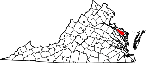
 Location of Warsaw, Virginia | |
| Coordinates: 37°57′27″N 76°45′30″W | |
| Country | United States |
| State | Virginia |
| County | Richmond |
| Government | |
| • Type | Council - Manager |
| • Mayor | Randall L. Phelps |
| • Police Chief | Joan Kent |
| • Town Manager | Joseph N. Quesenberry |
| Area | |
| • Total | 3.05 sq mi (7.91 km2) |
| • Land | 3.05 sq mi (7.91 km2) |
| • Water | 0.00 sq mi (0.00 km2) |
| Elevation | 131 ft (40 m) |
| Population (2010) | |
| • Total | 1,512 |
| • Estimate (2018)[2] | 1,489 |
| • Density | 487.56/sq mi (188.22/km2) |
| Time zone | UTC−5 (Eastern (EST)) |
| • Summer (DST) | UTC−4 (EDT) |
| ZIP code | 22572 |
| Area code | 804 |
| FIPS code | 51-83168[3] |
| GNIS ID | 1500279[4] |
| Website | Town website |
History
The original name of the town was Richmond Courthouse. In 1831 the town's name was changed to Warsaw, after the news of the bloody Battle of Warsaw reached local residents.[6] A number of other small towns in the United States changed their names to Warsaw at this time (Warsaw, Kentucky for instance), all as a result of sympathy in the United States for the November Uprising in Poland. Because Richmond Courthouse was still unincorporated in 1830, it is unclear who was responsible for the change of name to Warsaw. Historic sites nearby include Menokin, the former home of Francis Lightfoot Lee, Mount Airy and Sabine Hall. A former plantation estate Belle Mount is currently operated as a vineyard and winery within a few miles of Warsaw town limits.
In addition to Menokin, Mounty Airy, and Sabine Hall, Grove Mount and the Richmond County Courthouse are listed on the National Register of Historic Places. The formerly listed Bladensfield was destroyed by fire in 1996.[7]
Geography
Warsaw is located at 37°57′27″N 76°45′30″W (37.957617, −76.758302).[8]
According to the United States Census Bureau, the town has a total area of 3.0 square miles (7.9 km²), all of it land.
Climate
The climate in this area is characterized by hot, humid summers and generally mild to cool winters. According to the Köppen Climate Classification system, Warsaw has a humid subtropical climate, abbreviated "Cfa" on climate maps.[9]
Demographics

| Historical population | |||
|---|---|---|---|
| Census | Pop. | %± | |
| 1880 | 115 | — | |
| 1950 | 435 | — | |
| 1960 | 549 | 26.2% | |
| 1970 | 511 | −6.9% | |
| 1980 | 771 | 50.9% | |
| 1990 | 961 | 24.6% | |
| 2000 | 1,375 | 43.1% | |
| 2010 | 1,512 | 10.0% | |
| Est. 2018 | 1,489 | [2] | −1.5% |
| U.S. Decennial Census[10] | |||
At the 2000 census there were 1,375 people, 445 households, and 233 families living in the town. The population density was 453.0 people per square mile (174.6/km²). There were 468 housing units at an average density of 154.2 per square mile (59.4/km²). The racial makeup of the town was 67.64% White, 29.38% African American, 0.22% Native American, 0.44% Asian, 1.53% from other races, and 0.80% from two or more races. Hispanic or Latino of any race were 4.36%.[3]
Of the 445 households 22.5% had children under the age of 18 living with them, 39.1% were married couples living together, 10.8% had a female householder with no husband present, and 47.6% were non-families. 45.6% of households were one person and 24.3% were one person aged 65 or older. The average household size was 2.01 and the average family size was 2.81.
The age distribution was 13.3% under the age of 18, 9.7% from 18 to 24, 28.1% from 25 to 44, 19.4% from 45 to 64, and 29.5% 65 or older. The median age was 44 years. For every 100 females, there were 102.2 males. For every 100 females age 18 and over, there were 103.8 males.
The median household income was $28,971 and the median family income was $44,167. Males had a median income of $40,052 versus $23,661 for females. The per capita income for the town was $21,392. About 12.4% of families and 16.8% of the population were below the poverty line, including 20.6% of those under age 18 and 16.4% of those age 65 or over.
Economy
Warsaw is the location for the Northern Neck Regional Jail which was completed in 1995. The jail employs 100 people and has a capacity of 460 inmates with its most recent addition completed in 2000.[11]
Notable people
- William Atkinson Jones – member of United States House of Representatives, sometimes called architect of Philippine independence
- Cal Bowdler – power forward for NBA's Atlanta Hawks (1999–2002)
References
- "2018 U.S. Gazetteer Files". United States Census Bureau. Retrieved Feb 16, 2020.
- "Population and Housing Unit Estimates". Retrieved June 4, 2019.
- "U.S. Census website". United States Census Bureau. Retrieved 2008-01-31.
- "US Board on Geographic Names". United States Geological Survey. 2007-10-25. Retrieved 2008-01-31.
- "Find a County". National Association of Counties. Retrieved 2011-06-07.
- (in English) Francene Barber; David Jett; Brenda Harhai (2010). Warsaw. Images of America. Charleston, S.C.: Arcadia Publishing. pp. 30, 130. ISBN 978-0-7385-6776-1. LCCN 2009921315.
- "National Register Information System". National Register of Historic Places. National Park Service. July 9, 2010.
- "US Gazetteer files: 2010, 2000, and 1990". United States Census Bureau. 2011-02-12. Retrieved 2011-04-23.
- Climate Summary for Warsaw, Virginia
- "Census of Population and Housing". Census.gov. Retrieved June 4, 2015.
- "Northern Neck Regional Jail - History of the Jail". Northern Neck Regional Jail. Retrieved June 16, 2018.
External links
| Wikimedia Commons has media related to Warsaw, Virginia. |