U.S. Route 29 in Virginia
| |||||||
|---|---|---|---|---|---|---|---|
_map.svg.png) | |||||||
| Route information | |||||||
| Maintained by VDOT | |||||||
| Length | 248.00 mi[1] (399.12 km) | ||||||
| Existed | 1931–present | ||||||
| Tourist routes |
| ||||||
| Major junctions | |||||||
| South end |
| ||||||
|
| |||||||
| North end |
| ||||||
| Location | |||||||
| Counties | City of Danville, Pittsylvania, Campbell, City of Lynchburg, Amherst, Nelson, Albemarle, City of Charlottesville, Greene, Madison, Culpeper, Fauquier, Prince William, Fairfax, City of Fairfax, City of Falls Church, Arlington | ||||||
| Highway system | |||||||
| |||||||

U.S. Route 29 (US 29) is a major north–south route in the Commonwealth of Virginia. It covers 248 miles (399 km) from the North Carolina border at the city of Danville to the Key Bridge in Washington, D.C.. US 29 roughly bisects Virginia into eastern and western halves, and along with Interstate 81 in western Virginia, and 85/95 farther east, provides one of the major north–south routes through the Commonwealth.
For much of its length, US 29 in Virginia is known as the Seminole Trail. Through Northern Virginia, it is known as Lee Highway, except in Falls Church, where it acts as the east/west divider for city streets and is called North or South Washington Street. On April 7, 1993 the Virginia General Assembly officially designated the entire length of US 29 from the North Carolina border to the Potomac River as the "29th Infantry Division Memorial Highway" in honor of that Army unit, which, along with the 1st Infantry Division, formed the spearhead of the American infantry that landed on the morning of 6 June 1944 on Omaha Beach in Normandy as part of the invasion of France to liberate that country during World War II. These divisions next fought their way across France, and into Germany. In addition, the name of this highway serves to honor many members of the Virginia Army National Guard who serve as part of this National Guard Division today. Signs indicating this designation have been placed periodically on both sides of US 29.
For most of its route through Virginia, US 29 has been constructed to be at least four lanes along its route, with the two short exceptions being where the highway passes through Manassas National Battlefield Park, where it is two lanes wide for approximately three miles, and through Fairfax and Arlington counties, where it is sometimes wider.
US 29 in Virginia has eleven highway by-pass routes around various cities and towns. These bypasses are around Danville, Chatham, Gretna, Hurt-Altavista, Lynchburg-Madison Heights-Amherst, Lovingston, Charlottesville, Madison, Culpeper, Remington, and Warrenton. In addition, Interstate 66 serves for the most part as a by-pass of Manassas and also Fairfax and Arlington.
Route description
US 29 enters Virginia in Danville from North Carolina, immediately splitting into business and by-pass routes. US 29 joins the Danville Expressway and US 58 around the east side of Danville, entering Pittsylvania County, and re-merging with the business route north of town in Blairs. The interchange where the split of US 29 into Business and Bypass routes/junction with US 58 occurs has ramps that enter North Carolina and ramps that enter Virginia, complete with welcome signs from each state. There is a cloverleaf ramp that dips into North Carolina from Virginia and then crosses the state lines back into Virginia. Along the southeastern quadrant of the Danville Expressway between the North Carolina US 360, the route is designated as part of unsigned State Route 785 for 7.39 mi (11.89 km).[2] Created c. 2000, SR 785 is numbered in contradiction to the conventional system of numbering in the state, where primary routes are numbered less than 600 and secondary routes at or above this number. It is numbered as such because it is part of the planned Interstate 785, which will run south along US 29 to Interstate 85 in Greensboro, North Carolina, and is only one of two routes of this type. The other is Route 895 in Richmond for similar reasons.
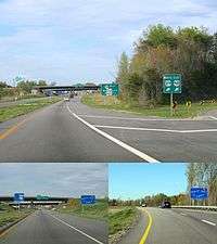
_just_north_of_the_junction_with_Northside_Lane_(U.S._Route_29_Business)_in_Lovingston%2C_Nelson_County%2C_Virginia.jpg)
US 29 then continues north where it splits into business and by-pass routes for Chatham, Gretna, and Hurt before entering Campbell County.
The next major city is Lynchburg. US 29 joins the US 460 by-pass of Lynchburg, splitting from it just before entering Amherst County. US 29 again by-passes Madison Heights and Amherst as an expressway, and enters Nelson County and passes the town of Lovingston and enters into Albemarle County. The route then continues north to Charlottesville, intersecting Interstate 64 and by-passing downtown Charlottesville. US 29 rejoins its congested business route just north of downtown, continuing north as a 6 lane road through Charlottesville's business district. Past Charlottesville, it converts back to 4 lanes and continues through Greene and Madison Counties, and then turns north-east toward Culpeper. US 15 joins US 29 around Culpeper, and heads to Warrenton, entering Northern Virginia.
US 29 / 15 is joined by US 17 south of Warrenton in Fauquier County, and continues around the town, with US 17 splitting off. US 29/15 continues mostly eastward to Gainesville where US 15 splits and US 29 intersects Interstate 66 for the first time. US 29 continues into Fairfax County, where it passes along the boundary of the city of Falls Church, where the road has two different names. The portion of the street running northbound is located in the City of Falls Church is called Washington Boulevard, and has different street addresses than the other side running southbound in Fairfax County, where it is named Lee Highway. The road continues into Arlington, having intersected I-66 five more times before crossing into the District.
History
The portion of what is now US 29 from the North Carolina state line to Warrenton was named the Seminole Trail by an act of the Virginia General Assembly on February 16, 1928. Although it was apparently not part of the National Auto Trails initiative early in the 20th century, the Seminole Trail is believed to have originated as part of an effort to promote the road as a through-route to Florida, home of the Native American Seminole tribe. Many road maps of the 1930s and 1940s list the Seminole Trail on highways in Virginia, the Carolinas, Georgia and ultimately Florida.
Gainesville Interchange
The Gainesville Interchange project took place at the interchange between Lee Highway (US 29) and Interstate 66 at the junction with Linton Hall Road (SR 619) starting in July 2011, with board planning on it dating back to 2006. The project was worth $230 million and included interchanges at many other heavily traveled roads in the area due to the rapid growth in development in Gainesville and Haymarket, along with it being a major area drivers departure off of I-66 to travel towards other major cities along Lee Highway, such as Charlottesville. Reasoning for this is because of the lack of road development to accommodate the new heavy traffic in the area. The plan included a single point interchange design and bridges over train tracks to ease traffic flow on Lee Highway onto I-66. Lee Highway was also widened around the interchange to combat this issue. What was once a two-lane country road is now a four lane suburban highway. Land was acquired by VDOT at the intersection of US 29 and Linton Hall Road/SR 619. The entire project was completed and opened to the general public on July 9, 2015.
Charlottesville Bypass
A western Route 29 bypass around Charlottesville was originally proposed in 1979. Engineering and environmental work on the project began in late 1984 and the location was approved by the Commonwealth Transportation Board in 1990.
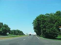
.jpg)
Acquisition of right of way for the project began in 1991 and continued until 2001. No additional right of way has been purchased since then. VDOT owns 36 properties that are currently leased and occupied.
In 1998 a lawsuit was filed challenging the project, alleging that the environmental impact review of the project violated the National Environmental Policy Act (NEPA). In 2001 the federal court ruled in favor of VDOT on the suit but required the agency to complete a Supplemental Environmental Impact Statement addressing the road's impacts on the South Fork Rivanna Reservoir and the mitigation to minimize those impacts. That document was completed and accepted by the Federal Highway Administration in 2003.
In 1996 the Charlottesville-Albemarle Metropolitan Planning Organization (MPO) inserted language into its Transportation Improvement Program that prevented additional funds from being allocated to construction of the Western Bypass. That language was removed by the MPO Policy Board in July 2011.[3]
All activities on the Route 29 Charlottesville Bypass project were suspended in March 2014 following notification from the Federal Highway Administration that a new Supplemental Environmental Impact Statement would be required before the environmental process could be completed. The new Supplemental EIS was required due to the history of litigation and controversy associated with the project.[4]
Major intersections
| County | Location | mi | km | Exit | Destinations | Notes |
|---|---|---|---|---|---|---|
| City of Danville | 0.00 | 0.00 | SR 785 begin | Continuation into North Carolina | ||
| ? | South end of US 58 overlap | |||||
| ? | Corning Drive | Southbound exit and northbound entrance | ||||
| ? | Elizabeth Street Extended | |||||
| ? | ||||||
| ? | ||||||
| ? | River Park Drive – Dan Daniel Memorial Park | |||||
| ? | SR 785 end | North end of concurrency with US 58; future northern terminus of I-785 | ||||
| Pittsylvania | | — | ||||
| | — | Northbound exit and southbound entrance | ||||
| | — | North end of freeway; southbound exit and northbound entrance | ||||
| Chatham | — | South end of expressway; northbound exit and southbound entrance | ||||
| | — | |||||
| | — | |||||
| | — | North end of expressway | ||||
| | — | South end of expressway; northbound exit and southbound entrance | ||||
| | — | |||||
| | — | North end of expressway; southbound exit and northbound entrance | ||||
| | — | South end of expressway | ||||
| | — | |||||
| Campbell | | — | ||||
| | — | |||||
| Altavista | — | |||||
| | — | North end of expressway | ||||
| Yellow Branch | ||||||
| | South end of freeway section; south end of concurrency with US 460 | |||||
| City of Lynchburg | Champions Circle | Southbound entrance only | ||||
| — | Candlers Mountain Road to SR 670 / University Boulevard – Liberty University | University Blvd. not signed northbound; SR 670 not signed southbound | ||||
| — | South end of concurrency with US 501 | |||||
| — | Odd Fellows Road | Future interchange; under construction[5] | ||||
| — | North end of freeway section; north end of concurrency with US 501 | |||||
| Campbell | | — | South end of freeway; north end of concurrency with US 460 | |||
| Amherst | | — | ||||
| | — | |||||
| Sweet Briar | — | |||||
| Amherst | — | |||||
| — | North end of freeway; SR 739 is former southern terminus of SR 150 | |||||
| | Former SR 150 | |||||
| | Former northern terminus of SR 150 | |||||
| | ||||||
| Nelson | Colleen | South end of concurrency with SR 56 | ||||
| Lovingston | North end of concurrency with SR 56 | |||||
| Woods Mill | South end of concurrency with SR 6 | |||||
| | North end of concurrency with SR 6 | |||||
| Albemarle | Crossroads | Former SR 230 north | ||||
| | — | South end of freeway; I-64 exit 118 | ||||
| | — | |||||
| | — | South end of concurrency with US 250 | ||||
| | — | Southbound exit and northbound entrance | ||||
| | — | Leonard Sandridge Road – University of Virginia | Northbound exit and entrance only | |||
| | — | |||||
| City of Charlottesville | — | North end of freeway; north end of concurrency with US 250 | ||||
| Greene | Ruckersville | |||||
| Burtonville | former SR 243 west | |||||
| Madison | | South end of concurrency with SR 230 | ||||
| | North end of concurrency with SR 230; south end of concurrency with SR 231 | |||||
| | North end of concurrency with SR 231; northbound exit and southbound entrance | |||||
| | former SR 27 | |||||
| | former SR 230 | |||||
| | ||||||
| Culpeper | | — | South end of expressway | |||
| | — | South end of concurrency with US 15 | ||||
| | — | |||||
| Inlet | — | North end of expressway | ||||
| | ||||||
| Fauquier | | |||||
| | ||||||
| Opal | Interchange; south end of concurrency with US 17 | |||||
| | ||||||
| Warrenton | Interchange | |||||
| Interchange; north end of concurrency with US 17 | ||||||
| Buckland | ||||||
| Prince William | | North end of concurrency with US 15 | ||||
| Gainesville | Interchange | |||||
| I-66 exit 43 | ||||||
| Manassas National Battlefield Park | ||||||
| Fairfax | Bull Run | |||||
| Centreville | I-66 exit 52 | |||||
| Interchange | ||||||
| Braddock Road (SR 620) / Old Centreville Road (SR 898) | ||||||
| Willow Springs | ||||||
| | Interchange | |||||
| Jermantown | ||||||
| City of Fairfax | South end of concurrency with US 50 | |||||
| Fairfax Circle (traffic circle with cut-through); north end of concurrency with US 50; south end of concurrency with SR 237 | ||||||
| Fairfax | | Blake Lane (SR 655) / Pickett Road | ||||
| Merrifield | ||||||
| | Interchange | |||||
| City of Falls Church | ||||||
| Arlington | East Falls Church | North end of concurrency with SR 237 | ||||
| Glebewood | ||||||
| Waverly Hills | South end of concurrency with SR 309; no left turn northbound | |||||
| North end of concurrency with SR 309 | ||||||
| Cherrydale | Lee Highway (SR 309 west) | |||||
| Lyon Village | I-66 exit 72 | |||||
| Rosslyn | I-66 exit 74; southbound exit and northbound entrance | |||||
| I-66 exit 74 | ||||||
| Interchange; no southbound entrance | ||||||
| Potomac River | Continuation into D.C. | |||||
1.000 mi = 1.609 km; 1.000 km = 0.621 mi
| ||||||
See also
References
- ↑ "2010 Traffic Data". Virginia Department of Transportation. 2010. Retrieved 2012-01-09.
- Pittsylvania County and City of Danville (PDF)
- Campbell County and City of Lynchburg (PDF)
- Amherst County (PDF)
- Nelson County (PDF)
- Albemarle County and City of Charlottesville (PDF)
- Greene County (PDF)
- Madison County (PDF)
- Culpeper County (PDF)
- Fauquier County (PDF)
- Prince William County, City of Manassas, and City of Manassas Park (PDF)
- Fairfax County, City of Fairfax, and City of Falls Church (PDF)
- Arlington County and City of Alexandria (PDF)
- ↑ "2005 Virginia Department of Transportation Jurisdiction Report - Daily Traffic Volume Estimates - Pittsylvania County" (PDF). (483 KiB)
- ↑ "Archived copy". Archived from the original on 2014-08-12. Retrieved 2014-08-08.
- ↑ "Archived copy" (PDF). Archived from the original (PDF) on 2016-03-04. Retrieved 2014-08-08.
- ↑ "Odd Fellows Road Interchange and Roadway Improvements" (PowerPoint). Virginia Department of Transportation. VDOT. January 12, 2016. p. 3. Retrieved July 29, 2017.
External links
| Wikimedia Commons has media related to U.S. Route 29 in Virginia. |
Route map:
| Previous state: North Carolina |
Virginia | Next state: District of Columbia |