Stjørdal
| Stjørdal kommune Skierde | |||||
|---|---|---|---|---|---|
| Municipality | |||||
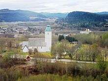
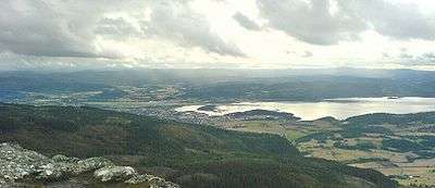 View of Stjørdalshalsen | |||||
| |||||
 Stjørdal within Trøndelag | |||||
| Coordinates: 63°28′30″N 11°10′15″E / 63.47500°N 11.17083°ECoordinates: 63°28′30″N 11°10′15″E / 63.47500°N 11.17083°E | |||||
| Country | Norway | ||||
| County | Trøndelag | ||||
| District | Stjørdalen | ||||
| Established | 1 Jan 1962 | ||||
| Administrative centre | Stjørdalshalsen | ||||
| Government | |||||
| • Mayor (2018) | Ivar Vigdenes (Sp) | ||||
| Area | |||||
| • Total | 938.28 km2 (362.27 sq mi) | ||||
| • Land | 913.72 km2 (352.79 sq mi) | ||||
| • Water | 24.56 km2 (9.48 sq mi) 2.6% | ||||
| Area rank | #118 in Norway | ||||
| Population (2017) | |||||
| • Total | 23,625 | ||||
| • Rank | #48 in Norway | ||||
| • Density | 25.9/km2 (67/sq mi) | ||||
| • Change (10 years) | 16.5% | ||||
| Demonym(s) | Stjørdaling[1] | ||||
| Time zone | UTC+01:00 (CET) | ||||
| • Summer (DST) | UTC+02:00 (CEST) | ||||
| ISO 3166 code | NO-5035 | ||||
| Official language form | Neutral | ||||
| Website |
stjordal | ||||

Stjørdal (![]()
The municipality is known for the village of Hell which is located in the Lånke area of Stjørdal. Hell is especially known for its train station, Hell Station, where you find the old sign saying Gods-expedition (meaning "Cargo handling").
The 938-square-kilometre (362 sq mi) municipality is the 118th largest by area out of the 422 municipalities in Norway. Stjørdal is the 48th most populous municipality in Norway with a population of 23,625. The municipality's population density is 25.9 inhabitants per square kilometre (67/sq mi) and its population has increased by 16.5% over the last decade.[2]
General information
The old prestegjeld of Stjørdalen was established as the municipality of Stjørdalen on 1 January 1838 (see formannskapsdistrikt). On 1 January 1850, Stjørdalen municipality was divided into two new municipalities: Øvre Stjørdal (population: 5,199) in the east and Nedre Stjørdal (population: 6,543) in the west. Later, on 1 January 1874, Øvre Stjørdal municipality was divided into two new municipalities: Hegra (population: 3,409) in the west and Meråker (population: 1,861) in the east. On 1 January 1902, Nedre Stjørdal municipality was divided into three new municipalities: Lånke (population: 1,449) in the south, Skatval (population: 2,125) in the north, and Stjørdal (population: 3,158) in the central part. This Stjørdal was quite small in comparison to its size today, but over time it was expanded.
During the 1960s, there were many municipal mergers across Norway due to the work of the Schei Committee. On 1 January 1962, the municipalities of Stjørdal (population: 6,204), Hegra (population: 2,704), Lånke (population: 1,967), and Skatval (population: 1,944) were all merged to form a much larger municipality of Stjørdal.[3]
On 1 January 2018, the municipality switched from the old Nord-Trøndelag county to the new Trøndelag county.
Name
The Old Norse form of the name was Stjórardalr. The first element is the genitive case of the river name Stjór (now called Stjørdalselva) and the last element is dalr which means "valley" or "dale". The meaning of the river name is unknown.[4]
The pronunciation of the name Stjørdal in the local dialect is [ʃøɽdaɽːɲ] (![]()
Coat of arms and flag
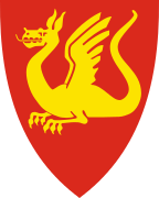
On 29 September 1983, by resolution of its municipal council, Stjørdal adopted a new municipal coat of arms in red and gold, bearing a gold or yellow Lindworm (a two-legged dragon or wyvern) on a field of red.[5] The arms were granted on 25 November 1983.[6]
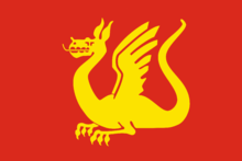
Most Norwegian municipalities have a banner of their respective coats of arms as a flag, and accordingly, the municipal flag of Stjørdal similarly bears a yellow wyvern on a red field.
Although the coat of arms is from modern times, the dragon motif of the arms was inspired by a medieval seal for the district, dating from 1344.[7] The old municipal seal was considered unsuitable for selection as the municipal coat of arms, because to obtain a municipal coat of arms and flag, a Norwegian municipality must fulfill certain heraldic requirements that do not apply to a seal.[5] For example, a coat of arms will generally contain only one pictorial motif, while Stjørdal's seal had three motifs and failed to meet additional requirements concerning color elements.[5] The municipality sought assistance from the National Archives of Norway, and was referred to archivist Hallvard Trætteberg, resulting in a collaboration to develop the new coat of arms.[5]
The dragon is a symbol of Saint Margaret of Antioch, and its depiction is derived from Stjørdal's old seal, which showed Saint Margaret standing on a slain dragon.[5][8] According to Stjørdal's municipal website, both the four-legged dragon and the two-legged wyvern are used in ancient designs of arms going back thousands of years, and have "always stood as a symbol of authority, power, and exalted dignity of great national cultures."[5]
Churches
The Church of Norway has four parishes (sokn) within the municipality of Stjørdal. It is part of the Stjørdal prosti (deanery) in the Diocese of Nidaros.
| Parish (Sokn) | Church Name | Location of the Church | Year Built |
|---|---|---|---|
| Hegra | Hegra Church | Hegra | 1783 |
| Floren Chapel | Flornes | 1936 | |
| Okkelberg Chapel | Skjelstadmarka | 1905 | |
| Lånke | Lånke Church | Lånke | 1899 |
| Elvran Chapel | Elvran | 1893 | |
| Skatval | Skatval Church | Skatval | 1901 |
| Stjørdal | Værnes Church | Prestmoen | 1100 |
History
| Historical population | ||
|---|---|---|
| Year | Pop. | ±% |
| 1951 | 5,105 | — |
| 1960 | 6,128 | +20.0% |
| 1970 | 13,545 | +121.0% |
| 1980 | 16,107 | +18.9% |
| 1990 | 17,276 | +7.3% |
| 2000 | 18,238 | +5.6% |
| 2010 | 21,375 | +17.2% |
| 2017 | 23,625 | +10.5% |
| Source: Statistics Norway. | ||

Stjørdal is the location of Steinvikholm Castle, the residence of Norway's last Catholic archbishop, Olav Engelbrektsson. It is located on the Skatval peninsula.
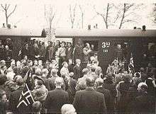
Hegra Fortress is located in the central part of the municipality. It was used as a defense against the Swedish military. It was also used during World War II in the Battle of Hegra Fortress.
The Stjørdal Folk Academy was founded in 1908 by Nils Anton Vaagland, who was later mayor of Stjørdal and also served as the academy's director for 10 years.[9]
Government
All municipalities in Norway, including Stjørdal, are responsible for primary education (through 10th grade), outpatient health services, senior citizen services, unemployment and other social services, zoning, economic development, and municipal roads. The municipality is governed by a municipal council of elected representatives, which in turn elect a mayor. The municipality falls under the Inntrøndelag District Court and the Frostating Court of Appeal.
Municipal council
The municipal council (Kommunestyre) of Stjørdal is made up of 41 representatives that are elected to four year terms. Currently, the party breakdown is as follows:[10]
| Party Name | Name in Norwegian | Number of representatives | |
|---|---|---|---|
| Labour Party | Arbeiderpartiet | 16 | |
| Progress Party | Fremskrittspartiet | 2 | |
| Conservative Party | Høyre | 6 | |
| Christian Democratic Party | Kristelig Folkeparti | 1 | |
| Green Party | Miljøpartiet De Grønne | 1 | |
| Red Party | Rødt | 1 | |
| Centre Party | Senterpartiet | 11 | |
| Socialist Left Party | Sosialistisk Venstreparti | 1 | |
| Liberal Party | Venstre | 2 | |
| Total number of members: | 41 | ||
Geography
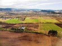
Stjørdal consists of the old municipalities of Skatval, Hegra, Lånke, and Stjørdal. The Stjørdalselva river runs through the Stjørdalen valley, with the Skatval peninsula on the northern side. The Forbordsfjellet mountain sits in the northern part of the municipality. The Skarvan and Roltdalen National Park lies in the eastern part of the municipality, as is a tiny part of the lake Feren.
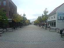
The village of Stjørdal declared town status in 1997. Stjørdal is one of the fastest-growing municipalities in Trøndelag due to its proximity to the city of Trondheim and also to Statoil's presence (it controls a large part of the petroleum activity in the Norwegian Sea from Stjørdal).
Trondheim is only about 32 kilometres (20 miles) from Stjørdal either by road (European route E6) or train (Trønderbanen). Stjørdal is in the process of "growing together" with Trondheim, a show of regional urbanization. The distance to Steinkjer is about 90 km (56 mi), and the towns of Levanger and Verdalsøra are both about 48 to 60 km (30 to 37 mi) to the north. All four of these towns are located on the eastern shore of Trondheimsfjord. Stjørdal is now considered a part of Trondheim due to its urbanization process and close location.
Climate
Trondheim Airport Værnes in Stjørdal is used by Norway's met office as climate reference station for the Trøndelag region, and is sometimes used as reference station for the city of Trondheim. The weather station started operating in 1946. The location near the wide and deep Trondheimsfjord moderates winter temperatures. The coldest month recorded at Værnes was February 1966 with mean −9.9 °C (14 °F) and average daily high −6 °C (21 °F). The warmest month was July 2014 with mean 19.5 °C (67 °F) and average high 24.9 °C (77 °F), while the weather station at nearby Kvithammar in Stjørdal recorded average high 26.1 °C (79 °F) in July 2014. On July 27 2018 Værnes set a new record high with 33°C. The record lows are all from before year 2000, the most recent is the January record low from 1996. Five of the monthly record highs are from 2000 or later. The warmest temperature ever recorded in Stjørdal was at an earlier weather station on 17 July 1945 with 34.5 °C (94 °F). This is the warmest temperature ever recorded in Nord-Trøndelag county.
The driest month at Værnes was January 1972 with 0.8 millimetres (0.031 in) of precipitation, and the wettest was December 1975 with 270.2 millimetres (10.64 in). The largest snow depth recorded is 130 centimetres (51 in) in March 1956, while the largest snow depth after 1980 is 71 centimetres (28 in) in January 1986. There are on average 14 days during winter with at least 25 centimetres (9.8 in) of snow cover on the ground based on the years 1971–2000. Temperatures have tended to be warmer in more recent decades with less snow cover in winter due to melting. The only year air frost has been recorded in August was in 1956, and the second-coldest low recorded in August is 1.3 °C (34 °F) in 1966. The only recording of air frost in June was in 1975.
| Climate data for Trondheim Airport Værnes 1981–2010 (12 m, 63°27′N 10°55′E, extremes 1946–present) | |||||||||||||
|---|---|---|---|---|---|---|---|---|---|---|---|---|---|
| Month | Jan | Feb | Mar | Apr | May | Jun | Jul | Aug | Sep | Oct | Nov | Dec | Year |
| Record high °C (°F) | 13.7 (56.7) |
13.8 (56.8) |
15.7 (60.3) |
22 (72) |
27.9 (82.2) |
31.7 (89.1) |
33.0 (91.4) |
31.3 (88.3) |
27.9 (82.2) |
20.9 (69.6) |
16.1 (61) |
13.1 (55.6) |
33 (91.4) |
| Average high °C (°F) | 1.3 (34.3) |
1.8 (35.2) |
4.4 (39.9) |
8.9 (48) |
13.9 (57) |
16.7 (62.1) |
19.4 (66.9) |
18.5 (65.3) |
14.5 (58.1) |
9.3 (48.7) |
4.3 (39.7) |
1.8 (35.2) |
9.6 (49.2) |
| Daily mean °C (°F) | −1.8 (28.8) |
−1.4 (29.5) |
1.1 (34) |
5.1 (41.2) |
9.6 (49.3) |
12.8 (55) |
15.3 (59.5) |
14.6 (58.3) |
11 (52) |
6.3 (43.3) |
1.5 (34.7) |
−1.3 (29.7) |
6.1 (42.9) |
| Average low °C (°F) | −5 (23) |
−4.5 (23.9) |
−2.3 (27.9) |
1.3 (34.3) |
5.3 (41.5) |
8.8 (47.8) |
11.2 (52.2) |
10.7 (51.3) |
7.4 (45.3) |
3.2 (37.8) |
−1.3 (29.7) |
−4.4 (24.1) |
2.5 (36.6) |
| Record low °C (°F) | −25.6 (−14.1) |
−25.5 (−13.9) |
−23 (−9) |
−13.9 (7) |
−4.7 (23.5) |
−0.2 (31.6) |
2.3 (36.1) |
−0.3 (31.5) |
−4.9 (23.2) |
−10.8 (12.6) |
−19 (−2) |
−23.5 (−10.3) |
−25.6 (−14.1) |
| Average precipitation mm (inches) | 74.7 (2.941) |
64.7 (2.547) |
54.2 (2.134) |
44.4 (1.748) |
55.3 (2.177) |
69.6 (2.74) |
87.4 (3.441) |
91.8 (3.614) |
94.1 (3.705) |
83.6 (3.291) |
69.4 (2.732) |
82 (3.23) |
871.2 (34.3) |
| Average precipitation days (≥ 1.0 mm) | 13 | 12 | 12 | 10 | 11 | 12 | 12 | 13 | 14 | 14 | 12 | 14 | 149 |
| Source #1: Meteo climat stats | |||||||||||||
| Source #2: eKlima/met.no | |||||||||||||
Birdlife
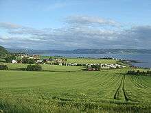
The Stjørdal area has a rich bird life with well over 260 recorded species and several good birding localities. Though Stjørdal can not boast of a long coastline (it's only 25 kilometres or 16 miles long) some of best birding areas are to be found along Stjørdalfjorden. Halsøen is virtually situated near the centre of Stjørdal, and can be easily viewed from a number of advantage points from route E6 in the east or Langøra in the west. Formed by the old river outlet, this tidal area is well worth checking. Due to the shallow waters and extensive areas of mud at low tide, Halsøen is used both as a wintering area and a migration stopover point by many species.
Culture
Kimen kulturhus is a culture house that opened in 2015,[11] which includes a 3-auditorium cinema,[12] a public library, and concert halls.
The radio station Radio Trøndelag is based in Stjørdal,[13] which broadcasts programming targeted to rural Trøndelag audiences, and is the only significant radio station in the Trondheim metropolitan area that still broadcasts on FM.
Sports-wise, the southern farming-based district of Lånke is the place of the Lånkebanen, a rallycross complex that hosts annual rounds of the FIA World Rallycross Championship and the FIA European Rallycross Championship. The municipality's primary sports team is IL Stjørdals-Blink, whose men's football team currently plays in the 2. Divisjon.
Transportation
.jpg)
Stjørdal is a regional transportation centre that is near the regional airport, Trondheim Airport, Værnes, as well as port facilities, European route E6, European route E14, and the Nordland Line going through the municipality from Trondheim to Bodø with stops at Hell Station, Trondheim Airport Station, Stjørdal Station, and Skatval Station. In addition, the Meråkerbanen railway line goes from Hell east to Åre Municipality in Sweden. Stations on that railway line include Hell Station, Hegra Station, Sona Station, and Flornes Station.
Regional bus services connect Stjørdal to Trondheim, Melhus, Orkanger, Steinkjer and Selbu 7 days a week,[14] while two local routes connecting downtown Stjørdal with its northern and southern neighbourhoods run 6 and 5 days a week respectively.
Twin cities
References
- ↑ "Navn på steder og personer: Innbyggjarnamn" (in Norwegian). Språkrådet. Retrieved 2015-12-01.
- ↑ Statistisk sentralbyrå (2017). "Table: 06913: Population 1 January and population changes during the calendar year (M)" (in Norwegian). Retrieved 2017-10-02.
- ↑ Jukvam, Dag (1999). "Historisk oversikt over endringer i kommune- og fylkesinndelingen" (PDF) (in Norwegian). Statistisk sentralbyrå.
- ↑ Rygh, Oluf (1903). Norske gaardnavne: Nordre Trondhjems amt (dokpro.uio.no) (in Norwegian) (15 ed.). Kristiania, Norge: W. C. Fabritius & sønners bogtrikkeri. p. 30.
- 1 2 3 4 5 6 "Kommunevåpen (Municipal Arms)". Stjørdal Kommune. Archived from the original on 2015-01-14.
- ↑ Heimer, Željko (2007). "Stjørdal, Nord-Trøndelag (Norway)". Flags of the World. Archived from the original on 2013-03-08.
- ↑ Norske Kommunevåpen (1990). "Nye kommunevåbener i Norden". Archived from the original on 2012-06-22. Retrieved 17 November 2008.
- ↑ "Civic heraldry of Norway - Norske Kommunevåpen". Heraldry of the World. Retrieved 2018-03-28.
- ↑ Vaagland, Nils Anton Simon (1948). Steenstrup, Bjørn, ed. Hvem er hvem? (in Norwegian). Oslo: Aschehoug. p. 576.
- ↑ "Table: 04813: Members of the local councils, by party/electoral list at the Municipal Council election (M)" (in Norwegian). Statistics Norway. 2015.
- ↑ "Om Kimen/åpningstider" (in Norwegian). Retrieved 30 January 2018.
- ↑ "Kinosaler" (in Norwegian). Retrieved 30 January 2018.
- ↑ Norsk lokalradioforbund. "Radio Trøndelag" (in Norwegian). Retrieved 30 January 2018.
- ↑ AtB. "Buss og bestillingstransport, regioner" (in Norwegian). Retrieved 30 January 2018.
- ↑ "Kolme vuosikymmentä pohjoismaisia ystäväkuntasuhteita Karstulassa" (PDF) (in Finnish). Karstulan Pohjola-Norden ry. Retrieved 7 May 2012.
External links
| Wikimedia Commons has media related to Stjørdal. |
- Official website

- Municipal fact sheet from Statistics Norway (in Norwegian)
- Angling in the Stjørdalselva (river)
| |||||||
| |||||||
| |||||||

| Authority control |
|---|