Snillfjord
| Snillfjord kommune | |||
|---|---|---|---|
| Municipality | |||
| |||
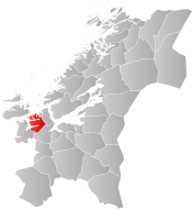 Snillfjord within Trøndelag | |||
| Coordinates: 63°25′29″N 09°26′05″E / 63.42472°N 9.43472°ECoordinates: 63°25′29″N 09°26′05″E / 63.42472°N 9.43472°E | |||
| Country | Norway | ||
| County | Trøndelag | ||
| District | Fosen | ||
| Established | 1 July 1924 | ||
| Administrative centre | Krokstadøra | ||
| Government | |||
| • Mayor (2015) | John Lernes (Ap) | ||
| Area | |||
| • Total | 508.12 km2 (196.19 sq mi) | ||
| • Land | 488.95 km2 (188.78 sq mi) | ||
| • Water | 19.17 km2 (7.40 sq mi) 3.8% | ||
| Area rank | #209 in Norway | ||
| Population (2017) | |||
| • Total | 982 | ||
| • Rank | #396 in Norway | ||
| • Density | 2.0/km2 (5/sq mi) | ||
| • Change (10 years) | -3.8% | ||
| Demonym(s) | Snillfjording[1] | ||
| Time zone | UTC+01:00 (CET) | ||
| • Summer (DST) | UTC+02:00 (CEST) | ||
| ISO 3166 code | NO-5012 | ||
| Official language form | Neutral | ||
| Website |
snillfjord | ||


Snillfjord is a municipality in Trøndelag county, Norway. It is part of the Fosen region. The administrative centre of the municipality is the village of Krokstadøra. Other villages in Snillfjord include Ytre Snillfjord, Hemnskjela, and Vutudal.
The 508-square-kilometre (196 sq mi) municipality is the 209th largest by area out of the 422 municipalities in Norway. Snillfjord is the 396th most populous municipality in Norway with a population of 982. The municipality's population density is 2 inhabitants per square kilometre (5.2/sq mi) and its population has decreased by 3.8% over the last decade.[2]
General information
The municipality of Snillfjord was established on 1 July 1924 when it was separated from the large municipality of Hemne. The initial population was 776. During the 1960s, there were many municipal mergers across Norway due to the work of the Schei Committee. On 1 January 1964, the eastern part of Heim (population: 724) and the western part of the neighboring municipality of Agdenes (population: 196) were merged with Snillfjord (population: 681) to form a new, larger municipality of Snillfjord. On 1 January 1995, the Midtun area of Agdenes municipality (population: 21) was transferred to Snillfjord. A road to the area had recently been built, but it connected to Snillfjord and not Agdenes, so it was decided to switch to the other municipality due to the newly opened road connection.[3]
On 1 January 2018, the municipality switched from the old Sør-Trøndelag county to the new Trøndelag county. On 1 January 2020, the municipality of Snillfjord will be dissolved and its lands will be split between the neighboring municipalities. The northwestern portion of Snillfjord will join the municipality of Hitra, the southwestern Vennastranda area will join the new municipality of Heim, and the rest will join the new municipality of Orkland.[4]
Name
The municipality is named after the Snillfjorden. The first element is probably an old river name of the Snilldalselva. The river name is derived from snild which comes from the word snjallr which means "fast" (related to German schnell).[5][6]
Coat of arms
The coat of arms is from modern times. They were adopted on 19 September 1990. The arms show a silver pitchfork pointing down on a green background. It symbolizes the importance of agriculture in the municipality.[7]
Churches
The Church of Norway has one parish (sokn) within the municipality of Snillfjord. It is part of the Orkdal prosti (deanery) in the Diocese of Nidaros.
| Parish (Sokn) | Church Name | Location of the Church | Year Built |
|---|---|---|---|
| Snillfjord | Snillfjord Church | Krokstadøra | 1898 |
Government
All municipalities in Norway, including Snillfjord, are responsible for primary education (through 10th grade), outpatient health services, senior citizen services, unemployment and other social services, zoning, economic development, and municipal roads. The municipality is governed by a municipal council of elected representatives, which in turn elect a mayor. The municipality falls under the Sør-Trøndelag District Court and the Frostating Court of Appeal.
Municipal council
The municipal council (Kommunestyre) of Snillfjord is made up of 17 representatives that are elected to four year terms. Currently, the party breakdown is as follows:[8]
| Party Name | Name in Norwegian | Number of representatives | |
|---|---|---|---|
| Labour Party | Arbeiderpartiet | 9 | |
| Green Party | Miljøpartiet De Grønne | 1 | |
| Centre Party | Senterpartiet | 7 | |
| Total number of members: | 17 | ||
Geography

The municipality of Snillfjord lies south of the Trondheimsleia and east of the Hemnfjorden. The Åstfjorden and Snillfjorden flow east from the Hemnfjorden into the municipality. The lake Våvatnet lies on the border with Orkdal in the southeast. The island of Hemnskjela lies in the Trondheimsleia in the north, and it is the southern entrance to the Hitra Tunnel.
The 508-square-kilometre (196 sq mi) municipality of Snillfjord is surrounded by four municipalities. The municipality of Hemne lies to the southwest, Hitra is to the northwest, Agdenes to the northeast, and Orkdal to the southeast.
References
- ↑ "Navn på steder og personer: Innbyggjarnamn" (in Norwegian). Språkrådet. Retrieved 2015-12-01.
- ↑ Statistisk sentralbyrå (2017). "Table: 06913: Population 1 January and population changes during the calendar year (M)" (in Norwegian). Retrieved 2017-10-05.
- ↑ Jukvam, Dag (1999). "Historisk oversikt over endringer i kommune- og fylkesinndelingen" (PDF) (in Norwegian). Statistisk sentralbyrå.
- ↑ "Kommunereformen" (in Norwegian). Snillfjord kommune. Retrieved 2017-10-05.
- ↑ Rygh, Oluf (1901). Norske gaardnavne: Søndre Trondhjems amt (in Norwegian) (14 ed.). Kristiania, Norge: W. C. Fabritius & sønners bogtrikkeri. pp. 91+92.
- ↑ Store norske leksikon. "Snillfjord" (in Norwegian). Retrieved 2011-01-24.
- ↑ "Faktaopplysninger" (in Norwegian). Snillfjord kommune. Retrieved 2008-10-29.
- ↑ "Table: 04813: Members of the local councils, by party/electoral list at the Municipal Council election (M)" (in Norwegian). Statistics Norway. 2015.
External links
| Wikimedia Commons has media related to Snillfjord. |

- Municipal fact sheet from Statistics Norway (in Norwegian)
| |||||||
| |||||||
| |||||||

| Authority control |
|---|