Sandvollan
| Sandvollan herred | |
|---|---|
| Former municipality | |
 Sandvollan herred Sandvollan within Nord-Trøndelag  Sandvollan herred Sandvollan herred (Norway) | |
| Coordinates: 63°56′47″N 11°19′42″E / 63.94639°N 11.32833°ECoordinates: 63°56′47″N 11°19′42″E / 63.94639°N 11.32833°E | |
| Country | Norway |
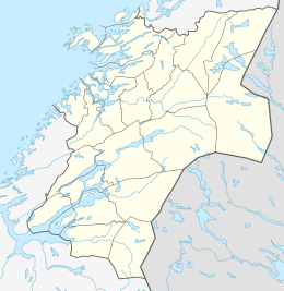
| County | Nord-Trøndelag |
| District | Innherred |
| Established | 1 Jan 1907 |
| Disestablished | 1 Jan 1962 |
| Area | |
| • Total | 28 km2 (11 sq mi) |
| *Area at municipal dissolution. | |
| Population (1962) | |
| • Total | 750 |
| • Density | 27/km2 (69/sq mi) |
| Time zone | UTC+01:00 (CET) |
| • Summer (DST) | UTC+02:00 (CEST) |
| ISO 3166 code | NO-1728 |
| Preceded by | Inderøy in 1907 |
| Succeeded by | Inderøy in 1962 |
Sandvollan is a former municipality in the old Nord-Trøndelag county, Norway. The 28-square-kilometre (11 sq mi) municipality existed from 1907 until its dissolution in 1962. It was located in the north part of what is now the municipality of Inderøy in Trøndelag county. There are two main villages in Sandvollan: Gangstad and Småland. Gangstad has a grocery store. Between the two villages lies Skjelvågen, a harbour that used to be a stop on the steam ship routes.
Sandvollan bordered the Sparbu area of the municipality of Steinkjer and the Børgin fjord to the east, the municipality of Inderøy to the southwest, and the Trondheimsfjord to the north. Sandvollan was mostly an agriarian area, though it also functions as a suburb of the town of Steinkjer, located about 10 kilometres (6.2 mi) away.[1]
There were two churches in the municipality of Sandvollan: the 12th-century Hustad Church and Heggstad Church from 1887. The older church was built for the chieftain of Hustad, Bård Standale, who was sheriff for Eystein Haraldsson around 1150. The newer church was built because the old one had become too small.
History
The municipality of Hustad was established on 1 January 1907 when the old municipality of Inderøy was divided into three municipalities: Røra (population: 866) in the southeast, Hustad (population: 732) in the north, and Inderøy (population: 2,976) in the west. In 1912, the name was changed to Sandvollan. During the 1960s, there were many municipal mergers across Norway due to the work of the Schei Committee. On 1 January 1962, the three neighboring municipalities of Røra (population: 1,003), Sandvollan (population: 750), and Inderøy (population: 3,194) to form a new, larger municipality of Inderøy.[2]
See also
References
- ↑ Olsen Haugen, Morten, ed. (2017-11-29). "Sandvollan". Store norske leksikon (in Norwegian). Kunnskapsforlaget. Retrieved 2018-04-12.
- ↑ Jukvam, Dag (1999). "Historisk oversikt over endringer i kommune- og fylkesinndelingen" (PDF) (in Norwegian). Statistisk sentralbyrå.
| |||||||
| |||||||
| |||||||
