Verdal
| Verdal kommune | |||
|---|---|---|---|
| Municipality | |||
 | |||
| |||
 Verdal within Trøndelag | |||
| Coordinates: 63°47′53″N 11°56′57″E / 63.79806°N 11.94917°ECoordinates: 63°47′53″N 11°56′57″E / 63.79806°N 11.94917°E | |||
| Country | Norway | ||
| County | Trøndelag | ||
| District | Innherad | ||
| Established | 1 Jan 1838 | ||
| Administrative centre | Verdalsøra | ||
| Government | |||
| • Mayor (2005) | Bjørn Iversen (Ap) | ||
| Area | |||
| • Total | 1,547.78 km2 (597.60 sq mi) | ||
| • Land | 1,479.63 km2 (571.29 sq mi) | ||
| • Water | 68.15 km2 (26.31 sq mi) 4.4% | ||
| Area rank | #48 in Norway | ||
| Population (2017) | |||
| • Total | 14,849 | ||
| • Rank | #80 in Norway | ||
| • Density | 10/km2 (30/sq mi) | ||
| • Change (10 years) | 6.4% | ||
| Demonym(s) | Verdaling[1] | ||
| Time zone | UTC+01:00 (CET) | ||
| • Summer (DST) | UTC+02:00 (CEST) | ||
| ISO 3166 code | NO-5038 | ||
| Official language form | Neutral | ||
| Website |
verdal | ||

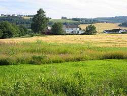
Verdal is a municipality in Trøndelag county, Norway. It is part of the Innherad region. The administrative centre of the municipality is the town of Verdalsøra. Other villages in the municipality include Forbregd/Lein, Lysthaugen, Stiklestad, Trones, Vera, Vinne, and Vuku.
The 1,548-square-kilometre (598 sq mi) municipality is the 48th largest by area out of the 422 municipalities in Norway. Verdal is the 80th most populous municipality in Norway with a population of 14,849. The municipality's population density is 10 inhabitants per square kilometre (26/sq mi) and its population has increased by 6.4% over the last decade.[2]
General information
The municipality of Værdalen was established on 1 January 1838 (see formannskapsdistrikt). It is one of very few municipalities in Norway with unchanged borders since that date, although the spelling of the name was modified to Verdal.[3] On 1 January 2018, the municipality switched from the old Nord-Trøndelag county to the new Trøndelag county.
Name
The Old Norse form of the name was Veradalr (from the word Verardalr). The first element is the genitive case of the river name Ver (now called Verdalselva) and the last element is dalr which means "valley" or "dale". The meaning of the river name is probably "the quiet one". The name was historically spelled Værdalen.[4]
Coat of arms
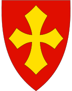
The coat of arms is from modern times; they were granted on 15 December 1972. They show a gold cross on a red background. The cross is taken from a large painting in the Nidaros Cathedral in Trondheim, in which the death of King Olav Haraldsson (Saint Olaf) is shown. He died in the Battle of Stiklestad, the site of which is in Verdal municipality. In the painting, he holds a shield with the typical cross. To commemorate the battle, the cross was taken as arms for the municipality.[5]
Churches
The Church of Norway has four parishes (sokn) within the municipality of Verdal. It is part of the Sør-Innherad prosti (deanery) in the Diocese of Nidaros.
| Parish (Sokn) | Church Name | Location of the Church | Year Built |
|---|---|---|---|
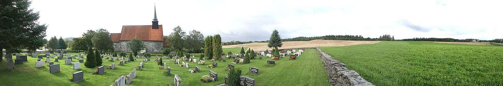
| Stiklestad | Stiklestad Church | Stiklestad | 1180 |
| Verdalsøra Chapel | Verdalsøra | 1969 | |
| Vera | Vera Chapel | Vera | 1899 |
| Vinne | Vinne Church | Vinne | 1817 |
| Vuku | Vuku Church | Vuku | 1655 |
History
Battle of Stiklestad
The most famous battle in Norwegian history, the Battle of Stiklestad, took place at Stiklestad in Verdal in the year 1030. The Stiklestad Church was built afterwards at the place where King Olav Haraldsson, later redesigned as St. Olaf, died during the battle. Olavsstøtta, a memorial pillar dedicated to St. Olaf, was erected in 1807 to commemorate the Battle of Stiklestad. [6]
Verdalsraset
Early on the night of 19 May 1893, the most deadly landslide in modern Norwegian history, known as Verdalsraset, took place in Verdal. It killed 116 people and at least 500 animals when approximately 100 farms were swept away. A wet winter and several spring floods in the river made the quick clay under the topsoil in a large area of the valley turn into a fluid. The slide moved about 60,000,000 cubic metres (78,000,000 cu yd) of clay, completely reshaping the topography of the area, including moving the course of the river.[7]
Culture
Råning
This culture is known for young people interested in cars, spending most of their time improving, enhancing, and styling their cars, and then driving them for display on a particular route around the town centre. This is not only positive, as they do show some general disregard for common laws and regulations. People living in the town center are at times bothered by noise, usually music being played at high volumes from their cars.
Stiklestad
Verdal is the location of the Stiklestad National Cultural Centre. The Saint Olav Drama appears here on an open stage every year in July. The play centers on events leading up to the Battle of Stiklestad.[8][9]
Geography
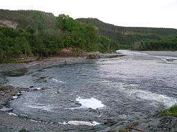
Verdal is centered on the Verdal valley. The river Verdalselva runs through the valley into the Trondheimsfjord at Verdalsøra. The rivers Helgåa and Inna join together at Vuku to form the Verdalselva. The lake Veresvatnet flows into the river Helgåa and the lake Innsvatnet flows into the river Inna. The large lake Leksdalsvatnet lies on the Verdal-Steinkjer border. The southern tip of the large Blåfjella–Skjækerfjella National Park lies in the northeastern part of Verdal. Rinnleiret is a beach area along the Levanger-Verdal border in the west.
Government
All municipalities in Norway, including Verdal, are responsible for primary education (through 10th grade), outpatient health services, senior citizen services, unemployment and other social services, zoning, economic development, and municipal roads. The municipality is governed by a municipal council of elected representatives, which in turn elect a mayor. The municipality falls under the Inntrøndelag District Court and the Frostating Court of Appeal.
Municipal council
The municipal council (Kommunestyre) of Verdal is made up of 35 representatives that are elected to four-year terms. Currently, the party breakdown is as follows:[10]
| Party Name | Name in Norwegian | Number of representatives | |
|---|---|---|---|
| Labour Party | Arbeiderpartiet | 15 | |
| Progress Party | Fremskrittspartiet | 2 | |
| Conservative Party | Høyre | 3 | |
| Christian Democratic Party | Kristelig Folkeparti | 1 | |
| Green Party | Miljøpartiet De Grønne | 1 | |
| Centre Party | Senterpartiet | 11 | |
| Socialist Left Party | Sosialistisk Venstreparti | 1 | |
| Liberal Party | Venstre | 1 | |
| Total number of members: | 35 | ||
Economy
Offshore industry (Aker Verdal) and agriculture are two of the most important parts of Verdal's economy. Despite its small size, Verdal is a municipality with great personality and cultural integrity. After several lottery grand prizes were received by some lucky inhabitants of Verdal, it is also known as one of the great "Lotto-bygds" of Norway (Small places with high a concentration of lottery wins in the national game of Lotto).
Transportation
European route E6 runs north and south through Verdalsøra, connecting the municipality with Steinkjer to the north and Levanger to the south. The Nordland Line also runs north and south through the municipality. There are two stations in Verdal: Verdal Station in Verdalsøra and Bergsgrav Station in Vinne.
References
- ↑ "Navn på steder og personer: Innbyggjarnamn" (in Norwegian). Språkrådet. Retrieved 2015-12-01.
- ↑ Statistisk sentralbyrå (2017). "Table: 06913: Population 1 January and population changes during the calendar year (M)" (in Norwegian). Retrieved 2017-10-02.
- ↑ Jukvam, Dag (1999). "Historisk oversikt over endringer i kommune- og fylkesinndelingen" (PDF) (in Norwegian). Statistisk sentralbyrå.
- ↑ Rygh, Oluf (1903). Norske gaardnavne: Nordre Trondhjems amt (dokpro.uio.no) (in Norwegian) (15 ed.). Kristiania, Norge: W. C. Fabritius & sønners bogtrikkeri. p. 117.
- ↑ "Civic heraldry of Norway - Norske Kommunevåpen". Heraldry of the World. Retrieved 2018-04-04.
- ↑ Olavsstøtta (Nationalen Kulturzentrum Stiklestad)
- ↑ "Verdalsraset" (in Norwegian). Geoportalen.no. Retrieved 2008-11-17.
- ↑ Stiklestad Nasjonale Kultursenter (EXARC)
- ↑ Spelet om Heilag Olav – Stiklestad – Verdal – Nord Trøndelag (Nationalen Kulturzentrum Stiklestad)
- ↑ "Table: 04813: Members of the local councils, by party/electoral list at the Municipal Council election (M)" (in Norwegian). Statistics Norway. 2015.
External links
| Wikimedia Commons has media related to Verdal. |

- Municipal fact sheet from Statistics Norway (in Norwegian)
- Stiklestad National Culture Centre Official Website
- Battle of Stiklestad
| |||||||
| |||||||
| |||||||

| Authority control |
|---|