Namsskogan
| Namsskogan kommune | |||
|---|---|---|---|
| Municipality | |||
 Brekkvasselv, Namsskogan | |||
| |||
 Namsskogan within Trøndelag | |||
| Coordinates: 64°52′19″N 12°58′35″E / 64.87194°N 12.97639°ECoordinates: 64°52′19″N 12°58′35″E / 64.87194°N 12.97639°E | |||
| Country | Norway | ||
| County | Trøndelag | ||
| District | Namdalen | ||
| Established | 1 July 1923 | ||
| Administrative centre | Namsskogan | ||
| Government | |||
| • Mayor (2011) | Stian Brekkvassmo (Ap) | ||
| Area | |||
| • Total | 1,417.16 km2 (547.17 sq mi) | ||
| • Land | 1,353.65 km2 (522.65 sq mi) | ||
| • Water | 63.51 km2 (24.52 sq mi) 4.5% | ||
| Area rank | #59 in Norway | ||
| Population (2017) | |||
| • Total | 872 | ||
| • Rank | #407 in Norway | ||
| • Density | 0.6/km2 (2/sq mi) | ||
| • Change (10 years) | -6.5% | ||
| Demonym(s) | Namsskoging[1] | ||
| Time zone | UTC+01:00 (CET) | ||
| • Summer (DST) | UTC+02:00 (CEST) | ||
| ISO 3166 code | NO-5044 | ||
| Official language form | Neutral | ||
| Website |
namsskogan | ||


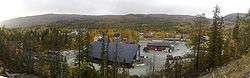
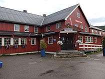
Namsskogan is a municipality in Trøndelag, Norway. Namsskogan is located in the upper part of the long Namdalen valley region. The administrative centre of the municipality is the village of Namsskogan. Other villages in the municipality include Brekkvasselv, Smalåsen, Skorovatn, and Trones.
The village of Namsskogan lies along the river Namsen in the northern part of the municipality. The European route E6 highway runs through the village.
The 1,417-square-kilometre (547 sq mi) municipality is the 59th largest by area out of the 422 municipalities in Norway. Namsskogan is the 407th most populous municipality in Norway with a population of 872. The municipality's population density is 0.6 inhabitants per square kilometre (1.6/sq mi) and its population has decreased by 6.5% over the last decade.[2]
General information

The municipality of Namsskogan was established on 1 July 1923 when it was separated from the large municipality of Grong. Initially, the population of Namsskogan was 469. The municipal boundaries have not changed since.[3] On 1 January 2018, the municipality switched from the old Nord-Trøndelag county to the new Trøndelag county.
Name
The name of the municipality was created in 1923. The first element is the name of the river Namsen and the last element is the plural form of skog which means "woods". Therefore, the meaning of the name is "the woodlands around Namsen".[4]
Coat of arms
The coat of arms is from modern times; they were granted on 21 December 1984. The arms show a gold moose's antler on a black background. The municipality is heavily forested and many moose can be found in the area. The arms are based on a very large antler, with a rare golden color, which hangs on the community hall.[5]
Churches
The Church of Norway has one parish (sokn) within the municipality of Namsskogan. It is part of the Namdal prosti (deanery) in the Diocese of Nidaros.
| Parish (Sokn) | Church Name | Location of the Church | Year Built |
|---|---|---|---|
| Namsskogan | Trones Church | Trones | 1832 |
| Bjørhusdal Church | Namsskogan | 1970 | |
| Skorovatn Chapel | Skorovatn | 1965 |
Geography
Namsskogan is located in the northeast part of Trøndelag county. It is a heavily forested area with several large lakes including Kalvvatnet, Mellingsvatnet, Storfrøyningen, Storgåsvatnet, and Tunnsjøflyan. The river Namsen runs south through the Namdalen valley. The extreme northeastern part of the municipality is part of Børgefjell National Park.
Government
All municipalities in Norway, including Namskogan, are responsible for primary education (through 10th grade), outpatient health services, senior citizen services, unemployment and other social services, zoning, economic development, and municipal roads. The municipality is governed by a municipal council of elected representatives, which in turn elect a mayor. The municipality falls under the Namdal District Court and the Frostating Court of Appeal.
Municipal council
The municipal council (Kommunestyre) of Namskogan is made up of 13 representatives that are elected to four year terms. Currently, the party breakdown is as follows:[6]
| Party Name | Name in Norwegian | Number of representatives | |
|---|---|---|---|
| Labour Party | Arbeiderpartiet | 6 | |
| Centre Party | Senterpartiet | 3 | |
| Socialist Left Party | Sosialistisk Venstreparti | 2 | |
| Local Lists | Lokale lister | 2 | |
| Total number of members: | 13 | ||
Politics
In the 2007 municipal elections, Namsskogan had the highest vote for the Socialist Left party in Norway, at 33.6 per cent.
References
- ↑ "Navn på steder og personer: Innbyggjarnamn" (in Norwegian). Språkrådet. Retrieved 2015-12-01.
- ↑ Statistisk sentralbyrå (2017). "Table: 06913: Population 1 January and population changes during the calendar year (M)" (in Norwegian). Retrieved 2017-10-01.
- ↑ Jukvam, Dag (1999). "Historisk oversikt over endringer i kommune- og fylkesinndelingen" (PDF) (in Norwegian). Statistisk sentralbyrå.
- ↑ Store norske leksikon. "Namsskogan" (in Norwegian). Retrieved 2011-09-16.
- ↑ "Civic heraldry of Norway - Norske Kommunevåpen". Heraldry of the World. Retrieved 2018-04-27.
- ↑ "Table: 04813: Members of the local councils, by party/electoral list at the Municipal Council election (M)" (in Norwegian). Statistics Norway. 2015.
External links
| Wikimedia Commons has media related to Namsskogan. |

- Municipal fact sheet from Statistics Norway (in Norwegian)
| |||||||
| |||||||
| |||||||

| Authority control |
|---|