Rusk, Texas
| Rusk, Texas | |
|---|---|
| City | |
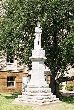 Confederate Monument at Cherokee County Courthouse in Rusk | |
| Motto(s): "The Heart of East Texas" | |
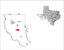
 Location of Rusk, Texas | |
 | |
| Coordinates: 31°47′54″N 95°9′0″W / 31.79833°N 95.15000°WCoordinates: 31°47′54″N 95°9′0″W / 31.79833°N 95.15000°W | |
| Country | United States |
| State | Texas |
| County | Cherokee |
| Area | |
| • Total | 7.3 sq mi (18.8 km2) |
| • Land | 7.2 sq mi (18.7 km2) |
| • Water | 0.04 sq mi (0.1 km2) |
| Elevation | 518 ft (158 m) |
| Population (2010) | |
| • Total | 5,551 |
| • Density | 768/sq mi (296.7/km2) |
| Time zone | UTC-6 (Central (CST)) |
| • Summer (DST) | UTC-5 (CDT) |
| ZIP code | 75785 |
| Area code(s) | 430, 903 |
| FIPS code | 48-63848[1] |
| GNIS feature ID | 1375860[2] |
| Website |
www |
The population was 5,551 at the 2010 census.[3] It is the county seat of Cherokee County.[4]
History
The town was established by an act of the Texas legislature on April 11, 1846. It was named after Thomas Jefferson Rusk, signer of the Texas Declaration of Independence.[5] By 1850, Rusk reportedly had 355 residents. A post office was authorized on March 8, 1847.
The city of Rusk is no longer dry; a beer and wine local option election passed on May 9, 2009.
Geography
According to the United States Census Bureau, the city has a total area of 7.3 square miles (18.8 km2), of which 0.03 square miles (0.07 km2), or 0.37%, is water.[3]
Rusk is crossed by U.S. Routes 69 and 84. US 69 leads northwest 14 miles (23 km) to Jacksonville, the largest city in Cherokee County, and southeast 43 miles (69 km) to Lufkin, while US 84 leads east 30 miles (48 km) to Mount Enterprise and west the same distance to Palestine. Rusk is about 160 miles (260 km) north of Houston, 125 miles (201 km) southeast of Dallas, and 40 miles (64 km) south of Tyler.
Surrounding municipalities | ||||||||||
|---|---|---|---|---|---|---|---|---|---|---|
| ||||||||||
Climate
The climate in this area is characterized by hot, humid summers and generally mild to cool winters. According to the Köppen Climate Classification system, Rusk has a humid subtropical climate, abbreviated "Cfa" on climate maps.[6]
Demographics
| Historical population | |||
|---|---|---|---|
| Census | Pop. | %± | |
| 1850 | 355 | — | |
| 1870 | 545 | — | |
| 1880 | 626 | 14.9% | |
| 1890 | 1,383 | 120.9% | |
| 1900 | 846 | −38.8% | |
| 1910 | 1,558 | 84.2% | |
| 1920 | 2,348 | 50.7% | |
| 1930 | 3,859 | 64.4% | |
| 1940 | 5,699 | 47.7% | |
| 1950 | 6,598 | 15.8% | |
| 1960 | 4,900 | −25.7% | |
| 1970 | 4,914 | 0.3% | |
| 1980 | 4,681 | −4.7% | |
| 1990 | 4,366 | −6.7% | |
| 2000 | 5,085 | 16.5% | |
| 2010 | 5,551 | 9.2% | |
| Est. 2016 | 5,573 | [7] | 0.4% |
| U.S. Decennial Census[8] | |||
As of the census[1] of 2010, there were 5,551 people, 1,306 households, and 867 families residing in the city. The population density was 745.4 people per square mile (287.9/km2). There were 1,539 housing units at an average density of 225.6 per square mile (87.1/km2). The racial makeup of the city was 62.71% White, 30.01% African American, 0.18% Native American, 0.96% Asian, 5.15% from other races, and 0.98% from two or more races. Hispanic or Latino of any race were 6.92% of the population.
There were 1,306 households out of which 32.3% had children under the age of 18 living with them, 45.6% were married couples living together, 17.5% had a female householder with no husband present, and 33.6% were non-families. 30.9% of all households were made up of individuals and 16.0% had someone living alone who was 65 years of age or older. The average household size was 2.44 and the average family size was 3.05.
In the city, the population was spread out with 17.3% under the age of 18, 8.9% from 18 to 24, 39.3% from 25 to 44, 20.6% from 45 to 64, and 13.9% who were 65 years of age or older. The median age was 38 years. For every 100 females, there were 154.6 males. For every 100 females age 18 and over, there were 168.4 males.
The median income for a household in the city was $27,370, and the median income for a family was $33,952. Males had a median income of $24,271 versus $22,438 for females. The per capita income for the city was $11,688. About 16.2% of families and 21.5% of the population were below the poverty line, including 29.4% of those under age 18 and 21.0% of those age 65 or over.
The presence of state prison units in the city considerably skews the demographics, as the two units house approximately 1,250 inmates at any time, making the actual population of the city closer to 3,835. This also affects all other demographic statistics such as ratio of males to females, the racial makeup of the city and the poverty rate.
Arts and culture
Rusk is home to the Texas State Railroad, which has a steam engine train. The Heritage Center of Cherokee County & Cherokee Civic Theater are located in Rusk.
Parks and recreation
Jim Hogg Park, Rusk State Park, and Gourmet Gardens are in Rusk. The longest footbridge in the nation (circa 1861) and the longest zip line in Texas are located in Rusk.[9] The Texas State Railroad operates between Rusk and Palestine.
Education
The city of Rusk and surrounding rural areas are served by the Rusk Independent School District.
Infrastructure
Postal service
The United States Postal Service operates the Rusk Post Office.[10]
Rusk State Hospital
The Texas Department of State Health Services operates the Rusk State Hospital in Rusk.[11] At that site, the Texas Prison System previously operated the Rusk Penitentiary.[12]
Notable people
Rusk has been home to three former governors, James Stephen Hogg, Thomas M. Campbell, and John B. Kendrick (Governor of Wyoming). Rusk has also been the home to Jim Swink and Johnny Horton.
Adrian Matthew Burk from Rusk played for the Baltimore Colts and the current world champions the Philadelphia Eagles in the 1950's.
References
- 1 2 "American FactFinder". United States Census Bureau. Retrieved 2008-01-31.
- ↑ "US Board on Geographic Names". United States Geological Survey. 2007-10-25. Retrieved 2008-01-31.
- 1 2 "Geographic Identifiers: 2010 Census Summary File 1 (G001): Rusk city, Texas". U.S. Census Bureau, American Factfinder. Retrieved July 27, 2015.
- ↑ "Find a County". National Association of Counties. Retrieved 2011-06-07.
- ↑ "Profile for Rusk, Texas". ePodunk. Retrieved 2010-05-08.
- ↑ Climate Summary for Rusk, Texas
- ↑ "Population and Housing Unit Estimates". Retrieved June 9, 2017.
- ↑ "Census of Population and Housing". Census.gov. Retrieved June 4, 2015.
- ↑ "Rusk Chamber of Commerce". Rusk Chamber of Commerce. Retrieved August 9, 2012.
- ↑ "Post Office Location - RUSK." United States Postal Service. Retrieved on October 6, 2010.
- ↑ "Rusk State Hospital." Texas Department of State Health Services. Retrieved on October 6, 2010.
- ↑ "Rusk Penitentiary (1883–1917)." Texas State Library and Archives Commission. Retrieved on October 6, 2010.
External links
Municipalities and communities of Cherokee County, Texas, United States | ||
|---|---|---|
| Cities |  | |
| Towns | ||
| CDP | ||
| Other unincorporated communities | ||
| Ghost towns | ||
| Footnotes | ‡This populated place also has portions in an adjacent county or counties | |
