Lake Cherokee, Texas
| Lake Cherokee, Texas | |
|---|---|
| Census-designated place | |
 Lake Cherokee  Lake Cherokee | |
| Coordinates: 32°21′25″N 94°39′05″W / 32.35694°N 94.65139°WCoordinates: 32°21′25″N 94°39′05″W / 32.35694°N 94.65139°W | |
| Country | United States |
| State | Texas |
| Counties | Rusk, Gregg |
| Area[1] | |
| • Total | 16.525 sq mi (42.80 km2) |
| • Land | 12.239 sq mi (31.70 km2) |
| • Water | 4.286 sq mi (11.10 km2) |
| Elevation | 338 ft (103 m) |
| Population (2010)[1] | |
| • Total | 3,071 |
| • Density | 250.9/sq mi (96.9/km2) |
| Time zone | UTC-6 (Central (CST)) |
| • Summer (DST) | UTC-5 (CDT) |
| Area code(s) | 430 & 903 |
| GNIS feature ID | 2586944[2] |
Lake Cherokee is an unincorporated community and census-designated place (CDP) in Gregg and Rusk counties, Texas, United States. Its population was 3,071 as of the 2010 census.[1]
Geography
The community consists of housing development that surrounds Lake Cherokee, a reservoir on Cherokee Bayou, an east-flowing tributary of the Sabine River. Texas State Highway 149 forms the northern border of the CDP; the highway leads northwest 12 miles (19 km) to Longview and southeast 24 miles (39 km) to Carthage.
According to the U.S. Census Bureau, the community has an area of 16.525 square miles (42.80 km2); 12.239 square miles (31.70 km2) of its area is land, and 4.286 square miles (11.10 km2) is water.[1] About three-quarters of the area of the CDP is within Rusk County, with the remainder in Gregg County. The county line follows the center of the lake for the lower half of its reach. The upstream half of the lake is entirely within Rusk County.
References
- 1 2 3 4 "2010 Census Gazetteer Files - Places: Texas". U.S. Census Bureau. Retrieved March 21, 2017.
- ↑ "Lake Cherokee". Geographic Names Information System. United States Geological Survey.
Municipalities and communities of Gregg County, Texas, United States | ||
|---|---|---|
| Cities | 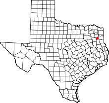 | |
| CDPs | ||
| Other unincorporated communities | ||
| Former communities | ||
| Footnotes | ‡This populated place also has portions in an adjacent county or counties | |
Municipalities and communities of Rusk County, Texas, United States | ||
|---|---|---|
| Cities | 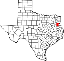 | |
| CDP | ||
| Other unincorporated communities |
| |
| Footnotes | ‡This populated place also has portions in an adjacent county or counties | |