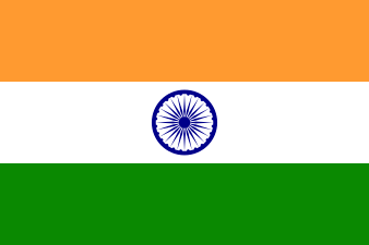
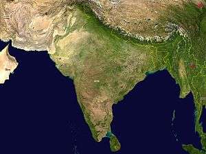
Outline of India
.svg.png)

The following outline is provided as an overview of and topical guide to India:
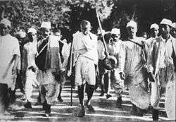
India – seventh-largest country by area, located on the Indian subcontinent in South Asia. India was home to the ancient Indus Valley Civilisation, and is the birthplace of four world religions—Hinduism, Sikhism, Buddhism, Jainism. India endured colonization, eventually being administered by the United Kingdom from the mid-19th century to the mid-20th century. India became an independent nation in 1947 after a struggle for independence that was mainly non-violent resistance, led by influential figures like Mahatma Gandhi, and underwent a violent partition. India is the second-most populous country with over 1.2 billion people, and is also the most populous democracy in the world.
General reference
- Pronunciation: /ˈɪndiə/
- Common English country name:India
- Official English country name:The Republic of India
- Common endonym(s): Bharat, Hindustan
- Official endonym(s): Bharat Ganarajya
- Adjectival(s): Indian
- Demonym(s): Indian
- Etymology: Names of India
- International rankings of India
- ISO country codes:IN, IND, 356
- ISO region codes:See ISO 3166-2:IN
- Internet country code top-level domain:.in
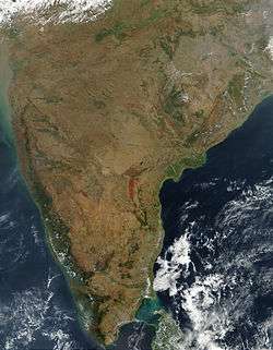
Geography of India
- India is:
- a subcontinent
- a country
- Location:
- High: Kangchenjunga 8,586 m (28,169 ft) – third highest peak on Earth
- Low: Kuttanad −2.2 m (−7 ft)
- Land boundaries: 14,103 km


- Coastline: 7,000 km
- Population of India: 1,210,193,422 people (2011 census) - 2nd most populous country
- Area of India:3,287,263 km2 (1,269,219 sq mi) - 7th largest country
- Atlas of India
- Subcontinent (Indian subcontinent)
Environment of India
Geographic features of India
- Beaches of India
- Glaciers of India
- Islands of India
- Lakes of India
- Mountains of India
- Rivers of India
- Valleys of India
- List of World Heritage Sites in India
Physical divisions of India
- The northern mountains including the Himalayas, which includes the Karakoram ranges and the northeast mountain ranges.
- Indo-Gangetic plains
- Thar Desert
- Central Highlands and Deccan Plateau
- Eastern coastal plains
- Western coastal plains
- Bordering seas and islands
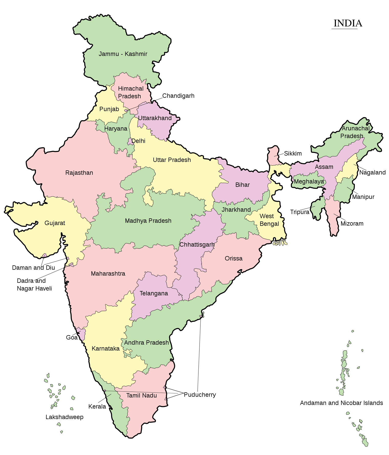
Administrative divisions of India
Administrative divisions of India
Administrative divisional structure of India
| Structure of administrative divisions in India | ||||||||||||||||||||||||||||||||||||||||||||||||||||||||||||||||||||||||||||||||||||||||||||||||||||||||||||||||||||||||||||||||||||||||||||||||||||||||||||||||||||||||||||||||||||||||||||||||||||||||||||||||||||||||||||||||||||||||||||||||||||||||||||||||||||||||||||||||||||||||||||||||||||||||||||||||||||||||||||||||||||||
|---|---|---|---|---|---|---|---|---|---|---|---|---|---|---|---|---|---|---|---|---|---|---|---|---|---|---|---|---|---|---|---|---|---|---|---|---|---|---|---|---|---|---|---|---|---|---|---|---|---|---|---|---|---|---|---|---|---|---|---|---|---|---|---|---|---|---|---|---|---|---|---|---|---|---|---|---|---|---|---|---|---|---|---|---|---|---|---|---|---|---|---|---|---|---|---|---|---|---|---|---|---|---|---|---|---|---|---|---|---|---|---|---|---|---|---|---|---|---|---|---|---|---|---|---|---|---|---|---|---|---|---|---|---|---|---|---|---|---|---|---|---|---|---|---|---|---|---|---|---|---|---|---|---|---|---|---|---|---|---|---|---|---|---|---|---|---|---|---|---|---|---|---|---|---|---|---|---|---|---|---|---|---|---|---|---|---|---|---|---|---|---|---|---|---|---|---|---|---|---|---|---|---|---|---|---|---|---|---|---|---|---|---|---|---|---|---|---|---|---|---|---|---|---|---|---|---|---|---|---|---|---|---|---|---|---|---|---|---|---|---|---|---|---|---|---|---|---|---|---|---|---|---|---|---|---|---|---|---|---|---|---|---|---|---|---|---|---|---|---|---|---|---|---|---|---|---|---|---|---|---|---|---|---|---|---|---|---|---|---|---|---|---|---|---|---|---|---|---|---|---|---|---|---|---|---|---|---|---|---|---|---|---|---|---|---|---|---|---|---|---|---|---|---|---|---|---|
| ||||||||||||||||||||||||||||||||||||||||||||||||||||||||||||||||||||||||||||||||||||||||||||||||||||||||||||||||||||||||||||||||||||||||||||||||||||||||||||||||||||||||||||||||||||||||||||||||||||||||||||||||||||||||||||||||||||||||||||||||||||||||||||||||||||||||||||||||||||||||||||||||||||||||||||||||||||||||||||||||||||||
States and territories of India
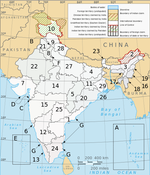
| 1. Andhra Pradesh | 13. Kerala | 25. Telangana |
| 2. Arunachal Pradesh | 14. Madhya Pradesh | 26. Tripura |
| 3. Assam | 15. Maharashtra | 27. Uttar Pradesh |
| 4. Bihar | 16. Manipur | 28. Uttarakhand |
| 5. Chhattisgarh | 17. Meghalaya | 29. West Bengal |
| 6. Goa | 18. Mizoram | A. Andaman and Nicobar Islands |
| 7. Gujarat | 19. Nagaland | B. Chandigarh |
| 8. Haryana | 20. Odisha | C. Dadra and Nagar Haveli |
| 9. Himachal Pradesh | 21. Punjab | D. Daman and Diu |
| 10. Jammu and Kashmir | 22. Rajasthan | E. Lakshadweep |
| 11. Jharkhand | 23. Sikkim | F. National Capital Territory of Delhi |
| 12. Karnataka | 24. Tamil Nadu | G. Puducherry |
States and territories of India
- Autonomous regions of India
- Emblems of Indian States
- States and territories of India
- By name
- States by name
- Andhra Pradesh(outline)
- Arunachal Pradesh (outline)
- Assam (outline)
- Bihar (outline)
- Chhattisgarh (outline)
- Goa (outline)
- Gujarat (outline)
- Haryana (outline)
- Himachal Pradesh (outline)
- Jammu and Kashmir (outline)
- Jharkhand (outline)
- Karnataka (outline)
- Kerala (outline)
- Madhya Pradesh (outline)
- Maharashtra (outline)
- Manipur (outline)
- Meghalaya (outline)
- Mizoram (outline)
- Nagaland (outline)
- Odisha (outline)
- Punjab (outline)
- Rajasthan (outline)
- Sikkim (outline)
- Tamil Nadu (outline)
- Telangana (outline)
- Tripura (outline)
- Uttar Pradesh (outline)
- Uttarakhand (outline)
- West Bengal (outline)
- Territories by name
- States by name
- By rank
- By economic rank
- By various rankings
- By population
- By population density
- By size
- By state code
- By name
- State and territory capitals
Divisions of India
- Divisions of Andhra Pradesh
- Divisions of Arunachal Pradesh
- Divisions of Assam
- Divisions of Bihar
- Divisions of Chhattisgarh
- Divisions of Goa
- Divisions of Gujarat
- Divisions of Haryana
- Divisions of Himachal Pradesh
- Divisions of Jammu and Kashmir
- Divisions of Jharkhand
- Divisions of Karnataka
- Divisions of Kerala
- Divisions of Madhya Pradesh
- Divisions of Maharashtra
- Divisions of Manipur
- Divisions of Meghalaya
- Divisions of Mizoram
- Divisions of Nagaland
- Divisions of Odisha
- Divisions of Punjab
- Divisions of Rajasthan
- Divisions of Sikkim
- Divisions of Tamil Nadu
- Divisions of Telangana
- Divisions of Tripura
- Divisions of Uttar Pradesh
- Divisions of Uttarakhand
- Divisions of West Bengal
- Divisions of Delhi
Municipalities of India
Geography of states and territories
- Geography of Andaman and Nicobar
- Geography of Andhra Pradesh
- Geography of Arunachal Pradesh
- Geography of Assam
- Geography of Bihar
- Geography of Chandigarh
- Geography of Chhattisgarh
- Geography of Dadra and Nagar Haveli
- Geography of Daman and Diu
- Geography of Delhi
- Geography of Goa
- Geography of Gujarat
- Geography of Haryana
- Geography of Himachal Pradesh
- Geography of Jammu and Kashmir
- Geography of Jharkhand
- Geography of Karnataka
- Geography of Kerala
- Geography of Lakshadweep
- Geography of Madhya Pradesh
- Geography of Maharashtra
- Geography of Manipur
- Geography of Meghalaya
- Geography of Mizoram
- Geography of Nagaland
- Geography of Odisha
- Geography of Puducherry
- Geography of Punjab
- Geography of Rajasthan
- Geography of Sikkim
- Geography of Tamil Nadu
- Geography of Telangana
- Geography of Tripura
- Geography of Uttar Pradesh
- Geography of Uttarakhand
- Geography of West Bengal
Demography of India
Demographics of states and territories
- Demographics of Andaman and Nicobar
- Demographics of Andhra Pradesh
- Demographics of Arunachal Pradesh
- Demographics of Assam
- Demographics of Bihar
- Demographics of Chandigarh
- Demographics of Chhattisgarh
- Demographics of Dadra and Nagar Haveli
- Demographics of Daman and Diu
- National Capital Territory of Delhi
- Demographics of Goa
- Demographics of Gujarat
- Demographics of Haryana
- Demographics of Himachal Pradesh
- Demographics of Jammu and Kashmir
- Demographics of Jharkhand
- Demographics of Karnataka
- Demographics of Kerala
- Demographics of Lakshadweep
- Demographics of Madhya Pradesh
- Demographics of Maharashtra
- Demographics of Manipur
- Demographics of Meghalaya
- Demographics of Mizoram
- Demographics of Nagaland
- Demographics of Odisha
- Demographics of Puducherry
- Demographics of Punjab
- Demographics of Rajasthan
- Demographics of Sikkim
- Demographics of Tamil Nadu
- Demographics of Tripura
- Demographics of Uttar Pradesh
- Demographics of Uttarakhand
- Demographics of West Bengal
Government and politics of India
- Form of government: Sovereign socialist secular federal parliamentary multi-party representative democratic republic.
- Sovereign – this means an independent nation.
- Socialist – this implies social and economic equality for all Indian citizens. This guarantees equal opportunity and equal social status. The government attempts to reduce economic inequality by reducing concentration of wealth.
- Secular – practices separation of church and state.This implies freedom to choose your religion. The state gives every citizen the right to practice and propagate a religion of his choice, and also right to reject all religions. The state treats all religions as equal and there is no official state religion.
- Democratic – this means the government is democratically elected, and the head of the government (prime minister) is elected by the people.
- Republic – this means the head of the state (president) is not a hereditary King or Queen but indirectly elected by the people.[1]
- Capital of India: New Delhi
- Elections in India
- Political parties in India
- Political scandals in India
- Taxation in India
Socio-economic issues in India
Branches of the government of India
Executive of the government of India
Legislature of the government of India
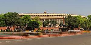
- Parliament of India
- Rajya Sabha (Council of States) - upper house of the parliament (Vice-President of India serves as the Chairman of the Rajya Sabha)
- Lok Sabha (House of the People) - lower house of the parliament (Speaker)
Judiciary of the government of India
.jpg)
Foreign relations of India
International organization membership
The Republic of India is a member of:[2]
- African Development Bank Group (AfDB) (nonregional member)
- Asian Development Bank (ADB)
- Association of Southeast Asian Nations (ASEAN) (dialogue partner)
- Association of Southeast Asian Nations Regional Forum (ARF)
- Bank for International Settlements (BIS)
- Bay of Bengal Initiative for Multi-Sectoral Technical and Economic Cooperation (BIMSTEC)
- Colombo Plan (CP)
- Commonwealth of Nations
- East Asia Summit (EAS)
- European Organization for Nuclear Research (CERN) (observer)
- Food and Agriculture Organization (FAO)
- Group of 15 (G15)
- Group of Twenty Finance Ministers and Central Bank Governors (G20)
- Group of 24 (G24)
- Group of 77 (G77)
- International Atomic Energy Agency (IAEA)
- International Bank for Reconstruction and Development (IBRD)
- International Chamber of Commerce (ICC)
- International Civil Aviation Organization (ICAO)
- International Criminal Police Organization (Interpol)
- International Development Association (IDA)
- International Federation of Red Cross and Red Crescent Societies (IFRCS)
- International Finance Corporation (IFC)
- International Fund for Agricultural Development (IFAD)
- International Hydrographic Organization (IHO)
- International Labour Organization (ILO)
- International Maritime Organization (IMO)
- International Mobile Satellite Organization (IMSO)
- International Monetary Fund (IMF)
- International Olympic Committee (IOC)
- International Organization for Migration (IOM)
- International Organization for Standardization (ISO)
- International Red Cross and Red Crescent Movement (ICRM)
- International Telecommunication Union (ITU)
- International Telecommunications Satellite Organization (ITSO)
- International Trade Union Confederation (ITUC)
- Inter-Parliamentary Union (IPU)
- League of Arab States (LAS) (observer)
- Multilateral Investment Guarantee Agency (MIGA)
- Nonaligned Movement (NAM)
- Organization for the Prohibition of Chemical Weapons (OPCW)
- Organization of American States (OAS) (observer)
- Pacific Islands Forum (PIF) (partner)
- Permanent Court of Arbitration (PCA)
- Shanghai Cooperation Organization (SCO) (observer)
- South Asia Co-operative Environment Programme (SACEP)
- South Asian Association for Regional Cooperation (SAARC)
- United Nations (UN)
- United Nations Conference on Trade and Development (UNCTAD)
- United Nations Disengagement Observer Force (UNDOF)
- United Nations Educational, Scientific, and Cultural Organization (UNESCO)
- United Nations High Commissioner for Refugees (UNHCR)
- United Nations Industrial Development Organization (UNIDO)
- United Nations Institute for Training and Research (UNITAR)
- United Nations Integrated Mission in Timor-Leste (UNMIT)
- United Nations Interim Force in Lebanon (UNIFIL)
- United Nations Mission in the Sudan (UNMIS)
- United Nations Operation in Cote d'Ivoire (UNOCI)
- United Nations Organization Mission in the Democratic Republic of the Congo (MONUC)
- Universal Postal Union (UPU)
- World Confederation of Labour (WCL)
- World Customs Organization (WCO)
- World Federation of Trade Unions (WFTU)
- World Health Organization (WHO)
- World Intellectual Property Organization (WIPO)
- World Meteorological Organization (WMO)
- World Tourism Organization (UNWTO)
- World Trade Organization (WTO)
Law and order in India
- Cannabis in India
- Capital punishment in India
- Constitution of India
- Crime in India
- Directive Principles in India
- Dowry law in India
- Fundamental Rights in India
- Law enforcement in India
- List of prisons in India
- Prisons in India
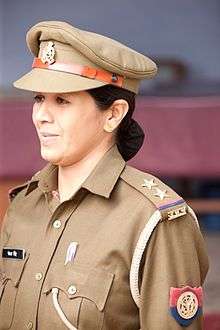
National law enforcement agencies
All India Service for policing — Indian Police Service
- Border Security Force
- Central Bureau of Investigation
- Central Industrial Security Force
- Central Reserve Police Force
- Defence Security Corps
- Directorate of Revenue Intelligence
- Indian Coast Guard
- Indian Home Guard
- Indo-Tibetan Border Police
- National Security Guards
- Railway Protection Force
- Special Protection Group
- Narcotics Control Bureau
State police forces
- Andaman and Nicobar Islands Police
- Andhra Pradesh Police
- Arunachal Pradesh Police
- Assam Police
- Bihar Police
- Chandigarh Police
- Chhattisgarh Police
- Dadra and Nagar Haveli Police
- Daman and Diu Police
- Goa Police
- Gujarat Police
- Haryana Police
- Himachal Pradesh Police
- Jammu and Kashmir Police
- Jharkhand Police
- Karnataka Police
- Kerala Police
- Lakshadweep Police
- Madhya Pradesh Police
- Maharashtra Police
- Manipur Police
- Meghalaya Police
- Mizoram Police
- Nagaland Police
- Orissa Police
- Punjab Police
- Puducherry Police
- Rajasthan Police
- Sikkim Police
- Tamil Nadu Police
- Telangana Police
- Tripura Police
- Uttar Pradesh Police
- Uttarakhand Police
- West Bengal Police
Police commissionerates
Armed forces of India
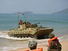

- Command
- Forces
- Military academies in India
- India and weapons of mass destruction
Government of states
- Government of Andaman and Nicobar
- Government of Andhra Pradesh
- Government of Arunachal Pradesh
- Government of Assam
- Government of Bihar
- Government of Chandigarh
- Government of Chhattisgarh
- Government of Dadra and Nagar Haveli
- Government of Daman and Diu
- National Capital Territory of Delhi
- Government of Goa
- Government of Gujarat
- Government of Haryana
- Government of Himachal Pradesh
- Government of Jammu and Kashmir
- Government of Jharkhand
- Government of Karnataka
- Government of Kerala
- Government of Lakshadweep
- Government of Madhya Pradesh
- Government of Maharashtra
- Government of Manipur
- Government of Meghalaya
- Government of Mizoram
- Government of Nagaland
- Government of Orissa
- Government of Puducherry
- Government of Punjab
- Government of Rajasthan
- Government of Sikkim
- Government of Tamil Nadu
- Government of Telangana
- Government of Tripura
- Government of Uttar Pradesh
- Government of Uttarakhand
- Government of West Bengal
Politics by states and territories
- Politics of Andaman and Nicobar
- Politics of Andhra Pradesh
- Politics of Arunachal Pradesh
- Politics of Assam
- Politics of Bihar
- Politics of Chandigarh
- Politics of Chhattisgarh
- Politics of Dadra and Nagar Haveli
- Politics of Daman and Diu
- Politics of Delhi
- Politics of Goa
- Politics of Gujarat
- Politics of Haryana
- Politics of Himachal Pradesh
- Politics of Jammu and Kashmir
- Politics of Jharkhand
- Politics of Karnataka
- Politics of Kerala
- Politics of Lakshadweep
- Politics of Madhya Pradesh
- Politics of Maharashtra
- Politics of Manipur
- Politics of Meghalaya
- Politics of Mizoram
- Politics of Nagaland
- Politics of Orissa
- Politics of Puducherry
- Politics of Punjab (India)
- Politics of Rajasthan
- Politics of Sikkim
- Politics of Tamil Nadu
- Politics of Telangana
- Politics of Tripura
- Politics of Uttar Pradesh
- Politics of Uttarakhand
- Politics of West Bengal
History of India
History of India by period
- Prehistoric India
- Riwatian people (1,900,000 BC)
- Soanian people (500,000 BC)
- South Asian Stone Age (70,000–3300 BCE)
- Ancient India
- Ancient Indian cities
- Indus Valley Civilization (3300–1700 BCE)
- Late Harappan culture (1700–1300 BCE)
- Vedic period (1500–500 BCE)
- Iron Age (1200–300 BCE)
- Mahajanapadas (700–300 BCE)
- Magadha Empire
- Haryanka dynasty (684–413 BCE)
- Shishunaga dynasty (413-345 BCE)
- Nanda dynasty (424-321 BCE)
- Maurya Empire (322- 185 BCE)
- Middle kingdoms of India (250 BCE–1279 CE)
- Chola Empire (250 BCE–1070 CE)
- Satavahana(230 BCE–220 CE)
- Shunga Empire (185-75 BCE)
- Kushan Empire (60–240 CE)
- Gupta Empire (280–550 CE)
- Pala Empire(750–1174 CE)
- Rashtrakuta (753–982 CE)
- Islamic empires in India (1206–1596)
- Delhi Sultanate (1206–1596)
- Deccan Sultanates(1490–1596)
- Hoysala Empire (1040–1346)
- Ahom Kingdom (1228–1826)
- Vijayanagara Empire (1336–1646)
- Mughal Empire (1526–1858)
- Maratha Empire (1674–1818)
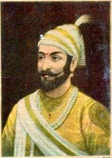
- Colonial India (1858–1947)
- Tipu Sultan
- Indian independence movement
- History of Republic of India (1947–present)
History of India by region
- History of Andaman and Nicobar
- History of Andhra Pradesh
- History of Arunachal Pradesh
- History of Assam
- History of Bihar
- History of Chandigarh
- History of Chhattisgarh
- History of Dadra and Nagar Haveli
- History of Daman and Diu
- National Capital Territory of Delhi
- History of Goa
- History of Gujarat
- History of Haryana
- History of Himachal Pradesh
- History of Jammu and Kashmir
- History of Jharkhand
- History of Karnataka
- History of Kerala
- History of Lakshadweep
- History of Madhya Pradesh
- History of Maharashtra
- History of Manipur
- History of Meghalaya
- History of Mizoram
- History of Nagaland
- History of Odisha
- History of Puducherry
- History of Punjab
- History of Rajasthan
- History of Sikkim
- History of Tamil Nadu
- History of Telangana
- History of Tripura
- History of Uttar Pradesh
- History of Uttarakhand
- History of West Bengal
History of India by subject
- Economic history of India
- Economy of India under the British Raj
- History of Buddhism in India
- History of clothing in India
- History of education in the Indian subcontinent
- History of Hinduism
- History of Indian archaeology
- History of Indian football
- History of Indian influence on Southeast Asia
- History of Indian Institutes of Technology
- History of rail transport in India
- History of sex in India
- History of the Indian cricket team
- History of the rupee
- Indian maritime history
- Indian natural history
- LGBT history in India
- Linguistic history of India
- List of massacres in India
- Military history of India
- Peopling of India
- Science and technology in ancient India
- Slavery in India
- Timeline of major famines in India during British rule
Culture of India
- Caste system in India
- Indian dress
- Festivals in India
- Humour in India
- Media in India
- National symbols of India
- Public holidays in India
- Religion in India
- World Heritage Sites in India
Cuisine of India
- Main dishes
- Sweets and desserts
- Drinks
- Snacks
- Spices
- Condiments
- History
- Supermarket chains in India
- Fast food
Cuisine by regions
|
|
|
|
|
The arts in India
Architecture of India
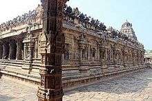
- Hindu temple architecture
- Buddhist architecture
- Indian rock-cut architecture
- Indian vernacular architecture
- Dravidian Architecture
- Hemadpanthi
- Western Chalukya Architecture
- Badami Chalukya Architecture
- Rajasthani architecture
- Architecture of Karnataka
- Architecture of Bengal
- Hoysala architecture
- Vijayanagara architecture
- Kalinga Architecture
- Mughal architecture
- Indo-Islamic architecture
- Indo-Saracenic Revival architecture
- Chandigarh
- List of Indian architects
Cinema of India

- Lists of Indian films
- List of Indian documentary films
- List of highest-grossing Bollywood films
- List of Bhojpuri films
- List of Marathi films
- List of Assamese films
- List of top Tamil-language films
- List of Telugu-language films
- List of Malayalam films
- List of Kannada films
- List of Bengali films
- List of Indian film actresses
- List of Indian film actors
- List of Indian film directors
- List of Indian film choreographers
- List of Indian film cinematographers
- List of Indian film score composers
- List of film festivals in India
- List of Indian film producers
- List of Indian film screenwriters
Film Awards
Cinema by region
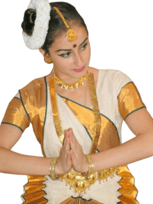
Music of India
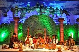

- Indian classical music
- Indian folk music
- Qawwali
- Indian pop
- Indian hip hop
- Filmi
- Indian rock
- Sangeet Natak Akademi
- Thyagaraja Aradhana
- Cleveland Thyagaraja Aradhana
- Chembai sangeetha utsavam
- List of Indian playback singers
- Indian musical instruments
Music by states and territories
- Music of Andaman and Nicobar
- Music of Andhra Pradesh
- Music of Arunachal Pradesh
- Music of Assam
- Music of Bihar
- Music of Chandigarh
- Music of Chhattisgarh
- Music of Dadra and Nagar Haveli
- Music of Daman and Diu
- National Capital Territory of Delhi
- Music of Goa
- Music of Gujarat
- Music of Haryana
- Music of Himachal Pradesh
- Music of Jammu and Kashmir
- Music of Jharkhand
- Music of Karnataka
- Music of Kerala
- Music of Lakshadweep
- Music of Madhya Pradesh
- Music of Maharashtra
- Music of Manipur
- Music of Meghalaya
- Music of Mizoram
- Music of Nagaland
- Music of Orissa
- Music of Puducherry
- Music of Punjab
- Music of Rajasthan
- Music of Sikkim
- Music of Tamil Nadu
- Music of Tripura
- Music of Uttar Pradesh
- Music of Uttarakhand
- Music of West Bengal
Literature of India
- List of Indian poets
- List of Indian authors
- Indian epic poetry
- Jnanpith award
- Sahitya Akademi Award
- Indian Literature (journal)
- Indian folklore
Literature by language
- Assamese literature
- Bengali literature
- Bhojpuri literature
- Gujarati literature
- Hindi literature
- Kannada literature
- Kashmiri literature
- Malayalam literature
- Marathi literature
- Nepali literature
- Oriya literature
- Pali litearature
- Prakrit literature
- Punjabi literature
- Rajasthani literature
- Sanskrit literature
- Sindhi literature
- Tamil literature
- Telugu literature
- Urdu literature
- Vedic literature
- Indian English literature
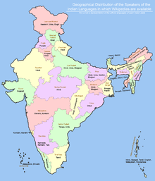
Languages in India
- Angika language
- Assamese language
- Bajjika language
- Bengali language
- Bodo language
- Bhojpuri language
- Dogri language
- English language
- Garo language
- Gujarati language
- Hindi language
- Haryanvi language
- Kannada language
- Kashmiri language
- Khasi language
- Kokborok language
- Konkani language
- Magahi language
- Maithali language
- Malayalam language
- Meitei language
- Marathi language
- Mizo language
- Nepali language
- Oriya language
- Prakrit language
- Punjabi language
- Rajasthani language
- Sanskrit language
- Santali language
- Sindhi language
- Saurashtra language
- Tamil language
- Telugu language
- Tulu language
- Urdu language
- Kodava language
Sports in India
- India at the Olympics
- India at the Commonwealth Games
- India at the Asian Games
- Wrestling in India
- Field hockey in India
- Cricket in India
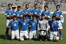
- Football in India
- Kabaddi
- Rugby in India
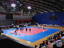
- Indian martial art
- Sports in Delhi
Major Sports Leagues
- Hockey India League (Hockey)
- Indian Premier League (Cricket)
- I-League (Football)
- Indian Super League (Football)
- Indian Badminton League (IBL) (Badminton)
- Pro Kabaddi (Kabaddi)
Culture by region
- Culture of Andaman and Nicobar
- Culture of Andhra Pradesh
- Culture of Arunachal Pradesh
- Culture of Assam
- Culture of Bihar
- Culture of Chandigarh
- Culture of Chhattisgarh
- Culture of Dadra and Nagar Haveli
- Culture of Daman and Diu
- National Capital Territory of Delhi
- Culture of Goa
- Culture of Gujarat
- Culture of Haryana
- Culture of Himachal Pradesh
- Culture of Jammu and Kashmir
- Culture of Jharkhand
- Culture of Karnataka
- Culture of Kerala
- Culture of Lakshadweep
- Culture of Madhya Pradesh
- Culture of Maharashtra
- Culture of Manipur
- Culture of Meghalaya
- Culture of Mizoram
- Culture of Nagaland
- Culture of Orissa
- Culture of Puducherry
- Culture of Punjab
- Culture of Rajasthan
- Culture of Sikkim
- Culture of Tamil Nadu
- Culture of Telangana
- Culture of Tripura
- Culture of Uttar Pradesh
- Culture of Uttarakhand
- Culture of West Bengal
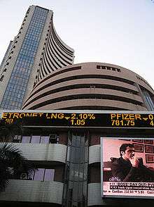
Economy and infrastructure of India
- Economic rank, by nominal GDP (2011): 9th (twelfth)
Economy and infrastructure of states
- Economy of Andaman and Nicobar
- Economy of Andhra Pradesh
- Economy of Arunachal Pradesh
- Economy of Assam
- Economy of Bihar
- Economy of Chandigarh
- Economy of Chhattisgarh
- Economy of Dadra and Nagar Haveli
- Economy of Daman and Diu
- National Capital Territory of Delhi
- Economy of Goa
- Economy of Gujarat
- Economy of Haryana
- Economy of Himachal Pradesh
- Economy of Jammu and Kashmir
- Economy of Jharkhand
- Economy of Karnataka
- Economy of Kerala
- Economy of Lakshadweep
- Economy of Madhya Pradesh
- Economy of Maharashtra
- Economy of Manipur
- Economy of Meghalaya
- Economy of Mizoram
- Economy of Nagaland
- Economy of Orissa
- Economy of Puducherry
- Economy of Punjab
- Economy of Rajasthan
- Economy of Sikkim
- Economy of Tamil Nadu
- Economy of Telangana
- Economy of Tripura
- Economy of Uttar Pradesh
- Economy of Uttarakhand
- Economy of West Bengal
Education in India
- Literacy
- Schools
- Department of Higher Education
- CBSE
- CISCE
- NIOS
- Sarva Shiksha Abhiyan
- University Grants Commission
- AICTE
- Distance Education Council
- NAAC
- Medical Council of India
- Dental Council of India
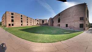
- Institutes of Technology
- Institutes of Management
- Institutes of Science
- Bar Council of India
- Legal education in India
- Autonomous law schools in India
Education in states
- Education in Andaman and Nicobar
- Education in Andhra Pradesh
- Education in Arunachal Pradesh
- Education in Assam
- Education in Bihar
- Education in Chandigarh
- Education in Chhattisgarh
- Education in Dadra and Nagar Haveli
- Education in Daman and Diu
- Education in Delhi
- Education in Goa
- Education in Gujarat
- Education in Haryana
- Education in Himachal Pradesh
- Education in Jammu and Kashmir
- Education in Jharkhand
- Education in Karnataka
- Education in Kerala
- Education in Lakshadweep
- Education in Madhya Pradesh
- Education in Maharashtra
- Education in Manipur
- Education in Meghalaya
- Education in Mizoram
- Education in Nagaland
- Education in Orissa
- Education in Puducherry
- Education in Punjab
- Education in Rajasthan
- Education in Sikkim
- Education in Tamil Nadu
- Education in Telangana
- Education in Tripura
- Education in Uttar Pradesh
- Education in Uttarakhand
- Education in West Bengal
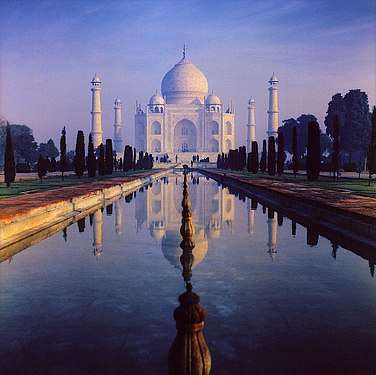
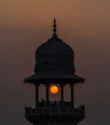
Tourism in India
Tourism in states
- Tourism in Andaman and Nicobar
- Tourism in Andhra Pradesh
- Tourism in Arunachal Pradesh
- Tourism in Assam
- Tourism in Bihar
- Tourism in Chandigarh
- Tourism in Chhattisgarh
- Tourism in Dadra and Nagar Haveli
- Tourism in Daman and Diu
- Tourism in National Capital Territory of Delhi
- Tourism in North East India
- Tourism in Goa
- Tourism in Gujarat
- Tourism in Haryana
- Tourism in Himachal Pradesh
- Tourism in Jammu and Kashmir
- Tourism in Jharkhand
- Tourism in Karnataka
- Tourism in Kerala
- Tourismin Lakshadweep
- Tourism in Madhya Pradesh
- Tourism in Maharashtra
- Tourism in Manipur
- Tourism in Meghalaya
- Tourism in Mizoram
- Tourism in Nagaland
- Tourism in Orissa
- Tourism in Puducherry
- Tourism in Punjab (India)
- Tourism in Rajasthan
- Tourism in Sikkim
- Tourism in Tamil Nadu
- Tourism in Telangana
- Tourism in Tripura
- Tourism in Uttar Pradesh
- Tourism in Uttarakhand
- Tourism in West Bengal
 House boat Kettuvallam, Kerala, India.
 Shikkaras at Dal lake, Jammu and Kashmir, India.
 Khajuraho Temple, Madhya Pradesh, India.
 Beach of Goa, India.
 Gangotri Glacier, Uttarakhand, India.
 A Tea Garden of Cachar, Assam, India.
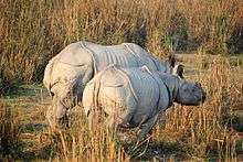 Kaziranga National Park, Assam, India.
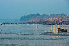 Kumbh Mela Sangam, Allahabad, Uttar Pradesh, India.
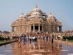 Akshardham Temple, Delhi, India.
See also
References
- ↑ http://www.indiaquickfacts.com/content/india-government-indian-democracy
- ↑ "India". The World Factbook. United States Central Intelligence Agency. 13 July 2009. Retrieved 23 July 2009.
External links

- Government
- Official entry portal of the Government of India
- Official directory of Indian Government websites
- General reference
- "India". The World Factbook. Central Intelligence Agency.
- Encyclopædia Britannica entry on India
- BBC country profile of India
- Library of Congress Country Studies entry on India
- Other
- Incredible India - The Official Tourism Website of Ministry of Tourism, Government of India
- Ministry of Petroleum and Natural Gas
- India at Curlie (based on DMOZ)
- India 4You - Directory of popular Indian websites.