Medford, Massachusetts
| Medford, Massachusetts | ||
|---|---|---|
| City | ||
 Medford Square, the intersection of Main Street, High Street, Forest Street, Salem Street, Riverside Avenue, and Ring Road | ||
| ||
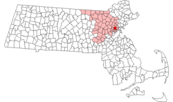 Location in Middlesex County in Massachusetts | ||
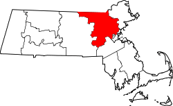
 Medford, Massachusetts Location in the United States | ||
| Coordinates: 42°25′06″N 71°06′24″W / 42.41833°N 71.10667°WCoordinates: 42°25′06″N 71°06′24″W / 42.41833°N 71.10667°W | ||
| Country | United States | |
| State | Massachusetts | |
| County | Middlesex | |
| Settled | 1630 | |
| Incorporated | 1630 | |
| City | 1892 | |
| Government | ||
| • Type | Mayor-council city | |
| • Mayor | Stephanie Muccini Burke | |
| Area | ||
| • Total | 8.6 sq mi (22.4 km2) | |
| • Land | 8.1 sq mi (21.1 km2) | |
| • Water | 0.5 sq mi (1.3 km2) | |
| Elevation | 14 ft (4 m) | |
| Population (2010) | ||
| • Total | 56,173 | |
| • Estimate (2016)[1] | 57,213 | |
| • Density | 6,500/sq mi (2,500/km2) | |
| Time zone | UTC−5 (Eastern) | |
| • Summer (DST) | UTC−4 (Eastern) | |
| ZIP code | 02153, 02155, 02156 | |
| Area code(s) | 781 / 339 | |
| FIPS code | 25-39835 | |
| GNIS feature ID | 0612778 | |
| Website | www.medford.org | |

Medford is a city 3.2 miles northwest of downtown Boston on the Mystic River in Middlesex County, Massachusetts, United States. In the 2010 U.S. Census, Medford's population was 56,173. It is home to Tufts University.
History
17th century
Medford was settled in 1630 as part of Charlestown.[2] The area was originally called "Mistick" by Thomas Dudley (a name which persisted for many decades), which his party renamed "Meadford".[3] The name may have come from a description of the "meadow by the ford" in the Mystic River, or from two locations in England that Cradock may have known: the hamlet of Mayford or Metford in Staffordshire near Caverswall, or from the parish of Maidford or Medford (now Towcester, Northamptonshire).[4] In 1634, the land north of the Mystic River became the private plantation of former Governor Matthew Cradock; across the river was Ten Hills Farm, which belonged to John Winthrop, Governor of the Massachusetts Bay colony.[5]
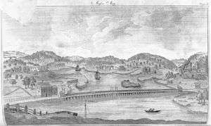
In 1637, the first bridge (a toll bridge) across the Mystic River was built at the site of the present-day Cradock Bridge, which carries Main Street into Medford Square.[6] It would be the only bridge across the Mystic until 1787, and as such became a major route for traffic coming into Boston from the north (though ferries and fords were also used).[7] The bridge would be rebuilt in 1880 and 1909.[6]
Until 1656, all of northern Medford was owned by Cradock, his heirs, or Edward Collins. Medford was governed as a "peculiar" or private plantation. As the land began to be divided among several people from different families, the new owners began to meet and make decisions locally and increasingly independently from the Charlestown town meeting. In 1674, a Board of Selectmen was elected, in 1684, the colonial legislature granted the ability to raise money independently, and in 1689, a representative to the legislature was chosen. The town got its own religious meeting room in 1690, and a secular meeting house in 1696.[7]
In 1692, the town engaged its first ordained preacher, Rev. John Hancock Sr., grandfather to John Hancock, first and third Governor of Massachusetts and famous revolutionary figure; during his time of service Rev. Hancock lived in Medford, serving until November 1693.[8][7]
18th and 19th centuries
The land south of the Mystic River, present-day South Medford, was originally known as "Mistick Field". It was transferred from Charlestown to Medford in 1754.[9] This grant also included the "Charlestown woodlots" (the Medford part of the Middlesex Fells), and part of what was at the time Woburn (now Winchester).[10] Other parts of Medford were transferred to Charlestown in 1811, Winchester in 1850 ("Upper Medford"), and Malden in 1879. Additional land was transferred to Medford from Malden (1817), Everett (1875), and Malden (1877) again.[4][11]
The population of Medford went from 230 in 1700 to 1,114 in 1800. After 1880, the population rapidly expanded, reaching 18,244 by 1900.[12] Farmland was divided into lots and sold to build residential and commercial buildings, starting in the 1840s and 1850s; government services expanded with the population (schools, police, post office) and technological advancement (gas lighting, electricity, telephones, railways).[11] Tufts University was chartered in 1852 and the Crane Theological School at Tufts opened in 1869.
Medford was incorporated as a city in 1892, and was a center of industry, including the manufacture of tiles and crackers,[13] bricks,[14] rum,[15] and clipper ships,[16] such as the White Swallow and the Kingfisher, both built by Hayden & Cudworth.[17]
Transportation
During the 17th century, a handful of major public roads (High Street, Main Street, Salem Street, "the road to Stoneham", and South Street) served the population, but the road network started a long-term expansion in the 18th century.[18] The Medford Turnpike Company was incorporated in 1803, and (as was reasonably common at the time) turned what is now Mystic Avenue over to the city in 1866. The Andover Turnpike Company was incorporated in 1805, and turned what is now Forest Street and Fellsway West over to Medford in 1830.[11]
Other major commercial transportation projects included the Middlesex Canal by 1803,[19] the Boston and Lowell Railroad in West Medford in the 1830s, and the Boston and Maine Railroad to Medford Center in 1847.
A horse-powered street railway began running to Somerville and Charlestown in 1860. The street railway network expanded in the hands of various private companies, and went electric in the late 1890s, when trolleys to Everett and downtown Boston were available.[11] Streetcars were converted to buses in the 20th century. Interstate 93 was constructed between 1956 and 1963.[20]
Gypsy moth
In 1868, a French astronomer and naturalist, Leopold Trouvelot, was attempting to breed a better silkworm using Gypsy moths. Several of the moths escaped from his home, at 27 Myrtle Street. Within ten years, the insect had denuded the vegetation in the neighborhood. It spread over North America.[21][22]
Holiday songs
In a tavern and boarding house on High Street (Simpson's Tavern) in the late 19th century, local resident James Pierpont wrote "Jingle Bells" after watching a sleigh race from Medford to Malden. Another local resident, Lydia Maria Child (1802–1880), made a poem out of the trip across town to her grandparents' house, now the classic song "Over the River and Through the Wood".
Other notables
Paul Revere's famous midnight ride traveled along Main Street, continuing onto High Street in Medford Square. An annual re-enactment takes place honoring the historic event.
The Peter Tufts House (350 Riverside Ave.) is thought to be the oldest all-brick building in New England. Another important site is the "Slave Wall" on Grove Street, built by "Pomp," a slave owned by the prominent Brooks family. The Isaac Royall House, which once belonged to one of Harvard Law School's founders, Isaac Royall, Jr., is a National Historic Landmark and a local history museum. The house was used by Continental Army troops, including George Washington and John Stark, during the American Revolutionary War.
George Luther Stearns, an American industrialist and one of John Brown's Secret Six. His passion for the abolitionist cause shaped his life, bringing him into contact with the likes of Abraham Lincoln and Ralph Waldo Emerson and starting The Nation magazine. He was given the rank of major by Massachusetts Governor John Andrew and spent most of the Civil War recruiting for the 54th and 55th Massachusetts regiments and the 5th cavalry.
Medford was home to Fannie Farmer, author of one of the world's most famous cookbooks—as well as James Plimpton, the man credited with the 1863 invention of the first practical four-wheeled roller skate, which set off a roller craze that quickly spread across the United States and Europe.[23]
Amelia Earhart lived in Medford while working as a social worker in 1925.
Elizabeth Short, the victim of an infamous Hollywood murder and who became known as The Black Dahlia, was born in Hyde Park (the southernmost neighborhood of the city of Boston, Massachusetts) but raised in Medford before going to the West Coast looking for fame.
Medford has sent more than its share of athletes to the National Hockey League; Shawn Bates, though born in Melrose, MA grew up in Medford, as did Keith Tkachuk, Mike Morrison, David Sacco, and Joe Sacco. Former Red Sox pitcher Bill Monbouquette grew up in Medford.
Medford was home to Michael Bloomberg, American businessman, philanthropist, and the founder of Bloomberg L.P.. He was the Mayor of New York City from 2002 to 2013. Mayor Bloomberg attended Medford High School and resided in Medford until after he graduated from college at Johns Hopkins University.[24] His mother remained a resident of Medford until her death in 2011.
The only cryobank of amniotic stem cells in the United States is located in Medford, built by Biocell Center, a biotechnology company led by Giuseppe Simoni.
Medford and the law
Medford was the location of some famous crimes:
- One of the biggest bank robberies and jewel heists in world history happened on Memorial Day weekend in 1980, when several crooked officers of the Medford Police and Metropolitan District Commission Police forces robbed the Depositors Trust bank in Medford square. The book The Cops Are Robbers: A Convicted Cop's True Story of Police Corruption is based upon this event. Salvatore's Restaurant, located at 55 High Street in Medford Square, is partially in the same location as the bank that was robbed. The private dining room in the restaurant uses the bank's vault door as an entrance way, and the hole in the corner of the ceiling that the robbers crawled through was left intact for nostalgia.
- An admitted Mob execution by Somerville's Winter Hill Gang of Joe "Indian-Joe" Notarangeli took place at the "Pewter Pot" cafe in Medford Square, now called the "Lighthouse Cafe."[25]
- In October 1989, the FBI recorded a Mafia initiation ceremony held by the Patriarca crime family at a home on Guild St. in Medford.
Geography
Medford is located at 42°25′12″N 71°6′29″W / 42.42000°N 71.10806°W (42.419996, −71.107942).[26]
According to the United States Census Bureau, the city has a total area of 8.6 square miles (22 km2), of which, 8.1 square miles (21 km2) of it is land and 0.5 square miles (1.3 km2) of it (5.79%) is water.
A park called the Middlesex Fells Reservation, to the north, is partly within the city. This 2,060-acre (8 km2) preserve is shared by Medford with the municipalities of Winchester, Stoneham, Melrose, and Malden. The Mystic River flows roughly west to southeast through the middle of the city.
Neighborhoods
People from Medford often identify themselves with a particular neighborhood.
- West Medford
- Fulton Heights/The Heights (North Medford)
- Wellington/Glenwood
- Station Landing
- Brooks Estate
- Lawrence Estates
- South Medford
- The Hillside
- Tufts University (mostly contiguous, situated on Medford Hillside)[27]
Demographics
| Historical population | ||
|---|---|---|
| Year | Pop. | ±% |
| 1790 | 1,029 | — |
| 1800 | 1,114 | +8.3% |
| 1810 | 1,443 | +29.5% |
| 1820 | 1,474 | +2.1% |
| 1830 | 1,755 | +19.1% |
| 1840 | 2,478 | +41.2% |
| 1850 | 3,749 | +51.3% |
| 1860 | 4,842 | +29.2% |
| 1870 | 5,717 | +18.1% |
| 1880 | 7,573 | +32.5% |
| 1890 | 11,079 | +46.3% |
| 1900 | 18,244 | +64.7% |
| 1910 | 23,150 | +26.9% |
| 1920 | 39,038 | +68.6% |
| 1930 | 59,714 | +53.0% |
| 1940 | 63,083 | +5.6% |
| 1950 | 66,113 | +4.8% |
| 1960 | 64,971 | −1.7% |
| 1970 | 64,397 | −0.9% |
| 1980 | 58,076 | −9.8% |
| 1990 | 57,407 | −1.2% |
| 2000 | 55,765 | −2.9% |
| 2010 | 56,173 | +0.7% |
| 2016 | 57,213 | +1.9% |
| * = population estimate. Source: United States Census records and Population Estimates Program data.[28][29][30][31][32][33][34][35][36][37][38] Source: | ||
Irish-Americans are a strong presence in the city and live in all areas. South Medford is a traditionally Italian neighborhood. West Medford, the most affluent of Medford's many neighborhoods, was once the bastion of some of Boston's elite families— including Peter Chardon Brooks, one of the wealthiest men in post-colonial America, and father-in-law to Charles Francis Adams — and is also home to an historic African-American neighborhood that dates to the Civil War.[40]
As of the census[41] of 2010, there were 56,173 people, 22,810 households, and 13,207 families residing in the city. The population density was 6,859.9 people per square mile (2,633.4/km²). There were 24,046 housing units at an average density of 2,796.0 per square mile (1,073.5/km²). The racial makeup of the city was 78.6% White, 8.80% African American, 0.2% Native American, 6.9% Asian, 0.01% Pacific Islander, 2.8% from other races, and 2.7% from two or more races. Hispanic or Latino of any race were 4.4% of the population.
There were 22,810 households out of which 22.3% had children under the age of 18 living with them, 42.5% were married couples living together, 11.4% had a female householder with no husband present, and 42.1% were non-families. 24.6% of all households were made up of individuals and 11.1% had someone living alone who was 65 years of age or older. The average household size was 2.38 and the average family size was 3.00.
In the city, the population was spread out with 13.8% under the age of 15, 14.3% from 15 to 24, 31.7% from 25 to 44, 24.9% from 45 to 64, and 15.2% who were 65 years of age or older. The median age was 37.7 years. For every 100 females, there were 91.5 males. For every 100 females age 18 and over, there were 89.4 males.[42]
The median income for a household in the city was $52,476, and the median income for a family was $62,409. Males had a median income of $41,704 versus $34,948 for females. The per capita income for the city was $24,707. About 4.1% of families and 6.4% of the population were below the poverty line, including 5.7% of those under age 18 and 7.4% of those age 65 or over.
Medford has three Public, educational, and government access (PEG) cable TV channels. The Public-access television channel is TV3, The Educational-access television is channel 15 and 16 is the Government-access television (GATV) municipal channel.
Education
Medford is home to many schools, public and private.
- Elementary
- Public
- Christopher Columbus Elementary School
- Brooks Elementary School
- John J. McGlynn Elementary School
- Milton Fuller Roberts Elementary School
- Private (non-sectarian)
- Eliot-Pearson Children's School (PK-2)[43]
- Gentle-Dragon Preschool (PK)[44]
- Merry-Go-Round Nursery School (PK)
- Play Academy Learning Center (PK-K)[45]
- Oakland Park Children's Center (PK)
- Six Acres Nursery School (PK-K) (non-sectarian, but run through Medford Jewish Community Center)[46]
- Private (sectarian)
- Middle School
- John J. McGlynn Middle School
- Madeline Dugger Andrews Middle School
- High School
- Public
- Medford High School
- Medford Vocational Technical High School
- Mascot: Mustang
- College
- Private
- Miscellaneous education
- Private
Government
| Clerk of Courts: | Michael A. Sullivan |
|---|---|
| District Attorney: | Marian Ryan |
| Register of Deeds: | Richard P. Howe, Jr. (North at Lowell) Eugene C. Brune (South at Cambridge) |
| Register of Probate: | Tara E. DeCristofaro |
| County Sheriff: | Peter Koutoujian (D) |
| State government | |
| State Representative(s): | Paul Donato (D) Sean Garballey (D) Christine Barber (D) |
| State Senator(s): | Patricia D. Jehlen (D) |
| Governor's Councilor(s): | Terrence W. Kennedy (D) |
| Federal government | |
| U.S. Representative(s): | Katherine Clark (D-5th District) |
| U.S. Senators: | Elizabeth Warren (D), Ed Markey (D) |
| Voter registration and party enrollment as of October 15, 2008[51] | |||||
|---|---|---|---|---|---|
| Party | Number of voters | Percentage | |||
| Democratic | 16,588 | 46.80% | |||
| Republican | 2,610 | 7.36% | |||
| Unaffiliated | 16,054 | 45.29% | |||
| Minor Parties | 193 | 0.54% | |||
| Total | 35,445 | 100% | |||
Local government
- Stephanie M. Burke, Mayor[52]
- Adam L. Hurtubise, City Clerk [53]
- Jennifer Dever Wood, Chief of Staff and Director of Personnel[54]
- Shab Kahn, Chief Procurement Officer[55]
City Council
- Richard F. Caraviello, President
- Frederick N. Dello Russo Jr., Vice President
- Michael J. Marks
- John C. Falco Jr.
- Adam Knight
- Breanna Lungo-Koehn
- George A. Scarpelli
School Committee
- Stephanie M. Burke, Chairperson
- Erin DiBennedetto
- Kathy Kreatz
- Mea Quinn Mustone
- Michael Ruggiero
- Paul Ruseau
- Paulette Van der Kloot
Local media & news
The City of Medford has several local news and media outlets:
Transportation
Numerous Massachusetts Bay Transportation Authority bus lines go through Medford—specifically, the 80, 94, 95, 96, 99, 100, 101, 108, and 134 bus routes provide local service and direct connections to nearby areas in Arlington, Somerville, Cambridge, Malden, Charlestown, Winchester, and Woburn, while the 325 and 326 routes provide express service to downtown Boston and the 710 route is contracted to Joseph's Transportation, a Medford family-owned company. The 90, 97, 106, 110, and 112 bus routes additionally terminate at Wellington station with at most one other stop in Medford, providing a direct connection between Medford and nearby areas in Somerville, Everett, Malden, Revere, Chelsea, East Boston, and Melrose. On Medford's east side, Wellington station on the Orange Line provides a connection to Boston and the entire rapid transit system. On the west side, the Lowell Commuter Rail Line stops in West Medford Square.
Discussion of bringing the Green Line into Medford, as is mandated by environmental mitigation provisions of the Big Dig project,[60] is ongoing. On February 2, 2009, the state formally endorsed extending the Green Line through Medford, terminating near the intersection of Boston Avenue and Mystic Valley Parkway (Massachusetts Route 16). As proposed, the terminus would not have parking facilities. The extension would serve an additional 10,000 potential Green Line riders.
Joseph's Limousine and Transportation of Medford runs a bus line through the city and also picks up passengers going to other parts of Greater Boston or out of state.
Interstate 93 travels roughly north–south through the city. State routes passing through Medford include 16, 28, 38, and 60.
Points of interest
_map.jpg)
_(c112-02-34).jpg)
- Tufts University: Though the Tufts campus is mainly located in Medford, the Somerville–Medford border actually runs through it. The school employs many local residents and has many community service projects that serve the city, especially those run through the Leonard Carmichael Society and the Jonathan M. Tisch College of Citizenship and Public Service, the latter of which especially emphasizes public service in Tufts' host communities.
- Isaac Royall House, a 1692 house operated as a non-profit museum.
- The Unitarian Universalist Church of Medford: Medford's first religious community since 1690.
- Amelia Earhart residence, 76 Brooks Street
- John Wade House, built 1784, added to the National Register of Historic Places in 1975
- Former site of Fannie Farmer's house, corner of Paris & Salem Streets
- Grandfather's House
- Grace Church, designed by H. H. Richardson
- Gravity Research Foundation monument at Tufts University
- Henry Bradlee Jr. House
- Jingle Bells historical marker, High Street
- Salem Street Burying Ground
- Old Ship Street Historic District: Area around Riverside Ave (formerly Ship Street) containing many historic homes
- United States Post Office–Medford Main, historic 1937 building
Notable people
- Edwin Adams, (1834–1877), stage comedian of the 19th century[61]
- Lou Antonelli, science-fiction writer
- Rev. Hosea Ballou II, Minister of 1st Universalist and first president of Tufts College
- Shawn Bates, professional hockey player, New York Islanders
- Jessica Biel, actress, resident while attending Tufts University
- Heber R. Bishop, 1840-1902, industrialist and financier
- Michael Bloomberg, mayor of New York City (2002–2013)[62]
- Dale Bozzio, lead singer of band Missing Persons, worked with Frank Zappa
- Hall L. Brooks, former member of the Wisconsin State Assembly
- Mary Carew, Olympic gold medalist sprinter, born in Medford
- Terri Lyne Carrington, jazz drummer
- John Ciardi, poet and translator of Dante
- Lydia Maria Child, anti-slavery activist, writer of the poem "Over the River and Through the Woods"
- Martha Coakley, former attorney general of Massachusetts
- James O. Curtis (1804-1890), Medford shipbuilder who built ships powered by sail or by screw and steam
- Thayer David, TV and film character actor
- Edward Dugger (1894-1939), African American military commander
- Amelia Earhart, pioneer aviator, born in Kansas, lived in Medford as a young woman
- Fannie Farmer, culinary expert
- Frank Fontaine, comedian and singer
- Paul Geary, former drummer of hard rock band Extreme, music manager for acts such as Godsmack
- Alan L. Gropman, military officer, college professor, and author
- Colonel Edward Needles Hallowell, merchant and commander of 54th Massachusetts Volunteer Infantry in the American Civil War
- Rev. John Hancock Sr., first ordained preacher of Medford, lived and served in Medford 1692–1693, grandfather to John Hancock, Governor of Massachusetts and famous revolutionary figure.[8]
- Robert Kelly, comedian, Tourgasm, Comedy Central
- Kathleen McCartney, president of Smith College, former dean of Harvard Graduate School of Education
- Michael McDowell, screenwriter of Beetlejuice and The Nightmare Before Christmas and author of several notable Southern Gothic novels
- Dave McGillivray, race director of Boston Marathon
- Laurel McGoff, actress and singer
- Maria Menounos, Miss Massachusetts Teen USA 1996, media personality (Entertainment Tonight, Access Hollywood and Extra), actress, professional wrestler
- Bill Monbouquette, Major League Baseball pitcher 1958–1968 (Red Sox, Tigers, Yankees)
- Priscilla Morrill, actress, played Edie Grant on the Mary Tyler Moore Show
- John Forbes Nash, Princeton professor, winner of Nobel Prize in Economics
- Julianne Nicholson, actress (Ally McBeal, Law and Order: Criminal Intent, August: Osage County)
- Alexis Ohanian, founder of reddit
- Mike Pagliarulo, Major League Baseball player (Yankees, Twins, Padres, Rangers, Orioles)
- James Pierpont, writer of "Jingle Bells"
- Rev. John Pierpont
Charles Pizzano-noted sculptor
- Ruth Posselt, classical violinist
- Robert D. Richardson, historian, grew up in the Osgood House
- William Zebina Ripley, economist and racial theorist
- Joe Rogan, comedian, podcaster, UFC host, host of Fear Factor
- Mark Roopenian, NFL player
- Isaac Royall, Jr., 18th Century benefactor of Harvard
- David Sacco, NHL player
- Joe Sacco, NHL player and coach
- Claude Shannon, scientist, father of Information Theory and modern digital communications[63]
- Elizabeth Short, aspiring actress, brutally mutilated and murdered, dubbed the "Black Dahlia" by the press
- Clifford Shull, Nobel Prize-winning American physicist
- Rev. Clarence Skinner, Dean of Religion at Tufts University, minister Hillside Universalist Church (1917–1920), theologian and pacifist
- George Luther Stearns, industrialist, one of John Brown's Secret Six, lead recruiter of 54th and 55th Regiments
- Mark T. Sullivan, author who has written novels on his own and has co-authored three James Patterson novels
- Paul Theroux, author
- Keith Tkachuk, NHL player
- Ed Tryon, halfback at Colgate University, elected to College Football Hall of Fame in 1963
- Bob Tufts, Major League Baseball pitcher
See also
References
- ↑ "Population and Housing Unit Estimates". Retrieved June 9, 2017.
- ↑ Charles Brooks; William Henry Whitmore (1855). History of the Town of Medford, Middlesex County, Massachusetts: From Its First Settlement, in 1630, to the Present Time, 1855. J.M. Usher. pp. 1–2. Retrieved 21 September 2017.
- ↑ History of the Town of Medford, p. 30
- 1 2 History of Middlesex County, p. 158
- ↑ History of the Town of Medford, p. 39
- 1 2 Bencks, Jarret (2011-10-27). "Cradock Bridge to Be Replaced in 2012 or 2013 - Medford, MA Patch". Medford.patch.com. AOL Inc. Retrieved 2012-03-20.
- 1 2 3 "A Peculiar Plantation: 17th Century Medford - Medford Historical Society & Museum". medfordhistorical.org.
- 1 2 John H. Hooper (1906). Proceedings of the Celebration of the Two Hundred and Seventy-fifth Anniversary of the Settlement of Medford, Massachusetts, June, Nineteen Hundred and Five: Prefaced by a Brief History of the Town and City from the Day of Settlement. Executive Committee. p. 62. Retrieved 21 September 2017.
- ↑ History of the Town of Medford, p. 5
- ↑ "A Quiet Country Town: 18th Century Medford - Medford Historical Society & Museum". medfordhistorical.org.
- 1 2 3 4 "The Emerging City: 19th Century Medford - Medford Historical Society & Museum". medfordhistorical.org.
- ↑ United States census
- ↑ Medford city history
- ↑ "Making Bricks in Medford - Medford Historical Society & Museum". medfordhistorical.org.
- ↑ "Medford Rum - Medford Historical Society & Museum". medfordhistorical.org.
- ↑ "Medford-Built Sailing Ships - Medford Historical Society & Museum". medfordhistorical.org.
- ↑ Gleason, Hall (1937). Old Ships and Ship-Building Days of Medford. Medford, MA: J.C. Miller. p. 76.
- ↑ History of the Town of Medford, "Roads" chapter.
- ↑ Medfordhistorical.org Archived 2008-09-19 at the Wayback Machine.
- ↑ "Northern Expressway (I-93)". www.bostonroads.com.
- ↑ Forbush, E. H. (1896). The Gypsy Moth. Boston, MA: Wright & Potter. pp. 2–44.
- ↑ "Learning from the Legacy of Leopold Trouvelot" (PDF). Bulletin of the ESA Summer 1989. Retrieved 2012-09-13.
- ↑ Skating, National Museum of Roller. "National Museum of Roller Skating: Homework Help". www.rollerskatingmuseum.com. Retrieved 2018-01-24.
- ↑ Town, Your (October 12, 2009). "New Michael Bloomberg biography takes a few jabs at Medford". The Boston Globe.
- ↑ "Black Mass: The Irish Mob, the Boston FBI and a Devil's Deal, "Dick Lehr (author), Gerard O'Neill (author) 1-891-62040-1 Public Affairs Press
- ↑ "US Gazetteer files: 2010, 2000, and 1990". United States Census Bureau. 2011-02-12. Retrieved 2011-04-23.
- ↑ "Archived copy" (PDF). Archived from the original (PDF) on 2013-11-02. Retrieved 2013-11-01.
- ↑ "Total Population (P1), 2010 Census Summary File 1". American FactFinder, All County Subdivisions within Massachusetts. United States Census Bureau. 2010.
- ↑ "Massachusetts by Place and County Subdivision - GCT-T1. Population Estimates". United States Census Bureau. Retrieved July 12, 2011.
- ↑ "1990 Census of Population, General Population Characteristics: Massachusetts" (PDF). US Census Bureau. December 1990. Table 76: General Characteristics of Persons, Households, and Families: 1990. 1990 CP-1-23. Retrieved July 12, 2011.
- ↑ "1980 Census of the Population, Number of Inhabitants: Massachusetts" (PDF). US Census Bureau. December 1981. Table 4. Populations of County Subdivisions: 1960 to 1980. PC80-1-A23. Retrieved July 12, 2011.
- ↑ "1950 Census of Population" (PDF). Bureau of the Census. 1952. Section 6, Pages 21-10 and 21-11, Massachusetts Table 6. Population of Counties by Minor Civil Divisions: 1930 to 1950. Retrieved July 12, 2011.
- ↑ "1920 Census of Population" (PDF). Bureau of the Census. Number of Inhabitants, by Counties and Minor Civil Divisions. Pages 21-5 through 21-7. Massachusetts Table 2. Population of Counties by Minor Civil Divisions: 1920, 1910, and 1920. Retrieved July 12, 2011.
- ↑ "1890 Census of the Population" (PDF). Department of the Interior, Census Office. Pages 179 through 182. Massachusetts Table 5. Population of States and Territories by Minor Civil Divisions: 1880 and 1890. Retrieved July 12, 2011.
- ↑ "1870 Census of the Population" (PDF). Department of the Interior, Census Office. 1872. Pages 217 through 220. Table IX. Population of Minor Civil Divisions, &c. Massachusetts. Retrieved July 12, 2011.
- ↑ "1860 Census" (PDF). Department of the Interior, Census Office. 1864. Pages 220 through 226. State of Massachusetts Table No. 3. Populations of Cities, Towns, &c. Retrieved July 12, 2011.
- ↑ "1850 Census" (PDF). Department of the Interior, Census Office. 1854. Pages 338 through 393. Populations of Cities, Towns, &c. Retrieved July 12, 2011.
- ↑ "1950 Census of Population" (PDF). 1: Number of Inhabitants. Bureau of the Census. 1952. Section 6, Pages 21-7 through 21-09, Massachusetts Table 4. Population of Urban Places of 10,000 or more from Earliest Census to 1920. Retrieved July 12, 2011.
- ↑ "Census of Population and Housing". Census.gov. Retrieved June 4, 2015.
- ↑ Scott, Helman. "Change on the Mystic". The Boston Globe. Retrieved 15 January 2014.
- ↑ "American FactFinder". United States Census Bureau. Retrieved 2008-01-31.
- ↑ "Archived copy". Archived from the original on 2014-11-29. Retrieved 2016-11-15.
- ↑ "Eliot-Pearson Children's School - Tufts University". ase.tufts.edu.
- ↑ "Gentle Dragon Preschool - Parent cooperative preschool providing a mixed-age environment for 13 children aged 2.9 to 5 years". www.gentledragonpreschool.org.
- ↑ "Play Academy Learning Center, Medford, MA 02155". www.play-academy.com.
- ↑ "Website Disabled". 6acres.homestead.com.
- ↑ Stjosephshoolmedford.com
- ↑ "Saint Raphael Parish School - Saint Raphael Parish". saintraphaelparish.org.
- ↑ "Address & Contact" (). Japanese Language School of Boston. Retrieved on May 8, 2014.
- ↑ "Welcome!" Japanese Language School of Boston. May 8, 2014. Retrieved on May 8, 2014.
- ↑ "Registration and Party Enrollment Statistics as of October 15, 2008" (PDF). Massachusetts Elections Division. Retrieved 2010-05-08.
- ↑ "City of Medford | Mayor's Office". www.medfordma.org. Retrieved 2016-01-22.
- ↑ "City of Medford | City Clerk". www.medfordma.org. Retrieved 2018-09-17.
- ↑ "City of Medford | Mayor's Staff". www.medfordma.org. Retrieved 2018-01-02.
- ↑ "City of Medford | Procurement". www.medfordma.org. Retrieved 2018-02-08.
- ↑ "City of Medford | City Council". www.medfordma.org. Retrieved 2018-02-08.
- ↑ "Medford Public Schools | Central Administration". www.medfordpublicschools.org. Retrieved 2018-01-02.
- ↑ "Medford Transcript". Wicked Local. Perinton, New York: GateHouse Media.
- ↑ "Newspapers In Medford, MA". Wicked Local. GateHouse Media. Archived from the original on 2012-03-10.
- ↑ Green Line stops discussed at Tufts workshop - Medford, MA - Medford Transcript Archived 2008-02-22 at the Wayback Machine.
- ↑ Who Was Who in America, Historical Volume, 1607-1896. Marquis Who's Who. 1967.
- ↑ Nichael M. Grynbaum (2012-03-19). "Mayor's Ties to Hometown Fade, but for a Few, They Are Still Felt". NY Times. Retrieved 2012-03-20.
- ↑ "MIT Professor Claude Shannon dies; was founder of digital communications". mit.edu.
Further reading
- Medford on the Mystic by Carl and Alan Seaburg, published by Medford Historical Society, is the source of much of the article.
- 1871 Atlas of Massachusetts. by Wall & Gray.Map of Massachusetts. Map of Middlesex County.
- 1880 Map of Medford, Bird's Eye View by C.H Brainard.
- History of the Town of Medford, Middlesex County, Massachusetts by Charles Brooks, published 1855, 576 pages
- History of Middlesex County, Volume II, p. 158 etc. (Medford, by W. H. Whitmore). 1880, published by Estes and Lauriat; edited by Samual Adams Drake
- Alan Seaburg. The First Universalist Church of Medford, Massachusetts. Billerica: Anne Miniver Press, 2013
External links
| Wikimedia Commons has media related to Medford, Massachusetts. |
| Wikisource has the text of the 1911 Encyclopædia Britannica article Medford. |
- City Hall's website
- Medford Transcript, newspaper
- InsideMedford.com, online newspaper
- Medford History by local schools
- Medford Genealogy by Sharon Guzik
- Medford Historical Society
- Medford Historical Commission
- Thatcher Magoun's Shipbuilding in Medford
- Parks and playgrounds