Londonderry, New Hampshire
| Londonderry, New Hampshire | ||
|---|---|---|
| ||
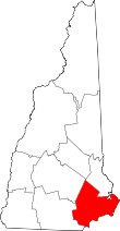
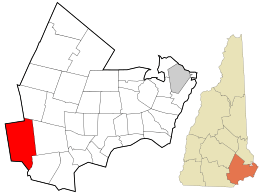 Location in Rockingham County and the state of New Hampshire. | ||
| Coordinates: 42°51′54″N 71°22′26″W / 42.86500°N 71.37389°WCoordinates: 42°51′54″N 71°22′26″W / 42.86500°N 71.37389°W | ||
| Country | United States | |
| State | New Hampshire | |
| County | Rockingham | |
| Incorporated | 1722 | |
| Villages |
Londonderry North Londonderry Wilson | |
| Government | ||
| • Town council |
John Farrell, Chair Joe Green Vice Chair Tom Dolan Ted Combes Jim Butler | |
| • Town Manager | Kevin H. Smith | |
| Area | ||
| • Total | 42.1 sq mi (109.1 km2) | |
| • Land | 42.0 sq mi (108.7 km2) | |
| • Water | 0.1 sq mi (0.3 km2) 0.31% | |
| Elevation | 420 ft (128 m) | |
| Population (2010) | ||
| • Total | 24,129 | |
| • Density | 575/sq mi (221.9/km2) | |
| Time zone | UTC-5 (Eastern) | |
| • Summer (DST) | UTC-4 (Eastern) | |
| ZIP codes | 03053 | |
| Area code(s) | 603 | |
| FIPS code | 33-43220 | |
| GNIS feature ID | 0873651 | |
| Website |
www | |

Londonderry is a town in western Rockingham County, New Hampshire, United States. The town sits between Manchester and Derry, the largest and fourth-largest communities in the state. The population was 24,129 at the 2010 census.[1] Londonderry is known for its apple orchards and is home to the headquarters of Stonyfield Farm and part of Manchester-Boston Regional Airport.
The more densely settled portion of town, where 11,037 people resided at the 2010 census,[2] is defined as the Londonderry census-designated place (CDP) and roughly occupies the southeastern and southern parts of town, around New Hampshire Route 102.
History
Londonderry lies in an area that was first known as "Nutfield" because of the dense woods with nut trees. The town was settled in 1718 by Scots-Irish settlers, many of whom had left their homes in Londonderry in the Province of Ulster in the north of Ireland, and arrived in Boston in 1718 to start a new life without religious wars and persecution. In 1722, the town was chartered and given the name "Londonderry".[3][4]
Early Ulster Scots settlers spread out into surrounding villages, bringing Irish and Scottish place names like Antrim, Derry and Dunbarton. Londonderry was the second largest town in early colonial times, and Derry, Windham and a portion of Manchester were formed from it.
In 1719, the first American potato was grown in Derry, then a part of Londonderry.
The first U.S. census, conducted in 1790, reported the town's population to be 2,622.
Antique postcards
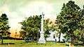 Civil War Soldiers' Monument c. 1905
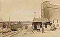 Railroad Station in 1914
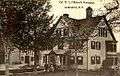 Col. W. S. Pillsbury residence c. 1910
Geography
Londonderry is the westernmost municipality in Rockingham County. It is bordered by the towns of Auburn to the northeast, Derry to the east, and Windham to the southeast, all in Rockingham County, and by Hudson to the south, Litchfield to the west, and Manchester to the north, in Hillsborough County. According to the United States Census Bureau, the town has a total area of 42.1 square miles (109.1 km2), of which 42.0 square miles (108.7 km2) is land and 0.1 square miles (0.3 km2) is water, comprising 0.31% of the town.[1]
The town of Londonderry is drained on the east by Beaver Brook and on the west by Little Cohas Brook and Nesenkeag Brook, all of which flow to the Merrimack River. The town's highest point is 535 feet (163 m) above sea level, on Number Eight Hill (named after the old school house that used to be on it) north of the center of town.
The town is crossed by Interstate 93, New Hampshire Route 102, New Hampshire Route 128, and New Hampshire Route 28. Half of Manchester–Boston Regional Airport, including the main terminal, is in the northwest corner of the town.
Though Londonderry has grown to become one of the larger towns, by population, in the state, it lacks any concentrated downtown area, central business district, or town center. Historically, no village had developed in Londonderry, as it was largely a rural farming area. Population growth in the town only began in the 1970s, when the construction of I-93 turned Londonderry into a bedroom community and exurb for the Greater Boston area. The major retail district lies in the town's southeastern corner near where NH 102 interchanges with I-93, with smaller commercial districts lying at the intersection of NH 128 and NH 102, and near where NH 28 and NH 128 merge. The Town Hall and schools are built near the geographic center of the town along an otherwise rural stretch of NH 128.
Climate
Londonderry has a four-season humid continental climate (Köppen Dfa), with long, cold, snowy winters, and very warm and somewhat humid summers; spring and fall in between are crisp and relatively brief transitions. Precipitation is well-spread throughout the year, including snowfall in the winter.
Demographics
| Historical population | |||
|---|---|---|---|
| Census | Pop. | %± | |
| 1790 | 2,622 | — | |
| 1800 | 2,650 | 1.1% | |
| 1810 | 2,766 | 4.4% | |
| 1820 | 3,127 | 13.1% | |
| 1830 | 1,469 | −53.0% | |
| 1840 | 1,556 | 5.9% | |
| 1850 | 1,731 | 11.2% | |
| 1860 | 1,717 | −0.8% | |
| 1870 | 1,405 | −18.2% | |
| 1880 | 1,363 | −3.0% | |
| 1890 | 1,220 | −10.5% | |
| 1900 | 1,408 | 15.4% | |
| 1910 | 1,533 | 8.9% | |
| 1920 | 1,303 | −15.0% | |
| 1930 | 1,373 | 5.4% | |
| 1940 | 1,429 | 4.1% | |
| 1950 | 1,640 | 14.8% | |
| 1960 | 2,457 | 49.8% | |
| 1970 | 5,346 | 117.6% | |
| 1980 | 13,598 | 154.4% | |
| 1990 | 19,781 | 45.5% | |
| 2000 | 23,236 | 17.5% | |
| 2010 | 24,129 | 3.8% | |
| Est. 2015 | 25,196 | [5] | 4.4% |
| U.S. Decennial Census[6] | |||
As of the census of 2010, there were 24,129 people, 8,438 households, and 6,678 families residing in the town. The population density was 574.5 people per square mile (221.9/km²). There were 8,771 housing units at an average density of 208.8 per square mile (80.7/km²). The racial makeup of the town was 95.8% White, 0.7% Black or African American, 0.1% Native American or Alaska Native, 1.7% Asian, 0.03% Pacific Islander, 0.4% some other race, and 1.2% from two or more races. Hispanic or Latino of any race were 2.1% of the population.[7]
There were 8,438 households, out of which 41.7% had children under the age of 18 living with them, 65.9% were headed by married couples living together, 9.2% had a female householder with no husband present, and 20.9% were non-families. 15.8% of all households were made up of individuals, and 5.1% were someone living alone who was 65 years of age or older. The average household size was 2.86, and the average family size was 3.21.[7]
In the town, the population was spread out with 26.9% under the age of 18, 7.1% from 18 to 24, 23.6% from 25 to 44, 33.6% from 45 to 64, and 8.7% who were 65 years of age or older. The median age was 39.6 years. For every 100 females, there were 98.3 males. For every 100 females age 18 and over, there were 94.7 males.[7]
For the period 2009-13, the estimated median annual income for a household in the town was $90,263, and the median income for a family was $107,100. Male full-time workers had a median income of $71,280 versus $50,081 for females. The per capita income for the town was $38,553. About 1.6% of families and 2.8% of the population were below the poverty line, including 2.6% of those under age 18 and 4.7% of those age 65 or over.[8]
Economy
Londonderry is home to numerous businesses, many of which are located in the northern part of the town near Manchester-Boston Regional Airport (MHT), or in the southeastern part of town near I-93, on NH 102. Major businesses headquartered in town include Stonyfield Farm and Blue Seal Feeds; a bottling facility of the Coca-Cola Bottling Co. is also located in town. The town is also home to numerous chain retailers.
Mack's Apples, Sunnycrest Farm, Elwood Orchards, and Woodmont Orchards are among the several orchards in town and are emblematic of the town's important farming heritage. The abundance of apple orchards in town has made apple picking a popular fall activity among all residents, many of which affectionately refer to the town as "Appletown". However, apple theft is a major issue within the town, and one that the town police are often preoccupied with.[9]
Transportation
Londonderry is crossed by three New Hampshire state highways and one Interstate Highway.
- NH 28 crosses North Londonderry, entering the town from Derry in the east and leaving the town into Manchester in the north. NH 28 is known locally as Rockingham Road when it enters from Derry, and merges with Mammoth Road at the northern terminus of NH 128.
- NH 102 crosses South Londonderry, entering the town from Hudson in the southwest corner, and leaving the town into Derry in the east. NH 102 is known locally as Nashua Road.
- NH 128 is the main north-south route through Londonderry, entering from Windham in the south and terminating at NH 28 in North Londonderry. It is known locally as Mammoth Road.
- Interstate 93 crosses the eastern side of Londonderry from south to north. There are two exits to access Londonderry: Exit 4 (NH 102) and Exit 5 (NH 28).
Additionally, the un-numbered Manchester Airport Access Road (Raymond Wieczorek Drive, which is mostly in Londonderry, provides direct access to the F.E. Everett Turnpike. Three other state highways touch, but do not cross, the Londonderry borders. NH 28A starts at the Londonderry-Manchester border and takes Mammoth Road into Manchester, while NH 28 Bypass (known locally as Londonderry Turnpike) touches the extreme northeastern corner of Londonderry. NH 3A passes close by Londonderry's northwestern corner, running through the middle of the narrow salient of Manchester that separates Londonderry from the Merrimack River.
Londonderry is partially home to the Manchester–Boston Regional Airport which it shares with the city of Manchester. There is no passenger rail service in Londonderry.
Education
The town is served by the Londonderry School District.
Kindergarten:
- Moose Hill School (includes LEEP, the Londonderry Early Education Program)
Elementary Schools:
- North School
- Matthew Thornton Elementary School
- South School
Middle School:
- Londonderry Middle School
High School:
- Londonderry High School (home of the Lancers), whose marching band program traveled to China in the summer of 2008 to participate in ceremonies for the Olympic Games. They also participated in the 2008 and 2012 Presidential Inaugural Parades.
Private Schools:
- Victory Baptist School (K-12)
- Adventures in Learning
- Applewood Learning Center
- Cozy Kid's Child Care
- Kindercare
- Pixie Preschool I
Notable people
- Ant, host of VH1 reality series Celebrity Fit Club
- Al Baldasaro, Republican member of the New Hampshire House of Representatives,[10] advisor to President Trump[11]
- John Bell, 18th governor of New Hampshire[12]
- Samuel Bell, 14th governor of New Hampshire[13]
- Silas Betton, US congressman[14]
- Dominic DiMaggio, outfielder with the Boston Red Sox
- John Fisher, industrialist; US congressman from New York[15]
- Ryan Griffin, tight end for the Houston Texans of the National Football League
- Kevin Hunt, NFL player (offensive lineman) for Green Bay Packers, New England Patriots, Houston Oilers, and New Orleans Saints[16]
- Arthur Livermore, US congressman[17]
- Joseph McKeen, president of Bowdoin College[18]
- Dan Mullen, head coach for the Mississippi State Bulldogs football team
- Ocean Born Mary, subject of a local ghost legend[19]
- William M. Oliver, US congressman[20]
- Ethan Paquin, poet[21]
- George W. Patterson, US congressman[22]
- Peter Patterson, businessman and Canadian politician
- William Patterson, US congressman[23]
- George Reid, Revolutionary War era officer[24]
- Laura Silva, 2007 Miss New Hampshire USA
- William Stark, Revolutionary War era officer[25]
- Samuel Taggart, US congressman[26]
- Matthew Thornton, signer of the Declaration of Independence;[27] he lived in a part of the town that is now in Derry
- Brian Wilson, pitcher with the Los Angeles Dodgers[28]
- James Wilson, first maker of globes in the US[29]
References
- 1 2 "Geographic Identifiers: 2010 Census Summary File 1 (G001): Londonderry town, Rockingham County, New Hampshire". U.S. Census Bureau, American Factfinder. Retrieved April 16, 2015.
- ↑ "Geographic Identifiers: 2010 Census Summary File 1 (G001): Londonderry CDP, New Hampshire". U.S. Census Bureau, American Factfinder. Retrieved April 16, 2015.
- ↑ "The Early History of Londonderry". Londonderry Historical Society. Archived from the original on August 4, 2012. Retrieved March 22, 2010.
- ↑ "The History of Londonderry" by Rev Edward L. Parker, p.60
- ↑ "Annual Estimates of the Resident Population for Incorporated Places: April 1, 2010 to July 1, 2015". Archived from the original on June 2, 2016. Retrieved July 2, 2016.
- ↑ "Census of Population and Housing". Census.gov. Retrieved June 4, 2016.
- 1 2 3 "Profile of General Population and Housing Characteristics: 2010 Census Summary File 1 (DP-1): Londonderry town, Rockingham County, New Hampshire". U.S. Census Bureau, American Factfinder. Retrieved April 16, 2015.
- ↑ "Selected Economic Characteristics: 2009-2013 American Community Survey 5-Year Estimates (DP03): Londonderry town, Rockingham County, New Hampshire". U.S. Census Bureau, American Factfinder. Retrieved April 16, 2015.
- ↑ Blessing, Kiera. "Apple thieves a recurring problem at Mack's". Eagle-Tribune. Retrieved 2017-03-08.
- ↑ "member". www.gencourt.state.nh.us. Archived from the original on 2009-11-02. Retrieved 2017-03-08.
- ↑ Gershon, Livia (2016-02-16). "Trump's biggest fan: a veteran and vote-wrangler – despite his own controversies". The Guardian. ISSN 0261-3077. Retrieved 2017-03-08.
- ↑ Porter, Joseph W. (1895). The Maine Historical Magazine, Volume 9. Joseph W. Porter. p. 41.
- ↑ "BELL, Samuel, (1770 - 1850)". Biographical Directory of the United States Congress. Retrieved January 14, 2014.
- ↑ "Alice Blaski". Biographical Directory of the United States Congress. Retrieved January 14, 2014.
- ↑ "FISHER, John, (1806 - 1882)". Biographical Directory of the United States Congress. Retrieved January 14, 2014.
- ↑ "Perseverance: Hunt Family Trait". The Courant. Retrieved January 14, 2014.
- ↑ "LIVERMORE, Arthur, (1766 - 1853)". Biographical Directory of the United States Congress. Retrieved January 14, 2014.
- ↑ "Joseph McKeen". Bowdoin College. Retrieved January 14, 2014.
- ↑ "Ocean Born Mary Legend". NHTourGuide.com. Retrieved January 14, 2014.
- ↑ "OLIVER, William Morrison, (1792 - 1863)". Biographical Directory of the United States Congress. Retrieved January 14, 2014.
- ↑ "EEthan Paquin, English". UMass Lowell. Archived from the original on January 16, 2014. Retrieved January 14, 2014.
- ↑ "PATTERSON, George Washington, (1799 - 1879)". Biographical Directory of the United States Congress. Retrieved January 14, 2014.
- ↑ "PATTERSON, William, (1789 - 1838)". Biographical Directory of the United States Congress. Retrieved March 12, 2014.
- ↑ Daughters of the American Revolution (1914). Lineage Book - National Society of the Daughters of the American Revolution, Volume 39. Daughters of the American Revolution. p. 318.
- ↑ Parker, Edward Lutwyche (1851). The History of Londonderry, Comprising the Towns of Derry and Londonderry, N. H. Perkins and Whipple. p. 96.
- ↑ "TAGGART, Samuel, (1754 - 1825)". Biographical Directory of the United States Congress. Retrieved January 14, 2014.
- ↑ Reynolds, Alistair, "Matthew Thornton" Archived 2013-10-23 at the Wayback Machine., Maine Ulsterscots Project, retrieved Oct. 8, 2014
- ↑ "Brian Wilson Stats". Baseball Almanac. Retrieved January 14, 2014.
- ↑ White, James Terry (1921). The National Cyclopaedia of American Biograph. J.T. White. p. 102.
Further reading
External links
| Wikimedia Commons has media related to Londonderry, New Hampshire. |
- Town of Londonderry official website
- Londonderry economic development website
- Leach Library
- Londonderry School District
- Derry News, local newspaper
- Londonderry Times, local newspaper
- Londonderry News, online news
- New Hampshire Economic and Labor Market Information Bureau Profile
- Londonderry Historical Society & Museum
- Londonderry Old Home Day
Places adjacent to Londonderry, New Hampshire | ||||||||||
|---|---|---|---|---|---|---|---|---|---|---|
| ||||||||||