Beverly, Massachusetts
Coordinates: 42°33′29″N 70°52′48″W / 42.558°N 70.880°W
| Beverly, Massachusetts | ||
|---|---|---|
| City | ||
 Post Office in 1919 | ||
| ||
|
Motto(s): Patri Simillima Proles (Latin) was"May we be as our children" | ||
 Location in Essex County and the state of Massachusetts. | ||
 Beverly, Massachusetts Location in the United States | ||
| Coordinates: 42°33′30″N 70°52′48″W / 42.55833°N 70.88000°W | ||
| Country | United States | |
| State | Massachusetts | |
| County | Essex | |
| Settled | 1626 | |
| Incorporated | 1668 | |
| Named for | Beverley, England | |
| Government | ||
| • Type | Mayor-council city | |
| • Mayor | Michael P. Cahill | |
| Area | ||
| • Total | 22.6 sq mi (58.5 km2) | |
| • Land | 15.1 sq mi (39.1 km2) | |
| • Water | 7.5 sq mi (19.4 km2) | |
| Elevation | 36 ft (11 m) | |
| Population (2010) | ||
| • Total | 39,502 | |
| • Estimate (2016) | 41,365 | |
| • Density | 1,700/sq mi (680/km2) | |
| Time zone | UTC−5 (Eastern) | |
| • Summer (DST) | UTC−4 (Eastern) | |
| ZIP Code | 01915 | |
| Area code(s) | 978/351 | |
| FIPS code | 25-05595 | |
| GNIS feature ID | 0614200[1] | |
| Website | City of Beverly Official Web Site | |
Beverly is a city in Essex County, Massachusetts, (MA) United States. The population was 39,502 at the 2010 census.[2] A resort, residential, and manufacturing community on the Massachusetts North Shore, Beverly includes Beverly Farms and Prides Crossing. Beverly is a rival of Marblehead for the title of being the birthplace of the U.S. Navy.
History
Originally part of Salem and the Naumkeag Territory, the area was first settled by Europeans in 1626 by Roger Conant. Because of religious differences with Governor John Endecott, Beverly would be set off and officially incorporated in 1668, when it was named "Beverley" after Beverley, the county town of the East Riding of Yorkshire, England.[3][4][5] Surviving from the settlement's early history is the Balch House, built, according to dendrochronological testing performed in 2006, about 1679.[6]
The first ship commissioned for the US military, by the US Army (the US Navy had yet to exist), was the armed schooner Hannah. It was outfitted at Glover's Wharf and first sailed from Beverly Harbor on September 5, 1775. For this reason Beverly calls itself the "Birthplace of America's Navy"—a claim disputed by other towns, including nearby Marblehead. The Hannah can be found on the patch of the city's police department.
Beverly has also been called the "birthplace of the American Industrial Revolution," as the site of the first cotton mill in America (1787),[7][8] and largest cotton mill of its time. The town is the home of one of the country's first Sunday schools (which was built in 1810). Beverly was incorporated as a city in 1894.
In 1902, the United Shoe Machinery Corporation built a quarter-mile stretch of factory buildings in Beverly. The stretch was an early landmark example of reinforced concrete construction, devised by concrete pioneer Ernest L. Ransome. In 1906 it went into production. Closed in 1987, the complex was bought by Cummings Properties in 1996, and developed into a campus of hi-tech companies and medical offices. Parker Brothers, makers of Monopoly and other games, has offices in Beverly. The city is also home to the Landmark School, known worldwide for the education it provides for students with learning disabilities.
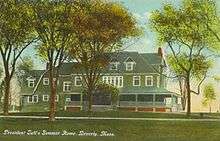
President William Howard Taft rented a house for the summer White House from Mrs. Maria Evans in Beverly. In the summers of 1909 and 1910, he lived in a house located at what is now the site of the Italian Garden in Lynch Park, the city's principal public park, and in 1911 and 1912 he rented a different house a mile away, "Parramatta", from Mrs. Robert Peabody.[9] Beverly Hills, California, was named in 1907 after Beverly Farms in Beverly because Taft vacationed there.[10]
Beverly has a former Nike missile site on L. P. Henderson Road, immediately east of the Beverly Municipal Airport. This site was in operation from March 1957 until August 1959, when the Army handed it over to the National Guard. It is now used by Beverly as a storage site and is under the scrutiny of many environmental organizations, as it and the surrounding areas—such as Casco Chemical—have polluted the groundwater, which could be potentially hazardous to the nearby Wenham Lake water supply.
Geography and transportation


According to the United States Census Bureau, the city has a total area of 22.6 square miles (58.5 km2), of which 15.1 square miles (39.1 km2) is land and 7.5 square miles (19.4 km2), or 33.19%, is water.[11] Beverly is located on the North Shore, the name given to communities north of Boston along Massachusetts Bay. There are many smaller coves, as well as two islands, the Great and Little Misery Islands, which are part of the city. From Woodbury Point westward lies Beverly Harbor, which lies at the mouth of the Danvers River. The Bass River empties into the Danvers River from within the city. Several other small streams lie within the city as well. A large portion of Wenham Lake, as well as several other lakes and ponds lie within the city. The city has its own city forest and reservation land as well.
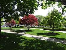
Much of the western half of the city is relatively urbanized, while the eastern part of the city (roughly from Woodbury Point east) is more rural. Beverly is home to several parks, five beaches, the Beverly Golf & Tennis Club (est. 1910) and two yacht clubs, Jubilee Yacht Club in Beverly Harbor and Bass Haven Yacht Club along the Bass River.

Besides Massachusetts Bay to the south, Beverly is bordered by Manchester-by-the-Sea to the east, Wenham to the north, Danvers to the west and Salem to the south. Beverly and Salem are separated by the Danvers River and Beverly Harbor, with three bridges, the Veterans Memorial Bridge (former location of the historic Essex Bridge), the MBTA railroad bridge, and the Kernwood Bridge, connecting the two cities. Beverly's city center lies 2 miles (3 km) north of Salem's, and is 14 miles (23 km) west-southwest of Gloucester and 17 miles (27 km) northeast of Boston.
Route 128, the chief circumferential highway of the Boston area, crosses Beverly from east to west and connects the city to Interstate 95 and U.S. Route 1 in Danvers. Route 1A passes through Beverly from south to north, along main streets in downtown Beverly. The city is also the terminus of four different state routes: Route 22, which heads northeast from Route 1A; Route 62, which heads west from Route 127; Route 97, which parts with Route 1A northwest of downtown before heading north; and Route 127 which heads east from Route 22.
Beverly is the site of the split between the separate lines of the Newburyport/Rockport Line of the MBTA Commuter Rail, which provides service to Boston's North Station. South of the junction lies Beverly Depot near downtown, which is accessible along both lines. Along the Newburyport portion of the line is the North Beverly stop, just south of the Wenham town line. Along the Rockport portion of the line are three stops, Montserrat, Prides Crossing and Beverly Farms. Additionally, MBTA Bus serves the city with Route 451, with service to downtown Beverly and Salem from the North Beverly station. A local bus route called the Beverly Shoppers Shuttle serves downtown and western Beverly, and is contracted through the Cape Ann Transportation Authority. Beverly is home to Beverly Municipal Airport, though parts of the airfield itself lie within Danvers, as well as a very small portion of the north runway in Wenham. Logan International Airport provides the nearest national and international air service.
Demographics
| Historical population | ||
|---|---|---|
| Year | Pop. | ±% |
| 1790 | 3,290 | — |
| 1800 | 3,881 | +18.0% |
| 1810 | 4,608 | +18.7% |
| 1820 | 4,283 | −7.1% |
| 1830 | 4,073 | −4.9% |
| 1840 | 4,689 | +15.1% |
| 1850 | 5,376 | +14.7% |
| 1860 | 6,154 | +14.5% |
| 1870 | 6,507 | +5.7% |
| 1880 | 8,456 | +30.0% |
| 1890 | 10,821 | +28.0% |
| 1900 | 13,884 | +28.3% |
| 1910 | 18,650 | +34.3% |
| 1920 | 22,561 | +21.0% |
| 1930 | 25,086 | +11.2% |
| 1940 | 25,537 | +1.8% |
| 1950 | 28,884 | +13.1% |
| 1960 | 36,108 | +25.0% |
| 1970 | 38,348 | +6.2% |
| 1980 | 37,655 | −1.8% |
| 1990 | 38,195 | +1.4% |
| 2000 | 39,862 | +4.4% |
| 2010 | 39,502 | −0.9% |
| 2016 | 41,365 | +4.7% |
Source: United States Census records and Population Estimates Program data.[12][13][14][15][16][17][18][19][20][21][22] Source: | ||

As of the census[24] of 2010, there are 39,502 people, 16,641 households, and 9,906 families residing in the city. The population density is 2,617.2 people per square mile (927.2/km2). There are 16,275 housing units at an average density of 980.5 per square mile (378.5/km2). The racial makeup of the city is 83.4% White, 2.6% African American, 0.2% Native American, 8.7% Asian, 0.03% Pacific Islander, 0.52% from other races, and 1.6% from two or more races. 2.3% of the population are Hispanic or Latino of any race.
There are 16,641 households out of which 28.8% have children under the age of 18 living with them, 50.1% are married couples living together, 9.7% have a female householder with no husband present, and 37.1% are non-families. Of all households 29.9% are made up of individuals and 11.4% have someone living alone who is 65 years of age or older. The average household size is 2.39 and the average family size is 3.02.
In the city, the population is spread out with 21.7% under the age of 18, 9.0% from 18 to 24, 30.9% from 25 to 44, 22.8% from 45 to 64, and 15.6% who are 65 years of age or older. The median age is 38 years. For every 100 females, there are 89.7 males. For every 100 females age 18 and over, there are 85.3 males.
The median income for a household in the city is $53,984, and the median income for a family is $66,486. Males have a median income of $45,348 versus $35,659 for females. The per capita income for the city is $28,626. 5.7% of the population and 4.0% of families are below the poverty line. Out of the total population, 6.5% of those under the age of 18 and 5.2% of those 65 and older are living below the poverty line.
Education
The city has five K–5 elementary schools: Ayers Ryal Side, Centerville, Cove, Hannah, and North Beverly. The city's sole middle school is Briscoe Middle School, serving grades 6–8. The city's other middle school, Memorial Middle School, has been torn down to be rebuilt into a new 5–8 middle school. The new school will be called Beverly Middle School, and will be the primary middle school, when it opens. The future of Briscoe Middle School is unknown at the moment.
Beverly is home to several private schools, including New England Academy, Harborlight-Stoneridge Montessori School, Kindercare Learning Center, Beverly School for the Deaf, Saints Academy, the Bright Horizons School, The Waring School, Glen Urquhart School, Shore Country Day, Mrs. Alexander's School, and several others.
Beverly High School is a grade 9–12 public high school located in Beverly. It was founded in 1858, and currently enrolls over 1300 students. In September 2011, construction was completed on a new academic building, which is now in use by students and faculty. Northshore Academy offers an alternative high school provision in Beverly.
.jpg)
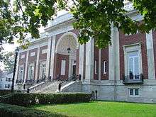
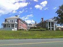
The city is home to Endicott College, which offers 23 bachelor programs, 27 concentrations, and 27 minors. Master programs are offered in Business, Education, Nursing, Computer Science, and Political Science. Beverly is also home of Montserrat College of Art, a private four-year visual arts college.
Points of interest
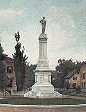
- The Beverly Cotton Manufactory site, the first cotton mill in America. The monument sits in North Beverly next to the Veterans Memorial and North Beverly fire station.
- The Cabot Street Cinema Theatre, boasted the world's longest running magician's show; Le Grand David Spectacular Magic Company ran from February 1977 through May 2012. The theater is early 20th-century style and shows films on a regular basis. The Cabot was purchased in 2014 to save it from demolition, and a board of directors created. In 2015 the Cabot Theatre was renovated and now hosts concerts in addition to movies and other community events.
- The Larcom Theatre, a beautiful &historic multipurpose music & performing arts theatre in Downtown Beverly. Built in 1912, this 560-seat restored vintage theatre known for its' amazing acoustics & intimate setting, will take you back in time. Built by the Ware brothers (architects of the Cabot Theatre.
- Harry Ball Field, home of the Beverly Little League—first and oldest little league in Massachusetts
- Hurd Stadium (home of the Beverly Panthers)
- John Balch House (c. 1679)
- John Cabot House (1781)
- Exercise Conant House (1695)
- John Hale House (c. 1694)
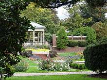
- Lynch Park & Beaches, located in the city's Cove section, is a popular summer spot for swimming, kayaking, sun bathing, and picnics.
- The North Shore Music Theatre, offering a program of musicals and celebrity concerts
- The Odd Fellows' Hall, on the corner of Cabot and Broadway streets
- Montserrat College of Art

Major employers
- Axcelis Technologies
- Crane Aerospace
- Microsoft
- Orchard Brands, owner of Blair and other catalogs and e-commerce sites
- Zipcar
Notable people
- Henry Adams, historian, lived in the Beverly Farms neighborhood while writing his works on Albert Gallatin
- David Alward, former premier of the Canadian province of New Brunswick
- John Appleton, congressman
- Frederick L. Ashworth, naval weaponer aboard Bockscar which dropped the atomic bomb on Nagasaki, Japan
- Jacob Bannon, artist, musician
- Will Barnet, artist
- Albert J. Beveridge. American Historian, Pulitzer Prize winner and US Senator from Indiana
- Benjamin C. Bradlee, Washington Post editor; summer resident; began his newspaper career as a copy boy for the Beverly Evening Times in 1937
- James F. Cahill, one of the first scuba divers and one of the first UDTs
- Nik Caner-Medley, professional basketball player for Maccabi Tel Aviv
- Caspian, instrumental post-rock band
- Rita Colwell, 2006 National Medal of Science recipient
- Nathan Dane, lawyer and congressman
- Le Grand David, magician
- Esther Earl, Internet vlogger and activist
- David Ferriero, Archivist of the United States
- Henry Clay Frick, industrialist (summer resident)
- John Hale, minister at the Salem witch trials
- Kerry Healey, former lieutenant-governor
- Joshua Herrick, congressman
- Oliver Wendell Holmes, Sr., author (summer resident)
- Oliver Wendell Holmes, Jr., Associate Justice of the United States Supreme Court (summer resident)
- Corey Johnson, first HIV-positive member of the New York City Council (elected 2013)
- Lucy Larcom, poet[26]
- Jack Leathersich, current MLB player for the New York Mets
- Mary Lou Lord, musician
- Jonathan Manzi, entrepreneur, youngest documented business millionaire
- Alfred Marshall, businessman, founder of Marshalls[27]
- David McWane, musician (Big D and the Kids Table)
- Angie Miller (American singer), singer-songwriter and American Idol contestant
- David Morse, actor
- Tom Nolan, actor
- Kevin O'Connor, television host
- Benjamin Osgood Peirce, teacher
- Howard Petrie, actor
- Joanna Quiner, sculptor
- Derek Rae, television sports commentator
- William Howard Taft, U.S. president and Chief Justice (summer resident)
- Elbridge Trask, frontiersman and mountain man
- John Updike, author
- Joseph Vittori, awarded the Medal of Honor for his actions in the Korean War
- Herbert Woodbury (privateer)]]
- Nicole Woods Current member of USA Field Hockey 's Women's National Team
- Philip Gordon Wylie, author


Film appearances
- The Thomas Crown Affair (1968) A bank robbery scene was filmed at Beverly National Bank, North Beverly Plaza. A car theft scene was filmed in front of Woolworth's (no longer there).
- Tell Me That You Love Me, Junie Moon (1970) A nighttime driving scene was filmed on Cabot Street from Washington Street to Bow Street. Webber's Department Store, Landers Pharmacy, Delaney's Drug Store and Elm Farm market are all shown in the scene.
- The Good Son (1993) Scenes were filmed in a house constructed for the movie at Lynch Park.
- Mrs. Winterbourne (1996) An exterior scene was filmed on Mechanic Street. Some scenes were also shot at the Beverly Farms train station.
- The Crucible (1996) Parts of the United Shoe Building (now Cummings Center) were used as a sound stage for interior scenes.
- State and Main (2000) A house on Abbott Street at Monument Square was used as the home of the Mayor (Charles Durning) and his wife (Patti Lupone). A parked Beverly Police cruiser appears in scenes shot through the front door. Additional scenes were shot at the Beverly Farms train station and at the Edwards School building on Rantoul Street.
- The Perfect Storm (2000) A helicopter scene was shot at Beverly Airport.
- The Proposal (2009) Scenes with Sandra Bullock and Ryan Reynolds were filmed at Beverly Airport in May 2008. The airport was a stand-in for the Sitka, Alaska, airport. Beverly City Councilor John Burke makes a cameo appearance as an airline passenger who cuts in front of Bullock's character as she descends the staircase of a small plane.
- Furry Vengeance (2010) Scenes with a small airplane were filmed at Beverly Airport
- Clear History (HBO) (2014) Scenes in Beverly Farms, North Shore Music Theater and Marino's Cafe, Rantoul St.
- Manchester by the Sea (2016) Scenes in downtown Beverly[28]
See also
References
- ↑ "Beverly – Populated Place". Geographic Names Information System. USGS. Retrieved May 9, 2008.
- ↑ "Profile of General Population and Housing Characteristics: 2010 Demographic Profile Data (DP-1): Beverly city, Massachusetts". U.S. Census Bureau, American Factfinder. Archived from the original on September 11, 2013. Retrieved August 30, 2012.
- ↑ Rev. E. M. Stone History of Beverley (Mass.), from its settlement in 1630 to 1842. 12mo. Boston, 1843
- ↑ Genealogical and Personal Memoirs – Page 1460 William Richard Cutter "Mr. Balch was born in Beverley, Massachusetts, September 30, 1704, and died in Bradford (Grove- land) January 12, 1791–2."
- ↑ Los Angeles Magazine – Dec 1996 – Page 99 Vol. 41, No. 12 "Beverly Farms appears to have been named for the nearby town of Beverly, which was in turn named for Beverley, England. That Yorkshire cathedral town was named in the eighth century or so for an earlier settlement called Beverlac – a ...
- ↑ "Old Planters – Balch House Associates Newsletter: Balch House Dendrochronology Report" (pdf). Chronicle. Beverly Historical Society. Spring 2007. Retrieved August 8, 2010.
- ↑ Beverly Community History Cotton Mill, www.globalindex.com. Retrieved January 14, 2007.
- ↑ The Worcester (Mass.) Spy. August 31, 1897, Wednesday. Page 2
- ↑ "New-York tribune. (New York [N.Y.]) 1866-1924, April 25, 1909, Image 17". April 25, 1909. Retrieved May 19, 2017 – via chroniclingamerica.loc.gov.
- ↑ Bright, William; Erwin G. Gudde (1998). 1500 California Place Names: Their Origin and Meaning. University of California Press. p. 23. ISBN 0-520-21271-1.
- ↑ "Geographic Identifiers: 2010 Demographic Profile Data (G001): Beverly city, Massachusetts". U.S. Census Bureau, American Factfinder. Archived from the original on September 11, 2013. Retrieved August 30, 2012.
- ↑ "Total Population (P1), 2010 Census Summary File 1". American FactFinder, All County Subdivisions within Massachusetts. United States Census Bureau. 2010.
- ↑ "Massachusetts by Place and County Subdivision - GCT-T1. Population Estimates". United States Census Bureau. Retrieved July 12, 2011.
- ↑ "1990 Census of Population, General Population Characteristics: Massachusetts" (PDF). US Census Bureau. December 1990. Table 76: General Characteristics of Persons, Households, and Families: 1990. 1990 CP-1-23. Retrieved July 12, 2011.
- ↑ "1980 Census of the Population, Number of Inhabitants: Massachusetts" (PDF). US Census Bureau. December 1981. Table 4. Populations of County Subdivisions: 1960 to 1980. PC80-1-A23. Retrieved July 12, 2011.
- ↑ "1950 Census of Population" (PDF). Bureau of the Census. 1952. Section 6, Pages 21-10 and 21-11, Massachusetts Table 6. Population of Counties by Minor Civil Divisions: 1930 to 1950. Retrieved July 12, 2011.
- ↑ "1920 Census of Population" (PDF). Bureau of the Census. Number of Inhabitants, by Counties and Minor Civil Divisions. Pages 21-5 through 21-7. Massachusetts Table 2. Population of Counties by Minor Civil Divisions: 1920, 1910, and 1920. Retrieved July 12, 2011.
- ↑ "1890 Census of the Population" (PDF). Department of the Interior, Census Office. Pages 179 through 182. Massachusetts Table 5. Population of States and Territories by Minor Civil Divisions: 1880 and 1890. Retrieved July 12, 2011.
- ↑ "1870 Census of the Population" (PDF). Department of the Interior, Census Office. 1872. Pages 217 through 220. Table IX. Population of Minor Civil Divisions, &c. Massachusetts. Retrieved July 12, 2011.
- ↑ "1860 Census" (PDF). Department of the Interior, Census Office. 1864. Pages 220 through 226. State of Massachusetts Table No. 3. Populations of Cities, Towns, &c. Retrieved July 12, 2011.
- ↑ "1850 Census" (PDF). Department of the Interior, Census Office. 1854. Pages 338 through 393. Populations of Cities, Towns, &c. Retrieved July 12, 2011.
- ↑ "1950 Census of Population" (PDF). 1: Number of Inhabitants. Bureau of the Census. 1952. Section 6, Pages 21–7 through 21-09, Massachusetts Table 4. Population of Urban Places of 10,000 or more from Earliest Census to 1920. Retrieved July 12, 2011.
- ↑ "Census of Population and Housing". Census.gov. Archived from the original on May 12, 2015. Retrieved June 4, 2015.
- ↑ "American FactFinder". United States Census Bureau. Archived from the original on September 11, 2013. Retrieved January 31, 2008.
- ↑ "Locations". Beverly Hospital. Retrieved May 19, 2017.
- ↑ Bierfelt, Kristin (March 30, 2009). The North Shore Literary Trail: From Bradstreet's Andover to Hawthorne's Salem. Arcadia Publishing. ISBN 9781614235330.
- ↑ Slotnik, Daniel E. (January 1, 2014). "Alfred Marshall, Founder of Stores That Bear His Name, Dies at 94". The New York Times. Retrieved May 19, 2017.
- ↑ Writer, Dustin Luca Staff. "Matt Damon's new film 'Manchester-by-the-Sea' shooting in Beverly, North Shore". Retrieved May 19, 2017.
Further reading
- Sidney Perley (1920). "Beverly in 1700". Essex Institute Historical Collections. Salem, Massachusetts: Essex Institute. 56.
External links
| Wikimedia Commons has media related to Beverly, Massachusetts. |

- "Beverly Community History". New England Business On Line (NSBOL). 1996–1998. Retrieved August 8, 2010.
- Smith, Jonathan (1795). "A Plan of the Town of Beverly Taken Agreeable to an order of the General Court upon a Scale of Two Hundred Rod to an Inch". Essex County 1795. Registry of Deeds, Southern Essex District. Retrieved August 8, 2010.
- 1830 Map of Beverly, by T. Wilson Flagg.
- 1872 Atlas of Essex County Map of Beverly, plate 97.
- 1872 Atlas of Essex County Map of Beverly Cove, plate 95, at the bottom of the page of the Map of Wenham.
- 1884 Atlas of Essex County, Map of Beverly, plate 68–69.
- 1907 Atlas of Beverly, by George H.Walker.
- 1919 North Shore Atlas. Click on map for much larger image.
Municipalities and communities of Essex County, Massachusetts, United States | ||
|---|---|---|
| Cities | 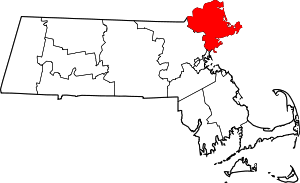 | |
| Towns | ||
| CDPs | ||
| Other villages | ||