Portsmouth, Rhode Island
| Portsmouth, Rhode Island | |
|---|---|
| Town | |
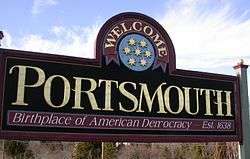 Portsmouth welcome sign | |
 Location of Portsmouth in Newport County, Rhode Island | |
| Coordinates: 41°36′N 71°15′W / 41.600°N 71.250°W | |
| Country | United States |
| State | Rhode Island |
| County | Newport |
| Established | March 7, 1638 |
| Government | |
| • Town Council |
Keith E. Hamilton (R), President Kevin M. Aguiar (D), Vice-President David M. Gleason (I) Paul F. Kesson (R) Elizabeth A. Pedro (R) J. Mark Ryan (D) Linda L. Ujifusa (D) |
| • Town Clerk | Jennifer M. West (D) |
| Area | |
| • Total | 59.3 sq mi (153.6 km2) |
| • Land | 23.2 sq mi (60.1 km2) |
| • Water | 36.1 sq mi (93.5 km2) |
| Elevation | 203 ft (62 m) |
| Population (2010) | |
| • Total | 17,389 |
| • Density | 749.5/sq mi (289.3/km2) |
| Time zone | UTC−5 (Eastern (EST)) |
| • Summer (DST) | UTC−4 (EDT) |
| ZIP Code | 02871 |
| Area code(s) | 401 |
| FIPS code | 44-57880[1] |
| GNIS feature ID | 1220065[2] |
| Website | www.portsmouthri.com |
Portsmouth is a town in Newport County, Rhode Island, USA. The population was 17,389 at the 2010 U.S. Census. Portsmouth is the second oldest municipality in Rhode Island, after Providence; it was one of the four colonies which merged to form the Colony of Rhode Island and Providence Plantations, the others being Providence, Newport, and Warwick.
Geography
According to the United States Census Bureau, the town has a total area of 59.3 square miles (154 km2), of which, only 23.2 square miles (60 km2) (39.14%) of it is land and 36.1 square miles (93 km2) (60.86%) of it is water. Most of its land area lies on Aquidneck Island, which it shares with Middletown and Newport. In addition, Portsmouth encompasses some smaller islands, including Prudence Island, Patience Island, Hope Island, and Hog Island.
History
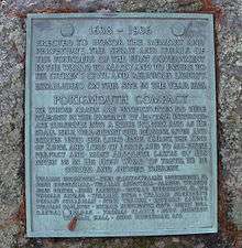
Portsmouth was settled in 1638 by a group of religious dissenters from Massachusetts Bay Colony, including Dr. John Clarke, William Coddington, and Anne Hutchinson. It is named after Portsmouth, Hampshire, England. Roger Williams convinced the settlers that they should go there instead of settling in the Province of New Jersey, where they had first planned on going.
It was founded by the signers of the Portsmouth Compact. Its original Indian name was Pocasset, and it was officially named Portsmouth on May 12, 1639. It became part of the Colony of Rhode Island and Providence Plantations (see Aquidneck Island) and eventually part of the State of Rhode Island and Providence Plantations.
Schools
Public
Portsmouth School Department operates public schools:
- Portsmouth High School
- Portsmouth Middle School
- Howard W. Hathaway Elementary School
- Melville Elementary School
- Prudence Island School (a Charter/Co-op "Home School" as of September 2009)
Private
- Portsmouth Abbey School (9th Grade through 12th Grade)
- Saint Philomena School (Pre-Kindergarten through 8th Grade)
- The Pennfield School (Nursery through 8th Grade)
Commerce
Since 1980, Portsmouth has been home to Clements' Market, a large supermarket. In addition, Portsmouth is home to the Portsmouth Business Park, as well as a few small plazas with a variety of businesses. Portsmouth is also home to a branch of Raytheon, and its Integrated Defense Systems department.
Sports
Portsmouth is the headquarters of US Sailing, the National Governing Body of Sailing in the U.S.[3] Portsmouth is also home to the Newport International Polo Series held at Glen Farm.[4] Portsmouth is also home to the Portsmouth Pirates, the town's soccer team. Portsmouth High School also has very successful football, basketball, baseball and soccer teams. All four teams are regularly in the top 5 teams in the state.
Demographics
| Historical population | |||
|---|---|---|---|
| Census | Pop. | %± | |
| 1790 | 1,560 | — | |
| 1800 | 1,684 | 7.9% | |
| 1810 | 1,795 | 6.6% | |
| 1820 | 1,645 | −8.4% | |
| 1830 | 1,727 | 5.0% | |
| 1840 | 1,706 | −1.2% | |
| 1850 | 1,833 | 7.4% | |
| 1860 | 2,048 | 11.7% | |
| 1870 | 2,003 | −2.2% | |
| 1880 | 1,979 | −1.2% | |
| 1890 | 1,949 | −1.5% | |
| 1900 | 2,105 | 8.0% | |
| 1910 | 2,681 | 27.4% | |
| 1920 | 2,590 | −3.4% | |
| 1930 | 2,969 | 14.6% | |
| 1940 | 3,683 | 24.0% | |
| 1950 | 6,578 | 78.6% | |
| 1960 | 8,251 | 25.4% | |
| 1970 | 12,521 | 51.8% | |
| 1980 | 14,257 | 13.9% | |
| 1990 | 16,857 | 18.2% | |
| 2000 | 17,149 | 1.7% | |
| 2010 | 17,389 | 1.4% | |
| Est. 2015 | 17,373 | [5] | −0.1% |
| U.S. Decennial Census[6][7] | |||
2000 U.S. Census
The 2000 U.S. Census[1] reported that there were 17,149 people, or an increase of 1.7%, residing in the town. There were also 6,758 households, and 4,865 families recorded. The population density was 739.0 people per square mile (285.3/km²). There were 7,386 housing units at an average density of 318.3 per square mile (122.9/km²). The racial makeup of the town was 95.82% White, 1.17% African American, 0.19% Native American, 1.36% Asian, 0.03% Pacific Islander, 0.37% from other races, and 1.05% from two or more races. Hispanic or Latino of any race were 1.45% of the population.
There were 6,758 households out of which 33.4% had children under the age of 18 living with them, 61.1% were married couples living together, 8.0% had a female householder with no husband present, and 28.0% were non-families. 23.3% of all households were made up of individuals and 10.0% had someone living alone who was 65 years of age or older. The average household size was 2.53 and the average family size was 3.00.
In the town, the population was spread out with 25.2% under the age of 18, 5.0% from 18 to 24, 29.5% from 25 to 44, 26.9% from 45 to 64, and 13.5% who were 65 years of age or older. The median age was 40 years. For every 100 females, there were 96.5 males. For every 100 females age 18 and over, there were 92.6 males.
The median income for a household in the town was $88,835, and the median income for a family was $108,577. Males had a median income of $46,297 versus $31,745 for females. The per capita income for the town was $46,161. About 2.0% of families and 3.4% of the population were below the poverty line, including 2.8% of those under age 18 and 6.4% of those age 65 or over.
2010 U.S. Census
The 2010 U.S. Census[1] reported that there were 17,349 people, or an increase of 1.15%, residing in the town. The racial makeup of the town was 94.57% White, 1.35% African American, 1.58% Asian, 0.21% American Indian or Alaskan Native, 0.04% Native Hawaiian or Pacific Islander, 0.40% of some other race, and 1.86% of two or more races.
In the town, 22.98% of the population was under the age of 18 and 16.47% were 65 years of age or older. Females made up 51.03% of the population.

Historic sites
- Battle of Rhode Island Site
- Greenvale Farm (1864)
- Green Animals Topiary Garden (1859)
- Hog Island Shoal Lighthouse (1901)
- Lawton-Almy-Hall Farm
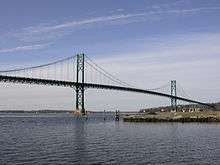
- Mount Hope Bridge (1929)
- Oak Glen
- Portsmouth Friends Meetinghouse Parsonage and Cemetery (1699)
- Prudence Island Lighthouse (1823)
- Union Church (1720)
- Wreck Sites of H.M.S. Cerberus and H.M.S. Lark (1778)
Notable people
- Ade Bethune (died 2002), liturgical artist and Catholic Worker
- Mike Cloud, running back for the Kansas City Chiefs, New England Patriots, and New York Giants
- Thomas Cornell (settler), one of the earliest settlers of Portsmouth and progenitor of Cornell family in America.
- Chris Cosentino, chef and cast member of "The Next Iron Chef"
- Charlie Day, American actor, screenwriter, producer, comedian, and musician
- Helen Glover, cast member on Survivor: Thailand and host of the Helen Glover Show on TalkRadio 920 WHJJ
- Anthony Harkness (1793-1858), businessman and inventor
- Julia Ward Howe (died 1910), author of "The Battle Hymn of the Republic"
- Anne Hutchinson (died 1643), founded colony of Rhode Island in 1638
- Betty Hutton (died 2007), film actress and singer[8]
- Patrick Kennedy, U.S. congressman for Rhode Island's First district (1995–2011)
- Ronald Machtley, U.S. congressman, President of Bryant University[9]
- Ryan Westmoreland, former baseball player, Boston Red Sox
References
- 1 2 3 "American FactFinder". United States Census Bureau. Retrieved 2008-01-31.
- ↑ "US Board on Geographic Names". United States Geological Survey. 2007-10-25. Retrieved 2008-01-31.
- ↑ "United States Sailing Association - The National Governing Body for the Sport of Sailing". United States Sailing Association.
- ↑ "Archived copy". Archived from the original on March 4, 2000. Retrieved August 21, 2008.
- ↑ "Annual Estimates of the Resident Population for Incorporated Places: April 1, 2010 to July 1, 2015". Archived from the original on June 2, 2016. Retrieved July 2, 2016.
- ↑ "Census of Population and Housing". Census.gov. Retrieved June 4, 2016.
- ↑ Snow, Edwin M. (1867). Report upon the Census of Rhode Island 1865. Providence, RI: Providence Press Company.
- ↑ Severo, Richard. "Betty Hutton, Film Star of 1940s and 1950s, Dies at 86".
- ↑ "Leadership | Bryant University". www.bryant.edu. Retrieved 2018-01-17.
Further reading
External links
| Wikimedia Commons has media related to Portsmouth, Rhode Island. |
| Wikivoyage has a travel guide for Portsmouth, Rhode Island. |
Municipalities and communities of Newport County, Rhode Island, United States | ||
|---|---|---|
| City | 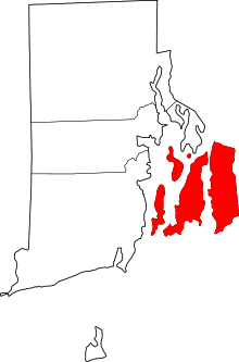 | |
| Towns | ||
| CDPs | ||
| Other villages | ||
Providence (capital) | |
| Topics |
|
| Society |
|
| Regions | |
| Cities | |
| Towns |
|
| Islands |  | |
|---|---|---|
| Major rivers | ||
| Cities & towns | ||
| Bridges | ||