Braintree, Massachusetts
| Braintree, Massachusetts | |||
|---|---|---|---|
| City | |||
| Town of Braintree | |||
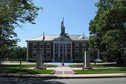 The Braintree Town Hall in 2009 | |||
| |||
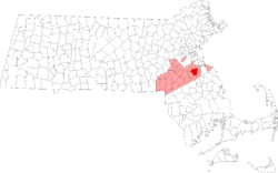 Location in Norfolk County in Massachusetts | |||
 Braintree, Massachusetts Location in the United States | |||
| Coordinates: 42°12′22″N 71°00′18″W / 42.206°N 71.005°WCoordinates: 42°12′22″N 71°00′18″W / 42.206°N 71.005°W | |||
| Country | United States | ||
| State | Massachusetts | ||
| County | Norfolk | ||
| Settled | 1625[1] | ||
| Colonized | 1635[2] | ||
| Incorporated | 1640[3] | ||
| Government | |||
| • Type | Mayor-council | ||
| • Mayor | Joseph C. Sullivan | ||
| Area | |||
| • Total | 14.5 sq mi (37.6 km2) | ||
| • Land | 13.9 sq mi (36.0 km2) | ||
| • Water | 0.6 sq mi (1.6 km2) | ||
| Elevation | 90 ft (27 m) | ||
| Population (2010) | |||
| • Total | 35,744 | ||
| • Estimate (2016)[4] | 37,297 | ||
| • Density | 2,500/sq mi (950/km2) | ||
| Time zone | UTC−5 (Eastern) | ||
| • Summer (DST) | UTC−4 (Eastern) | ||
| ZIP code | 02184/02185 (Braintree Highlands) | ||
| Area code(s) | 339 / 781 | ||
| FIPS code | 25-07740, 25-07665 | ||
| GNIS feature ID | 0618316 | ||
| Website |
www | ||

Braintree (US: /ˈbreɪnˌtri/), officially the Town of Braintree, is a suburban New England city in Norfolk County, Massachusetts, United States. Although officially known as a town, Braintree adopted a municipal charter, effective 2008, with a mayor-council form of government, and is considered a city under Massachusetts law.[5] The population was 35,744 at the 2010 census.[6] The town is part of the Greater Boston area with access to the MBTA Red Line, and is a member of the Metropolitan Area Planning Commission's South Shore Coalition.[7] The first and current mayor of Braintree is Joe Sullivan.[8][9]
Braintree, Massachusetts is named after Braintree, Essex in England. The town was first chartered in 1640. Later, some sections of Braintree formed separate municipalities: Quincy (1792), Randolph (1793), and Holbrook (1872).
History
The town of Braintree was settled in 1625,[1] colonized in 1635 and incorporated in 1640[3] and named after the English town of Braintree. In addition to the present Braintree, it comprised land that was later split-off into the separate municipalities of Quincy (incorporated in 1792), Randolph (1793), and Holbrook (1872).[10] Braintree was part of Suffolk County until the formation of Norfolk County in 1793.[11]
The town of Braintree was the birthplace of presidents John Adams and John Quincy Adams, as well as statesman John Hancock. General Sylvanus Thayer, the "father of West Point", was born in the section of town now known as Braintree Highlands.
Braintree was the site of the infamous 1920 murders that led to the trial of Sacco and Vanzetti. It was the retirement home of the co-inventor of the telephone, Thomas A. Watson.
Braintree's population grew by over 50% during the 1920s.[12]
In January 2008, Braintree converted from a representative town meeting form of government to a mayor-council government.
Geography
Braintree shares borders with Quincy to the north, Randolph to the west (separated by the Cochato River), Holbrook to the south, and Weymouth to the east.
According to the United States Census Bureau, the town has a total area of 14.5 square miles (37.6 km²), of which 13.9 square miles (36.0 km²) is land and 0.6 sq mi (1.6 km²) is water. The total area is 4.34% water
Park and recreation locations in Braintree include Pond Meadow Park, Sunset Lake, and Blue Hills Reservation.
Environment
Braintree has a humid continental climate (Köppen Dfb) with some maritime influence. Summers are typically warm to hot, rainy, and humid, while winters oscillate between periods of cold rain and snow, with cold temperatures. Spring and fall are usually mild, with varying conditions dependent on wind direction and jet stream positioning. Prevailing wind patterns that blow offshore minimize the influence of the Atlantic Ocean.
The hottest month is July, with a mean temperature of 69.7 °F (20.9 °C). The coldest month is January, with a mean of 25.7 °F (−3.5 °C). Periods exceeding 90 °F (32 °C) in summer and below freezing in winter are not uncommon but rarely extended, with about 13 and 25 days per year seeing each, respectively. The city's average window for freezing temperatures is November 9 through April 5. Official temperature records have ranged from −21 °F (−29 °C) in February 1934, up to 101 °F (38 °C) in August 1949 and 1974.
Braintree's coastal location on the North Atlantic moderates its temperature, but makes the city very prone to nor'easter weather systems that can produce much snow and rain. The city averages 48.63 inches (1,240 mm) of precipitation a year, with 61.1 inches (155 cm) of snowfall per season. Snowfall increases dramatically as one goes inland away from the city (especially north and west of the city)—away from the moderating influence of the ocean.
Most snowfall occurs from December through March, as most years see no measurable snow in April and November, and snow is rare in May and October. There is also high year-to-year variability in snowfall; for instance, the winter of 2011−12 saw only 24.2 in (61.5 cm) of accumulating snow, but in the 2014–15 winter, the figure was 150.8 in (3.83 m).
Fog is fairly common, particularly in spring and early summer, and the occasional tropical storm or hurricane can threaten the region, especially in late summer and early autumn. Due to its situation along the North Atlantic, the city is often subjected to sea breezes, especially in the late spring, when water temperatures are still quite cold and temperatures at the coast can be more than 20 °F (11 °C) colder than a few miles inland, sometimes dropping by that amount near midday.
Thunderstorms occur from May to September, and are occasionally severe with large hail, damaging winds and heavy downpours. Although Braintree has never been struck by a violent tornado, the city has experienced many tornado warnings. Damaging storms are more common in areas north, west, and northwest of the city.
| Climate data for Blue Hills Reservation (Blue Hill Meteorological Observatory), 1891−2010 normals, extremes 1885−present | |||||||||||||
|---|---|---|---|---|---|---|---|---|---|---|---|---|---|
| Month | Jan | Feb | Mar | Apr | May | Jun | Jul | Aug | Sep | Oct | Nov | Dec | Year |
| Record high °F (°C) | 68 (20) |
68 (20) |
89 (32) |
94 (34) |
94 (34) |
99 (37) |
100 (38) |
101 (38) |
99 (37) |
88 (31) |
81 (27) |
74 (23) |
101 (38) |
| Average high °F (°C) | 33.6 (0.9) |
34.8 (1.6) |
43.4 (6.3) |
54.9 (12.7) |
66.3 (19.1) |
74.6 (23.7) |
80.0 (26.7) |
77.9 (25.5) |
70.9 (21.6) |
60.5 (15.8) |
48.8 (9.3) |
37.4 (3) |
56.9 (13.8) |
| Daily mean °F (°C) | 25.7 (−3.5) |
26.4 (−3.1) |
34.4 (1.3) |
44.7 (7.1) |
55.3 (12.9) |
64.1 (17.8) |
69.7 (20.9) |
68.1 (20.1) |
61.2 (16.2) |
51.1 (10.6) |
40.6 (4.8) |
29.8 (−1.2) |
47.6 (8.7) |
| Average low °F (°C) | 18.4 (−7.6) |
18.9 (−7.3) |
27.0 (−2.8) |
36.5 (2.5) |
46.4 (8) |
55.4 (13) |
61.5 (16.4) |
60.3 (15.7) |
53.6 (12) |
43.4 (6.3) |
33.7 (0.9) |
22.9 (−5.1) |
39.8 (4.3) |
| Record low °F (°C) | −16 (−27) |
−21 (−29) |
−5 (−21) |
6 (−14) |
27 (−3) |
36 (2) |
44 (7) |
39 (4) |
28 (−2) |
21 (−6) |
5 (−15) |
−19 (−28) |
−21 (−29) |
| Average precipitation inches (mm) | 4.24 (107.7) |
3.95 (100.3) |
4.61 (117.1) |
4.06 (103.1) |
3.70 (94) |
3.69 (93.7) |
3.64 (92.5) |
4.08 (103.6) |
3.94 (100.1) |
3.97 (100.8) |
4.36 (110.7) |
4.39 (111.5) |
48.63 (1,235.1) |
| Average snowfall inches (cm) | 16.0 (40.6) |
16.1 (40.9) |
11.7 (29.7) |
2.9 (7.4) |
0.1 (0.3) |
0.0 (0) |
0.0 (0) |
0.0 (0) |
0.0 (0) |
0.3 (0.8) |
2.6 (6.6) |
11.4 (29) |
61.1 (155.3) |
| Mean monthly sunshine hours | 132.1 | 146.7 | 174.0 | 185.6 | 220.2 | 231.8 | 258.1 | 242.5 | 204.1 | 182.1 | 133.3 | 125.9 | 2,236.4 |
| Percent possible sunshine | 46.3 | 50.9 | 48.5 | 47.9 | 50.4 | 52.7 | 58.0 | 58.7 | 56.7 | 55.1 | 47.0 | 45.9 | 51.5 |
| Source: Blue Hill Observatory & Science Center[13][14] | |||||||||||||
Demographics
| Historical population | ||
|---|---|---|
| Year | Pop. | ±% |
| 1800 | 1,285 | — |
| 1810 | 1,351 | +5.1% |
| 1820 | 1,466 | +8.5% |
| 1830 | 1,758 | +19.9% |
| 1840 | 2,168 | +23.3% |
| 1850 | 2,969 | +36.9% |
| 1860 | 3,468 | +16.8% |
| 1870 | 3,948 | +13.8% |
| 1880 | 3,855 | −2.4% |
| 1890 | 4,848 | +25.8% |
| 1900 | 5,981 | +23.4% |
| 1910 | 8,066 | +34.9% |
| 1920 | 10,580 | +31.2% |
| 1930 | 15,712 | +48.5% |
| 1940 | 16,378 | +4.2% |
| 1950 | 23,161 | +41.4% |
| 1960 | 31,069 | +34.1% |
| 1970 | 35,050 | +12.8% |
| 1980 | 36,337 | +3.7% |
| 1990 | 33,836 | −6.9% |
| 2000 | 33,828 | −0.0% |
| 2010 | 35,744 | +5.7% |
| 2016 | 37,297 | +4.3% |
| * = population estimate. Source: United States Census records and Population Estimates Program data.[15][16][17][18][19][20][21][22][23][24] Source: | ||
As of the census[27] of 2000, there were 33,828 people, 12,652 households, and 8,907 families residing in the town. The population density was 2,434.4 people per square mile (939.6/km²). There were 12,973 housing units at an average density of 933.6 per square mile (360.4/km²). The racial makeup of the town was 93.96% White, 1.18% Black or African American, 0.11% Native American, 3.14% Asian, 0.03% Pacific Islander, 0.64% from other races, and 0.95% from two or more races. Hispanic or Latino people of any race were 1.16% of the population. More than 46% of town residents have Irish ancestry. As of 2014 Braintree had the 2nd highest concentration of Irish Americans in the entire country, slightly behind Scituate, Massachusetts.[28]
There were 12,652 households out of which 29.6% had children under the age of 18 living with them, 55.4% were married couples living together, 11.7% had a female householder with no husband present, and 29.6% were non-families. 24.4% of all households were made up of individuals and 11.9% had someone living alone who was 65 years of age or older. The average household size was 2.61 and the average family size was 3.16.
In the town the population was spread out with 22.5% under the age of 18, 6.5% from 18 to 24, 28.9% from 25 to 44, 24.0% from 45 to 64, and 18.1% who were 65 years of age or older. The median age was 40 years. For every 100 females, there were 89.1 males. For every 100 females age 18 and over, there were 84.4 males.
The median income for a household in the town is $85,590, and the median income for a family is $90,590 as of a 2007 estimate[29]). Males had a median income of $89,607 versus $36,034 for females. The per capita income for the town was $28,683. About 2.1% of families and 3.8% of the population were below the poverty line, including 4.6% of those under age 18 and 3.3% of those age 65 or over.
Sports
Braintree High School participates in the Bay State Conference, a Division 1 conference in the Massachusetts Interscholastic Athletic Association. The girls' basketball team has won back-to-back state championships and finished 2014 undefeated.[30] The Braintree High dance team competes at the regional and national stage.[31] The Wamps baseball team won the Super Eight Baseball Tournament in 2015 over St. John's Preparatory School in their second-straight finals appearance.[32]
Braintree American Little League plays at Michael F. Dunn Little League Complex located at Hollingsworth Park. East Braintree Little League plays at Watson Park.
The Braintree Athletic Complex is scheduled to be located at Braintree High School and will feature two ice hockey rinks, a basketball court, a multi-use court, a swimming pool and an indoor baseball diamond.[33]
Education
Braintree is home to various educational institutions, both public and private.
Public primary and secondary education
Public education at the primary and secondary levels is managed by Braintree Public Schools (BPS), a system that includes one kindergarten center, six elementary schools, two middle schools and one high school.
- Public high school
- Public middle schools
- East Middle School
- South Middle School
- Public elementary schools
- Flaherty Elementary School
- Highlands Elementary School
- Hollis Elementary School
- Liberty Elementary School
- Morrison Elementary School
- Ross Elementary School
Private and alternative education
Private and alternative education institutions in Braintree include Thayer Academy (TA) and Archbishop Williams High School (AWHS). CATS Academy, an internationally focused boarding school with three campuses in the United Kingdom, is in the process of building a school in the Braintree Highlands area and planned to open in 2016.[34]
Infrastructure
Transportation
Braintree is situated in the Greater Boston Area, which has rail, air, and highway facilities. State Route 128 and Interstate 95 divide the region into inner and outer zones, which are connected by numerous "spokes" providing direct access to the airport, port, and intermodal facilities of Boston.

From 1948 to 1968, the town was the home of Braintree Airport, a general aviation airport located near Great Pond that was used by civil defense officials and private pilots. The airport featured a 2,800 foot dirt runway and offered flight training. Residential development, proximity to the town's water supply, and a number of accidents led to its closure in 1968.[35][36]
Principal highways in Braintree are Interstate 93 (which runs concurrently with U.S. 1) and Route 3, as well as 37, and 53. Entering Braintree from the north, I-93, Route 1, and Route 3 all run concurrently as the Southeast Expressway from Boston; in Braintree they diverge, with Route 3 heading south toward Cape Cod as the Pilgrims Highway, and I-93 and Route 1 heading west toward Route 128.
Commuter rail service to South Station, Boston, is available on the Middleboro & Plymouth lines from the Braintree Red Line/Commuter Rail Station located on Union Street. The CapeFLYER rail service from Boston to Hyannis as well as Buzzards Bay stations also stops at Braintree Station. The MBTA Red Line is accessible at the same location. Weekday rail service on the Greenbush Line started in late 2007 and is accessible from the Weymouth Landing/East Braintree station on Quincy Avenue.
Commerce
Braintree is home to several large companies, including Altra Industrial Motion, Greater Media, Haemonetics, and TopSource LLC.
From 1964 to 1991 Braintree was the home of a Valle's Steak House restaurant. The chain was an East Coast landmark that stretched from Maine to Florida. The 30,000 square foot Braintree restaurant was the largest in the chain when it opened, and featured a dining room that sat 600 customers, banquet rooms that accommodated 1,000, parking for 700 cars, and two kitchens, one used exclusively for banquets. The restaurant had over 150 employees. Max Bodner of Quincy was the original manager.[37] One of the chain's busiest locations, it was capable of serving over 5,000 customers per day.[38] The restaurant changed names several times after the Valle's corporation closed in 1991 and was eventually razed to make way for a Toyota dealership.[39] Among the notable moments in the restaurant's history was in 1980 when then presidential candidate Ronald Reagan made a campaign speech at a South Shore Chamber of Commerce luncheon.[40]
Points of interest
Notable people
- Abigail Adams, wife of President John Adams; mother of John Quincy Adams
- Henry Adams, original emigrant to the Americas
- Jeremy Adams, original emigrant to the Americas
- John Adams, signer of the U.S. Declaration of Independence; first Vice President of the United States, serving eight years; second President of the United States, serving four years
- John Quincy Adams, diplomat, sixth President of the United States, serving four years; member of the United States House of Representatives
- Joe Amorosino, reporter and sports director for WHDH-TV.
- Amy Bishop, perpetrator of the 2010 University of Alabama in Huntsville shooting
- Oscar Florianus Bluemner, German-born American Modernist painter
- Jim Calhoun, former head coach of University of Connecticut men's basketball team
- Priscilla Chan, philanthropist and pediatrician; wife of Mark Zuckerberg
- Chris Doherty, musician and recording artist from the band Gang Green
- Brian Gibbons, NHL player
- John Hancock, signer of the U.S. Declaration of Independence; fourth President of the Continental Congress; first and third Governor of the Commonwealth of Massachusetts; diplomat and statesman
- Tiffany Kelly, beauty pageant winner, Miss Massachusetts of 2006
- Peter Kormann, gymnast and winner of the bronze medal in men's floor competition at the 1976 Olympics
- Don McKenney, hockey center; captain of the Boston Bruins, 1954–1963
- Jose Offerman, baseball player for the Boston Red Sox[41]
- William Rosenberg, creator of the Dunkin' Donuts restaurant chain
- Butch Stearns, sports anchorman; Chief Content Officer for the Pulse Network[42]
- Sylvanus Thayer, superintendent of the U.S. Military Academy; called "the father of West Point"
- Mo Vaughn, baseball player for the Boston Red Sox[43]
- Donnie Wahlberg, record producer, songwriter, singer, actor; founding member of the musical group New Kids on the Block[44]
- Mark Wahlberg, film and television producer; Academy Award-nominated actor; former lead singer of Marky Mark and the Funky Bunch[45]
- Thomas A. Watson, primary assistant of Alexander Graham Bell; assisted in invention of the telephone; founder of Fore River Shipyard
Films shot in Braintree
- June 1969: Tell Me That You Love Me, Junie Moon, directed by Otto Preminger (sequence filmed on 710 West Street)[46]
- October 2006: The Departed, directed by Martin Scorsese (sequence filmed in the Fore River Shipyard)
- April 2008: Paul Blart: Mall Cop, directed by Steve Carr (sequence filmed in the South Shore Plaza)[47]
- September 2009: What Doesn't Kill You, directed by Brian Goodman (sequence filmed at the Mobil station on Elm Street)[48]
- April 2016: Stronger, directed by David Gordon Green (sequence filmed at the Skyline Drive Apartment Complex)[49]
References
- 1 2 "Braintree Historical Society". Braintree Historical Society. Archived from the original on March 12, 2017. Retrieved April 30, 2015.
- ↑ "Town of Braintree Massachusetts: About Braintree". Town of Braintree. Archived from the original on January 19, 2017. Retrieved April 7, 2015.
Braintree was founded on land first colonized in 1625 by Captain Wollaston, and initially named Mount Wollaston.
- 1 2 "Town of Braintree Massachusetts: About Braintree". Town of Braintree. Archived from the original on February 18, 2017. Retrieved April 6, 2015.
Incorporated in 1640, Braintree has a rich history and a promising future.
- ↑ "Population and Housing Unit Estimates". Archived from the original on May 29, 2017. Retrieved June 9, 2017.
- ↑ Braintree Town Charter Archived September 12, 2009, at the Wayback Machine. and MGL 39: City and town forms of government Archived November 11, 2009, at the Wayback Machine.
- ↑ "Braintree Town (city) QuickFacts from the US Census Bureau". United States Census Bureau. Archived from the original on September 5, 2015. Retrieved August 22, 2015.
- ↑ MAPC South Shore Coalition Archived September 27, 2007, at the Wayback Machine.
- ↑ The Patriot Ledger, 1/3/2008
- ↑ "Town of Braintree Massachusetts: Mayor". Town of Braintree. Archived from the original on February 21, 2015. Retrieved April 6, 2015.
In November 2007, Joe Sullivan was elected as the first Mayor of Braintree and in November 2011, he was re-elected.
- ↑ "Town of Braintree Massachusetts: About Braintree". Town of Braintree. Archived from the original on January 19, 2017. Retrieved April 7, 2015.
The area was resettled and incorporated as the town of Braintree in 1640, on land which is now part of the current town of Braintree, from which Randolph, Holbrook, the City of Quincy.
- ↑ Davis, William T. Bench and Bar of the Commonwealth of Massachusetts, p. 44. The Boston History Company, 1895.
- ↑ Schaeffer, K. H. and Elliott Sclar. Access for All: Transportation and Urban Growth. Columbia University Press, 1980. Accessed on Google Books. 86. Retrieved on January 16, 2010. ISBN 0-231-05165-4, ISBN 978-0-231-05165-1.
- ↑ "Blue Hill Meteorological Observatory 1891-2010 Means and Extremes". Blue Hill Meteorological Observatory. 7 May 2013. Retrieved 19 December 2016.
- ↑ "Blue Hill Observatory daily sunshine data". Blue Hill Meteorological Observatory. Retrieved 11 October 2015.
- ↑ "Total Population (P1), 2010 Census Summary File 1". American FactFinder, All County Subdivisions within Massachusetts. United States Census Bureau. 2010.
- ↑ "Massachusetts by Place and County Subdivision - GCT-T1. Population Estimates". United States Census Bureau. Retrieved July 12, 2011.
- ↑ "1990 Census of Population, General Population Characteristics: Massachusetts" (PDF). US Census Bureau. December 1990. Table 76: General Characteristics of Persons, Households, and Families: 1990. 1990 CP-1-23. Retrieved July 12, 2011.
- ↑ "1980 Census of the Population, Number of Inhabitants: Massachusetts" (PDF). US Census Bureau. December 1981. Table 4. Populations of County Subdivisions: 1960 to 1980. PC80-1-A23. Retrieved July 12, 2011.
- ↑ "1950 Census of Population" (PDF). Bureau of the Census. 1952. Section 6, Pages 21-10 and 21-11, Massachusetts Table 6. Population of Counties by Minor Civil Divisions: 1930 to 1950. Retrieved July 12, 2011.
- ↑ "1920 Census of Population" (PDF). Bureau of the Census. Number of Inhabitants, by Counties and Minor Civil Divisions. Pages 21-5 through 21-7. Massachusetts Table 2. Population of Counties by Minor Civil Divisions: 1920, 1910, and 1920. Retrieved July 12, 2011.
- ↑ "1890 Census of the Population" (PDF). Department of the Interior, Census Office. Pages 179 through 182. Massachusetts Table 5. Population of States and Territories by Minor Civil Divisions: 1880 and 1890. Retrieved July 12, 2011.
- ↑ "1870 Census of the Population" (PDF). Department of the Interior, Census Office. 1872. Pages 217 through 220. Table IX. Population of Minor Civil Divisions, &c. Massachusetts. Retrieved July 12, 2011.
- ↑ "1860 Census" (PDF). Department of the Interior, Census Office. 1864. Pages 220 through 226. State of Massachusetts Table No. 3. Populations of Cities, Towns, &c. Retrieved July 12, 2011.
- ↑ "1850 Census" (PDF). Department of the Interior, Census Office. 1854. Pages 338 through 393. Populations of Cities, Towns, &c. Retrieved July 12, 2011.
- ↑ "Census of Population and Housing". Census.gov. Archived from the original on May 12, 2015. Retrieved June 4, 2015.
- ↑ "A Look at Braintree's Population History". Braintree, MA Patch. May 29, 2011. Archived from the original on August 6, 2018. Retrieved March 11, 2017.
- ↑ "American FactFinder". United States Census Bureau. Archived from the original on September 11, 2013. Retrieved 2008-01-31.
- ↑ "Braintree Among Most Irish Towns in State". Braintree, MA Patch. March 18, 2013. Archived from the original on August 16, 2017. Retrieved March 11, 2017.
- ↑ "American FactFinder - Community Facts". Factfinder.census.gov. October 5, 2010. Archived from the original on June 6, 2011. Retrieved July 5, 2017.
- ↑ Jay N. Miller (March 14, 2015). "H.S. GIRLS BASKETBALL: Braintree wins Division 1 title". Worcester, Massachusetts: The Patriot Ledger. p. 1. Archived from the original on June 26, 2015. Retrieved May 17, 2015.
Braintree defended its state title and solidified a legacy as one of the most consistently excellent girls hoop teams ever in the Bay State with a 64-43 victory over the scrappy Eagles.
- ↑ "Braintree High School dance team wins New England championship". The Patriot Ledger. March 21, 2014. Archived from the original on May 4, 2015. Retrieved May 17, 2015.
The Braintree High School varsity dance team won two first place dance titles at the New England High School Dance Championship at Bellows Falls Union High School in Bellows Falls, Vt., March 8.
- ↑ Nate Weitzer (June 18, 2015). "Super 8 Final: Braintree 7, St. John's Prep 2". Brockton, Massachusetts: ESPN Boston. Archived from the original on June 26, 2015. Retrieved June 26, 2015.
- ↑ Lane Lambert (May 15, 2015). "After 52 years, Braintree to get its Petersen Pool – and ice rinks, too". Braintree, Massachusetts: The Patriot Ledger. Archived from the original on December 22, 2015. Retrieved May 17, 2015.
- ↑ Robert Aicardi (January 15, 2015). "CATS Academy opening delayed until 2016". Braintree Forum. Archived from the original on July 4, 2015. Retrieved May 1, 2015.
- ↑ Markman, Joseph (September 20, 2011) "Braintree's Expansion and Dangerous Flights Proved too Much for Old Airport" Braintree Patch. Retrieved November 4, 2013 Archived November 10, 2013, at the Wayback Machine.
- ↑ Freeman, Paul "Braintree Airport, Braintree, Mass." Abandoned & Little-Known Airfields. Retrieved November 6, 2013 "Archived copy". Archived from the original on May 30, 2009. Retrieved December 28, 2013.
- ↑ "Largest Valle's Opens in Braintree" (May 8, 1964) The Boston Globe page A4
- ↑ Value, John B. (February 2, 1965) “They All Stay Trim Keeping Others Fed” The Boston Globe, page 21
- ↑ Collins, Rick (March 8, 2006) Last roundup: Hilltop in Braintree to close; Famed eatery will make way for Toyota dealership” The Patriot Ledger (Quincy, Mass), page 1
- ↑ Tuoti, Gerard (June 11, 2004) "Ronald Reagan 1911-2004" The Patriot Ledger (Quincy, Mass), page 10.
- ↑
- ↑
- ↑ "News in a New Century: Reporting in An Age of Converging Media - Jerry Lanson, Barbara Croll Fought - Google Books". Books.google.com. 1999-01-14. Retrieved 2017-07-05.
- ↑ ""Donnie Wahlberg: Biography" The New York Times". Archived from the original on June 15, 2013. Retrieved February 6, 2017.
- ↑ "Bennetts, Leslie "Rogue Star" (August 2001) Vanity Fair". Archived from the original on October 13, 2012. Retrieved November 21, 2012.
- ↑ "Tell Me That You Love Me, Junie Moon (1970) - Trivia". IMDb. Archived from the original on January 12, 2016. Retrieved May 12, 2015.
- ↑ Dennis Tatz (May 15, 2008). "Scenes for upcoming movie being filmed at Braintree mall". Braintree, Massachusetts: MetroWest Daily News. Archived from the original on January 12, 2016. Retrieved May 12, 2015.
- ↑ "Braintree American Fun Facts". 9/10 Eastern Region Baseball Tournament. Retrieved 12 May 2015.
- ↑ "Jake Gyllenhaal film "Stronger" shooting scenes around Braintree". Archived from the original on August 18, 2016. Retrieved July 8, 2016.
- Dennehy, John A. "Images of America: Braintree." Arcadia Publishing, 2010. ISBN 978-0-7385-7247-5
External links
| Wikimedia Commons has media related to Braintree, Massachusetts. |
| Wikivoyage has a travel guide for Braintree (Massachusetts). |
| Wikisource has the text of the 1911 Encyclopædia Britannica article Braintree (Massachusetts). |
- Braintree Public Schools
- Town of Braintree
- Thayer Public Library
- Braintree Historical Society
- Historic letters written from Braintree
- Answer Book/Braintree: Everything you need to know
- The Settlement of Braintree
Places adjacent to Braintree, Massachusetts | |
|---|---|
Municipalities and communities of Norfolk County, Massachusetts, United States | ||
|---|---|---|
| Cities | 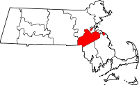 | |
| Towns | ||
| CDPs | ||
| Other villages | ||