| Name |
Image |
Location |
Coordinates |
Year first lit |
Automated |
Year deactivated |
Current Lens |
Focal Height |
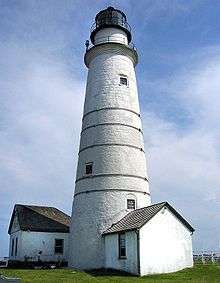
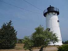
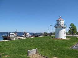
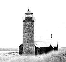
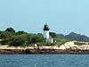
| Annisquam Harbor Light |
 |
Gloucester
(Cape Ann) |
42°39′43″N 70°40′53″W / 42.6619°N 70.6815°W / 42.6619; -70.6815 (Annisquam Harbor Light) |
1801 (Former)
1898 (Current) |
1974 |
Active |
190mm |
045 45 ft (14 m) |
| Bakers Island Light |
 |
Salem |
42°32′11″N 70°47′09″W / 42.5364°N 70.7859°W / 42.5364; -70.7859 (Bakers Island Light) |
1791 (Former)
1821 (Current) |
1972 |
Active |
190mm |
111 111 ft (34 m) |
| Billingsgate Island Light |
 |
Wellfleet
(Billingsgate Island) |
41°52′16″N 70°04′05″W / 41.871°N 70.068°W / 41.871; -70.068 (Billingsgate Island Light)[5] |
1858 |
Never |
1915
(Destroyed) |
None |
040 40 ft (12 m) |
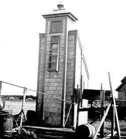
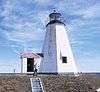
| Bird Island Light |
.jpg) |
Marion
(Buzzards Bay) |
41°40′10″N 70°43′03″W / 41.6694°N 70.7174°W / 41.6694; -70.7174 (Bird Island Light) |
1819 |
1997
(Relit) |
Active
(Inactive: 1933-1997) |
Unknown |
047 47 ft (14 m)[6] |
| Bishop and Clerks Light |
 |
Hyannis |
41°34′27″N 70°15′00″W / 41.5743°N 70.2501°W / 41.5743; -70.2501 (Bishop and Clerks Light) |
1858 |
1923 |
1928
(Demolished in 1952) |
None |
059 59 ft (18 m)[4] |
| Borden Flats Light |
 |
Fall River
(Taunton River) |
41°42′16″N 71°10′28″W / 41.7044°N 71.1744°W / 41.7044; -71.1744 (Borden Flats Light) |
1875 (Former)
1881 (Current) |
1963 |
Active |
250mm |
047 47 ft (14 m) |
| Boston Light |
 |
Boston
(Little Brewster Island) |
42°19′41″N 70°53′24″W / 42.3280°N 70.8901°W / 42.3280; -70.8901 (Boston Light) |
1716 (Former)
1783 (Current) |
1998 |
Active |
Second-order Fresnel |
102 102 ft (31 m) |
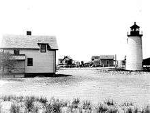
| Brant Point Light |
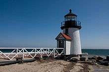 |
Nantucket |
41°17′23″N 70°05′33″W / 41.2898°N 70.0924°W / 41.2898; -70.0924 (Old Brant Point Light)[7]
(Old Tower)
41°17′24″N 70°05′25″W / 41.2900°N 70.0903°W / 41.2900; -70.0903 (Brant Point Light)
(New Tower) |
1856
(Old)
1901
(Current) |
1965 |
1900
(Old)
Active
(Current) |
Fifth-order Fresnel |
046 46 ft (14 m)[8]
(Old)
26 ft (7.9 m)
(Current) |
| Broad Sound Channel Inner Range Lights |
 |
Boston
(Spectacle Island) |
42°19′40″N 70°59′03″W / 42.3278°N 70.9842°W / 42.3278; -70.9842 (Broad Sound Channel Inner Range Front Light)[9]
(Front Light)
42°19′39″N 70°59′07″W / 42.3275°N 70.9853°W / 42.3275; -70.9853 (Broad Sound Channel Inner Range Rear Light)[9]
(Rear Light) |
1903[10] |
Never |
1950[10]
(Removed) |
None |
053 53 ft (16 m)[10]
(Front)
70 ft (21 m)[10]
(Rear) |
| Butler Flats Light |
 |
New Bedford
(Acushnet River) |
41°36′11″N 70°53′38″W / 41.603°N 70.894°W / 41.603; -70.894 (Butler Flats Light) |
1898 |
1978 |
Active |
Fifth-order Fresnel |
025 25 ft (7.6 m) |
| Buzzards Bay Entrance Light |
_MA.JPG) |
Buzzards Bay |
41°23′49″N 71°02′05″W / 41.3970°N 71.0347°W / 41.3970; -71.0347 (Buzzards Bay Entrance Light) |
1961 (Former)
1997 (Current) |
1980 |
Active |
Unknown |
101 101 ft (31 m)[11] |
Cape Ann Light Station
(aka: Thacher Island Lights) |
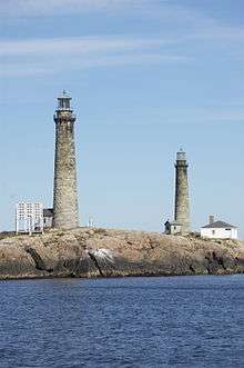 |
Rockport
(Thacher Island) |
42°38′12″N 70°34′30″W / 42.6368°N 70.5749°W / 42.6368; -70.5749 (Cape Ann Light (south)) |
1861 |
1979
(South Tower)
1989
(North Tower) |
Active
(North Tower was Inactive
from 1932 to 1989) |
VRB-25 |
166 166 ft (51 m) |
| Cape Poge Light |
 |
Edgartown
(Chappaquiddick Island) |
41°25′10″N 70°27′08″W / 41.4194°N 70.4523°W / 41.4194; -70.4523 (Cape Poge Light) |
1801 (Former)
1893 (Current) |
1943 |
Active |
300mm |
065 65 ft (20 m) |
| Chatham Light |
 |
Chatham |
41°40′17″N 69°57′01″W / 41.6713°N 69.9502°W / 41.6713; -69.9502 (Chatham Light) |
1808 (Former)
1877 (Current) |
1982 |
Active |
DCB-224 |
080 80 ft (24 m) |
| Clarks Point Light |
 |
New Bedford |
41°35′36″N 70°54′05″W / 41.5932°N 70.9014°W / 41.5932; -70.9014 (Clarks Point Light) |
1797 (Former)
1869 (Current) |
2001
(Relit) |
Active
(Inactive: 1898-2001) |
250mm |
068 68 ft (21 m)[4] |
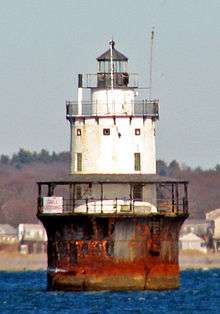
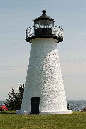
| Cleveland East Ledge Light |
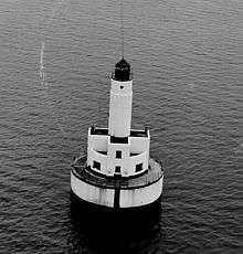 |
Falmouth |
41°37′52″N 70°41′39″W / 41.6310°N 70.6942°W / 41.6310; -70.6942 (Cleveland East Ledge Light) |
1943 |
1978 |
Active |
190mm |
074 74 ft (23 m) |
| Cuttyhunk Light |
 |
Gosnold
(Cuttyhunk Island) |
41°24′50″N 70°57′00″W / 41.414°N 70.950°W / 41.414; -70.950 (Cuttyhunk Light) |
1823
(The last L.H.
was built in 1891) |
1947
(skeleton tower) |
2005
(skeleton tower) |
None |
Unknown |
| Deer Island Light |
 |
Boston
(Deer Island) |
42°20′24″N 70°57′16″W / 42.3399°N 70.9545°W / 42.3399; -70.9545 (Deer Island Light) |
1890 |
1960 |
1982
(Destroyed in 1984) |
None |
053 53 ft (16 m)[12] |
| Derby Wharf Light |
 |
Salem |
42°30′59″N 70°53′01″W / 42.5165°N 70.8835°W / 42.5165; -70.8835 (Derby Wharf Light) |
1871 |
1917[13] |
Active
(Inactive: 1977-1983) |
Optic |
025 25 ft (7.6 m) |
| Dumpling Rocks Light |
 |
Buzzards Bay |
41°32′17″N 70°55′16″W / 41.538°N 70.921°W / 41.538; -70.921 (Dumpling Rocks Light) |
1829
(The last L.H.
was built in 1889) |
Never |
1938
(Destroyed) |
None |
Unknown |
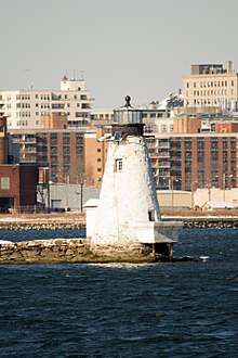
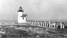
| Duxbury Pier Light |
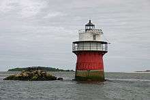 |
Duxbury
(Plymouth Harbor) |
41°59′15″N 70°38′55″W / 41.9874°N 70.6485°W / 41.9874; -70.6485 (Duxbury Pier Light) |
1871 |
1961 |
Active |
Fourth-order Fresnel |
035 35 ft (11 m) |
| East Chop Light |
 |
Oak Bluffs |
41°28′13″N 70°34′03″W / 41.4703°N 70.5675°W / 41.4703; -70.5675 (East Chop Light) |
1869 (Former)
1878 (Current) |
1933 |
Active |
300mm |
079 79 ft (24 m) |
| Eastern Point Light |
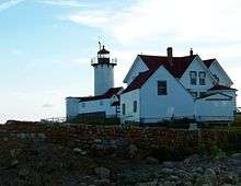 |
Gloucester
(Cape Ann) |
42°34′49″N 70°39′52″W / 42.5802°N 70.6644°W / 42.5802; -70.6644 (Eastern Point Light) |
1833 (Former)
1890 (Current) |
1985 |
Active |
DCB-24 |
057 57 ft (17 m) |
| Edgartown Harbor Light |
 |
Edgartown |
41°23′27″N 70°30′11″W / 41.3909°N 70.5031°W / 41.3909; -70.5031 (Edgartown Harbor Light) |
1828 (Former)
1939 (Current) |
1939 |
Active |
250mm |
045 45 ft (14 m) |
| Egg Rock Light |
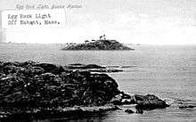 |
Egg Rock
(Near Nahant) |
42°25′59″N 70°53′53″W / 42.433°N 70.898°W / 42.433; -70.898 (Egg Rock Light)[14] |
1856
(The last L.H.
was built in 1898) |
1918[15] |
1922
(Destroyed in 1927) |
None |
090 90 ft (27 m)[14] |
| Fairhaven Bridge Light |
 |
Fairhaven |
41°38′21″N 70°55′03″W / 41.6392°N 70.9175°W / 41.6392; -70.9175 (Fairhaven Bridge Light) |
1888 |
Never |
1891
(Razed) |
None |
Unknown |
| Falmouth Inner Light |
 |
Falmouth |
41°32′32″N 70°36′30″W / 41.5421°N 70.6083°W / 41.5421; -70.6083 (Falmouth Inner Light) |
Unknown |
Unknown |
Active
(skeleton tower) |
Unknown |
025 25 ft (7.6 m) |
| Fort Pickering Light |
_Light_MA.JPG) |
Salem
(Winter Island) |
42°31′35″N 70°51′59″W / 42.5264°N 70.8664°W / 42.5264; -70.8664 (Fort Pickering Light) |
1871 |
1983 |
Active
(Inactive: 1969-1983) |
Unknown |
028 28 ft (8.5 m) |
| Gay Head Light |
 |
Aquinnah |
41°20′54″N 70°50′06″W / 41.3484°N 70.8350°W / 41.3484; -70.8350 (Gay Head Light) |
1799 (Former)
1856 (Current) |
1956 |
Active |
DCB-224 |
170 170 ft (52 m) |
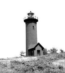
| Great Point Light |
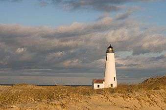 |
Nantucket |
41°23′25″N 70°02′54″W / 41.3902°N 70.0483°W / 41.3902; -70.0483 (Great Point Light) |
1769 (Former)
1986 (Current) |
1950s |
Active
(Inactive: 1984-1986) |
VRB-25 |
071 71 ft (22 m) |
| Highland Light |
 |
Truro
(North Truro) |
41°23′27″N 70°30′11″W / 41.3909°N 70.5031°W / 41.3909; -70.5031 (Highland Light) |
1797[16](Former)
1857[16](Current) |
1987[16] |
Active |
LED |
170 170 ft (52 m) |
| Hospital Point Range Front Light |
 |
Beverly |
42°32′47″N 70°51′22″W / 42.5465°N 70.8560°W / 42.5465; -70.8560 (Hospital Point Range Front Light) |
1872 |
1947 |
Active |
Optic |
070 70 ft (21 m) |
| Hospital Point Range Rear Light |
 |
Beverly |
42°32′54″N 70°52′43″W / 42.5483°N 70.8785°W / 42.5483; -70.8785 (Hospital Point Range Rear Light) |
1927 |
Unknown |
Active |
Unknown |
183 183 ft (56 m) |
| Hyannis Front Range Light |
 |
Hyannis |
41°38′02″N 70°17′20″W / 41.634°N 70.289°W / 41.634; -70.289 (Hyannis Rear Range Light) |
1885 |
Never |
1929 |
None |
020 20 ft (6.1 m)[17] |
| Hyannis Rear Range Light |
 |
Hyannis |
41°38′10″N 70°17′19″W / 41.636°N 70.2885°W / 41.636; -70.2885 (Hyannis Rear Range Light)[18] |
1849 |
Never |
1929 |
None |
043 43 ft (13 m)[17] |
| Ipswich Front Range Light |
|
Ipswich |
42°41′10″N 70°45′54″W / 42.686°N 70.765°W / 42.686; -70.765 (Ipswich Range Front Light)[19] |
1838 |
Never |
1932 |
None |
025 25 ft (7.6 m)[19] |
| Ipswich Rear Range Light |
 |
Ipswich |
42°41′07″N 70°45′58″W / 42.6853°N 70.7662°W / 42.6853; -70.7662 (Ipswich Range Rear Light) |
1838 (Former)
1939 (Current) |
1939 |
Active
(skeleton tower) |
Unknown |
042 42 ft (13 m)[19] |
| Long Island Head Light |
 |
Boston
(Long Island) |
42°19′49″N 70°57′28″W / 42.3302°N 70.9577°W / 42.3302; -70.9577 (Long Island Head Light) |
1819[20](Former)
1901[20](Current) |
1929[20] |
Active
(Inactive: 1982-1985)[20] |
Acrylic |
120 120 ft (37 m) |
| Long Point Light |
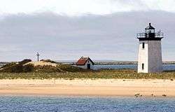 |
Provincetown
(Long Point) |
42°01′59″N 70°10′07″W / 42.0331°N 70.1687°W / 42.0331; -70.1687 (Long Point Light) |
1827 (Former)
1875 (Current) |
1952 |
Active |
Optic |
036 36 ft (11 m) |
| Lovells Island Range Lights |
 |
Boston
(Lovells Island) |
42°19′58″N 70°55′49″W / 42.3328°N 70.9303°W / 42.3328; -70.9303 (Lovells Island Range Front Light)[4]
(Front Light)
42°19′55″N 70°55′52″W / 42.3319°N 70.9311°W / 42.3319; -70.9311 (Lovells Island Range Rear Light)[4]
(Rear Light) |
1903 |
Never |
1939 |
None |
031 31 ft (9.4 m)[21]
(Front Light)
40 ft (12 m)[21]
(Rear Light) |
| Marblehead Light |
 |
Marblehead |
42°30′19″N 70°50′01″W / 42.5054°N 70.8337°W / 42.5054; -70.8337 (Marblehead Light)[22] |
1835 (Former)
1895 (Current) |
1960 |
Active |
300mm |
130 130 ft (40 m)[22] |
| Mayo Beach Light |
N/A |
Wellfleet
(Mayo Beach) |
41°55′51″N 70°02′03″W / 41.9307°N 70.0343°W / 41.9307; -70.0343 (Mayo Beach Light)[23] |
1837
(The last L.H.
was built in 1881) |
Never |
1922
(Tower moved) |
None |
Unknown |
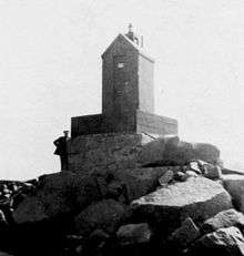
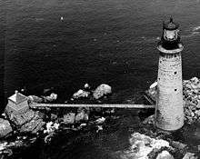
| Minot's Ledge Light |
 |
Cohasset |
42°01′59″N 70°10′07″W / 42.0331°N 70.1687°W / 42.0331; -70.1687 (Minot's Ledge Light) |
1850 (Former)
1860 (Current) |
1947 |
Active
(Inactive: 1851-1860) |
300mm |
085 85 ft (26 m) |
| Monomoy Point Light |
 |
Chatham
(Monomoy Island) |
41°33′32″N 69°59′38″W / 41.559°N 69.994°W / 41.559; -69.994 (Monomoy Point Light)[24] |
1823 (Former)
1849 (Current) |
Never |
1923 |
None |
047 47 ft (14 m)[24] |
| Nantucket Beacon |
.JPG) |
Nantucket |
41°16′23″N 70°04′23″W / 41.273°N 70.073°W / 41.273; -70.073 ([Nantucket Beacon)[8] |
1794
(Coast Guard clam)
or
1820
(Congressional claim) |
Never |
Unknown |
None |
024 24 ft (7.3 m)[8] |
| Nantucket Cliff Range Lights |
 |
Nantucket |
41°17′38″N 70°06′25″W / 41.294°N 70.107°W / 41.294; -70.107 ([Nantucket Cliff Range Lights)[25] |
1838[25](Former)
1889[25] (Current) |
Never |
1912
(Now a private house) |
None |
Unknown |
| Nantucket Harbor Range Lights |
 |
Nantucket
(Brant Point) |
41°17′23″N 70°05′32″W / 41.2898°N 70.0923°W / 41.2898; -70.0923 (Nantucket Harbor Range Front Light)
(Front Light)
41°17′21″N 70°05′31″W / 41.2893°N 70.0919°W / 41.2893; -70.0919 (Nantucket Harbor Range Rear Light)
(Rear Light) |
1908 |
Unknown |
Active |
Unknown |
035 35 ft (11 m)
(Front Light)
51 ft (16 m)
(Rear Light) |
| Nauset Beach Light |
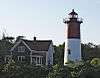 |
Eastham
(Nauset Beach) |
41°51′36″N 69°57′11″W / 41.860°N 69.953°W / 41.860; -69.953 (Nauset Beach Light) |
1838 (Former)
1877 (Current) |
1955 |
Active |
DB-224 |
120 120 ft (37 m) |
| Ned Point Light |
 |
Mattapoisett |
41°39′03″N 70°47′44″W / 41.6509°N 70.7956°W / 41.6509; -70.7956 (Ned Point Light) |
1838 |
1923 |
Active
(Inactive: 1951-1963) |
250mm |
041 41 ft (12 m) |
| Newburyport Harbor Light |
 |
Newburyport |
42°48′55″N 70°49′08″W / 42.8152°N 70.8189°W / 42.8152; -70.8189 (Newburyport Harbor Light) |
1788 (Former)
1898 (Current) |
1951 |
Active |
Fourth-order Fresnel |
050 50 ft (15 m) |
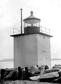
| Newburyport Harbor Front Range Light |
 |
Newburyport |
42°48′41″N 70°51′53″W / 42.8115°N 70.8648°W / 42.8115; -70.8648 (Newburyport Harbor Front Range Light)[26] |
1873 |
1952 |
1961 |
None |
037 37 ft (11 m)[27] |
| Newburyport Harbor Rear Range Light |
.jpg) |
Newburyport |
42°48′42″N 70°51′58″W / 42.8116°N 70.8662°W / 42.8116; -70.8662 (Newburyport Harbor Rear Range Light)[28] |
1873 |
Unknown |
1961 |
None |
058 58 ft (18 m)[27] |
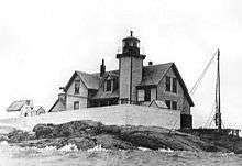
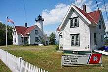
| Nobska Light |
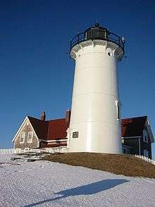 |
Woods Hole |
41°30′57″N 70°39′18″W / 41.5158°N 70.6551°W / 41.5158; -70.6551 (Nobska Light) |
1829 (Former)
1876 (Current) |
1985 |
Active |
Fourth-order Fresnel |
087 87 ft (27 m) |
| Old Scituate Light |
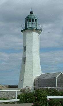 |
Scituate
(Scituate Harbor) |
42°12′17″N 70°42′57″W / 42.2048°N 70.7158°W / 42.2048; -70.7158 (Scituate Light) |
1811 |
1994
(Relit) |
Active
(Inactive: 1860-1994) |
Replica lantern |
070 70 ft (21 m)[29] |
| Palmer Island Light |
 |
New Bedford |
41°37′37″N 70°54′33″W / 41.6270°N 70.9091°W / 41.6270; -70.9091 (Palmer Island Light) |
1849 |
1941 |
Active
(Inactive: 1962-1998[30]) |
Fifth-order Fresnel |
034 34 ft (10 m)[30] |
| Plymouth Light |
 |
Plymouth |
42°00′13″N 70°36′02″W / 42.0037°N 70.6006°W / 42.0037; -70.6006 (Plymouth Light) |
1768 (Former)
1843 (Current) |
1986 |
Active |
100mm |
102 102 ft (31 m) |
| Point Gammon Light |
|
Hyannis |
41°36′35″N 70°15′58″W / 41.6097°N 70.2662°W / 41.6097; -70.2662 (Point Gammon Light)[31] |
1816[32] |
1858[32] |
1858
(Converted to
observation tower[32]) |
None |
070 70 ft (21 m)[32] |
| Race Point Light |
 |
Provincetown |
42°03′44″N 70°14′35″W / 42.0623°N 70.2430°W / 42.0623; -70.2430 (Race Point Light) |
1816 (Former)
1876 (Current) |
1972 |
Active |
VRB-25 |
041 41 ft (12 m) |
| Sandy Neck Light |
 |
Barnstable |
41°43′23″N 70°16′52″W / 41.723°N 70.281°W / 41.723; -70.281 (Sandy Neck Light) |
1826 (Former)
1857 (Current) |
2007
(Relit) |
Active
(Inactive: 1931-2007)[33] |
Unknown |
Unknown |
| Sankaty Head Light |
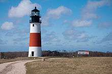 |
Nantucket
(Siasconset) |
41°17′04″N 69°57′58″W / 41.2844°N 69.9661°W / 41.2844; -69.9661 (Sankaty Head Light) |
1850 |
1965 |
Active |
Second-order Fresnel |
158 158 ft (48 m) |
| Spectacle Island Range Lights |
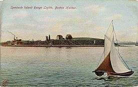 |
Boston
(Spectacle Island) |
42°19′41″N 70°59′07″W / 42.3281°N 70.9853°W / 42.3281; -70.9853 (Spectacle Island Range Front Light)[9]
(Front Light)
42°19′39″N 70°59′04″W / 42.3275°N 70.9844°W / 42.3275; -70.9844 (Spectacle Island Range Rear Light)[9]
(Rear Light) |
1897 |
Never |
1913 |
None |
029 29 ft (8.8 m)[9]
(Front Light)
54 ft (16 m)[9]
(Rear Light) |
| Stage Harbor Light |
 |
Chatham |
41°39′31″N 69°59′01″W / 41.6587°N 69.9837°W / 41.6587; -69.9837 (Stage Harbor Light)[34] |
1880 |
Never |
1933
(Now a private house) |
None |
Unknown |
| Straitsmouth Island Light |
 |
Rockport |
42°39′44″N 70°35′17″W / 42.6623°N 70.5881°W / 42.6623; -70.5881 (Straitsmouth Island Light) |
1835 (Former)
1896 (Current) |
1967 |
Active |
250mm |
046 46 ft (14 m) |
| Tarpaulin Cove Light |
 |
Gosnold
(Naushon Island) |
41°28′08″N 70°45′27″W / 41.4688°N 70.7575°W / 41.4688; -70.7575 (Tarpaulin Cove Light) |
1818 (Former)
1891 (Current) |
1941 |
Active |
300mm |
078 78 ft (24 m) |
| Ten Pound Island Light |
 |
Gloucester |
42°36′07″N 70°39′56″W / 42.6019°N 70.6656°W / 42.6019; -70.6656 (Ten Pound Island Light) |
1821 (Former)
1881 (Current) |
1934 |
Active
(Inactive: 1956-1989) |
250mm |
057 57 ft (17 m) |
| The Graves Light |
 |
Boston
(The Graves) |
42°21′54″N 70°52′09″W / 42.3649°N 70.8691°W / 42.3649; -70.8691 (The Graves Light) |
1905 |
1976 |
Active |
VRB-25 |
098 98 ft (30 m) |
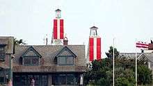
| Three Sisters of Nauset |
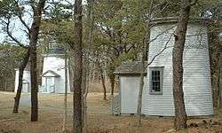 |
Eastham |
41°51′32″N 69°57′26″W / 41.859°N 69.9571°W / 41.859; -69.9571 (The Three Sisters of Nauset)[35] |
1838 (Former)
1892 (Current) |
Never |
1923 |
None |
Unknown |
| West Chop Light |
 |
Tisbury |
41°28′51″N 70°35′59″W / 41.4808°N 70.5998°W / 41.4808; -70.5998 (West Chop Light) |
1817 (Former)
1891 (Current) |
1976 |
Active |
Unknown |
084 84 ft (26 m) |
| West Dennis Light |
 |
West Dennis |
41°39′07″N 70°10′12″W / 41.652°N 70.170°W / 41.652; -70.170 (West Dennis Light) |
1855 |
1989
(Relit) |
Active
(Inactive: 1914-1989) |
300mm |
044 44 ft (13 m) |
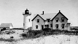
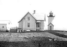
| Wing's Neck Light |
.jpg) |
Pocasset |
41°40′49″N 70°39′40″W / 41.6802°N 70.6612°W / 41.6802; -70.6612 (Wing's Neck Light) |
1849 |
Unknown |
1945 |
None |
Unknown |
| Wood End Light |
 |
Provincetown
(Long Point) |
42°01′17″N 70°11′37″W / 42.0213°N 70.1935°W / 42.0213; -70.1935 (Wood End Light) |
1864 (Former)
1872 (Current) |
1960 |
Active |
VRB-25 |
045 45 ft (14 m) |