Erlanger, Kentucky
| Erlanger, Kentucky | |
|---|---|
| City | |
| Nickname(s): The Friendship City | |
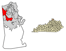 Location of Erlanger in Kenton County, Kentucky. | |
| Coordinates: 39°0′49″N 84°35′39″W / 39.01361°N 84.59417°WCoordinates: 39°0′49″N 84°35′39″W / 39.01361°N 84.59417°W | |
| Country | United States |
| State | Kentucky |
| County | Kenton |
| Government | |
| • Type | Local or city government |
| • Mayor of Erlanger | Tyson Hermes |
| • City Administrator | Matthew Kremer |
| Area | |
| • Total | 8.4 sq mi (21.8 km2) |
| • Land | 8.3 sq mi (21.6 km2) |
| • Water | 0.1 sq mi (0.3 km2) |
| Elevation | 912 ft (278 m) |
| Population (2010) | |
| • Total | 18,082 |
| • Estimate (2016)[1] | 18,813 |
| • Density | 2,213.0/sq mi (850.4/km2) |
| Time zone | UTC−5 (Eastern (EST)) |
| • Summer (DST) | UTC−4 (EDT) |
| ZIP codes | 41018 |
| Area code(s) | 859 |
| FIPS code | 21-25300 |
| GNIS feature ID | 0491808 |
| Website | http://erlangerky.gov/ |
Erlanger is a home rule-class city in Kenton County, Kentucky, United States. It had a 2010 census population of 18,368. Erlanger is part of the Cincinnati-Middletown, OH-KY-IN Metropolitan Statistical Area.
History
Erlanger was founded in the 1880s.[2] The city was named after the Parisian family bank of Emile d'Erlanger,[3] which helped finance the town's early development. In current usage, the name is pronounced in an anglicized way, with neither a French nor German accent. Nearby Elsmere was originally known as "South Erlanger".
Geography
Erlanger is located at 39°0′49″N 84°35′39″W / 39.01361°N 84.59417°W (39.013511, -84.594042).[4]
According to the United States Census Bureau, the city has a total area of 8.4 square miles (22 km2), of which 8.3 square miles (21 km2) is land and 0.1 square miles (0.26 km2) (1.19%) is water.
Demographics
As of the 2000 census,[5] there were 16,676 people, 6,597 households, and 4,406 families residing in the city. The population density was 2,002.4 people per square mile (772.9/km²). There were 6,865 housing units at an average density of 824.3 per square mile (318.2/km²). The racial makeup of the city was 60% White, 27% African American, 0.02% Native American, 0.04% Asian, 0.02% Pacific Islander, 0.42% from other races, and 1.87% from two or more races. Hispanic or Latino of any race were 10% of the population.
There were 6,597 households out of which 51.8% had children under the age of 18 living with them, 32.1% were married couples living together, 33.8% had a female householder with no husband present, and 11.1% were non-families. 28.0% of all households were made up of individuals and 9.3% had someone living alone who was 65 years of age or older. The average household size was 2.50 and the average family size was 4.09.
| Historical population | |||
|---|---|---|---|
| Census | Pop. | %± | |
| 1900 | 453 | — | |
| 1910 | 700 | 54.5% | |
| 1920 | 711 | 1.6% | |
| 1930 | 1,853 | 160.6% | |
| 1940 | 2,416 | 30.4% | |
| 1950 | 3,694 | 52.9% | |
| 1960 | 7,072 | 91.4% | |
| 1970 | 12,676 | 79.2% | |
| 1980 | 14,466 | 14.1% | |
| 1990 | 15,979 | 10.5% | |
| 2000 | 16,676 | 4.4% | |
| 2010 | 18,082 | 8.4% | |
| Est. 2016 | 18,813 | [1] | 4.0% |
| U.S. Decennial Census[6] | |||
The age range was 26.4% under the age of 18, 8.7% from 18 to 24, 33.0% from 25 to 44, 20.2% from 45 to 64, and 11.7% who were 65 years of age or older. The median age was 34 years. For every 100 females, there were 92.8 males. For every 100 females age 18 and over, there were 87.8 males.
The median income for a household in the city was $29,835, and the median income for a family was $40,442. Males had a median income of $21,585 versus $19,296 for females. The per capita income for the city was $17,834. About 27.0% of families and 29.8% of the population were below the poverty line, including 42.0% of those under age 18 and 33.6% of those age 65 or over.
Neighborhoods
Erlanger has multiple neighborhoods within city limits such as Cherry Hill (partially in Boone County), Central Erlanger (the section marked between streets Sunset Ave. and Commonwealth Ave.), an industrial area surrounding the Cincinnati Airport (includes Mineola Pike), Historic Erlanger (between Riggs Ave. and Crescent Ave.), Northeast Erlanger (Dixie Hwy. & Stevenson Rd. through Turkeyfoot Rd.), North Central Erlanger (Erlanger Rd. and Riggs Ave. to Rosary Dr.)
Economy
Toyota Boshoku America has a major manufacturing plant in Erlanger and is headquartered here as well.
The United States Playing Card Company's corporate headquarters are also located here.[7]
Perfetti Van Melle, an Italian confectionery manufacturer, manufactures candy such as AirHeads here.
The global shipping center, Pitney Bowes, resides here as well, often used to send international online purchases.[8]
Education
Erlanger and its neighbor Elsmere are served by the Erlanger/Elsmere School District, which operates four elementary schools, one middle school, and one high school. Erlanger is served by a branch of the Kenton County Public Library.[9]
References
- 1 2 "Population and Housing Unit Estimates". Retrieved June 9, 2017.
- ↑ "History". Boone County. Retrieved 24 March 2018.
- ↑ Tenkotte, Paul A.; Claypool, James C. (5 February 2015). The Encyclopedia of Northern Kentucky. University Press of Kentucky. p. 308. ISBN 978-0-8131-5996-6.
- ↑ "US Gazetteer files: 2010, 2000, and 1990". United States Census Bureau. 2011-02-12. Retrieved 2011-04-23.
- ↑ "American FactFinder". United States Census Bureau. Archived from the original on 2013-09-11. Retrieved 2008-01-31.
- ↑ "Census of Population and Housing". Census.gov. Archived from the original on May 12, 2015. Retrieved June 4, 2015.
- ↑ "Contact Us". The United States Playing Card Company. Retrieved 14 August 2015.
- ↑ "Contact Us". Manta.com - Pitney Bowes. Retrieved 21 August 2018.
- ↑ "Erlanger". Kenton County Public Library. Retrieved 24 February 2018.
External links
Municipalities and communities of Kenton County, Kentucky, United States | ||
|---|---|---|
| Cities | 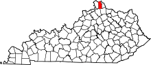 | |
| Unincorporated communities | ||
| Footnotes | ‡This populated place also has portions in an adjacent county or counties. | |
