Daytona Beach, Florida
| Daytona Beach, Florida | ||
|---|---|---|
| City | ||
| City of Daytona Beach | ||
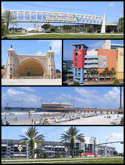 From top, left to right: Welcome sign when entering Daytona Beach; Daytona Beach Bandshell; Ocean Walk Shoppes; Daytona Beach Pier; Daytona International Speedway | ||
| ||
| Nickname(s): "The World's Most Famous Beach", "The Spring Break Capital of the World" | ||
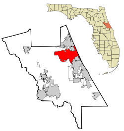 Location in Volusia County and the state of Florida | ||
 Daytona Beach Location in Florida and the United States  Daytona Beach Daytona Beach (the US) | ||
| Coordinates: 29°11′24″N 81°5′22″W / 29.19000°N 81.08944°WCoordinates: 29°11′24″N 81°5′22″W / 29.19000°N 81.08944°W[1] | ||
| Country | United States | |
| State | Florida | |
| County | Volusia | |
| Founded | 1870 | |
| Incorporated | July 1876 | |
| Government | ||
| • Type | Commission–Manager | |
| • Mayor | Derrick Henry | |
| Area[2] | ||
| • City | 67.63 sq mi (175.16 km2) | |
| • Land | 65.11 sq mi (168.63 km2) | |
| • Water | 2.52 sq mi (6.53 km2) | |
| • Urban | 190.65 sq mi (493.8 km2) | |
| Elevation[3] | 13 ft (4 m) | |
| Population (2010)[4][5][6] | ||
| • City | 61,005 | |
| • Estimate (2016)[7] | 66,645 | |
| • Density | 1,023.61/sq mi (395.22/km2) | |
| • Urban | 349,064 (109th, U.S.) | |
| • Metro | 609,939 (90th, U.S.) | |
| • CSA | 3,045,707 (20th, U.S.) | |
| Time zone | UTC-5 (EST) | |
| • Summer (DST) | UTC-4 (EDT) | |
| ZIP Codes | 32114–32126, 32198 | |
| Area code(s) | 386 | |
| FIPS code | 12-16525[5] | |
| GNIS feature ID | 0281353[3] | |
| Website |
www | |
Daytona Beach is a city in Volusia County, Florida, United States. It lies about 51 miles (82.1 km) northeast of Orlando, 86 miles (138.4 km) southeast of Jacksonville, and 242 miles (389.5 km) northwest of Miami. In the 2010 U.S. Census, it had a population of 61,005. It is a principal city of the Deltona–Daytona Beach–Ormond Beach metropolitan area, which was home to 590,289 people in 2010. Daytona Beach is also a principal city of the Fun Coast region of Florida.
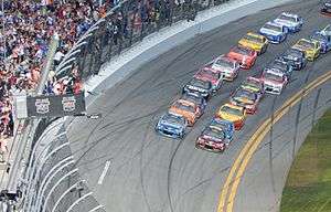
The city is historically known for its beach where the hard-packed sand allows motorized vehicles to drive on the beach in restricted areas.[8] This hard-packed sand made Daytona Beach a mecca for motorsports, and the old Daytona Beach Road Course hosted races for over 50 years. This was replaced in 1959 by Daytona International Speedway. The city is also the headquarters for NASCAR.
Daytona Beach hosts large groups of out-of-towners that descend upon the city for various events, notably Speedweeks in early February when over 200,000 NASCAR fans come to attend the season-opening Daytona 500. Other events include the NASCAR Coke Zero Sugar 400 race in July, Bike Week in early March, Biketoberfest in late October, and the 24 Hours of Daytona endurance race in January.
History
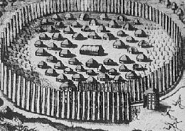
The area where Daytona Beach is located was once inhabited by the indigenous Timucuan Indians who lived in fortified villages. The Timucuas were nearly exterminated by contact with Europeans through war, enslavement and disease and became extinct as a racial entity through assimilation and attrition during the 18th century. The Seminole Indians, descendants of Creek Indians from Georgia and Alabama, frequented the area prior to the Second Seminole War.
During the era of British rule of Florida between 1763 and 1783, the King's Road passed through present-day Daytona Beach. The road extended from Saint Augustine, the capital of East Florida, to Andrew Turnbull's experimental colony in New Smyrna. In 1804 Samuel Williams received a land grant of 3,000 acres (12 km2) from the Spanish Crown, which had regained Florida from the British after the American Revolution. This land grant encompassed the area that would become Daytona Beach. Williams built a slave-labor-based plantation to grow cotton, rice and sugar cane. His son Samuel Hill Williams would abandon the plantation during the Second Seminole War, when the Seminoles burned it to the ground.
The area now known as the Daytona Beach Historical District was once the Orange Grove Plantation, a citrus and sugar cane plantation granted to Samuel Williams in 1787. The plantation was situated on the west bank of the tidal channel known as the Halifax River, 12 miles north of Mosquito Inlet. Williams was a British loyalist from North Carolina who fled to the Bahamas with his family until the Spanish reopened Florida to non-Spanish immigration. After his death in 1810, the plantation was run by his family until it was burned down in 1835. In 1871, Mathias Day, Jr. of Mansfield, Ohio, purchased the 3,200 acre tract of the former Orange Grove Plantation. He built a hotel around which the initial section of town arose. In 1872, due to financial troubles, Day lost title to his land; nonetheless, residents decided to name the city Daytona in his honor, and incorporated the town in 1876.[9][10]
In 1886, the St. Johns & Halifax River Railway arrived in Daytona. The line would be purchased in 1889 by Henry M. Flagler, who made it part of his Florida East Coast Railway. The separate towns of Daytona, Daytona Beach, Kingston, and Seabreeze merged as "Daytona Beach" in 1926, at the urging of civic leader J.B. Kahn and others. By the 1920s, it was dubbed "The World's Most Famous Beach".
Daytona's wide beach of smooth, compacted sand attracted automobile and motorcycle races beginning in 1902, as pioneers in the industry tested their inventions.[11] It hosted land speed record attempts beginning in 1904, when William K. Vanderbilt set an unofficial record of 92.307 mph (148.554 km/h).[12] Land speed racers from Barney Oldfield to Henry Seagrave to Malcolm Campbell would visit Daytona repeatedly and make the 23 mi (37 km) beach course famous.[13] Record attempts, including numerous fatal endeavors such as Frank Lockhart (Stutz Black Hawk, 1926) and Lee Bible (Triplex Special, 1929), would continue until Campbell's March 7, 1935 effort, which set the record at 276.816 mph (445.492 km/h) and marked the end of Daytona's land speed racing days.[14]
On March 8, 1936, the first stock car race was held on the Daytona Beach Road Course, located in the present-day Town of Ponce Inlet. In 1958, William France Sr. and NASCAR created the Daytona International Speedway to replace the beach course. Automobiles are still permitted on most areas of the beach, at a maximum speed of 10 mph (16 km/h).
Geography
| Daytona Beach, Florida | ||||||||||||||||||||||||||||||||||||||||||||||||||||||||||||
|---|---|---|---|---|---|---|---|---|---|---|---|---|---|---|---|---|---|---|---|---|---|---|---|---|---|---|---|---|---|---|---|---|---|---|---|---|---|---|---|---|---|---|---|---|---|---|---|---|---|---|---|---|---|---|---|---|---|---|---|---|
| Climate chart (explanation) | ||||||||||||||||||||||||||||||||||||||||||||||||||||||||||||
| ||||||||||||||||||||||||||||||||||||||||||||||||||||||||||||
| ||||||||||||||||||||||||||||||||||||||||||||||||||||||||||||
Daytona Beach is located at 29°12′N 81°2′W (29.2073, −81.0379). According to the United States Census Bureau, the city has a total area of 64.93 sq mi (168 km2). of which 58.68 sq mi (152 km2) is land and 6.25 sq mi (16 km2) is water. Water is 9.6% of the total area.
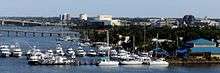
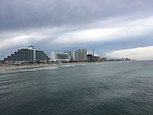
The city of Daytona Beach is split in two by the Halifax River lagoon, part of the Intracoastal Waterway, and sits on the Atlantic Ocean. It is bordered on the north by Holly Hill and Ormond Beach and on the south by Daytona Beach Shores, South Daytona and Port Orange.
Climate
Daytona Beach has a humid subtropical climate (Köppen climate classification Cfa), which is typical of the Gulf and South Atlantic states. As is typical of much of Florida, there are two seasons in Daytona Beach; the warmer, wetter season (late May through October) and the cooler and drier season (November through April).
In summer, temperatures are relatively stable and there is an average of only 9.2 days annually with a maximum at or above 95 °F (35 °C); the last 100 °F (38 °C) reading was seen on August 2, 1999.[15] The Bermuda High pumps hot and unstable tropical air from the Bahamas and Gulf of Mexico, resulting in daily, but brief thundershowers. This results in the months of June through September accounting for a majority of the average annual rainfall of 49.6 in (1,260 mm).[15]
In winter, Daytona Beach has weather conditions typical of other cities on the Florida peninsula. On average, the coolest month is January, with a normal monthly mean temperature of 57.9 °F (14.4 °C). Occasional cold fronts can bring freezes, which from 1981 to 2010 were seen on an average of 4.7 nights annually; however, minima below 25 °F (−4 °C) are very rare, and were last seen on December 28, 2010.[15] Like much of Florida, Daytona Beach often can be very dry in late winter and early spring, and brush fires and water restrictions can be an issue. There is no record of snow on the ground in Daytona Beach since 1906; however, snow flurries have been observed twice since 1880 – on January 1, 1977 and in January 2010.
Official record temperatures range from 15 °F (−9 °C) on January 21, 1985, up to 102 °F (39 °C) on July 15, 1981 and June 24, 1944; the record cold daily maximum is 33 °F (1 °C) on Christmas 1985, while, conversely, the record warm daily minimum is 82 °F (28 °C) on September 1 and 10–11, 2008.[15] Annual rainfall has ranged from 31.36 in (797 mm) in 2006 and 1956, up to 79.29 in (2,014 mm) in 1953.[15] The most rainfall to have occurred in a calendar day was 12.85 in (326 mm) on October 10, 1924, which contributed to 24.82 in (630 mm) of rain that fell that month, the most of any calendar month.[15]
| Climate data for Daytona Beach Int'l, Florida (1981–2010 normals,[16] extremes 1923–present) | |||||||||||||
|---|---|---|---|---|---|---|---|---|---|---|---|---|---|
| Month | Jan | Feb | Mar | Apr | May | Jun | Jul | Aug | Sep | Oct | Nov | Dec | Year |
| Record high °F (°C) | 92 (33) |
89 (32) |
92 (33) |
96 (36) |
100 (38) |
102 (39) |
102 (39) |
101 (38) |
99 (37) |
95 (35) |
90 (32) |
88 (31) |
102 (39) |
| Mean maximum °F (°C) | 81.7 (27.6) |
83.4 (28.6) |
86.8 (30.4) |
89.5 (31.9) |
93.6 (34.2) |
95.1 (35.1) |
96.1 (35.6) |
95.4 (35.2) |
92.4 (33.6) |
89.5 (31.9) |
85.1 (29.5) |
82.5 (28.1) |
97.5 (36.4) |
| Average high °F (°C) | 68.4 (20.2) |
70.7 (21.5) |
74.5 (23.6) |
79.2 (26.2) |
84.7 (29.3) |
88.4 (31.3) |
90.2 (32.3) |
89.6 (32) |
86.9 (30.5) |
82.0 (27.8) |
76.0 (24.4) |
70.4 (21.3) |
80.1 (26.7) |
| Average low °F (°C) | 47.3 (8.5) |
50.1 (10.1) |
54.2 (12.3) |
58.6 (14.8) |
65.4 (18.6) |
71.4 (21.9) |
73.0 (22.8) |
73.4 (23) |
72.2 (22.3) |
65.9 (18.8) |
57.3 (14.1) |
50.5 (10.3) |
61.7 (16.5) |
| Mean minimum °F (°C) | 29.6 (−1.3) |
33.3 (0.7) |
38.4 (3.6) |
44.6 (7) |
54.8 (12.7) |
65.2 (18.4) |
68.4 (20.2) |
69.5 (20.8) |
65.2 (18.4) |
51.1 (10.6) |
41.7 (5.4) |
32.8 (0.4) |
27.2 (−2.7) |
| Record low °F (°C) | 15 (−9) |
24 (−4) |
26 (−3) |
32 (0) |
40 (4) |
52 (11) |
60 (16) |
63 (17) |
52 (11) |
39 (4) |
25 (−4) |
19 (−7) |
15 (−9) |
| Average rainfall inches (mm) | 2.74 (69.6) |
2.78 (70.6) |
4.24 (107.7) |
2.18 (55.4) |
3.13 (79.5) |
5.83 (148.1) |
5.83 (148.1) |
6.40 (162.6) |
6.96 (176.8) |
4.21 (106.9) |
2.69 (68.3) |
2.63 (66.8) |
49.62 (1,260.3) |
| Average rainy days (≥ 0.01 in) | 7.5 | 7.3 | 8.2 | 5.8 | 6.8 | 13.3 | 12.8 | 14.0 | 13.5 | 10.6 | 7.7 | 7.5 | 115.0 |
| Mean daily sunshine hours | 7.0 | 8.0 | 9.0 | 9.0 | 9.0 | 9.0 | 9.0 | 9.0 | 8.0 | 7.0 | 7.0 | 7.0 | 8 |
| Percent possible sunshine | 64 | 73 | 75 | 69 | 64 | 64 | 64 | 69 | 67 | 64 | 64 | 70 | 67 |
| Source #1: NOAA[15][17] | |||||||||||||
| Source #2: Weather Atlas (sunshine data) [18] | |||||||||||||
| Climate data for Daytona Beach | |||||||||||||
|---|---|---|---|---|---|---|---|---|---|---|---|---|---|
| Month | Jan | Feb | Mar | Apr | May | Jun | Jul | Aug | Sep | Oct | Nov | Dec | Year |
| Average sea temperature °F (°C) | 61.0 (16.1) |
59.0 (15.0) |
64.9 (18.3) |
71.4 (21.9) |
76.5 (24.7) |
79.5 (26.4) |
80.1 (26.7) |
80.4 (26.9) |
82.6 (28.1) |
77.5 (25.3) |
71.1 (21.7) |
64.9 (18.3) |
72.4 (22.5) |
| Mean daily daylight hours | 11.0 | 11.0 | 12.0 | 13.0 | 14.0 | 14.0 | 14.0 | 13.0 | 12.0 | 11.0 | 11.0 | 10.0 | 12.2 |
| Average Ultraviolet index | 4 | 6 | 8 | 10 | 10 | 11 | 11 | 10 | 9 | 7 | 5 | 4 | 7.9 |
| Source #1: NOAA Coastal Water Temperature Guide [19] | |||||||||||||
| Source #2: Weather Atlas [18] | |||||||||||||
Hurricanes and tornadoes

Typically tropical cyclones pass offshore once they reach the northern portion of the Atlantic coast of Florida. As such, the hurricane risk for Daytona Beach is significantly lower than areas of southern Florida like Miami and Key West. The 2004 hurricane season was by far the most active in the Daytona Beach area in the last 50 years. However, since 1950 there has only been one direct hit by a tropical cyclone to the Daytona Beach area, Hurricane Donna in 1960.
Although Daytona Beach has a significantly lesser tornado risk than areas like the Great Plains and Midwest, there have been a few deadly and destructive tornadoes in the last 100 years in Daytona Beach area. Most recently, on February 22, 1998 a tornado killed 3 people, injured 70 people, and caused $31 million in damages.
Rogue wave
On July 3, 1992, a 28-mile (45 km) long rogue wave hit the Volusia County beaches. The wave's range was from Ormond Beach in the north, to New Smyrna Beach on the south. The crest was 9 feet (2.7 m) high and centered at Daytona Beach. Sailboats crashed ashore onto cars and many people suffered cuts and bruises from glass and debris. Two people required hospitalization and 200 vehicles were damaged. Seventy five injuries were reported. The prevailing theory is that an underwater landslide caused the rogue wave, although others have theorized that it was the result of a squall line.[21][22]
Law and government
Local government
Under Daytona Beach's commission-manager form of government, voters elect a City commission which consists of seven members who serve four-year, staggered terms. Six are elected by district, the Mayor is elected citywide.
The City Commission establishes ordinances and policies for the city. It also reviews and approves the city budget annually. The Commission appoints a City Manager, who carries out the will of the Commission and handles day-to-day business.
Law enforcement
Law enforcement in Daytona Beach is provided by the 241-member Daytona Beach Police Department (DBPD) headed by police chief Craig Capri. In a unique and controversial program to help fund the Police Explorer program, run by a subsidiary of the Boy Scouts of America, T-shirts with the words Scumbag Eradication Team: Not in Our Town are sold at the police headquarters.[23]
The T-shirts contain a caricature of Retired Chief Chitwood standing next to a toilet bowl with the legs of multiple individuals sticking out. The T-shirt has been cited in at least one lawsuit against the DBPD alleging police brutality, the lawyer in the case in which the client sustained broken ribs and a fractured eye socket during an arrest for an open container of beer, claims the T-shirt shows the DBPD condones violence.[24]
The Volusia County Sheriff's department, headed by Mike Chitwood is a countywide law enforcement agency with 446 sworn positions, 438 civilian employees, 300 volunteers and an annual operating budget of $73 million that has jurisdiction in unincorporated areas of Volusia County and provides additional law enforcement support to Daytona Beach during such events as the Daytona 500 and aids in joint investigations of certain crimes.[25]
The Volusia County Beach Patrol provides law enforcement as well as EMT services along Volusia County beaches including the beaches in the city of Daytona Beach.[26]
Eminent domain case
The city of Daytona Beach made national headlines when it designated the several–mile radius around Main Street on the barrier island portion of the city as a blighted area and has targeted it for redevelopment by private developers. This follows the Supreme Court decision of the eminent domain case in Kelo v. City of New London, which upheld the right of municipalities the right to use eminent domain to take private property for redevelopment by private entities.[27]
Federal, state, and county representation
The United States Postal Service operates a post office at 500 Bill France Boulevard in Daytona Beach
Daytona Beach is part of Florida's 6th congressional district.[28] It is part of Florida's 25th and 26th State House of Representatives Districts and the 6th and 8th State Senate Districts.
Florida's 6th congressional district, which extends from the southern Jacksonville suburbs to New Smyrna Beach and includes St. Augustine and Daytona Beach, is currently represented by Republican Ron DeSantis.
Demographics
| Historical population | |||
|---|---|---|---|
| Census | Pop. | %± | |
| 1910 | 331 | — | |
| 1920 | 825 | 149.2% | |
| 1930 | 16,598 | 1,911.9% | |
| 1940 | 22,584 | 36.1% | |
| 1950 | 30,167 | 33.6% | |
| 1960 | 37,395 | 24.0% | |
| 1970 | 45,327 | 21.2% | |
| 1980 | 54,176 | 19.5% | |
| 1990 | 61,921 | 14.3% | |
| 2000 | 64,112 | 3.5% | |
| 2010 | 61,005 | −4.8% | |
| Est. 2016 | 66,645 | [7] | 9.2% |
| U.S. Decennial Census[29] | |||
| Daytona Beach demographics | ||||
|---|---|---|---|---|
| 2010 U.S. Census | Daytona Beach | Volusia County | Florida | |
| Total population | 61,005 | 494,593 | 18,801,310 | |
| Population, percent change, 2000 to 2010 | −4.8% | +11.6% | +17.6% | |
| Population density | 1,044.4/sq mi | 449.2/sq mi | 350.6/sq mi | |
| White or Caucasian (including White Hispanic) | 57.8% | 82.5% | 75.0% | |
| (Non-Hispanic White or Caucasian) | 54.4% | 75.4% | 57.9% | |
| Black or African-American | 35.4% | 10.5% | 16.0% | |
| Hispanic or Latino (of any race) | 6.2% | 11.2% | 22.5% | |
| Asian | 2.3% | 1.5% | 2.4% | |
| Native American or Native Alaskan | 0.4% | 0.4% | 0.4% | |
| Pacific Islander or Native Hawaiian | 0.0% | 0.0% | 0.1% | |
| Two or more races (Multiracial) | 2.3% | 2.1% | 2.5% | |
| Any Other Race | 1.8% | 3.0% | 3.6% | |
As of 2010, there were 33,920 households out of which 19.5% were vacant. As of 2000, 18.0% had children under the age of 18 living with them, 30.1% were married couples living together, 14.5% had a female householder with no husband present, and 51.6% were non-families. 39.4% of all households were made up of individuals and 14.4% had someone living alone who was 65 years of age or older. The average household size was 2.06 and the average family size was 2.77.
In 2000, the city the population was spread out with 17.6% under the age of 18, 16.6% from 18 to 24, 25.6% from 25 to 44, 20.5% from 45 to 64, and 19.7% who were 65 years of age or older. The median age was 37 years. For every 100 females, there were 99.7 males. For every 100 females age 18 and over, there were 98.5 males.
In 2000, the median income for a household in the city was $25,439, and the median income for a family was $33,514. Males had a median income of $25,705 versus $20,261 for females. The per capita income for the city was $17,530. 23.6% of the population and 16.9% of families were below the poverty line. Out of the total population, 34.9% of those under the age of 18 and 12.1% of those 65 and older were living below the poverty line.
Languages
As of 2000, English spoken as a first language accounted for 90.37% of all residents, while 9.62% spoke other languages as their mother tongue. The most significant were Spanish speakers who made up 4.01% of the population, while French came up as the third most spoken language, which made up 0.90%, and German was at fourth, at 0.86%, as well as, Arabic with 0.66% of the population.[30]
Culture
The Museum of Arts and Sciences is the primary cultural facility for Daytona Beach and Volusia County. Other museums located in the city include the Southeast Museum of Photography and the Halifax Historical Museum. The Museum of Arts and Sciences is actually a collection of museums and galleries and includes the Klancke Environmental Complex, the Cuban Museum, Root Family Museum featuring one of the largest Coca-Cola collections in the world, the Dow American Gallery and the Bouchelle Center for Decorative Arts which together form what is probably one of the finest collections of furniture and decorative arts in the Southeast. There are also changing exhibitions and a children's science center opened in 2008. Since 1952, the non-profit Daytona Beach Symphony Society has sponsored performances by U.S. and international orchestras, opera and dance companies each season at the Peabody Auditorium.[31]
Beaches and parks
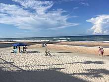
Daytona Beach has over 23 miles (37 km) of white sandy beaches open to pedestrians without time restrictions.[32] Cars can be driven on some of the beaches during daylight hours.[32] There are more than ten waterfront parks in Daytona Beach.[33] Thong bikinis are prohibited in all areas of Daytona Beach,[34] with a penalty of up to $500 and 60 days in jail.[35]
Sports
Daytona Beach is home to the headquarters of NASCAR, IMSA, International Speedway Corporation, in Florida.
Motorsports
The Daytona International Speedway hosts the annual 24 Hours of Daytona (Rolex 24 At Daytona) and Daytona 500 races, among other events.
Baseball
In addition to motorsports, Daytona is also the home of the Daytona Tortugas, a minor league baseball team of the Florida State League who play at Jackie Robinson Ballpark; it was established in 1993 and currently has 6 championships.
Golf
There are a number of golf courses in Daytona Beach.
- Daytona Beach Golf Course: Two courses, North and South Courses designed in 1922.
- LPGA International: The golf club offers two 18-hole courses, Hills and Jones (originally Legends and Champions).
Special events
The city attracts over 8,000,000 tourists each year. Special events that draw visitors to Daytona Beach include:
- Speedweeks (Daytona 500 NASCAR race, Rolex 24 sports car race, and others)
- Coke Zero Sugar 400, NASCAR race held on the first Saturday of July (formerly called the Pepsi 400 and the Firecracker 400)
- Daytona Beach Bike Week Daytona 200 motorcycle races, bike shows and biker reunion in March
- Spring break (date varies, usually the first and second week of March)
During motorcycle events (Bike Week and Biketoberfest), several hundred thousand bikers from all over the world visit the greater Daytona Beach area. The city is also often associated with spring break, though the efforts of the local government to discourage rowdiness, combined with the rise of other spring break destinations, have affected Daytona's preeminence as a spring break destination. It is the destination of Dayton 2 Daytona, an annual event that draws over 3,000 University of Dayton college students since 1977.
Media
Newspapers
- The Daytona Beach News-Journal – Daily newspaper covering the Greater Daytona Beach Area.
- Hometown News – Weekly newspaper covering the Greater Daytona Beach Area.
- East Coast Current – Community Newspaper covering Volusia County. www.ECCurrent.com
- Orlando Sentinel – Newspaper and news site based in Orlando with a bureau covering Daytona Beach and Volusia County.
- The Avion Newspaper – Student college publication of Embry–Riddle Aeronautical University in Daytona Beach.
- The Daytona Times – Black newspaper covering Daytona Beach
- HeadlineSurfer.com – Internet-only newspaper covering the Greater Daytona Beach-Orlando Area.
Radio
AM
- WNDB, 1150 AM, Daytona Beach, News/Talk/Sports
- WROD, 1340 AM, Daytona Beach, Oldies
- WMFJ, 1450 AM, Daytona Beach, Religious
- WPUL, 1590 AM, Daytona Beach, Adult Contemporary/Newstalk
FM
- WCFB, 94.5 FM, Daytona Beach, Urban Adult Contemporary
- WQMP/101.9 MHz: Modern rock
- WIKD-LP, 102.5 FM, Daytona Beach, Campus Radio of Embry–Riddle Aeronautical University "The WIKD (Wicked) 102.5"
- W231CN, 94.1 FM, Daytona Beach, Urban Contemporary "HOT 94.1"[36]
Television
- WESH, Channel 2, digital channel 11, NBC
- WDSC-TV, analog channel 15, digital channel 33, PBS
- Central Florida News 13, Bright House Networks cable channel 13
Economy
A major part of the Daytona Beach area economy is involved in the tourist industry. Over 8 million visitors came to the Daytona Beach area in 2004.
The area's economy includes other industries besides tourism, such as manufacturing. Daytona Beach has industrial sites within an enterprise zone and sites within a foreign trade zone adjacent to Daytona Beach International Airport. Prime Interstate 4 and Interstate 95 sites are available with access to road, air, rail and water transportation.
Companies and organizations that have their corporate headquarters or a major presence in the area:
- Brown & Brown
- Halifax Health
- Halifax Media Group
- International Speedway Corporation
- Gambro-Renal Products
- Ladies Professional Golf Association
- NASCAR
Shopping
- Volusia Mall, 1700 West International Speedway Blvd. The largest shopping mall in Daytona Beach. Anchored by Sears, JCPenney, Macy's, and Dillard's.
- Ocean Walk Shoppes, 250 North Atlantic Ave. Open-air shopping center, located in the heart of the beach area.
- Tanger Outlets, located in the southeast quadrant of Interstate 95 and LPGA Blvd. The 380,000 square feet (35,000 m2) retail center was completed in November 2016.
Education
Primary and secondary schooling
Public primary and secondary education is handled by Volusia County Schools. Daytona Beach has two public traditional high schools, two middle schools and six elementary schools. Some of the larger private schools include Father Lopez Catholic High School.
Elementary schools
- Ortona Elementary
- Champion Elementary
- Palm Terrace Elementary
- R.J. Longstreet Elementary
- Turie T. Small Elementary
- Westside Elementary
Middle schools
- David C. Hinson Middle
- Campbell Middle
High schools
- Seabreeze High
- Mainland High
- Father Lopez Catholic High School
Colleges and universities
- Bethune–Cookman University
- Daytona State College
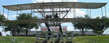
- Embry–Riddle Aeronautical University
- University of Central Florida, Daytona Beach Campus
Vocational schools
- The Airline Academy – Offers flight training for pilots and other airline professionals.
- Keiser College
- Phoenix East Aviation – Offers flight training for pilots.
- WyoTech (formerly AMI) motorcycle repair, and marine repair training.[37]
Infrastructure
Health systems
Healthcare in Daytona Beach is dominated by Halifax Health (formerly known as Halifax Hospital). The Halifax Hospital Taxing District was established in 1927 by an Act of the Florida Legislature as a public hospital district.[38] There are dozens of individual practitioners and Professional Associations (PA) in the Daytona Beach area.
Utilities
Basic utilities in Daytona Beach (water and sewer) are provided by the City Government.
- Florida Power & Light is Daytona Beach's local electric power provider.
- TECO/People's Gas is Daytona Beach's natural gas provider.
- Spectrum and AT&T Networks is Daytona Beach's local cable provider.
- AT&T Inc. (formerly BellSouth) is Daytona Beach's local phone provider.
The city has a successful recycling program with separate pickups for garbage, yard waste and recycling. Collection is provided by several private companies under contract to Volusia County, Florida.
Transportation
Airports

Passenger airline services are located at Daytona Beach International Airport (DAB), which is centrally located within the city adjacent to Daytona International Speedway. The site was first used as an airport with terminals being constructed in 1952 and 1958. The present facility was constructed in 1992 at the cost of $46 million, and includes both a domestic terminal and an International terminal. Despite the new facilities, DAB has found difficulty in attracting and retaining carriers; Continental Airlines, AirTran Airways, and United Airlines discontinued flights to Daytona in 2007 and 2008.[39] LTU & American Airlines also serviced Daytona Beach during the 1980s and 1990s, both of which ended all flights in 1994 & 1997.
Current passenger airlines serving DAB include Delta Air Lines (with nonstop service to Atlanta), American Airlines (with non-stop service to Charlotte), and JetBlue Airways (with non-stop service to New York-JFK). All three carriers offer connecting service from those cities to destinations worldwide. International flights from DAB fly to destinations in the Bahamas through air taxi and charter services Airgate Aviation and IslandPass; non-stop flights are available from DAB to Marsh Harbour, Treasure Cay, and North Eleuthera.[40] DAB is also heavily used for general aviation, largely due to Embry–Riddle Aeronautical University, whose campus is located at the airport.
Larger airports nearby are Orlando International Airport and Jacksonville International Airport, both of which are approximately one and one half hours away.
Buses
- Daytona Beach is served by Greyhound Bus Lines, which has a terminal located at 138 South Ridgewood Avenue (US 1). The Greyhound routes from Daytona Beach connect with hubs in Jacksonville and Orlando.
- Votran is the local bus service provided by Volusia County.
Automobiles
Daytona Beach is easily accessible by I-95 that runs north and south and I-4 connecting Daytona Beach with Orlando and Tampa. US 1 (Ridgewood Avenue) also passes north-south through Daytona Beach. US 92 (International Speedway Boulevard) runs east-west through Daytona Beach. SR A1A is a scenic north-south route along the beach.
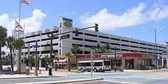
The Volusia County Parking Garage is located at 701 Earl Street at North Atlantic Avenue (SR A1A). The garage is strategically located, next to the Ocean Center, Daytona Lagoon, and across the street from the Hilton Hotel and Ocean Walk Shoppes. Over one thousand parking spaces are available inside the garage, which also houses an intermodal transfer station for VoTran.
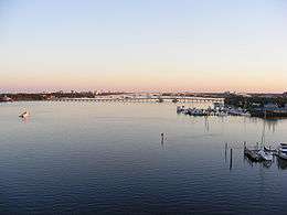
Bridges
There are four bridges over the Halifax River (and Intracoastal Waterway) at Daytona Beach. They include (starting from furthest downstream) the Veterans Memorial Bridge (which carries CR 4050 traffic), the Broadway Bridge (which carries US 92 traffic), the Main Street Bridge (which carries CR 4040 traffic), and the Seabreeze Bridge (which carries SR 430 traffic). All four bridges charge no toll to traffic.[41] In June, 2016, the Veterans Memorial Bridge was closed as part of a three-year project to demolish the drawbridge and replace it with a high span bridge.[42]
-0794.JPG) Veterans Memorial Bridge
Veterans Memorial Bridge_broad4sm.jpg)
_0806.JPG) Main Street Bridge
Main Street Bridge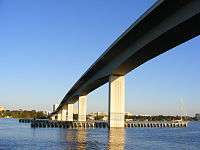 Seabreeze Bridge
Rail
Passenger railroad service to Daytona Beach was established no later than 1889 by the Jacksonville, St. Augustine and Halifax River Railway, predecessor of the Florida East Coast Railroad (FEC). Passenger trains continued calling at Daytona Beach till 1968, when the FEC terminated passenger operations system-wide. The FEC currently operates freight trains through Daytona Beach.
Daytona Beach is served by Amtrak by way of a Thruway Motorcoach connection between the beachside and Amtrak's DeLand Station, 28 miles (45 km) to the west. There, the service connects northbound with train 92, the Silver Star, and train 98, the Silver Meteor. Southbound connections from Daytona Beach are limited to Silver Meteor southbound train 97. The DeLand – Daytona Beach service is Amtrak's only Florida Thruway Motorcoach route provided by a taxi-cab, rather than a bus.
Points of interest
National Historic Places
- The Abbey
- Mary McLeod Bethune Home
- Bethune–Cookman College Historic District
- Delos A. Blodgett House
- City Island
- City Island Ball Park
- Cypress Street Elementary School
- Daytona Beach Bandshell and Oceanfront Park Complex
- Daytona Beach Surfside Historic District
- Bartholomew J. Donnelly House
- El Pino Parque Historic District
- Amos Kling House
- S.H. Kress and Co. Building
- Merchants Bank Building
- Olds Hall
- Rogers House
- Seabreeze Historic District
- Seybold Baking Company Factory
- South Beach Street Historic District
- South Peninsula Historic District
- South Ridgewood Elementary School
- Southwest Daytona Beach Black Heritage District
- Tarragona Tower
- Howard Thurman House
- Tourist Church
- US Post Office
- White Hall
- S. Cornelia Young Memorial Library
Other points of interest
- Daytona 500 Experience
- Daytona International Speedway
- Daytona Beach Boardwalk
- Daytona Lagoon Water Park
- Halifax Historical Museum
- Jackie Robinson Ballpark
- Main Street Pier
- Mary McLeod Bethune Performing Arts Center and Visual Arts Gallery
- Museum of Arts and Sciences
- News Journal Center
- Southeast Museum of Photography
- The Ocean Center
- List of Registered Historic Buildings in Daytona Beach, Florida
In popular culture
Novels set in Daytona Beach include:
- Day Number 142 (1974) by Edgar A. Anderson
- Last Cruise of the Nightwatch (1956) by Howard Broomfield
- Kick of the Wheel (1957) by Stewart Sterling
There have been a number of movies based on Daytona Beach, usually with a racing theme. The most recent example was the 1990 hit Days of Thunder, parts of which were filmed in Daytona Beach and nearby DeLand. Chris Rea wrote the song "Daytona" which was in his 1989 album The Road to Hell. Suzi Quatro's song "Daytona Demon" is often believed to refer to the city.[43] Also, about half of the video for the song "Steal My Sunshine" by Len was filmed at Daytona Beach.
Daytona Beach was also the destination of a group of plagued teenagers in the movie Final Destination 2.
Daytona Beach was also one of the settings in the 2008 film Marley & Me.
Notable people
- Dan Allen, comedian
- Duane Allman and Gregg Allman, musicians
- Perry Baker, rugby player for U.S. national team
- Fulgencio Batista, 19th President of Cuba
- Pete Carr, musician
- Vince Carter, basketball player, 8-time NBA All-Star
- Ed Charles, former Major League Baseball player
- Bill France, Sr., founder of NASCAR
- Lee H. Hamilton former Indiana U.S. Congressman
- Danielle Harris, actress
- Zora Neale Hurston, writer, anthropologist
- Alex Kinsey, singer
- E. J. Kuale, professional football player
- Gary Russell Libby, art historian, curator, and former director of Museum of Arts and Sciences
- Ryan Lochte, swimmer, winner of 12 Olympic medals including six gold
- Mark Martin, NASCAR driver
- Martin Mayhew, pro football player and executive
- Mary McLeod Bethune, educator and civil rights activist
- Walter M. Miller, Jr., author of A Canticle for Leibowitz
- Matthew Tyler Musto, musician
- Kevin Nash, professional WWE wrestler
- Ransom Eli Olds, automobile pioneer
- Josef Papp, engineer
- Kitty Pryde, rapper
- Glen "Fireball" Roberts, NASCAR driver
- Jackie Robinson, professional baseball player
- Bob Ross, artist and television host
- Galen Seaman, lawyer, Wisconsin State Assemblyman, and mayor of Daytona Beach
- David Sholtz, 26th governor of Florida
- Mike Skinner, NASCAR driver
- Howard Thurman, author and theologian
- Eric Weems, professional football player
- T. K. Wetherell, president of Florida State University
- Robert Wright, musical theater writer
- Aileen Wuornos, serial killer executed in 2002
- Smokey Yunick, mechanic and motor racing innovator
- Denzel Washington, actor
- Bryan Cranston, actor
See also
References
Notes
- ↑ "US Gazetteer files: 2010, 2000, and 1990". United States Census Bureau. February 12, 2011. Retrieved April 23, 2011.
- ↑ "2016 U.S. Gazetteer Files". United States Census Bureau. Retrieved Jul 7, 2017.
- 1 2 "US Board on Geographic Names". United States Geological Survey. 2007-10-25. Retrieved 2008-01-31.
- ↑ 2010 List of Populations of Urban Areas. U.S. Census Bureau. census.gov. Accessed 2015-02-22.
- 1 2 "American FactFinder". United States Census Bureau. Archived from the original on September 11, 2013. Retrieved 2015-06-28.
- ↑ "Annual Estimates of the Resident Population for Incorporated Places: April 1, 2010 to July 1, 2014". Archived from the original on May 23, 2015. Retrieved June 4, 2015.
- 1 2 "Population and Housing Unit Estimates". Retrieved June 9, 2017.
- ↑ Daytona Beach Guide Overview Archived August 28, 2009, at the Wayback Machine.
- ↑ Historic Daytona Beach By Harold D. Cardwell, Priscilla D. Cardwell. p. 7 Publisher: Arcadia Publishing (August 25, 2004). ISBN 0-7385-1675-9
- ↑ Spencer, Donald D. (2003). Historic Plantations of Northeast Florida : a Pictorial Encyclopedia. Ormond Beach, Fla.: Camelot Pub. Co. ISBN 9780892183623.
- ↑ Dickens, Bethany (October 1, 2014). "Episode 27 Leather Cap and Goggles". A History of Central Florida Podcast. Retrieved January 27, 2016.
- ↑ Kettlewell, Mike. "Daytona", in Northey, Tom, ed. World of Automobiles (London: Orbis, 1974), Volume 5, p.501.
- ↑ Kettlewell, pp.501–2; Northey, Tom, "Land-speed record: The Fastest Men on Earth", in Northey, Tom, ed. World of Automobiles, Volume 10, pp.1161–1165.
- ↑ Northey, p.1165.
- 1 2 3 4 5 6 7 "NowData - NOAA Online Weather Data". National Oceanic and Atmospheric Administration. Retrieved 2018-03-22.
- ↑ Mean monthly maxima and minima (i.e. the highest and lowest temperature readings during an entire month or year) calculated based on data at said location from 1981 to 2010.
- ↑ "Station Name: FL DAYTONA BEACH INTL AP". National Oceanic and Atmospheric Administration. Retrieved 2018-03-22.
- 1 2 "Daytona Beach, Florida, USA - Climate data". Weather Atlas. Retrieved 3 April 2017.
- ↑ "Coastal Water Temperature Guide". NOAA. Retrieved 3 April 2017.
- ↑ Summary report on building performance: 2004 hurricane season By United States. Federal Emergency Management Agency p. 6
- ↑ NOAA, Florida Weather History: Volusia County
- ↑ The Daytona Beach Wave of July 3–4, 1992: A Shallow Water Gravity Wave Forced by a Propagating Squall Line, January 1995
- ↑ "Scumbag T-Shirt Raises Money For Police Youth Program". www.wftv.com. Archived from the original on November 2, 2008. Retrieved November 19, 2015.
- ↑ "FloriDUH | Sun Sentinel Blogs | Suit against top cop cites "Scumbag" T-shirt". weblogs.sun-sentinel.com. Retrieved 2015-11-19.
- ↑ "VOLUSIA COUNTY SHERIFF'S OFFICE". www.volusia.org. Retrieved 2015-11-19.
- ↑ "Beach Safety". www.volusia.org. Retrieved 2015-11-19.
- ↑ "Daytona Business Owners Fight Eminent Domain". NPR.org. Retrieved 2015-11-19.
- ↑ "Find Your Representative in the U.S. House of Representatives". www.house.gov. Retrieved 2015-11-19.
- ↑ "Census of Population and Housing". Census.gov. Archived from the original on May 12, 2015. Retrieved June 4, 2015.
- ↑ Modern Language Association Data Center Results of Daytona Beach, Florida.
- ↑ "Homepage – Daytona Beach Symphony Society". Daytona Beach Symphony Society.
- 1 2 Daytona Beach Area Convention & Visitors Bureau (2017). "The Beach". Retrieved 23 August 2017.
Our 23 miles of sandy, white beaches are open to pedestrians 24/7 with free access! Cars are permitted in designated areas of the beach from sunrise to sunset, tidal conditions permitting.
- ↑ Daytona Beach Area Convention & Visitors Bureau (2017). "Beachfront Parks in Daytona Beach". Retrieved 23 August 2017.
Highlights include Lighthouse Point Park and Smyrna Dunes Park on opposite sides of Ponce Inlet offering a combined 125 acres of fun with some areas welcoming pets for a walk, run or a swim.Topping out at 40 acres in Ormond Beach is Michael Crotty Bicentennial Park with areas for favorite sports - football, baseball, basketball, soccer, tennis and volleyball.
- ↑ Daytona Beach, Florida (2017). "Code of Ordinances - Chapter 62 - MISCELLANEOUS OFFENSES - Sec. 62-183. - Public nudity and exposure of certain body parts prohibited". Retrieved 23 August 2017.
(3) One-third of the male or female buttocks centered over the cleavage of the buttocks for the length of the cleavage. This area is more particularly described as that portion of the buttocks which lies between the top and bottom of the buttocks, and between two imaginary straight lines, one on each side of the anus and each line being located one-third of the distance from the anus to the outside perpendicular line defining the buttocks, and each line being perpendicular to the ground and to the horizontal lines defining the buttocks... (c) Attire which is insufficient to comply with these requirements includes but is not limited to those items commonly known as G-strings, T-backs, dental floss, and thongs.
- ↑ Daytona Beach, Florida (2017). "Code of Ordinances - Sec. 1-14. - General penalty; continuing violations". Retrieved 23 August 2017.
Where no specific penalty is provided, the violation of any section of this Code shall be punished by a fine not exceeding $500.00 or by imprisonment for a term not exceeding 60 days or by both such fine and imprisonment.
- ↑ http://hotdaytona.com
- ↑ "WyoTech Daytona". wyotech.edu.
- ↑ "Taxing Districts". hfch.org. Archived from the original on July 26, 2011.
- ↑ "DBIA History". Volusia County, Florida. Archived from the original on March 26, 2009. Retrieved 2009-06-16.
- ↑ "IslandPass". IslandPass, LLC. Archived from the original on June 7, 2009. Retrieved 2009-06-16.
- ↑ "FDOT Florida Bridge Information" (PDF). Florida Dept. of Transportation. Archived from the original (PDF) on 2016-03-04. Retrieved 2011-01-16.
- ↑ http://www.veteransmemorialbridge.com
- ↑ Ausländer, Phillip; Performing Glam Rock: Gender And Theatricality in Popular Music; p. 210. ISBN 0472068687
Sources
- Kettlewell, Mike. "Daytona", in Northey, Tom, ed. World of Automobiles, Volume 10, pp. 501–503. London: Orbis, 1974.
- Northey, Tom, "Land-speed record: The Fastest Men on Earth", in Northey, Tom, ed. World of Automobiles, Volume 10, pp. 1161–1166. London: Orbis, 1974.
External links
- City of Daytona Beach
- Daytona Beach Chamber of Commerce
- Daytona Beach Convention & Visitors Bureau
- A History of Central Florida Podcast – "Leather Cap and Goggles", "Rum Runner"
Municipalities and communities of Volusia County, Florida, United States | ||
|---|---|---|
| Cities | 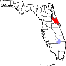 | |
| Towns | ||
| CDPs | ||
| Unincorporated communities | ||
| Footnotes | ‡This populated place also has portions in an adjacent county or counties | |
