Clintwood, Virginia
| Clintwood, Virginia | ||
|---|---|---|
| Town | ||
| ||
| Motto(s): "The county seat of Virginia's baby"[1] | ||
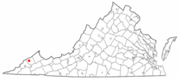 Location of Clintwood, Virginia | ||
| Coordinates: 37°9′0″N 82°27′24″W / 37.15000°N 82.45667°WCoordinates: 37°9′0″N 82°27′24″W / 37.15000°N 82.45667°W | ||
| Country | United States | |
| State | Virginia | |
| County | Dickenson | |
| Area | ||
| • Total | 1.9 sq mi (4.9 km2) | |
| • Land | 1.9 sq mi (4.9 km2) | |
| • Water | 0.0 sq mi (0.0 km2) | |
| Elevation | 1,755 ft (535 m) | |
| Population (2010) | ||
| • Total | 1,414 | |
| • Density | 745/sq mi (287.6/km2) | |
| Time zone | UTC−5 (Eastern (EST)) | |
| • Summer (DST) | UTC−4 (EDT) | |
| ZIP code | 24228 | |
| Area code(s) | 276 | |
| FIPS code | 51-17552[2] | |
| GNIS feature ID | 1498468[3] | |
| Website |
www | |

Clintwood is a town in Dickenson County, Virginia, United States. The population was 1,414 at the 2010 census,[4] with an estimated population of 1,343 in 2014.[5] It is the county seat of Dickenson County.[6]
Although originally called "Holly Creek" after a small stream that runs through the town, it was later named "Clintwood" after Major Henry Clinton Wood, a Confederate officer in the 37th Virginia Infantry Regiment.[7]
History
In June 1948, the town of Clintwood elected an all-female town council for the period from 1948 to 1950. The "Petticoat Government", as it was nicknamed, implemented change in many areas, including cleanup of the town, eliminating parking problems, organizing a systematic garbage disposal system, eliminating several traffic hazards, organizing the town's fire department, and purchasing a fire truck. The "Petticoat Government" received the attention of Lady Astor, a member of the British Parliament who expressed a desire to visit Clintwood to see how the experiment was going. The town was also featured in broadcasts by the Voice of America.[8]
Geography
Clintwood is located in northwestern Dickenson County at 37°9′0″N 82°27′24″W / 37.15000°N 82.45667°W (37.150054, −82.456698).[9] Virginia State Route 83 passes through the town, leading east 11 miles (18 km) to Clinchco and west 9 miles (14 km) to Pound.
According to the United States Census Bureau, Clintwood has a total area of 1.9 square miles (4.9 km2), all of it land.[4]
Demographics
| Historical population | |||
|---|---|---|---|
| Census | Pop. | %± | |
| 1900 | 255 | — | |
| 1910 | 342 | 34.1% | |
| 1920 | 400 | 17.0% | |
| 1930 | 729 | 82.3% | |
| 1940 | 1,106 | 51.7% | |
| 1950 | 1,366 | 23.5% | |
| 1960 | 1,400 | 2.5% | |
| 1970 | 1,320 | −5.7% | |
| 1980 | 1,369 | 3.7% | |
| 1990 | 1,542 | 12.6% | |
| 2000 | 1,549 | 0.5% | |
| 2010 | 1,414 | −8.7% | |
| Est. 2016 | 1,302 | [10] | −7.9% |
| U.S. Decennial Census[11] | |||
As of the census[2] of 2000, there were 1,549 people, 672 households, and 426 families residing in the town. The population density was 812.0 people per square mile (313.1/km²). There were 756 housing units at an average density of 396.3 per square mile (152.8/km²). The racial makeup of the town was 98.52% White, 0.19% African American, 0.19% Native American, 0.13% Asian,and 0.97% from two or more races. Hispanic or Latino of any race were 0.52% of the population.
There were 672 households out of which 21.9% had children under the age of 18 living with them, 44.8% were married couples living together, 15.5% had a female householder with no husband present, and 36.5% were non-families. 33.8% of all households were made up of individuals and 17.7% had someone living alone who was 65 years of age or older. The average household size was 2.10 and the average family size was 2.65.
In the town, the population was spread out with 16.5% under the age of 18, 8.3% from 18 to 24, 23.2% from 25 to 44, 27.8% from 45 to 64, and 24.3% who were 65 years of age or older. The median age was 46 years. For every 100 females, there were 84.4 males. For every 100 females age 18 and over, there were 81.5 males.
The median income for a household in the town was $22,663, and the median income for a family was $30,833. Males had a median income of $29,844 versus $21,250 for females. The per capita income for the town was $16,323. About 16.0% of families and 21.6% of the population were below the poverty line, including 30.5% of those under age 18 and 16.7% of those age 65 or over.
Education
- Ridgeview High School (Grades 9 – 12)
- Ridgeview Middle School (Grades 5 – 8)
- Clintwood Elementary School (Grades Pre-K – 4)
- Dickenson Center for Education and Research
- Dickenson County Career Center
Industry
- Serco North America
- Kids Central & Dickenson County Child Care Center
- Range Resources
- Dickenson Research and Education Center (many businesses also have offices here)
- Appalachian Power
- Marty Materials
- Dickenson County Behavioral Health Services
- DCWIN (Dickenson County Wireless Integrated Network)
Recreation
- Kids Korner Park
- Walking track
- Bear Pen Recreation Area (includes pool, park, picnic shelters, walking track, field for activities, and Pound River)
- Cranes Nest River and Recreation/Camping Area (includes fishing spots, multiple playgrounds, campground with RV sites, and walking/biking/horseback riding trails)
- Birch Knob Tower
- Breaks Interstate Park
- Lower Twin Campground
- Pound River Campground
- John W. Flanagan Dam and Reservoir
Area attractions
- Jettie Baker Center
- Ralph Stanley Museum
- John W. Flanagan Dam and Reservoir (11 miles (18 km) northeast)
- Bear Pen Recreation area
- Historical Society
- Cranes Nest River and camping/recreation area
- Birch Knob Tower (10 miles (16 km) north)
- Jefferson National Forest
- Dickenson County Courthouse
- Dickenson County Art Center & Gallery
- Lower Twin Campground
- Pound River Campground (5 miles (8 km) northeast)
- Mountain Music Festival
- Dickenson County Chamber of Commerce
- Dickenson County Visitor's Center & Dr. Phipps Museum
- Phipp's Family Memorial Park
Notable persons
Singer, songwriter and multi-instrumentalist Mark Linkous (Sparklehorse) has family ties to Clintwood, and for a short time called Clintwood home.
Justin Hamilton was a former star at Clintwood High School, defensive back for the Virginia Tech Hokies and former member of the National Football League's Cleveland Browns and Washington Redskins football organizations.
Bluegrass musician Ralph Stanley is from Dickenson County and lives on Sandy Ridge in the mountains that surround Clintwood. A museum honoring his musical legacy is located in the historic district of downtown.
Americana/Indie/Appalachian band Foddershock call Clintwood home, and their studio is located in the Blowing Rock section of Dickenson County, at the base of Birch Knob.
References
- ↑ Town of Clintwood official website
- 1 2 "American FactFinder". United States Census Bureau. Archived from the original on 2013-09-11. Retrieved 2008-01-31.
- ↑ "US Board on Geographic Names". United States Geological Survey. 2007-10-25. Retrieved 2008-01-31.
- 1 2 "Geographic Identifiers: 2010 Demographic Profile Data (G001): Clintwood town, Virginia". American Factfinder. U.S. Census Bureau. Retrieved January 13, 2016.
- ↑ "Annual Estimates of the Resident Population for Incorporated Places: April 1, 2010 to July 1, 2014". Retrieved June 4, 2015.
- ↑ "Find a County". National Association of Counties. Archived from the original on 2011-05-31. Retrieved 2011-06-07.
- ↑ Tennis, Joe (2004). Southwest Virginia Crossroads: An Almanac of Place Names and Places to See. The Overmountain Press. p. 6. ISBN 978-1-57072-256-1.
- ↑ Short, Martha. "Petticoat Government".
- ↑ "US Gazetteer files: 2010, 2000, and 1990". United States Census Bureau. 2011-02-12. Retrieved 2011-04-23.
- ↑ "Population and Housing Unit Estimates". Retrieved June 9, 2017.
- ↑ "Census of Population and Housing". Census.gov. Archived from the original on May 12, 2015. Retrieved June 4, 2015.
External links
Municipalities and communities of Dickenson County, Virginia, United States | ||
|---|---|---|
| Towns | 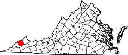 | |
| CDP | ||
| Unincorporated communities | ||
| Footnotes | ‡This populated place also has portions in an adjacent county or counties | |
