Pound, Virginia
| Pound, Virginia | |
|---|---|
| Town | |
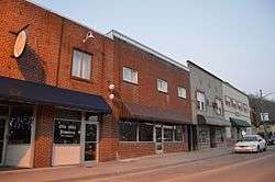 Main Street | |
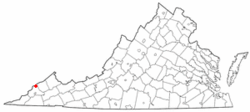 Location in the Commonwealth of Virginia | |
| Coordinates: 37°7′26″N 82°36′28″W / 37.12389°N 82.60778°WCoordinates: 37°7′26″N 82°36′28″W / 37.12389°N 82.60778°W | |
| Country | United States |
| State | Virginia |
| County | Wise |
| Government | |
| • Mayor | George Dean |
| Area | |
| • Total | 2.6 sq mi (6.8 km2) |
| • Land | 2.6 sq mi (6.8 km2) |
| • Water | 0 sq mi (0 km2) |
| Elevation | 1,565 ft (477 m) |
| Population (2000) | |
| • Total | 1,089 |
| • Density | 417.6/sq mi (161.2/km2) |
| Time zone | UTC-5 (EST) |
| • Summer (DST) | UTC-4 (EDT) |
| ZIP code | 24279 |
| Area code(s) | 276 |
| FIPS code | 51-64272[1] |
| GNIS feature ID | 1499906[2] |
| Website | http://www.poundva.com/ |
Pound is a town in Wise County, Virginia, United States. The population was recorded as 1,037 in the 2010 United States Census.
History
The Flat Gap High School and Sunnydale Farm are listed on the National Register of Historic Places.[3]
Author and motivational speaker Napoleon Hill was born in Pound in 1883.[4]
Edith Maxwell was convicted in 1935 of murdering her father, Trigg Maxwell. She was pardoned in 1941 after appeals from Eleanor Roosevelt and the Washington Post raised funds for her legal defense.
Geography
Pound is located at 37°7′26″N 82°36′28″W / 37.12389°N 82.60778°W (37.123820, -82.607859).[5]
According to the United States Census Bureau, the town has a total area of 2.6 square miles (6.8 km²), all land.
Demographics
| Historical population | |||
|---|---|---|---|
| Census | Pop. | %± | |
| 1950 | 1,193 | — | |
| 1960 | 1,135 | −4.9% | |
| 1970 | 995 | −12.3% | |
| 1980 | 1,086 | 9.1% | |
| 1990 | 995 | −8.4% | |
| 2000 | 1,089 | 9.4% | |
| 2010 | 1,037 | −4.8% | |
| Est. 2016 | 954 | [6] | −8.0% |
| U.S. Decennial Census[7] | |||
As of the census[1] of 2000, there were 1,089 people, 455 households and 322 families residing in the town. The population density was 417.6 per square mile (161.1/km²). There were 516 housing units at an average density of 197.9 per square mile (76.3/km²). The racial makeup of the town was 98.71% White, 0.09% Native American, 0.09% from other races, and 1.10% from two or more races. Hispanic or Latino of any race were 0.18% of the population.
There were 455 households out of which 31.2% had children under the age of 18 living with them, 52.5% were married couples living together, 15.8% had a female householder with no husband present, and 29.2% were non-families. 25.9% of all households were made up of individuals and 14.3% had someone living alone who was 65 years of age or older. The average household size was 2.39 and the average family size was 2.88.
In the town, the population was spread out with 24.0% under the age of 18, 8.8% from 18 to 24, 29.8% from 25 to 44, 21.5% from 45 to 64, and 16.0% who were 65 years of age or older. The median age was 39 years. For every 100 females there were 87.8 males. For every 100 females age 18 and over, there were 80.8 males.
The median income for a household in the town was $29,107, and the median income for a family was $33,688. Males had a median income of $32,065 versus $22,143 for females. The per capita income for the town was $14,375. About 19.4% of families and 23.0% of the population were below the poverty line, including 37.9% of those under age 18 and 9.8% of those age 65 or over.
Education
Pound has one public school: James Woodrow Adams Combined School.[8]
Highways
US 23 runs through Pound and crosses into Kentucky at Pound Gap. Pound is also the proposed connection to US 23 for the planned Coalfield Expressway.
Places of interest
Notable residents
- Glen Roberts - Professional Basketball Player
- Francis Gary Powers - Central Intelligence Agency Pilot
- Napoleon Hill - Author
- Tony Mullins - Songwriter
- Sean Brock - Chef, Writer
- Kaitlyn Baker - Singer, songwriter
Notable acts
The town council adopted an ordinance forbidding dancing without a permit (Section 127-138). When the town turned down a dance application, the ordinance was challenged and overturned by the federal District Court in 1999 as "unconstitutional on its face."[9]
Climate
The climate in this area is characterized by relatively high temperatures and evenly distributed precipitation throughout the year. The Köppen Climate System describes the weather as humid subtropical, and uses the abbreviation Cfa.[10]
References
- 1 2 "American FactFinder". United States Census Bureau. Retrieved 2008-01-31.
- ↑ "US Board on Geographic Names". United States Geological Survey. 2007-10-25. Retrieved 2008-01-31.
- ↑ National Park Service (2010-07-09). "National Register Information System". National Register of Historic Places. National Park Service.
- ↑ http://www.tom2tall.com/Pound-Virginia.html
- ↑ "US Gazetteer files: 2010, 2000, and 1990". United States Census Bureau. 2011-02-12. Retrieved 2011-04-23.
- ↑ "Population and Housing Unit Estimates". Retrieved June 9, 2017.
- ↑ "Census of Population and Housing". Census.gov. Retrieved June 4, 2015.
- ↑
- ↑ http://www.grunge.com/26819/weirdest-local-laws-us/s/dancing-in-pound-virginia/
- ↑ Climate Summary for Pound, Virginia
Municipalities and communities of Wise County, Virginia, United States | ||
|---|---|---|
| Towns |  | |
| CDP | ||
| Unincorporated communities | ||
| Footnotes | ‡This populated place also has portions in an adjacent county or counties | |
