Rich Creek, Virginia
| Rich Creek, Virginia | |
|---|---|
| Town | |
 Old Virginia Avenue in the commercial district | |
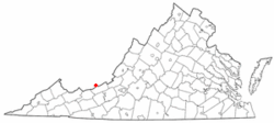 Location of Rich Creek, Virginia | |
| Coordinates: 37°23′2″N 80°49′19″W / 37.38389°N 80.82194°WCoordinates: 37°23′2″N 80°49′19″W / 37.38389°N 80.82194°W | |
| Country | United States |
| State | Virginia |
| County | Giles |
| Area | |
| • Total | 0.85 sq mi (2.20 km2) |
| • Land | 0.83 sq mi (2.15 km2) |
| • Water | 0.02 sq mi (0.05 km2) |
| Elevation | 1,532 ft (467 m) |
| Population (2010) | |
| • Total | 774 |
| • Density | 934/sq mi (360.5/km2) |
| Time zone | UTC-5 (Eastern (EST)) |
| • Summer (DST) | UTC-4 (EDT) |
| ZIP code | 24147 |
| Area code(s) | 540 |
| FIPS code | 51-66896[1] |
| GNIS feature ID | 1497138[2] |
| Website |
www |
Rich Creek is a town in Giles County, Virginia, United States. The population was 774 at the 2010 census,[3] up from 665 at the 2000 census. It is part of the Blacksburg–Christiansburg–Radford Metropolitan Statistical Area.
Geography
Rich Creek is located in northwestern Giles County at 37°23′2″N 80°49′19″W / 37.38389°N 80.82194°W (37.383960, -80.821818),[4] on the east side of the New River at the mouth of Rich Creek. U.S. Route 460 passes through the town, leading south (upriver) 4 miles (6 km) to Narrows and west (downriver) 3.5 miles (5.6 km) to Glen Lyn. Pearisburg is 9 miles (14 km) southeast of Rich Creek (upriver).
U.S. Route 219 has its southwestern terminus at US 460 in Rich Creek. It leads northeast 2 miles (3 km) to Peterstown, West Virginia, and ultimately 535 miles (861 km) to West Seneca, New York, near Buffalo.
According to the United States Census Bureau, Rich Creek has a total area of 0.85 square miles (2.2 km2), of which 0.02 square miles (0.05 km2), or 2.28%, are water.[3]
Demographics
| Historical population | |||
|---|---|---|---|
| Census | Pop. | %± | |
| 1950 | 740 | — | |
| 1960 | 748 | 1.1% | |
| 1970 | 729 | −2.5% | |
| 1980 | 746 | 2.3% | |
| 1990 | 670 | −10.2% | |
| 2000 | 665 | −0.7% | |
| 2010 | 774 | 16.4% | |
| Est. 2016 | 754 | [5] | −2.6% |
| U.S. Decennial Census[6] | |||
As of the census[1] of 2000, there were 665 people, 277 households, and 186 families residing in the town. The population density was 765.0 people per square mile (295.1/km²). There were 312 housing units at an average density of 358.9 per square mile (138.5/km²). The racial makeup of the town was 98.20% White, 1.35% African American, 0.30% Asian, and 0.15% from two or more races. Hispanic or Latino of any race were 0.60% of the population.
There were 277 households out of which 22.4% had children under the age of 18 living with them, 55.2% were married couples living together, 9.4% had a female householder with no husband present, and 32.5% were non-families. 30.3% of all households were made up of individuals and 14.4% had someone living alone who was 65 years of age or older. The average household size was 2.19 and the average family size was 2.71.
In the town, the population was spread out with 17.4% under the age of 18, 5.0% from 18 to 24, 23.3% from 25 to 44, 27.2% from 45 to 64, and 27.1% who were 65 years of age or older. The median age was 48 years. For every 100 females there were 87.3 males. For every 100 females age 18 and over, there were 79.4 males.
The median income for a household in the town was $34,519, and the median income for a family was $43,958. Males had a median income of $31,417 versus $21,250 for females. The per capita income for the town was $18,553. About 7.9% of families and 13.1% of the population were below the poverty line, including 21.8% of those under age 18 and 2.0% of those age 65 or over.
References
- 1 2 "American FactFinder". United States Census Bureau. Archived from the original on September 11, 2013. Retrieved 2008-01-31.
- ↑ "US Board on Geographic Names". United States Geological Survey. 2007-10-25. Retrieved 2008-01-31.
- 1 2 "Geographic Identifiers: 2010 Demographic Profile Data (G001): Rich Creek town, Virginia". U.S. Census Bureau, American Factfinder. Retrieved March 29, 2017.
- ↑ "US Gazetteer files: 2010, 2000, and 1990". United States Census Bureau. 2011-02-12. Retrieved 2011-04-23.
- ↑ "Population and Housing Unit Estimates". Retrieved June 9, 2017.
- ↑ "Census of Population and Housing". Census.gov. Archived from the original on May 12, 2015. Retrieved June 4, 2015.
External links
Municipalities and communities of Giles County, Virginia, United States | ||
|---|---|---|
| Towns | 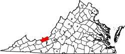 | |
| Unincorporated communities | ||