Parksley, Virginia
| Parksley, Virginia | |
|---|---|
| Town | |
 Dunne Avenue and Bennett Street, the commercial center of Parksley | |
 Location in Accomack County and the state of Virginia. | |
| Coordinates: 37°47′6″N 75°39′15″W / 37.78500°N 75.65417°WCoordinates: 37°47′6″N 75°39′15″W / 37.78500°N 75.65417°W | |
| Country | United States |
| State | Virginia |
| County | Accomack |
| Area | |
| • Total | 0.6 sq mi (1.6 km2) |
| • Land | 0.6 sq mi (1.6 km2) |
| • Water | 0.0 sq mi (0.0 km2) |
| Elevation | 39 ft (12 m) |
| Population (2010) | |
| • Total | 842 |
| • Density | 1,400/sq mi (530/km2) |
| Time zone | UTC−5 (Eastern (EST)) |
| • Summer (DST) | UTC−4 (EDT) |
| ZIP code | 23421 |
| Area code | 757 |
| FIPS code | 51-60680[1] |
| GNIS feature ID | 1497072[2] |
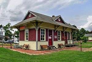
Parksley is a town in Accomack County, Virginia, United States. The population was 842 at the 2010 census.[3] It is home to the Eastern Shore Railway Museum.
Geography
Parksley is located at 37°47′6″N 75°39′15″W / 37.78500°N 75.65417°W (37.785078, -75.654222).[4]
According to the United States Census Bureau the town has a total area of 0.6 square miles (1.6 km²), all of it land.
Demographics
| Historical population | |||
|---|---|---|---|
| Census | Pop. | %± | |
| 1920 | 601 | — | |
| 1930 | 697 | 16.0% | |
| 1940 | 701 | 0.6% | |
| 1950 | 883 | 26.0% | |
| 1960 | 850 | −3.7% | |
| 1970 | 903 | 6.2% | |
| 1980 | 979 | 8.4% | |
| 1990 | 779 | −20.4% | |
| 2000 | 837 | 7.4% | |
| 2010 | 842 | 0.6% | |
| Est. 2016 | 841 | [5] | −0.1% |
| U.S. Decennial Census[6] | |||
As of the census[1] of 2000, there were 837 people, 363 households, and 226 families residing in the town. The human population density was 1,368.5 people per square mile (529.8/km²). There were 405 housing units at an average density of 662.2 per square mile (256.3/km²). The racial makeup of the town was 82.20% White, 10.75% African American, 0.60% Native American, 0.48% Asian, 4.30% from other races, and 1.67% from two or more races. Hispanic or Latino of any race were 7.65% of the population.
There were 363 households out of which 27.3% had children under the age of 18 living with them, 47.9% were married couples living together, 11.6% had a female householder with no husband present, and 37.5% were non-families. 32.8% of all households were made up of individuals and 18.2% had someone living alone who was 65 years of age or older. The average household size was 2.31 and the average family size was 2.87.
In the town, the population was spread out with 23.3% under the age of 18, 5.9% from 18 to 24, 28.1% from 25 to 44, 21.3% from 45 to 64, and 21.5% who were 65 years of age or older. The median age was 41 years. For every 100 females there were 86.4 males. For every 100 females age 18 and over, there were 81.4 males.
The median income for a household in the town was $35,313, and the median income for a family was $45,227. Males had a median income of $30,909 versus $21,538 for females. The per capita income for the town was $17,855. About 4.8% of families and 6.8% of the population were below the poverty line, including 10.6% of those under age 18 and 2.5% of those age 65 or over.
History
The history of Parksley is directly tied to the arrival of the New York, Philadelphia, and Norfolk [NYP&N] Railroad on Virginia’s Eastern Shore in the mid-1880s. When the rail line connecting the lower Delmarva Peninsula to the markets of the northeast was built in 1884, several new towns were created along its route which bypassed many of the shore’s older established communities. Parksley was the second such planned town on the Virginia shore (after Cape Charles at the railroad’s southern terminus in Northampton County) and was laid out in 1885 under the management of the Parksley Land Improvement Company.[7] In 1898, town leaders made an unsuccessful attempt to relocate the county seat from Accomac to the Parksley.[8] The town was incorporated in 1904. During the first-half of the 20th century, Parksley became an important shipping point for seafood and agricultural products harvested from the Chesapeake Bay and the Atlantic Ocean in Accomack County.[9] During World War II, Parksley was the site of the Shore National Guard Armory and its airfield was utilized by the Civil Air Patrol, part of military reconnaissance activities guarding the east coast of the United States against possible German invasion.[10] Parksley was home to the Parksley Spuds, a team which played in the Eastern Shore Baseball League.
References
- 1 2 "American FactFinder". United States Census Bureau. Archived from the original on September 11, 2013. Retrieved 2008-01-31.
- ↑ "US Board on Geographic Names". United States Geological Survey. 2007-10-25. Retrieved 2008-01-31.
- ↑ "Profile of General Population and Housing Characteristics: 2010 Demographic Profile Data (DP-1): Parksley town, Virginia". U.S. Census Bureau, American Factfinder. Archived from the original on September 11, 2013. Retrieved April 5, 2012.
- ↑ "US Gazetteer files: 2010, 2000, and 1990". United States Census Bureau. 2011-02-12. Retrieved 2011-04-23.
- ↑ "Population and Housing Unit Estimates". Retrieved June 9, 2017.
- ↑ "Census of Population and Housing". Census.gov. Archived from the original on May 12, 2015. Retrieved June 4, 2015.
- ↑ Turman, Nora Miller (1964). The Eastern Shore of Virginia 1603-1964. Onancock, VA: The Eastern Shore News, Inc. p. 203.
- ↑ Turman, Nora Miller (1964). The Eastern Shore of Virginia 1603-1964. Onancock, VA: The Eastern Shore News, Inc. p. 208.
- ↑ Bennett, H.R. "Parksley". Eastern Shore History: Parksley Virginia in 1929. Ghotes of Virginia.
- ↑ Turman, Nora Miller (1964). The Eastern Shore of Virginia 1603-1964. Onancock, VA: The Eastern Shore News, Inc. p. 243.
External links
| Wikimedia Commons has media related to Parksley, Virginia. |
- Welcome to Parksley Virginia
- Parksley, Virginia at Eastern Shore Visitor