Wachapreague, Virginia
| Wachapreague, Virginia | |
|---|---|
| Town | |
 Sea marsh and fishing boats in Wachapreague | |
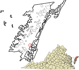 Location in Accomack County and the state of Virginia. | |
| Coordinates: 37°36′23″N 75°41′26″W / 37.60639°N 75.69056°WCoordinates: 37°36′23″N 75°41′26″W / 37.60639°N 75.69056°W | |
| Country | United States |
| State | Virginia |
| County | Accomack |
| Area | |
| • Total | 0.3 sq mi (0.7 km2) |
| • Land | 0.3 sq mi (0.7 km2) |
| • Water | 0.0 sq mi (0.0 km2) |
| Elevation | 10 ft (3 m) |
| Population (2010) | |
| • Total | 232 |
| • Density | 770/sq mi (330/km2) |
| Time zone | UTC−5 (Eastern (EST)) |
| • Summer (DST) | UTC−4 (EDT) |
| ZIP code | 23480 |
| Area code(s) | 757 |
| FIPS code | 51-82320[1] |
| GNIS feature ID | 1500265[2] |
Wachapreague is a town in Accomack County, Virginia, United States. The population was 232 at the 2010 census.[3]
History
The name of the town came from the Wachapreague, an Algonquian people who resided in the area centuries ago.[4]
Bunting Place was added to the National Register of Historic Places in 2003.[5]
Geography
According to the United States Census Bureau, the town has a total area of 0.3 square miles (0.7 km²), all of it land.
The Wachapreague Channel winds from the town, through the seaside marsh, out to the barrier islands. Between Cedar and Parramore Islands it reaches the Atlantic Ocean. Easy access to the marsh and ocean makes this a popular place for fishermen.
Demographics
| Historical population | |||
|---|---|---|---|
| Census | Pop. | %± | |
| 1910 | 485 | — | |
| 1920 | 498 | 2.7% | |
| 1930 | 585 | 17.5% | |
| 1940 | 548 | −6.3% | |
| 1950 | 551 | 0.5% | |
| 1960 | 507 | −8.0% | |
| 1970 | 399 | −21.3% | |
| 1980 | 404 | 1.3% | |
| 1990 | 291 | −28.0% | |
| 2000 | 236 | −18.9% | |
| 2010 | 232 | −1.7% | |
| Est. 2016 | 230 | [6] | −0.9% |
| U.S. Decennial Census[7] | |||
As of the census[1] of 2000, there were 236 people, 133 households, and 69 families residing in the town. The population density was 922.9 people per square mile (350.5/km²). There were 225 housing units at an average density of 879.9 per square mile (334.1/km²). The racial makeup of the town was 93.22% White, 2.54% African American, 0.42% Native American, 1.69% from other races, and 2.12% from two or more races. Hispanic or Latino of any race were 1.69% of the population.
There were 133 households out of which 9.0% had children under the age of 18 living with them, 43.6% were married couples living together, 3.8% had a female householder with no husband present, and 48.1% were non-families. 42.9% of all households were made up of individuals and 25.6% had someone living alone who was 65 years of age or older. The average household size was 1.77 and the average family size was 2.32.
In the town, the population was spread out with 7.6% under the age of 18, 3.8% from 18 to 24, 20.3% from 25 to 44, 33.1% from 45 to 64, and 35.2% who were 65 years of age or older. The median age was 56 years. For every 100 females, there were 87.3 males. For every 100 females age 18 and over, there were 83.2 males.
The median income for a household in the town was $36,625, and the median income for a family was $39,063. Males had a median income of $30,313 versus $21,563 for females. The per capita income for the town was $21,680. About 2.9% of families and 7.7% of the population were below the poverty line, including none of those under the age of eighteen and 7.0% of those sixty five or over.
Notable person
- G. Walter Mapp, member of the Virginia Senate.
References
- 1 2 "American FactFinder". United States Census Bureau. Retrieved 2008-01-31.
- ↑ "US Board on Geographic Names". United States Geological Survey. 2007-10-25. Retrieved 2008-01-31.
- ↑ "Profile of General Population and Housing Characteristics: 2010 Demographic Profile Data (DP-1): Wachapreague town, Virginia". U.S. Census Bureau, American Factfinder. Retrieved April 5, 2012.
- ↑ Federal Writers' Project (1938). The Ocean Highway: New Brunswick, New Jersey to Jacksonville, Florida. Works Progress Administration. p. 73.
- ↑ National Park Service (2010-07-09). "National Register Information System". National Register of Historic Places. National Park Service.
- ↑ "Population and Housing Unit Estimates". Retrieved June 9, 2017.
- ↑ "Census of Population and Housing". Census.gov. Retrieved June 4, 2015.
External links
- Town of Wachapreague official website
- Wachapreague, Virginia at Eastern Shore Visitor