Westford, Massachusetts
Westford is a town in Middlesex County, Massachusetts, United States. The population was 24,310 at the 2017 census.
Westford, Massachusetts | |
|---|---|
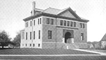
 Old Westford Academy, now the Westford Museum | |
 Seal | |
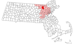 Location in Middlesex County in Massachusetts | |
| Coordinates: 42°34′45″N 71°26′18″W | |
| Country | |
| State | |
| County | Middlesex |
| Region | New England |
| Settled | 1635 [1] |
| Incorporated | September 23, 1729 |
| Government | |
| • Type | Open town meeting |
| Area | |
| • Total | 81.1 km2 (31.3 sq mi) |
| • Land | 79.3 km2 (30.6 sq mi) |
| • Water | 1.9 km2 (0.7 sq mi) |
| Elevation | 124 m (406 ft) |
| Population (2010) | |
| • Total | 24,310 |
| • Density | 274.8/km2 (712.1/sq mi) |
| Time zone | UTC−5 (Eastern) |
| • Summer (DST) | UTC−4 (Eastern) |
| ZIP Code | 01886 |
| Area code(s) | 351/978 |
| FIPS code | 25-76135 |
| GNIS feature ID | 0618244 |
| Website | Town of Westford |
History

Originally a part of neighboring Chelmsford, West Chelmsford soon grew large enough to sustain its own governance, and was officially incorporated as Westford on September 23, 1729.[2][3]
In the late 18th and early 19th centuries, Westford primarily produced granite, apples, and worsted yarn. The Abbot Worsted Company was said to be the first company in the nation to use camel hair for worsted yarns.[4] Citizens from Westford also had some notable involvement in the Revolutionary War.[2] Westford Minutemen were alerted by efforts of Samuel Prescott who alerted Acton, to the southeast towards Stow.

Paul Revere's son attended Westford Academy and a bell cast by Revere graces its lobby today.[5] A weather vane made by Paul Revere sits atop the Abbot Elementary school.
By the end of the American Civil War, as roads and transportation improved, Westford began to serve as a residential suburb for the factories of Lowell, becoming one of the earliest notable examples of suburban sprawl. Throughout the 20th century (and with the invention of the automobile), Westford progressively grew, continuing to serve as residential housing for the industries of Lowell, and later, Boston.
In the 1960s, the town was home to one of the research sites supporting Project West Ford.
By the 1970s, with the advent of the 128 Technology Belt, Westford began to act as a suburb for high-tech firms in Burlington, Woburn, and other areas, and later became a center of technology itself.
By the 1990s, Westford was home to offices for Cascade Communications now part of Nokia, NETSCOUT, Red Hat, Samsung, Sonus Networks, Seagate, Iris Associates and many other technology firms, most located along Massachusetts Route 110, parallel to I-495. It is also the North American headquarters for Puma, which holds a road race in town.[6]
Geography
.jpg)
According to the United States Census Bureau, the town has a total area of 31.3 square miles (81 km2), of which 30.6 square miles (79 km2) is land and 0.7 square miles (1.8 km2) (2.30%) is water.
The town is bordered by Chelmsford to the east, Tyngsborough to the north, Groton to the west, Littleton to the southwest, Acton to the south, and Carlisle to the southeast.
Places adjacent to Westford, Massachusetts | ||||||||||
|---|---|---|---|---|---|---|---|---|---|---|
| ||||||||||
Regionally, it is on the edge of the Merrimack Valley, Northern Middlesex County, and the Metrowest regions of Massachusetts.
Colloquially, the town is divided into different regions based on location, including Forge Village, Nabnasset, Graniteville, Parker Village, and Center of Town.
The town was rated as #11 Best Places to live by CNN Money in 2013.[7]
Demographics
| Historical population | ||
|---|---|---|
| Year | Pop. | ±% |
| 1850 | 1,473 | — |
| 1860 | 1,624 | +10.3% |
| 1870 | 1,803 | +11.0% |
| 1880 | 2,147 | +19.1% |
| 1890 | 2,250 | +4.8% |
| 1900 | 2,624 | +16.6% |
| 1910 | 2,851 | +8.7% |
| 1920 | 3,170 | +11.2% |
| 1930 | 3,600 | +13.6% |
| 1940 | 3,830 | +6.4% |
| 1950 | 4,262 | +11.3% |
| 1960 | 6,261 | +46.9% |
| 1970 | 10,368 | +65.6% |
| 1980 | 13,434 | +29.6% |
| 1990 | 16,392 | +22.0% |
| 2000 | 20,754 | +26.6% |
| 2010 | 21,951 | +5.8% |
| * = population estimate. Source: United States Census records and Population Estimates Program data.[8][9][10][11][12][13][14][15][16][17] | ||
As of the 2010 census[18] there were 21,951 people, 7,498 households, and 6,165 families residing in the town. The racial makeup of the town was 76.1% White, 0.40% African American, 0.1% Native American, 22.6% Asian (10.7% Indian, 8.2% Chinese, 1.6% Korean, 0.3% Cambodian, 0.2% Vietnamese, 0.2% Japanese, 0.1% Filipino, 0.1% Pakistani, 0.1% Bangladeshi), 0.0% Pacific Islander, 0.30% from other races, and 1.5% from two or more races. Hispanic or Latino of any race were 1.5% of the population.
As of the 2010 census,[18] there were 7,498 households out of which 45.3% had children under the age of 18 living with them, 72.5% were married couples living together, 7.3% had a female head of household, and 17.8% were other families. The average household size was 2.93 and the average family size was 3.27.
In the town, the population was spread out with 31.8% under the age of 18, 4.2% from 18 to 24, 32.8% from 25 to 44, 23.9% from 45 to 64, and 7.2% who were 65 years of age or older. The median age was 37 years. For every 100 females, there were 99.0 males. For every 100 females age 18 and over, there were 95.4 males.
The median income for a household in the town was $121,136, and the median income for a family was $137,230. The per capita income for the town was $48,951. About 1.3% of families and 1.7% of the population were below the poverty line, including 2.2% of those under age 18 and 1.0% of those age 65 or over.
Education
Westford Public Schools
The Superintendent of Westford's Public Schools is Everett "Bill" Olsen, who has held that role since 1986. The Assistant Superintendent is Kerry Clery.
- Westford Academy, Public High School (known as W.A.)
- Lloyd G. Blanchard Middle School, Public Middle School (known as Blanchard)
- Stony Brook Middle School, Public Middle School (known as Stony Brook)
- Norman E. Day Elementary School, Public Elementary School (3-5) (known as Day)
- Abbot Elementary, Public Elementary School (3-5) (known as Abbot)
- John A. Crisafulli Elementary, Public Elementary School (3-5) (known as Crisafulli)
- Col. John Robinson School, Public Elementary School (K-2) (known as Robinson)
- Nabnasset Elementary School, Public Elementary School (K-2) (known as Nab)
- Rita Edwards Miller School, Public Elementary School (K-2) (known as Miller)
Nashoba Valley Technical High School District
Nashoba Valley Technical High School enrolls students from Westford, Chelmsford, Ayer, Groton, Littleton, Townsend, Shirley, and Pepperell
Established in 1968, Nashoba Valley Technical High School is a public, four-year, vocational high school.
- Nashoba Valley Technical High School, Public Regional Vocational Technical (known as Nashoba Tech, or The Tech)
Transportation
Freight travels daily through Westford over the tracks of the historic Stony Brook Railroad. The line currently serves as a major corridor of Pan Am Railways' District 3 which connects New Hampshire and Maine with western Massachusetts, Vermont, and New York.[19] Interstate 495 (Massachusetts) also passes through the town, linking it to other parts of the state as well as New Hampshire.[20] US-3 passes through the town, although the nearest interchanges are located in neighboring Tyngsborough (exit 34) and Chelmsford (exit 33).
The LRTA 15 bus connects Westford along Route 110 with Chelmsford and the Lowell train station on the MBTA Commuter Rail Lowell Line.
Local routes passing through town are Massachusetts Routes 110, 40, 225, and 27.
Annual events

- In March or April, Westford FunFest has Breakfast with the Bunny.
- In May, the Westford Charitable Foundation 5k/10k Road Races, or The Westford Road Race are held.
- In May, the Kiwanis club hosts the Apple Blossom Parade and Carnival .
- In June, The First Parish Church hosts the Strawberry Festival.
- In August, the Westford Rotary Club hosts the Blues & Brews Festival as well as the Pig & Pepper Festival at the Nashoba Valley Ski Area, featuring top blues bands and many local beers to sample.
- In October, the Westford Education Foundation sponsors the Family Fun Run, Westford FunFest holds a Fall Festival at Kimball Farms, and the Nashoba Valley Ski Resort runs the Witch's Woods Halloween Screampark.
- In December, First Parish Church hosts the Westford Greens Sale, Westford Academy has its annual Holiday Bazaar, Westford FunFest holds the Festival of Trees, Wreaths and Gingerbread Creations and Breakfast with Santa.
- In December, Westford's United Methodist Church holds an outdoor Live Nativity overlooking the Stony Brook Reservoir pond, including farm animals, music & bonfire http://www.umcw.org/christmas [21]
- In December, the Rabbi from Chabad Nashoba Valley lights the candles of the 9 foot Menorah during Chanukah. One of the evenings includes music and dancing after the lighting. The menorah is displayed on the town common.
- There is a celebratory parade of where the graduated seniors of Westford Academy make trips around the middle schools as a tribute to their experience with the teachers at each place and then ride through town center.
Notable people
- Nettie Stevens, American geneticist
- Joel Abbot, (1793–1855), born in Westford, noted naval officer[22]
- Pat Bradley, Member of World Golf Hall of Fame[23]
- Jackie MacMullan, sportswriter[24]
- Lt. Col. John Robinson, Revolutionary War soldier[25]
- Aaron Stanford, actor; Main Cast Member of Nikita (CW TV show)[26]
- Ellen Henrietta Swallow Richards, creator of the field of home economics, first woman admitted to MIT, co-founder of American Association of University Women[27]
- Michael Fucito, Retired Major League Soccer player, first drafted by the Seattle Sounders FC,[28]
Points of Interest
- The Butterfly Place
- East Boston Camps
- First Parish Church[29]
- Westford Knight stone and memorial
- Westford Poe Marker
- Nashoba Valley Ski Area
- Kimball Farm
References
- History of the town of Westford, in the county of Middlesex, Massachusetts, 1659–1883 by Hodgman, Edwin R. (Edwin Ruthven), 1819–1900; Westford Town History Association (Westford, Mass.)
- http://www.westford.com/museum/research_westford_history.html
- http://westford.patch.com/articles/you-asked-patch-answers-7c8c087c
- Oliphant, Robert W. "A brief history of Westford". Westford Museum and Historical Society. Retrieved 18 April 2014.
- http://www.wickedlocal.com/westford/town_info/history/x2136193253#axzz1YSz4BoBM
- http://westford.patch.com/articles/image-gallery-puma-5-miler-road-race#photo-7436786 IMAGE GALLERY: Puma 5 Miler Road Race, Westford Patch
- "Best Places To Live 2013". MONEY.com. Retrieved 2018-04-02.
- "Total Population (P1), 2010 Census Summary File 1". American FactFinder, All County Subdivisions within Massachusetts. United States Census Bureau. 2010.
- "Massachusetts by Place and County Subdivision - GCT-T1. Population Estimates". United States Census Bureau. Retrieved July 12, 2011.
- "1990 Census of Population, General Population Characteristics: Massachusetts" (PDF). US Census Bureau. December 1990. Table 76: General Characteristics of Persons, Households, and Families: 1990. 1990 CP-1-23. Retrieved July 12, 2011.
- "1980 Census of the Population, Number of Inhabitants: Massachusetts" (PDF). US Census Bureau. December 1981. Table 4. Populations of County Subdivisions: 1960 to 1980. PC80-1-A23. Retrieved July 12, 2011.
- "1950 Census of Population" (PDF). Bureau of the Census. 1952. Section 6, Pages 21-10 and 21-11, Massachusetts Table 6. Population of Counties by Minor Civil Divisions: 1930 to 1950. Retrieved July 12, 2011.
- "1920 Census of Population" (PDF). Bureau of the Census. Number of Inhabitants, by Counties and Minor Civil Divisions. Pages 21-5 through 21-7. Massachusetts Table 2. Population of Counties by Minor Civil Divisions: 1920, 1910, and 1920. Retrieved July 12, 2011.
- "1890 Census of the Population" (PDF). Department of the Interior, Census Office. Pages 179 through 182. Massachusetts Table 5. Population of States and Territories by Minor Civil Divisions: 1880 and 1890. Retrieved July 12, 2011.
- "1870 Census of the Population" (PDF). Department of the Interior, Census Office. 1872. Pages 217 through 220. Table IX. Population of Minor Civil Divisions, &c. Massachusetts. Retrieved July 12, 2011.
- "1860 Census" (PDF). Department of the Interior, Census Office. 1864. Pages 220 through 226. State of Massachusetts Table No. 3. Populations of Cities, Towns, &c. Retrieved July 12, 2011.
- "1850 Census" (PDF). Department of the Interior, Census Office. 1854. Pages 338 through 393. Populations of Cities, Towns, &c. Retrieved July 12, 2011.
- "U.S. Census website". United States Census Bureau. Retrieved 2008-01-31.
- Pan Am Railways route map Archived 2007-01-11 at the Wayback Machine.panamrailways.com. Accessed April 30, 2007.
- "interstate-guide.com". Accessed November 5, 2008.
- http://www.wickedlocal.com/x1479406947/A-Christmas-tradition-continues-in-Westford
- Who Was Who in America, Historical Volume, 1607-1896. Marquis Who's Who. 1967.
- World Golf Hall of Fame Profile: Pat Bradley
- http://westford.patch.com/articles/this-week-in-sports-fall-2011-openers
- Massachusetts Soldiers and Sailors of the Revolutionary War, 1775-1783, 13, Boston: Wright and Potter, 1905, p. 451
- O'Connor, Austin (2003-05-04), "Westford actor Aaron Stanford is hot", Lowell Sun, retrieved 2012-01-22
- "Ellen Swallow Richards", Biographical Snapshots of Famous Women and Minority Chemists, Journal of Chemical Education, retrieved 2012-01-22
- Hare, Bill (2010-11-03), Mike Fucito: Seattle Sounders' Embodiment of Desire and Spirit, Bleacher Report, retrieved 2012-01-22
- Westford Museum
Further reading
- 1871 Atlas of Massachusetts. by Wall & Gray.Map of Massachusetts. Map of Middlesex County.
- History of Middlesex County, Massachusetts, Volume 1 (A-H), Volume 2 (L-W) compiled by Samuel Adams Drake, published 1879 and 1880. 572 and 505 pages. Westford section in volume 2 page 475 by Hodgman and Julian Abbott.
- History of the Town of Westford, in the County of Middlesex, Massachusetts, by Rev. Edwin Ruthven Hodgman, published 1883, 494 pages.
- A Brief History of Westford, by Robert W. Oliphant, Town Historian.
External links
| Wikimedia Commons has media related to Westford, Massachusetts. |
| Wikivoyage has a travel guide for Westford. |
- Town of Westford
- The Westford Web Community Web Site
- Westford Historical Society and Museum
- Kimball Farm

Municipalities and communities of Middlesex County, Massachusetts, United States | ||
|---|---|---|
| Cities |  | |
| Towns |
| |
| CDPs | ||
| Other villages |
| |
| Authority control |
|
|---|