Springfield, Massachusetts
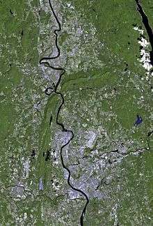
Springfield is a city in the state of Massachusetts, United States, and the seat of Hampden County.[14] Springfield sits on the eastern bank of the Connecticut River near its confluence with three rivers: the western Westfield River, the eastern Chicopee River, and the eastern Mill River. As of the 2010 Census, the city's population was 153,060.[15] As of 2019, the estimated population was 153,606, making it the third-largest city in Massachusetts, the fourth-most populous city in New England after Boston, Worcester, and Providence, and the 12th-most populous in the Northeastern United States.[15] Metropolitan Springfield, as one of two metropolitan areas[lower-alpha 2] in Massachusetts (the other being Greater Boston), had a population of 692,942 as of 2010.[10]
Springfield, Massachusetts | |
|---|---|
City | |
| City of Springfield | |
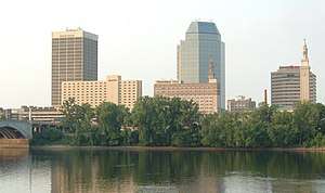  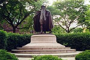 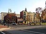  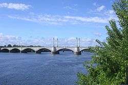  Clockwise from top: The Springfield skyline, The Puritan statue of pioneer Samuel Chapin by Augustus St. Gaudens, the Basketball Hall of Fame, Springfield Armory National Historic Site, Hampden County Memorial Bridge overlooking the Connecticut River, Court Square Historic District, and Symphony Hall | |
| Nickname(s): | |
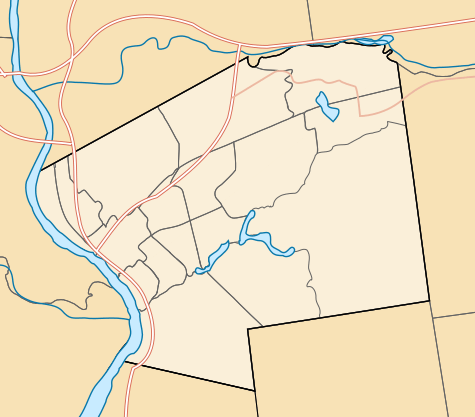
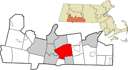 Location in Hampden County in Massachusetts | |
 Springfield, Massachusetts Location in the United States | |
| Coordinates: 42°06′05″N 72°35′25″W | |
| Country | |
| State | |
| County | |
| Region | New England |
| Historic countries | Kingdom of England Kingdom of Great Britain |
| Historic colonies | Connecticut Colony (1636–1641) Massachusetts Bay Colony (1641–1686, 1689–1691) Dominion of New England (1686–1689) Province of Massachusetts Bay (1691–1780) |
| Settled (town) | May 14, 1636 |
| Incorporated (city) | May 25, 1852 |
| Founded by | William Pynchon |
| Named for | Springfield, Essex |
| Government | |
| • Type | Mayor-council city |
| • Mayor | Domenic Sarno (D) |
| Area | |
| • City | 33.1 sq mi (85.7 km2) |
| • Land | 31.9 sq mi (82.5 km2) |
| • Water | 1.2 sq mi (3.1 km2) |
| Elevation | 70 ft (21 m) |
| Population | |
| • City | 153,060 |
| • Estimate (2019)[9] | 153,606 |
| • Rank | 165th, U.S. as of 2017 incorporated places estimate |
| • Density | 4,803/sq mi (1,854.6/km2) |
| • Metro | 692,942 |
| Demonym(s) | Springfieldian[lower-alpha 1] Springfielder[12] |
| Time zone | UTC−5 (Eastern) |
| • Summer (DST) | UTC−4 (Eastern) |
| ZIP Codes | 01101, 01103–01105, 01107–01109, 01118–01119, 01128–01129, 01151 |
| Area code | 413 |
| FIPS code | 25-67000 |
| GNIS feature ID | 0609092 |
| GDP | $30 billion USD[13] |
| Primary Airport | Bradley International Airport |
| Interstates | |
| Commuter Rail | |
| Transit | |
| Website | www |

Founded in 1636 as the first Springfield in the New World, during the American Revolution, George Washington designated it as the site of the Springfield Armory for its central location, subsequently the site of Shays' Rebellion. The city would also play a pivotal role in the Civil War, as a stop on the Underground Railroad and home of abolitionist John Brown, widely known for his raid on Harpers Ferry,[16] and for the Armory's manufacture of the famed "Springfield rifles" used ubiquitously by Union troops. Closing during the Johnson administration, today the national park site features the largest collection of historic American firearms in the world.[17] Today the city is the largest in western New England, and the urban, economic, and media capital of Massachusetts' section of the Connecticut River Valley, colloquially known as the Pioneer Valley. Springfield has several nicknames—"The City of Firsts", due to the many innovations developed there, such as the first American dictionary, the first American gas-powered automobile, and the first machining lathe for interchangeable parts; "The City of Homes", due to its Victorian residential architecture; and "Hoop City", as basketball—one of the world's most popular sports[18]—was invented in Springfield in 1891 by James Naismith.
Hartford, the capital of Connecticut, lies 24 miles (39 km) south of Springfield, on the western bank of the Connecticut River. The Hartford–Springfield region is known as the Knowledge Corridor because it hosts over 160,000 university students and over 32 universities and liberal arts colleges—the second-highest concentration of higher-learning institutions in the United States.[19] The city of Springfield itself is home to Springfield College, Western New England University, American International College, and Springfield Technical Community College, among other higher educational institutions.
History
Springfield was founded in 1636 by English Puritan William Pynchon as "Agawam Plantation" under the administration of the Connecticut Colony. In 1641 it was renamed after Pynchon's hometown of Springfield, Essex, England, following incidents, including trade disputes as well as Captain John Mason's hostilities toward native tribes, which precipitated the settlement's joining the Massachusetts Bay Colony.[20][21] During its early existence, Springfield flourished both as an agricultural settlement and as a trading post, although its prosperity waned dramatically during (and after) King Philip's War in 1675, when natives laid siege to it and burned it to the ground as part of the ongoing campaign. During that attack, three-quarters of the original settlement was burned to the ground, with many of Springfield's residents survived by taking refuge in John Pynchon's brick house, the "Old Fort", the first such house to be built in the Connecticut River Valley. Out of the siege, Miles Morgan and his sons were lauded as heroes; as one of the few homesteads to survive the attack, alerting troops in Hadley, as well as Toto, often referred to as the "Windsor Indian" who, running 20 miles from Windsor, Connecticut to the settlement, was able to give advance warning of the attack.[22]
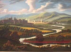
The original settlement—today's downtown Springfield—was located atop bluffs at the confluence of four rivers, at the nexus of trade routes to Boston, Albany, New York City, and Montreal, and with some of the northeastern United States' most fertile soil.[23] In 1777, Springfield's location at numerous crossroads led George Washington and Henry Knox to establish the United States' National Armory at Springfield, which produced the first American musket in 1794, and later the famous Springfield rifle.[24] From 1777 until its closing during the Vietnam War, the Springfield Armory attracted skilled laborers to Springfield, making it the United States' longtime center for precision manufacturing.[25] The near-capture of the armory during Shays' Rebellion of 1787 led directly to the formation of the U.S. Constitutional Convention.
During the 19th and 20th centuries, Springfielders produced many innovations, including the first American-English dictionary (1805, Merriam-Webster); the first use of interchangeable parts and the assembly line in manufacturing (1819, Thomas Blanchard); the first American horseless car (1825, Thomas Blanchard); the mass production of vulcanized rubber (1844, Charles Goodyear); the first American gasoline-powered car (1893, Duryea Brothers); the first successful motorcycle company (1901, "Indian"); one of America's first commercial radio stations (1921, WBZ, broadcast from the Hotel Kimball); and most famously, the world's second-most-popular sport, basketball (1891, Dr. James Naismith).[24] Springfield would play major roles in machine production, initially driven by the arms industry of the Armory, as well as from private companies such as Smith & Wesson, established by Horace Smith and Daniel B. Wesson. Similarly, the industrial economy led Thomas and Charles Wason to establish the Wason Manufacturing Company, which produced the first manufactured sleeping car.[26] The largest railcar works in New England, Wason produced 100 cars a day at its peak; the company was eventually was purchased by Brill in 1907 and closed during the Depression in 1937.[27] Among numerous other industries, during the first half of the 20th century Springfield also produced brass goods, chemicals, clothing and knit goods, paper goods, watches, boilers, engines, manufacturing machinery, silverware, jewelry, skates, carriages, buttons, needles, toys, and printed books and magazines.[28]
Springfield underwent a protracted decline during the second half of the 20th century, due largely to the decommissioning of the Springfield Armory in 1969; poor city planning decisions, such as the location of the elevated I-91 along the city's Connecticut River front; and overall decline of industry throughout the northeastern United States. During the 1980s and 1990s, Springfield developed a national reputation for crime, political corruption, and cronyism. During the early 21st century, Springfield saw long-term revitalization projects and several large projects, including the $1 billion New Haven–Hartford–Springfield intercity rail;[29] a $1 billion MGM casino.[30][31]
Geography
Springfield is located at 42°6′45″N 72°32′51″W (42.112411, −72.547455).[32] According to the United States Census Bureau, the city has a total area of 33.1 square miles (85.7 km2), of which 31.9 square miles (82.5 km2) are land and 1.2 square miles (3.1 km2), or 3.65%, are water.[33] Once nicknamed "The City in a Forest", Springfield features over 4.0 square miles (10.4 km2) of urban parkland, 12% of its total land area.[34]
Located in the fertile Connecticut River Valley, surrounded by mountains, bluffs, and rolling hills in all cardinal directions, Springfield sits on the eastern bank of the Connecticut River, near its confluence with two major tributary rivers—the western Westfield River, which flows into the Connecticut opposite Springfield's South End Bridge; and the eastern Chicopee River, which flows into the Connecticut less than 0.5 mi (0.8 km) north of Springfield, in the city of Chicopee (which constituted one of Springfield's most populous neighborhoods until it separated and became an independent municipality in 1852).[35] The Connecticut state line is only 4 miles (6 km) south of Springfield, beside the wealthy suburb of Longmeadow, which itself separated from Springfield in 1783.[35]
Springfield's densely urban Metro Center district surrounding Main Street is relatively flat, and follows the north–south trajectory of the Connecticut River; however, as one moves eastward, the city becomes increasingly hilly.
Aside from its rivers, Springfield's second most prominent topographical feature is the city's 735-acre (297 ha) Forest Park, designed by renowned landscape architect Frederick Law Olmsted. Forest Park lies in the southwestern corner of the city, surrounded by Springfield's attractive garden districts, Forest Park and Forest Park Heights, which feature over 600 Victorian Painted Lady mansions. Forest Park also borders Western Massachusetts' most affluent town, Longmeadow. Springfield shares borders with other well-heeled suburbs such as East Longmeadow, Wilbraham, Ludlow and the de-industrializing city of Chicopee. The small cities of Agawam and West Springfield lie less than a mile (1.6 km) from Springfield's Metro Center, across the Connecticut River.
The City of Springfield also owns the Springfield Country Club, located in the autonomous city of West Springfield, which separated from Springfield in 1774.[35]
Climate
| Springfield, MA | ||||||||||||||||||||||||||||||||||||||||||||||||||||||||||||
|---|---|---|---|---|---|---|---|---|---|---|---|---|---|---|---|---|---|---|---|---|---|---|---|---|---|---|---|---|---|---|---|---|---|---|---|---|---|---|---|---|---|---|---|---|---|---|---|---|---|---|---|---|---|---|---|---|---|---|---|---|
| Climate chart (explanation) | ||||||||||||||||||||||||||||||||||||||||||||||||||||||||||||
| ||||||||||||||||||||||||||||||||||||||||||||||||||||||||||||
| ||||||||||||||||||||||||||||||||||||||||||||||||||||||||||||
Springfield, like other cities in southern New England, has a hot-summer humid continental climate (Köppen: Dfa) with four distinct seasons and precipitation evenly distributed throughout the year, but the intensity (and sometimes the duration) of warmer periods greater than northern areas. Winters are cold with a daily average in January of around 26 °F (−3 °C). During winter, nor'easter storms can drop significant snowfalls on Springfield and the Connecticut River Valley. Temperatures below 0 °F (−18 °C) can occur each year, though the area does not experience the high snowfall amounts and blustery wind averages of nearby cities such as Worcester, Massachusetts and Albany, New York.
Springfield's summers are very warm and sometimes humid. During summer, several times per month, on hot days afternoon thunderstorms will develop when unstable warm air collides with approaching cold fronts. The daily average in July is around 74 °F (23 °C). Usually several days during the summer exceed 90 °F (32 °C), constituting a "heat wave". Spring and fall temperatures are usually pleasant, with mild days and crisp, cool nights. Precipitation averages 45.85 inches (1,165 mm) annually, and snowfall averages 40.5 inches (103 cm), most of which falls from mid-December to early March. Although not unheard of, extreme weather events like hurricanes and tornadoes occur infrequently in Springfield compared with other areas in the country. On the occasions that hurricanes have hit New England, Springfield's inland, upriver location has caused its damages to be considerably less than shoreline cities like New Haven, Connecticut and Providence, Rhode Island.
On June 1, 2011, Springfield was directly struck by the second-largest tornado ever to hit Massachusetts.[36] With wind speeds exceeding 160 mph (257 km/h), the tornado left three dead, hundreds injured, and over 500 homeless in the city alone.[37][38] The tornado caused hundreds of millions of dollars worth of damage to Springfield and destroyed nearly everything in a 39-mile-long (63 km) path from Westfield to Charlton, Massachusetts.[36] It was the first deadly tornado to strike Massachusetts since May 29, 1995.
| Climate data for Bradley International Airport, Connecticut (1981–2010 normals,[lower-alpha 3] extremes 1905–present)[lower-alpha 4] | |||||||||||||
|---|---|---|---|---|---|---|---|---|---|---|---|---|---|
| Month | Jan | Feb | Mar | Apr | May | Jun | Jul | Aug | Sep | Oct | Nov | Dec | Year |
| Record high °F (°C) | 72 (22) |
74 (23) |
89 (32) |
96 (36) |
99 (37) |
100 (38) |
103 (39) |
102 (39) |
101 (38) |
91 (33) |
83 (28) |
76 (24) |
103 (39) |
| Mean maximum °F (°C) | 55.6 (13.1) |
57.4 (14.1) |
70.1 (21.2) |
82.9 (28.3) |
89.0 (31.7) |
92.8 (33.8) |
95.1 (35.1) |
94.1 (34.5) |
88.7 (31.5) |
79.4 (26.3) |
70.8 (21.6) |
59.0 (15.0) |
97.2 (36.2) |
| Average high °F (°C) | 34.5 (1.4) |
38.5 (3.6) |
47.7 (8.7) |
60.5 (15.8) |
71.2 (21.8) |
79.6 (26.4) |
84.5 (29.2) |
82.7 (28.2) |
74.9 (23.8) |
63.1 (17.3) |
51.6 (10.9) |
39.7 (4.3) |
60.7 (15.9) |
| Daily mean °F (°C) | 26.1 (−3.3) |
29.7 (−1.3) |
37.8 (3.2) |
49.4 (9.7) |
59.5 (15.3) |
68.5 (20.3) |
73.6 (23.1) |
71.9 (22.2) |
63.8 (17.7) |
52.1 (11.2) |
42.4 (5.8) |
31.6 (−0.2) |
50.5 (10.3) |
| Average low °F (°C) | 17.7 (−7.9) |
20.9 (−6.2) |
27.9 (−2.3) |
38.4 (3.6) |
47.7 (8.7) |
57.3 (14.1) |
62.7 (17.1) |
61.1 (16.2) |
52.7 (11.5) |
41.1 (5.1) |
33.2 (0.7) |
23.4 (−4.8) |
40.3 (4.6) |
| Mean minimum °F (°C) | −2 (−19) |
1.9 (−16.7) |
10.7 (−11.8) |
26.2 (−3.2) |
33.5 (0.8) |
44.2 (6.8) |
51.5 (10.8) |
48.4 (9.1) |
37.8 (3.2) |
26.9 (−2.8) |
17.5 (−8.1) |
6.0 (−14.4) |
−4.5 (−20.3) |
| Record low °F (°C) | −26 (−32) |
−24 (−31) |
−6 (−21) |
9 (−13) |
28 (−2) |
37 (3) |
44 (7) |
36 (2) |
30 (−1) |
17 (−8) |
1 (−17) |
−18 (−28) |
−26 (−32) |
| Average precipitation inches (mm) | 3.23 (82) |
2.89 (73) |
3.62 (92) |
3.72 (94) |
4.35 (110) |
4.35 (110) |
4.18 (106) |
3.93 (100) |
3.88 (99) |
4.37 (111) |
3.89 (99) |
3.44 (87) |
45.85 (1,165) |
| Average snowfall inches (cm) | 12.3 (31) |
11.0 (28) |
6.4 (16) |
1.4 (3.6) |
0 (0) |
0 (0) |
0 (0) |
0 (0) |
0 (0) |
0 (0) |
2.0 (5.1) |
7.4 (19) |
40.5 (103) |
| Average precipitation days (≥ 0.01 inch) | 10.8 | 9.7 | 11.5 | 11.2 | 12.8 | 12.2 | 10.4 | 10.0 | 9.8 | 10.2 | 10.7 | 10.7 | 130.0 |
| Average snowy days (≥ 0.1 inch) | 5.8 | 4.7 | 3.5 | 0.5 | 0 | 0 | 0 | 0 | 0 | 0 | 0.9 | 4.7 | 20.1 |
| Average relative humidity (%) | 63.9 | 63.0 | 60.4 | 58.0 | 63.0 | 67.3 | 68.0 | 70.6 | 72.9 | 69.2 | 68.3 | 68.0 | 66.0 |
| Mean monthly sunshine hours | 169.8 | 176.1 | 213.9 | 228.2 | 258.6 | 273.4 | 293.1 | 269.6 | 223.6 | 199.4 | 139.4 | 139.5 | 2,584.6 |
| Percent possible sunshine | 58 | 59 | 58 | 57 | 57 | 60 | 64 | 63 | 60 | 58 | 47 | 49 | 58 |
| Average ultraviolet index | 1 | 2 | 4 | 6 | 7 | 8 | 8 | 8 | 6 | 4 | 2 | 1 | 5 |
| Source 1: NOAA (relative humidity and sun 1961–1990)[40][41][42] | |||||||||||||
| Source 2: Weather Atlas [43] | |||||||||||||
Neighborhoods
N
Neighborhoods of Springfield, Massachusetts
Springfield is divided into 17 distinct neighborhoods; in alphabetical order, they are:
- Bay: features Blunt Park. In terms of demographics, Bay is primarily African American.
- Boston Road: named for its proximity to the original Boston Post Road system, features the Eastfield Mall. Primarily commercial in character, it comprises several shopping plazas designed for automobile travel.
- Brightwood: features numerous Baystate Health specialty buildings. Amputated from the rest of Springfield by the Interstate 91 elevated highway, academic suggestions are being made to reunite the neighborhood with the city.[44][45]
- East Forest Park: Primarily middle class residential in character. Borders East Longmeadow, Massachusetts.
- East Springfield: features Smith & Wesson and the Performance Food Group. Residential and working-class in character.
- Forest Park: features Frederick Law Olmsted's renowned 735 acres (3.0 km2) Forest Park and the Forest Park Heights Historic District, (established 1975).[46] Residential in character, featuring a commercial district at "The X" and an upper-class garden district surrounding Olmsted's park.
- Indian Orchard: features a well-defined Main Street and historic mill buildings that have become artists' spaces. Formerly a suburb of Springfield, Indian Orchard developed separately as a milltown on the Chicopee River before joining Springfield. Primarily residential in character, Indian Orchard features Lake Lorraine State Park, Hubbard Park, and weekly farmers markets.[47]
- Liberty Heights: features Springfield's three nationally ranked hospitals: Baystate Health, Mercy Medical, and Shriner's Children's Hospital. Primarily residential and medical in character, it features a demographically diverse population. Liberty Heights includes eclectic districts like Hungry Hill and Atwater Park, and Springfield's 3rd largest park, Van Horn Park.
- The McKnight Historic District: features the Knowledge Corridor's largest array of historic, Victorian architecture, including over 900 Painted Ladies. Primarily residential in character, McKnight was the United States' first planned residential neighborhood.[24] McKnight's commercial district is called Mason Square. Features American International College. In terms of demographics, McKnight features significant populations of African American and LGBT residents, and is home to Mason Square, named for African American philanthropist Primus P. Mason.
- Memorial Square: features the North End's commercial district.
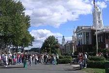
- Metro Center: features nearly all major cultural venues in the region.[48] Commercial, cultural, civic, and increasingly residential in character. Features the Downtown Business District, The Club Quarter—with more than 60 clubs, restaurants, and bars—numerous festivals, cultural institutions, educational institutions, and significant historic sites.
- North End: not technically a Springfield neighborhood, but rather three northern Springfield neighborhoods. Includes Brightwood, which is residential and medical in character, but cut off from the rest of the city by Interstate 91; Memorial Square, which is commercial in character; and Liberty Heights, which is medical and residential in character. In terms of demographics, the North End is predominantly Puerto Rican.
- Old Hill: features Springfield College. Residential in character. Bordering Lake Massasoit. Old Hill is primarily Latino.[49]
- Pine Point: features the headquarters of MassMutual, a Fortune 100 company. Primarily middle-class and residential in character.
- Six Corners: features Mulberry Street in the Ridgewood Historic District (established 1977);[50] the Lower Maple Historic District (established 1977);[51] and the Maple Hill Historic District, (established 1977).[52] Urban and residential in character.
- Sixteen Acres: features Western New England University and SABIS International School. Suburban in character. Includes much of Springfield's post-World War II suburban architecture.
- South End: features numerous Italian–American restaurants, festivals, and landmarks. Urban and commercial in character, this neighborhood was hard hit by the June 1, 2011, tornado. Includes the Naismith Memorial Basketball Hall of Fame; however, it is separated from it by Interstate 91.
- Upper Hill: features Wesson Park. Bordering Lake Massasoit. Residential in character. Located between Springfield College and American International College.
Demographics
| Historical population | |||
|---|---|---|---|
| Census | Pop. | %± | |
| 1790 | 1,574 | — | |
| 1800 | 2,312 | 46.9% | |
| 1810 | 2,767 | 19.7% | |
| 1820 | 3,914 | 41.5% | |
| 1830 | 6,784 | 73.3% | |
| 1840 | 10,985 | 61.9% | |
| 1850 | 11,766 | 7.1% | |
| 1860 | 15,199 | 29.2% | |
| 1870 | 26,703 | 75.7% | |
| 1880 | 33,340 | 24.9% | |
| 1890 | 44,179 | 32.5% | |
| 1900 | 62,059 | 40.5% | |
| 1910 | 88,926 | 43.3% | |
| 1920 | 129,614 | 45.8% | |
| 1930 | 149,900 | 15.7% | |
| 1940 | 149,554 | −0.2% | |
| 1950 | 162,399 | 8.6% | |
| 1960 | 174,463 | 7.4% | |
| 1970 | 163,905 | −6.1% | |
| 1980 | 152,319 | −7.1% | |
| 1990 | 156,983 | 3.1% | |
| 2000 | 152,082 | −3.1% | |
| 2010 | 153,060 | 0.6% | |
| Est. 2019 | 153,606 | [9] | 0.4% |
| : * population estimate. [53] [54][55] | |||
According to the 2010 Census, Springfield had a population of 153,060, of which 72,573 (47.4%) were male and 80,487 (52.6%) were female. 73.0% of the population were over 18 years old, and 10.9% were over 65 years old; the median age was 32.2 years. The median age for males was 30.2 years and 34.1 years for females.
According to the 2010 Census, there were 61,706 housing units in Springfield, of which 56,752 were occupied. This was the highest average of home occupancy among the four distinct Western New England metropolises (the other three being Hartford, New Haven, and Bridgeport, Connecticut). Also as of 2010, Springfield features the highest average homeowner occupancy ratio among the four Western New England metropolises at 50%—73,232 Springfielders live in owner-occupied units, versus 74,111 in rental units. By comparison, as of the 2010 Census, New Haven features an owner occupancy rate of 31%; Hartford of 26%; and Bridgeport of 43%.[56]
In terms of race and ethnicity, Springfield is 51.8% White, 22.3% Black or African American, 0.6% American Indian and Alaska Native, 2.4% Asian (1.2% Vietnamese, 0.3% Chinese, 0.2% Indian, 0.1% Cambodian, 0.1% Filipino, 0.1% Korean, 0.1% Pakistani, 0.1% Laotian), 0.1% Native Hawaiian and Other Pacific Islander, 18.0% from Some Other Race, and 4.7% from Two or More Races (1.5% White and Black or African American; 1.0% White and Some Other Race). Hispanics and Latinos of any race made up 38.8% of the population (33.2% Puerto Rican, 1.7% Dominican, 1.0% Mexican, 0.5% Guatemalan, 0.3% Cuban, 0.2% Colombian, 0.2% Spanish, 0.2% Salvadoran, 0.1% Peruvian, 0.1% Ecuadorian, 0.1% Panamanian, 0.1% Costa Rican, 0.1% Honduran).[57] Non-Hispanic Whites were 36.7% of the population in 2010,[58] down from 84.1% in 1970.[59]
| Racial composition | 2010[58] | 1990[60] | 1970[60] | 1940[60] |
|---|---|---|---|---|
| White | 51.8% | 68.5% | 87% | 97.9% |
| —Non-Hispanic | 36.7% | 63.6% | 84.1%[61] | − |
| Black or African American | 22.3% | 19.2% | 3.3% | 2.1% |
| Hispanic or Latino (of any race) | 38.8% | 16.9% | 3.3%[61] | − |
| Asian | 2.4% | 1% | 0.1% | − |
Income
Data is from the 2009–2013 American Community Survey 5-Year Estimates.[62][63][64]
| Rank | ZIP Code (ZCTA) | Per capita income |
Median household income |
Median family income |
Population | Number of households |
|---|---|---|---|---|---|---|
| Massachusetts | $35,763 | $66,866 | $84,900 | 6,605,058 | 2,530,147 | |
| 1 | 01128 | $33,573 | $78,864 | $86,964 | 2,468 | 964 |
| United States | $28,155 | $53,046 | $64,719 | 311,536,594 | 115,610,216 | |
| 2 | 01129 | $26,752 | $61,435 | $67,083 | 7,505 | 2,892 |
| Hampden County | $25,817 | $49,094 | $61,474 | 465,144 | 177,990 | |
| 3 | 01119 | $21,261 | $46,055 | $58,458 | 13,962 | 4,831 |
| 4 | 01108 | $18,347 | $34,064 | $35,083 | 25,755 | 9,348 |
| Springfield | $18,133 | $34,311 | $39,535 | 153,428 | 55,894 | |
| 5 | 01104 | $17,307 | $32,273 | $39,475 | 23,083 | 8,884 |
| 6 | 01103 | $17,095 | $14,133 | $17,457 | 2,556 | 1,553 |
| 7 | 01151 | $16,169 | $30,043 | $28,415 | 9,134 | 3,410 |
| 8 | 01109 | $13,938 | $33,376 | $36,737 | 31,429 | 9,555 |
| 9 | 01107 | $12,440 | $21,737 | $29,199 | 11,271 | 3,920 |
| 10 | 01105 | $12,137 | $18,402 | $21,345 | 12,360 | 4,836 |
Economy
Distribution of Greater Springfield NECTA Labor Force (2016)[65]
| Top Springfield companies for 2018 (ranked by revenues) with City and U.S. ranks Source: Fortune 500[66] | |||||||
| Spfld. | Corporation | US | Revenue (in millions) | ||||
| 1 | MassMutual | 93 | $33,495.4 | ||||
| 2 | Eversource Energy | 364 | $7,752 | ||||
| Top City Employers Source: MA Executive Office of Labor and Workforce Development[67] | |||||||
| Rank | Company/Organization | ||||||
| 1 | Baystate Medical Center | ||||||
| 2 | Smith & Wesson | ||||||
| 3 | General Dynamics | ||||||
| 4 | MassMutual | ||||||
| 5 | Mercy Medical Center | ||||||
| 6 | U.S. Postal Service | ||||||
| 7 | Big Y Foods | ||||||
| 8 | Massachusetts Trial Court | ||||||
| 9 | Springfield Republican | ||||||
| 10 | Springfield College | ||||||
Springfield's vicinity to both Boston and New York City lends it a location well suited for distribution, and in the past this has played a significant role in its economy. For this reason in the early 20th century it was the largest producer in New England of commercially produced cakes and pastries, and among the largest in bread—with one 1926 estimate of 1.4 million loaves of bread and 14 million breakfast rolls produced in the city on a weekly basis.[68]
Today Springfield's top five industries (in order, by number of workers) are: Education and Health Services; Trade and Transportation; Manufacturing; Tourism and Hospitality; and Professional & Business Services. Springfield is considered to have a "mature economy", which protects the city to a degree during recessions and inhibits it somewhat during bubbles.[69] Springfield is considered to have one of America's top emerging multi-cultural markets—the city features a 33% Latino population with buying power that has increased over 295% from 1990 to 2006. As of 2006, more than 60% of Hispanic Springfielders had arrived in the city since 1986.[70]
With 25 universities and colleges within a 15-mile (24 km) radius from Springfield, including several of America's most prestigious universities and liberal arts colleges, and more than six institutions within the city itself, the Hartford–Springfield metropolitan area has been dubbed the Knowledge Corridor by regional educators, civic authorities, and businessmen—touting its 32 universities and liberal arts colleges, numerous highly regarded hospitals, and nearly 120,000 students. The Knowledge Corridor universities and colleges provide the region with an educated workforce, which yields a yearly GDP of over $100 billion—more than at least 16 U.S. States. Hartford–Springfield has become home to a number of biotech firms and high-speed computing centers. As of 2009 Springfield ranks as the 24th most important high-tech center in the United States with approximately 14,000 high-tech jobs.[71]
In 2010,[72] the median household income was $35,236. Median income for the family was $51,110. The per capita income was $16,863. About 21.3% of families and 26.8% of the population were below the poverty line, including 40.0% of those under age 18 and 17.5% of those age 65 or over.
Business headquarters
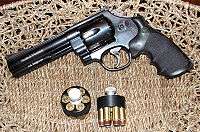
The City of Springfield is the economic center of Western Massachusetts. It features the Pioneer Valley's largest concentration of retail, manufacturing, entertainment, banking, legal, and medical groups. Springfield is home to the Commonwealth of Massachusetts' largest Fortune 100 company, MassMutual Financial Group. It is also home to the world's largest producer of handguns, Smith & Wesson, founded in 1852. It is home to Merriam Webster, the first and most widely read American–English dictionary, founded in 1806. It also serves as the headquarters of the professional American Hockey League, the NHL's minor league, Peter Pan Bus, and Big Y Supermarkets, among other businesses.
Springfield is also home to the Commonwealth of Massachusetts' third largest employer, Baystate Health, with over 10,000 employees. Baystate is the western campus of Tufts University School of Medicine.[74] Baystate Health is in the midst of a $300 million addition; nicknamed "The Hospital of the Future", it is the largest construction project in New England.[75] In addition to Baystate, Springfield features two other nationally ranked hospitals; Mercy Medical, run by The Sisters of Providence, and Shriners Hospital for Children. The following companies maintain their headquarters in Springfield:
- The American Hockey League: the primary development league for the NHL.
- Baystate Health: Largest employer and healthcare provider in Western Massachusetts; 3rd largest employer in Massachusetts, constructing the $300 million "Hospital of the Future".[75]
- Big Y: a regional supermarket chain that was founded in nearby Chicopee, but is now headquartered in Springfield. Big Y operates more than 50 supermarkets throughout Massachusetts and Connecticut.
- Breck Shampoo: Founded in Springfield in 1936.
- Fenton's Athletic Supplies: Sporting goods provider founded in 1924.
- Hampden Bank: Founded in Springfield in 1852. Headquartered in Springfield.
- Health New England
- Massachusetts Mutual Life Insurance Company: Founded in 1851. MassMutual is the second largest Fortune 100 company based in Massachusetts (2010 list). The corporate headquarters are on State Street.
- Merriam-Webster: Publisher of the original Webster Dictionary[76]
- NuVo Bank: Founded in 2008. Headquartered in Springfield.
- Peter Pan Bus Lines: Headquartered in Metro Center, Peter Pan is moving its Springfield terminal and operations to Union Station as renovations are completed throughout 2017.[77]
- Smith & Wesson: Founded in 1852, Smith & Wesson is America's largest producer of handguns. The company maintains its corporate headquarters on Roosevelt Avenue in East Springfield.
Former companies
With a history spanning nearly four centuries, Springfield has been home to a number of legacy companies that were household names, including:
- Forbes & Wallace: Regional department store, closed in 1974
- Friendly Ice Cream Corporation: Founded in Springfield, headquartered in the Springfield suburb of Wilbraham, Massachusetts.
- Good Housekeeping: Founded in Holyoke in 1885, and published in Springfield from 1887 to 1911 before being moved to New York City with its purchase by the Hearst Corporation.
- Indian Motocycle Manufacturing Company: America's first motorcycle brand, was founded by George M. Hendee and C. Oscar Hedström in Springfield in 1901
- Milton Bradley Company: American game company established in 1860. Headquartered in Springfield until its relocation to suburban East Longmeadow, Massachusetts.
- Monarch Insurance: Founded in Springfield in 1901, filed for bankruptcy in 1991, soon after completing Springfield's tallest skyscraper, Monarch Place.
- Rolls-Royce: Rolls-Royce of America Inc. was formed in 1919 to meet the growing U.S. luxury car market. A manufacturing plant was set up on Hendee Street in Springfield, Massachusetts, at the former 'American Wire Wheel Company' building. Over the years, the factory's 1,200 employees produced 1,703 Silver Ghosts and 1,241 Phantoms, with the first Silver Ghost chassis finished in 1921. The 1929 stock market crash led to the plant's closure in 1931. Springfield is the only place outside Britain where Rolls-Royce luxury cars have ever been built.[78]
- Sheraton Hotels and Resorts: founded in Springfield in 1937 with the purchase of The Stonehaven Hotel, and later the Hotel Kimball.
- Springfield Armory: Founded by George Washington in 1777; began production of the M1 Garand in 1919, closed by the Pentagon in 1968.
- Wason Manufacturing Company, one founded in 1845, large railway livery manufacturer, first mass-producer of a sleeping car; closed 1932
Arts and culture
Amusement parks and fairs
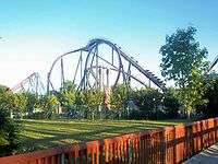
Within two miles (3 km) of Springfield are New England's largest and most popular amusement park, Six Flags New England, and its largest and most popular fair, The Big E. Six Flags New England, located across Springfield's South End Bridge in Agawam features Superman the Ride, a roller coaster that has ranked first or second every year since 2001 in the annual Golden Ticket Awards publication by Amusement Today. Six Flags New England also features a large water park, kid's rides, and an outdoor concert stadium, among numerous other attractions. It opens in mid-April and closes at the end of October.
The Eastern States Exposition ("The Big E") is located across Springfield's Memorial Bridge in West Springfield. The Big E serves as the New England states' collective state fair. The Big E is currently the sixth largest agricultural fair in America and brings in thousands of tourists each September–October. The Big E features rides, carnival food, music, and replicas of each of the six New England state houses, each of which is owned by its respective New England state. During the Big E, these state houses serve as consulates for the six New England states, and also serve food for which the states are known.
Cuisine
Springfield's mosaic of ethnic communities have long played a role in its culinary institutions, with many newer smaller restaurants and several decades-old establishments in its downtown.[48] Among its oldest institutions are Smith's Billiards, founded in 1902, which serves Theodore's Blues, Booze, & BBQ, a neighboring barbecue and music venue since 1979, recognized as the "Best Blues Club in the Country" in 2004 by the Blues Foundation. Other venues include The Student Prince Cafe, a long-running German restaurant at its downtown location since 1935, featured on Thrillist's 2014 Editor's Choice bars, and a wide array of long-running acclaimed Italian restaurants such as Frigo's (1950), The Red Rose (1963), and Leone's (1988) and pastry shops like La Fiorentina (1947).[79][80]
In recent decades the city has also become home to a number of cuisines not found elsewhere in the region, including Cajun restaurant Chef Wayne's Big Mamou,[81] Lebanese restaurant Nadim's Downtown,[82] local chain Puerto Rican Bakery,[83] and a host of other Greek, Jamaican, Mexican, and Vietnamese venues.[84]
Among the best known of Springfield's eateries outside the city is Friendly's, the East Coast restaurant chain whose first store was opened by the Blake brothers as "Friendly Ice Cream" in Springfield in 1935; their original location has since closed and today the chain maintains its headquarters in the neighboring town of Wilbraham.[85]
Festivals
- Hoop City Jazz Festival: an annual event sponsored by the Springfield-headquartered Hampden Bank, which in the past has featured Springfield native and jazz legend Taj Mahal, the Average White Band, and others. In 2011 the Hoop City Jazz Festival took place July 8–10 on Court Square, featuring a jazz tribute to the City of New Orleans.
- Basketball Hall of Fame Enshrinement Weekend: a week of events that culminates in the Basketball Hall of Fame's enshrinement ceremony. It features numerous VIP galas, awards dinners, and press conferences.[86] Enshrinement takes place in Springfield's Neo-Classical Symphony Hall on Court Square. In 2011, Enshrinement Weekend will take place August 11–13.
- Armory Big Band Concerts: annually each summer the Springfield Armory National Park and National Historic Site features 1940s big band concerts. The band dresses in period costumes, and free dance lessons are provided. In 2011, an Armory Big Band Concert will be held on July 9.[87]
- Springfield Gay Pride Week: Springfield celebrated its first gay pride event June 8–16, 2011. Events range from political roundtables, to film showings, to celebrations at local gay clubs. According to 2010 Census statistics, Springfield has experienced a dramatic rise in its LGBT population during the last decade, and this celebration is aimed at increasing the visibility and voice of the LGBT community and its allies.[88]
- Our Lady of Mount Carmel Society Festival: in Springfield's Italian South End, it is long-running tradition to celebrate Italian Feast Days, in particular during the summer. The largest of these festivals is the Our Lady of Mount Carmel Society festival, which features a parade, and numerous food stands offering all sorts of Italian foods, e.g. fried dough, pasta with meatballs or sausages, sausage and peppers, meatball and steak grinders, and sugar cones, cotton candy, candy apples and gelato. The festival takes place each year in mid-July.
- Stearns Square Concert Series and Bike Nights: annually from June through September on Thursday evenings from 7 to 10 p.m., Springfield sponsors free live music at Stearns Square, in the heart of Metro Center's Club Quarter. Hundreds and sometimes thousands of motorcyclists attend Bike Nights, which coincide with the Stearns Square Concerts.
- Mattoon Street Arts Festival: one of the largest annual art festivals in Springfield. In 2011, it will feature a record number of exhibitors when it takes place from September 10–11, 2011 in the Mattoon Street Historic District. The art festival takes place at the corner of Mattoon and Chestnut Streets, near the Apremont Triangle and Kimball Towers Luxury Condominiums.[89]
- Pioneer Valley Jewish Film Festival: each spring the Pioneer Valley Jewish Film Festival presents two weeks of films, renowned guest speakers, and events related to Jewish culture. In 2011, the festival took place from March 23 to April 11.[90]
- St. Patrick's Day Parade: 7 miles (11 km) north of Springfield's Metro Center, the small city of Holyoke, Massachusetts, stages the United States' second-largest annual St. Patrick's Day Parade (larger than Boston's and Chicago's, but slightly smaller than New York City's). In 2011, Holyoke's St. Patrick's Day Parade attracted over 400,000 revelers.[91]
- World's Largest Pancake Breakfast: annually, near the city's founding date (May 14) Springfield attempts to break the Guinness Book of World Records' mark for the largest number of pancakes served. 2011's event drew over 30,000 people to Main Street, where approximately 60,000 pancakes were served.[92]
- Star Spangled Springfield: annually on July 4, Springfield stages an evening of patriotism, pageantry and pyrotechnics. The evening begins in Court Square with a patriotic concert by the Springfield Symphony Orchestra and concludes with an elaborate fireworks display from the Memorial Bridge. Numerous hills and bluffs in Springfield afford views of the fireworks.
- Caribbean Festival: in general held in late August each year, Springfield's Caribbean Festival celebrates the culture of the West Indies, which has increased greatly in Springfield during recent years. Highlights of the festival include a parade, dancers, floats, Caribbean music, and even a fashion show celebrating traditional Caribbean-dress.[93]
- The Parade of Big Balloons: since 1991, the Parade of Big Balloons has helped to usher in the holiday season in Springfield. A 75-foot (23 m) inflatable "Cat in the Hat" and a dozen or more big balloons, bands, and colorful marching contingents parade through Springfield's Metro Center at 11 a.m. on the day after Thanksgiving. The Parade of Big Balloons starts in the city's North End and make its way down Main Street to the South End, entertaining crowds estimated at 75,000. In general, this parade is broadcast by local TV and radio affiliates.
- Bright Nights: during the holiday season, over 600,000 lights illuminate a 2.5-mile (4.0 km) driving tour of Frederick Law Olmsted's Forest Park. Since its inception in the 1990s, the event has become a national attraction. From the new "Poinsettia Fantasy" entry to the giant Poinsettia Candles marking the exit, passengers in cars, vans, buses and campers drive by and through lighting displays including "Seuss Land", a display approved by the estate of Dr. Seuss, "Spirit of the Season", "Noah's Ark", "Victorian Village", "Barney Mansion", "Winter Woods", "North Pole Village", "Toy Land", and "Season's Greetings".
Museums
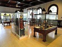
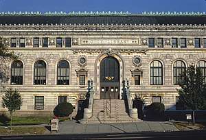
Springfield is home to five distinct museums at the Quadrangle, along with the ornate Springfield Public Library—an architecturally significant example of the City Beautiful movement. The Quadrangle's five distinct collections include the first American-made planetarium, designed and built (1937) by Frank Korkosz; the Dr Seuss National Memorial Sculpture Garden; the largest collection of Chinese cloisonne outside of China; and the original casting of Augustus Saint Gaudens's most famous sculpture, Puritan.
The Quadrangle's five museums are the Museum of Fine Arts, which features a large Impressionist collection; the George Walter Vincent Smith Art Museum, a collection of Asian curiosities; the Springfield Science Museum, which features a life-size Tyrannosaurus Rex, an aquarium and the United States' first planetarium; the Connecticut Valley Historical Museum, which, as visitors find out, is inextricably linked with American History; and the Museum of Springfield History, a museum about the multi-faceted city.[95]
Springfield's Indian Orchard neighborhood is home to the RMS Titanic Historical Society's Titanic Museum. Unlike Springfield's urban Quadrangle museums, the setting for Indian Orchard's Titanic Museum looks like 1950s suburbia. Inside 208 Main Street is displayed a collection of rare artifacts that tell stories about the ill-fated ocean liner's passengers and crew.[96]
Music
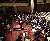
Classical music aficionados hold the progressive Springfield Symphony Orchestra in high esteem. The Springfield Symphony Orchestra performs in Springfield Symphony Hall, a venue known for its ornate, Greek Revival architecture and "perfect acoustics". The SSO's conductor is Kevin Rhodes.
Notable musicians from Springfield include blues legend Taj Mahal; the band Staind and its frontman Aaron Lewis; Linda Perry, former leader singer of 4 Non Blondes and songwriter and producer; Taj Mahal's sister, Carole Fredericks, a soul singer; numerous jazz musicians, including Joe Morello, drummer for the Dave Brubeck Quartet; Phil Woods, saxophonist for Quincy Jones; Tony MacAlpine, keyboardist and guitarist with Steve Vai; and Paul Weston, composer for Frank Sinatra, among many others.
In 2011, Springfield's music scene was eclectic. It featured a notable heavy rock scene, from which the bands Gaiah, Staind, All That Remains, Shadows Fall, and The Acacia Strain rose to national prominence. Jazz and blues rival rock in popularity. Each summer, the Springfield-headquartered Hampden Bank sponsors the annual Hoops City Jazz & Art Festival, a three-day event that draws approximately 30,000 people to Metro Center to hear varieties of different jazz music—from smooth jazz, to hard bop, to New Orleans-style jazz. Headliners have included Springfield great Taj Mahal, the Average White Band, and Poncho Sanchez.
Fifteen miles north in the college towns of Northampton and Amherst, there is an active independent and alternative rock scene. Many of these bands perform regularly in Springfield's Club Quarter, at venues such as Fat Cats Bar & Grille, Theodore's, and the restored Paramount Theater. In the Club Quarter, centered on Stearns Square, nightly offerings include blues, college rock, jazz, indie, hip-hop, jam band, Latin, hard rock, pop, metal, karaoke, piano bars, and DJs.
Each Thursday during the summer, a free concert is held at Stearns Square to coincide with Bike Night, a happening that in general attracts thousands of motorcyclists to the Quarter and thousands more spectators to hear live music.
Larger rock and hip-hop acts play at the 7,000-seat MassMutual Center. The arena has played host to artists such as Marilyn Manson, Alice Cooper, Nirvana, David Bowie, David Lee Roth, Poison, Pearl Jam, and Bob Dylan.
Nightlife
Springfield's Club Quarter is the nightlife capital of the Pioneer Valley and the Knowledge Corridor, featuring approximately 60 dance clubs, bars, music venues, LGBT venues, and after-hours establishments. In general, most clubs, bars, music venues, and other nightspots are located on or near upper Worthington Street, on and around Stearns Square, or on Chestnut Street.
Springfield's Club Quarter features a large (and growing) LGBT nightlife scene at establishments like Oz (397 Dwight Street), Pure (324 Chestnut Street), The Pub Lounge (382 Dwight Street), and Club Xtatic (240 Chesnut Street, featuring dancers). In 2011, LGBT magazine The Advocate ranked Springfield No. 13 among its "New Gay American Cities", ahead of San Diego and Albuquerque, New Mexico. There has been a notable increase in Springfield's LGBT nightlife since Massachusetts legalized gay marriage in 2004.
Points of interest
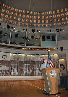
- Basketball Hall of Fame: housed in a $47 million structure designed by Gwathmey Siegel & Associates, it is a shrine to the world's second most popular sport, basketball. Located in the city where basketball was invented, the facility—built beside the Connecticut River—spans 80,000 square feet (7,400 m2) features numerous restaurants and the WMAS-FM studios. However, it is separated from Springfield's Metro Center by an eight-lane highway, Interstate 91.
- The Big E: also known as The Eastern States Exposition, it is New England's collective, annual state fair. Held on a permanent fairgrounds approximately 1.5 miles (2.4 km) west of Springfield's Metro Center, across the ornate Memorial Bridge in West Springfield, it attracts more than 1 million visitors per year during its 14- to 17-day run beginning in mid-September.
- Bright Nights: during the holiday season, Forest Park hosts a lighting display.
- City Stage: features off-Broadway productions, comedians, and children's programming.
- Club Quarter: a grouping of 60 clubs, bars, and restaurants around Stearns Square, Worthington and Main Streets. Springfield's variety of nightclubs and entertainment is part of what makes it, according to Yahoo!, one of America's ten best cities for dating.[97] LGBT and dance clubs are integrated with hip-hop, rock, jazz, and blues clubs. Thursday, Friday, and Saturday are particularly busy evenings.
- Connecticut River Walk Park: a landscaped park that snakes along the Connecticut River, affording views of the Mount Tom Range, Mount Holyoke Range, and Springfield's skyline. However, this park is separated from Springfield by the badly designed, eight-lane Interstate 91 highway, which cuts through three Springfield riverfront neighborhoods, and thus presents a major obstacle to accessing this riverfront park. In 2010, the Urban Land Institute released a plan for Springfield's riverfront, which has given Springfielders cause for hope that Interstate 91 will either be moved or made more easily passable via new design features that would allow people to access the River Walk and the Basketball Hall of Fame.[98][99][100]
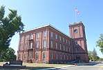
- Court Square: a park, referred to as "Springfield's front door", it remains the city's only topographical constant since its founding in 1636. Located on Main Street and surrounded by ornate architecture, including the iconic Springfield Municipal Group, Court Square is the civic heart of Springfield. Until the 1960s, Court Square extended to the Connecticut River; however, as with Olmsted's Forest Park, its connection to the river was severed by the building of the Interstate 91 elevated highway.
- Dr. Seuss National Memorial Sculpture Garden: amidst the Quadrangle, there are large, bronze statues of characters from Springfield native Dr. Seuss's books.
- First Game of Basketball Sculpture: located directly on the site of the first game of basketball, this illuminated sculpture in Springfield's Mason Square commercial district has become a site of pilgrimage for basketball fans from around the world.
- Forest Park: designed by Frederick Law Olmsted, the renowned landscape designer of New York City's Central Park, Springfield's Forest Park is nearly the same size as Central Park at 735 acres (297.4 ha). It features the Zoo at Forest Park; the 31 acres (12.5 ha) Porter Lake; numerous playgrounds; a formal rose garden; 38 tennis courts; a skating arena; numerous basketball and bocce courts; lawn bowling fields; Victorian promenades and water gardens; tree groves; baseball diamonds; numerous statues; an aquatic park; and the Barney Carriage House, where many weddings take place.
- King Philip's Stockade: a historic, city park where in 1675, the Pocumtuc Indians—organized by Chief Metacomet, also known as King Philip—initiated the Attack on Springfield during King Philip's War. During the attack, approximately 75% of the city was burned.
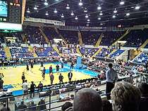
- MassMutual Center: formerly known as the Springfield Civic Center, this 8,000-seat arena and convention center received a $71 million renovation in 2003–2005. Located across from historic Court Square in Metro Center, the arena houses the American Hockey League's Springfield Thunderbirds. The venue also attracts big-name concert tours. In the past, it has hosted concerts by Nirvana, Pearl Jam, Van Halen, Marilyn Manson, The Eagles, and Bob Dylan, among many others.
- Mulberry Street: the street featuring the house that inspired Dr. Seuss's first children's book, the classic And to Think That I Saw It on Mulberry Street.
- The Puritan: a famous statue designed by Augustus Saint-Gaudens depicting Deacon Samuel Chapin, an early settler of Springfield. Originally located in Stearns Square, it has been located in Merrick Park in the Quadrangle for over 100 years and become a symbol of Springfield.
- The Quadrangle: a campus of five museums surrounding the Dr. Seuss National Memorial Sculpture Garden. It includes the Museum of Fine Arts, known for its Impressionist and Dutch Renaissance collections, as well as its collection of American masters, including works by Springfielder James McNeill Whistler. The Springfield Science Museum features the United States' first planetarium (built 1931), and a large dinosaur exhibit. The George Walter Vincent Smith Museum is known worldwide for housing the largest collection of Chinese cloisonne outside of China; it also features exotic curiosities like Asian suits of armor, and a collection of marble busts. The Quadrangle also features two regional history museums: the Connecticut Valley Historical Society, which tells the story of "The Great River" and its people, and the new Museum of Springfield History, which showcases the innovations that make Springfield "The City of Progress" during the abolitionist period and Industrial Revolution, which includes the first American–English dictionary, the first gasoline-powered car, the first successful motorcycle company, the first modern fire engine, and dozens of other firsts (see below for a more complete list).
- St. John's Congregational Church: founded in 1844 as the Sanford Street "Free Church", St. John's Congregational Church is a predominately black church that played a pivotal role in the abolitionist movement. While living in Springfield, John Brown attended services here from 1846 to 1850, and as of 2011, the church still displays John Brown's Bible. It was at this church where John Brown met Frederick Douglass, Sojourner Truth, and other prominent abolitionists—and where he later founded the militant League of Gileadites in response to the Fugitive Slave Act. As of 2011, St. John's remains one of the most prominent, predominately black congregations in the Northeastern United States.[101]
- St. Michael's Cathedral: beside the Quadrangle, this elegant Catholic Church is the seat of the Diocese of Greater Springfield.
- Stacy Building: the location where, in 1892–93, the Duryea Brothers built the first, American gasoline-powered car, which in 1895 won the first automobile race in Chicago, Illinois. A model of the Duryea Brothers' first car sits in a tree-shaded park beside the historic location, amidst the restaurants and bars of the Club Quarter.
- Six Flags New England: located 1 mile (1.6 km) west of Springfield's South End in Agawam, this amusement park is the largest in the Northeast and features a roller coaster, Superman the Ride.
- The Springfield Armory National Historic Site: founded by General George Washington and Henry Knox in 1777; the site of Shays' Rebellion in 1787, which led directly to the U.S. Constitutional Convention; the site of numerous technological innovations including the manufacturing advances known as interchangeable parts, the assembly line, and mass production; and the producer of the United States Military's firearms from 1794 to 1968, when the Armory was controversially shut down by Defense Secretary Robert McNamara. Today, it is a National Historic Site, and features a museum that includes one of the world's largest collections of firearms.[102]
- Springfield Cemetery: opened in 1841 and located in the heart of the city, it is designed in the scenic rural cemetery tradition. The cemetery is the final resting place of many pioneer settlers and noted individuals from Springfield and the region.
- Symphony Hall: dedicated in 1913 by President William Howard Taft as part of the Springfield Municipal Group, Springfield Symphony Hall features "perfect acoustics". It is home to the Springfield Symphony Orchestra conducted by showman Kevin Rhodes, and also hosts Broadway touring productions.
- Stearns Square: designed by the artistic team of Stanford White and Augustus Saint-Gaudens in 1897, this small park is the center of Springfield's Club Quarter.[103] It features ornate architectural and sculptural details from the original team's design; however, most of those were meant to accompany The Puritan, and thus moved to storage. Stearns Square hosts a large motorcycle gathering each Thursday evening, and is the site of a summer concert series.
Sports
Besides Springfield's historic connection with basketball, the city has a rich sporting history. Volleyball was invented in the adjacent city of Holyoke, and the first exhibition match was held in 1896 at the International YMCA Training School, now known as Springfield College.
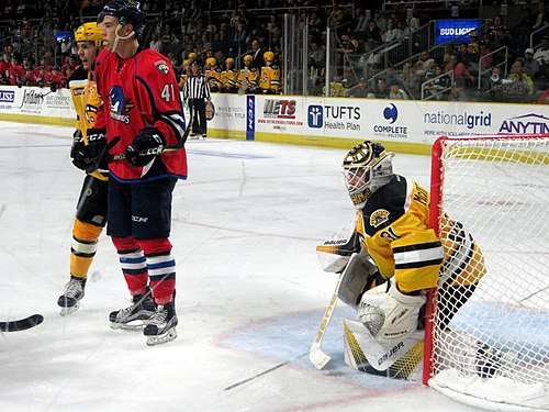
Ice hockey has been played professionally in Springfield since the 1920s, and Springfield is home to the league headquarters of the American Hockey League. The Springfield Indians of the American Hockey League (now located in Utica, New York) was the oldest minor league hockey franchise in existence. In 1994 the team relocated to Worcester and was replaced by the Springfield Falcons, who played at the MassMutual Center. The Falcons were then replaced by the Springfield Thunderbirds in 2016. For parts of two seasons (1978–80) the NHL Hartford Whalers played in Springfield while their arena was undergoing repairs after a roof collapse. On the amateur level, the Junior A Springfield Olympics played for many years at the Olympia, while American International College's Yellow Jackets compete in NCAA Division I hockey.
Basketball remains a popular sport in Springfield's sporting landscape. Prior to the 2014–15 season, Springfield was home to the Springfield Armor of the NBA Development League, which began play in 2009 at the MassMutual Center. Beginning in the 2011–12 season, the Armor was the exclusive affiliate of the Brooklyn Nets.[104] For many years, the Hall of Fame Tip-Off Classic has been the semi-official start to the college basketball season, and the NCAA Division II championships are usually held in Springfield. The Metro Atlantic Athletic Conference will play its championships in Springfield from 2012 to 2014.[105] The New England Blizzard of the ABL played its first game in Springfield, and several minor pro men's and women's teams have called the city home, including the Springfield Fame of the United States Basketball League (the league's inaugural champion in 1985) and the Springfield Hall of Famers of the Eastern Professional Basketball League.
Springfield has had professional baseball in the past, and according to its current mayor, remains intent on pursuing it in the future.[106] The Springfield Giants of the Single- and Double-A Eastern League played between 1957 and 1965. The team was quite successful, winning consecutive championships in 1959, 1960 and 1961, by startling coincidence the same seasons in which the Springfield Indians won three straight Calder Cup championships in hockey. The Giants played at Pynchon Park by the Connecticut River until relocating after the 1965 season. Pynchon Park's grandstands were destroyed by fire the year after in 1966.[107] Before that time, the Springfield Cubs played in the minor league New England League from 1946 until 1949, after which the league folded; they then played in the International League until 1953. For many years before the Giants, Springfield was also a member of the Eastern League, between 1893 and 1943. In general, the team was named the Ponies, but it also carried the nicknames of "Maroons" (1895), "Green Sox" (1917), "Hampdens" (1920–21), "Rifles (1932, 1942–43) and "Nationals" (1939–41). The team located closest are the Valley Blue Sox of the New England Collegiate Baseball League who play their games in nearby Holyoke, but house their team offices at 100 Congress Street in Springfield.
Springfield has an official roller derby team: Pair O' Dice City Roller Derby.[108] They are a non-profit organization which uses their roller derby games as fundraisers for groups such as Dakin Animal Shelter and the Shriners.
Architecture

%2C_Springfield%2C_Massachusetts.jpg)
In addition to its nickname The City of Firsts, Springfield is known as The City of Homes for its attractive architecture, which differentiates it from most medium-size, Northeastern American cities. Most of Springfield's housing stock consists of Victorian "Painted Ladies" (similar to those found in San Francisco); however, Springfield also features Gilded Age mansions, urban condominiums buildings, brick apartment blocks, and more suburban post-World War II architecture (in the Sixteen Acres and Pine Point neighborhoods). While Springfield's architecture is attractive, much of its built-environment stems from the 19th and early 20th centuries when the city experienced a period of "intense and concentrated prosperity"—today, its Victorian architecture can be found in various states of rehabilitation and disrepair. As of 2011, Springfield's housing prices are considerably lower than nearby New England cities which do not feature such intricate architecture.
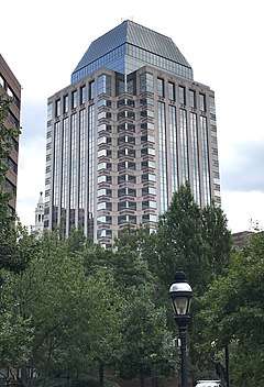
In Metro Center, stands the two prominent skyscrapers, Tower Square, and Monarch Place, the latter of which is the tallest building in Massachusetts outside of Boston. Many of the city's Victorian buildings including former hotels, factories, and other institutions have been converted into apartment buildings and luxury condominiums. For example, Springfield's ornate Classical High School (235 State Street), with its immense Victorian atrium—where Dr. Seuss, Timothy Leary, and Taj Mahal all went to high school—is now a luxury condominium building. The Hotel Kimball, (140 Chestnut Street), which hosted several U.S. Presidents as guests and once featured the United States' first commercial radio station (WBZ), has been converted into The Kimball Towers Condominiums.[109] The former McIntosh Shoe Company (158 Chestnut Street), one of Springfield's finest examples of the Chicago School of Architecture, has been converted into industrial-style condominiums; and the red-brick, former Milton Bradley toy factory is now Stockbridge Court Apartments (45 Willow Street). In the Ridgewood Historic District, the 1950s-futurist Mulberry House (101 Mulberry Street), is now a condominium building that features some of the finest views of Springfield.
Forest Park (and Forest Park Heights), surrounding Frederick Law Olmsted's 735 acres (297.4 ha) Forest Park, is a New England Garden District featuring more than 600 Victorian Painted Ladies. The McKnight National Historic District, America's first planned residential neighborhood, (1881), features more than 900 Victorian Painted Ladies, many of which have been rehabilitated by Springfield's growing LGBT community. The Old Hill, Upper Hill, and Bay neighborhoods also feature this type of architecture.
Maple High, which is architecturally (and geographically) distinct from, but often included with Springfield's economically depressed Six Corners neighborhood, was Springfield's first "Gold Coast". Many mansions from the early 19th century and later gilded age stand atop a bluff on Maple Street, overlooking the Connecticut River. The Ridgewood Historic district on Ridgewood and Mulberry Streets also feature historic mansions from the 19th and early 20th centuries.
Springfield—like many mid-size Northeastern cities, e.g., Hartford, Albany, and New Haven—from the 1950s to the 1970s, razed a significant number of historic commercial buildings in the name of urban renewal. In 1961, this included Unity Church, the first building designed by the young Henry Hobson Richardson.[110] Springfield's Metro Center remains more aesthetically cohesive than many its peer cities; however, as elsewhere, the city currently features a patchwork of parking lots and grand old buildings. Current efforts are underway to improve the cohesion of Springfield's Metro Center, including the completed Main Street and State Street Corridor improvement projects, the upcoming $70 million renovation to Springfield's 1926 Union Station and the renovation of the Epiphany Tower on State Street into a new hotel. New constructions include the architecturally award-winning, $57 million Moshe Safdie-designed Federal Building on State Street.[111]
Parks
In 2010, Springfield was cited as the fourth "Greenest City" in the United States—the largest city cited in the Top 10. The recognition noted Springfield's numerous parks, the purity of its drinking water, its regional recycling center, and organizations like ReStore Home Improvement Center, which salvages building materials.[112] Springfield features over 2,400 acres (10 km2) of parkland distributed among 35 urban parks, including the grand, 735 acres (297.4 ha) Forest Park. Well-known parks include the following, among others:
- Apremont Triangle Park is a triangular, pocket park in front of Springfield's historic Kimball Towers in Metro Center. Named for Springfield's 104th Infantry Regiment, which following the World War I Battle of Apremont, became the first U.S. military unit awarded for heroism by a foreign power, receiving France's highest military honor: the croix de guerre for bravery in combat. The same Springfield unit received the same honor again in World War II. Apremont Triangle Park, steps from both the bohemian Kimball Towers and upper-class Quadrangle-Mattoon Street Historic District offers a place to sit amidst the restaurants on the northern fringe of the Club Quarter.[113]
- Armoury Commons is a rectangular park just south of the Springfield Armory, located at the corner of Pearl and Spring Streets in Metro Center. Renovated in 2009, Armoury Commons features several sculptures, including Pynchon Park's original sculpture. The park is often used as a place to play chess and other games.
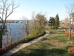
- Connecticut River Walk Park is a narrow, landscaped park that snakes along the scenic Connecticut River for several miles. Beginning near the Basketball Hall of Fame, it features jogging trails, benches, boat docks, and plazas—all of which afford scenic vistas of the Connecticut River and Connecticut River Valley. However, Interstate 91's position, height, and ancillary structures—including a 1756-car, below-grade parking lot, (the largest in the city, ) and 20-foot (6 m) stone walls block all views of the Connecticut River, and all but three passages to the park from Metro Center. Despite Springfield's rating as one of the most walkable cities in the U.S., due to the poor planning of I-91, this park can be difficult to reach on foot.[114]
- Court Square has been Springfield's one topographical constant since colonial days—it is located in Metro Center. Featuring monuments to Springfield's hero during King Philip's War of 1675, Miles Morgan; President William McKinley; and a Civil War memorial Court Square is surrounded by extraordinarily fine architecture, including H.H. Richardson's Richardsonian Romanesque Courthouse; the Springfield Municipal Group featuring the Greek Revival City Hall, Symphony Hall, and the 300-foot (91 m) Italianate Campanile; and also the 1819 reconstruction of the 1638 Old First Church. Other buildings included are the One Financial Plaza skyscraper, UMass Amherst's Urban Design Studio in the Byers Block (b. 1835); and, across Main Street, the MassMutual Center arena and convention center.
- Five Mile Pond is a Naturalist park and pond approximately 5 miles (8 km) from Springfield's Metro Center in the Pine Point neighborhood of Springfield. There are several, glacial lakes in the Five Mile Pond area, including Lake Lorraine, Loon Pond, and Long Pond. Five Mile Pond is popular with boaters.
- Forest Park is one of the United States' largest urban parks (at 735 acres (297.4 ha)) and also one of its most historically important urban parks. Designed by Frederick Law Olmsted—the famed designer of New York City's Central Park—Forest Park is nearly as large, and similarly diverse. Amenities include the Zoo at Forest Park, which features many exotic animals; the United States' first public swimming pool (1899); numerous playgrounds; an ice-skating rink; a formal rose garden; the 31 acres (12.5 ha) Porter Lake, which features fishing and paddle-boating; 38 tennis courts; numerous basketball and bocce courts; lawn bowling fields; Victorian promenades and water gardens; dozens of hiking and walking trails; an aquatic park; numerous sculptures; and the Carriage House of Springfielder Everett Hosmer Barney, the man who invented the ice skate and popularized the roller skate during the 19th century. During the holiday season, Forest Park hosts the nationally renowned lighting display, "Bright Nights".
- King Philip's Stockade is an historic park, famous as the site where Native Americans organized the 1675 Sack of Springfield; The Stockade features numerous picnic pavilions, excellent views of the Connecticut River Valley, and a sculpture of The Windsor Indian, who tried in vain to warn the residents of Springfield of coming danger.[115]
- Leonardo da Vinci Park is a small greenspace (0.4 acres), located in the historically Italian South End of Springfield. It features ornamental perimeter fencing surrounding a playground. Leonardo da Vinci Park was renovated in 2009 and now features new picnic tables and playground equipment.
- Pynchon Park is an architecturally interesting brutalist-style city park, which was dedicated in 1977. It links Springfield's Metro Center with the Quadrangle cultural grouping, (the museums and sculptures sit atop a steep bluff). Mostly made of poured concrete, but featuring a waterfall, lush greenery, and fountains, Pynchon Park received numerous accolades from the American Institute of Architecture for "enhancing the quality of the urban environment in the core of the city". It features two levels and a distinctive elevator.[106]
- Stearns Square is a rectangular park between Worthington Street and Bridge Street in Springfield's Club Quarter, located in Metro Center. Designed by the creative 'dream-team' of Stanford White and Augustus Saint-Gaudens. It was there that St. Gaudens' most famous work, The Puritan, originally stood. The Puritan has since been moved to the Quadrangle, at the corner of State and Chestnut Streets; however, White's and St. Gaudens' original fountain, bench, and turtle sculptures, all meant to complement The Puritan, remain in Stearns Square.
- Van Horn Park is a large park in the Hungry Hill section of Liberty Heights in Springfield. It features two ponds and a reservoir. The Reservoir and lower dam are not generally accessible to the public. The Main Entrance is on Armory Street near Chapin Terrace.
Government

| County-level state agency heads | |
|---|---|
| Clerk of Courts: | Laura S. Gentile (D) |
| District Attorney: | Anthony Gulluni (D) |
| Register of Deeds: | Cheryl Coakley-Rivera (D) |
| Register of Probate: | Suzanne Seguin (I) |
| County Sheriff: | Nicholas Cocchi (D) |
| State government | |
| State Representative(s): | Michael Finn (D-West Springfield) Thomas Petrolati (D-Ludlow) |
| State Senator(s): | James T. Welch (D-West Springfield) Eric Lesser (D-Longmeadow) |
| Governor's Councilor(s): | Mary Hurley (D) |
| Federal government | |
| U.S. Representative(s): | Richard Neal (D-1st District), |
| U.S. Senators: | Elizabeth Warren (D), Ed Markey (D) |
City of Springfield
Springfield employs a strong-mayor form of city government. Springfield's mayor is Domenic J. Sarno, who has been serving since 2008.
The city's governmental bureaucracy consists of 33 departments, which administer a wide array of municipal services, e.g. police, fire, public works, parks, public health, housing, economic development, and the Springfield Public School System, New England's 2nd largest public school system.[116]
Springfield's legislative body is its City Council, which features a mix of eight ward representatives—even though the city has more than twice that many neighborhoods, resulting in several incongruous "wards"—and five at-large city representatives, several of whom have served for well over a decade.
The Springfield Fire Department provides fire protection and emergency medical services to the city and holds the distinction of being one of the oldest established fire departments in the United States.[117]
Finances
In 2003, the City of Springfield was on the brink of financial default, and thus taken over by a Commonwealth-appointed Finance Control Board until 2009. Disbanded in June of that year, the Control Board made great strides stabilizing Springfield's finances.[118] While Springfield has achieved balanced budgets since 2009, the city has not enlarged its tax base, and thus many of its public works projects—which have been in the pipeline for years, some even decades—remain unfinished (e.g., repairs to Springfield's landmark Campanile).[119] The construction of MGM Springfield, which opened in 2018, fueled a number of projects in the years leading up to and after its opening, with an estimated $3 billion of new development and infrastructure spending materializing.[120]
Building off of the work of the Control Board, the city's finances have remained stable under Mayor Domenic J. Sarno's (2008–present) despite the Great Recession and several natural and man made disasters: June 1, 2011, tornado Springfield Tornado, Hurricane Irene, a freak October snow storm (which in some ways was more damaging than the tornado),[121] and a large gas explosion in the downtown area in 2012. The city has recovered, however receiving a bond upgrade from Standard and Poor's Investment Services and the GFOA's Distinguished Budget Award for six consecutive years.
Judicial system
Like every other municipality in Massachusetts, Springfield has no judicial branch itself. Rather, it uses the Springfield-based state courts, which include Springfield district court and Hampden County Superior Court, both of which are based in Springfield. The Federal District Court also regularly hears cases in Springfield—now in an architecturally award-winning building on State Street, constructed in 2009.
Politics
| Voter Registration and Party Enrollment as of February 1, 2017[122] | |||||
|---|---|---|---|---|---|
| Party | Number of Voters | Percentage | |||
| Democratic | 53,416 | 51.24% | |||
| Republican | 7,952 | 7.63% | |||
| Unaffiliated | 41,643 | 39.95% | |||
| Minor Parties | 1,230 | 1.18% | |||
| Total | 104,241 | 100% | |||
Springfield became a city on May 25, 1852, by decree of the Massachusetts Legislature, after a decade-long internal dispute that resulted in the partition of Chicopee from Springfield, and thus the loss of two fifths of the city's population.
Springfield, like all municipalities in Massachusetts, enjoys limited home rule. The current city charter, in effect since 1959, uses a "strong mayor" government with most power concentrated in the mayor, as in Boston and elsewhere. The mayor representing the city's executive branch presents the budget, appoints commissioners and department heads, and in general runs the city. The mayor is former City Councilor Domenic Sarno, elected November 6, 2007, by a margin of 52.54% to 47.18% against incumbent Charles Ryan. He took office in January 2008. In November 2009 and 2011, Sarno won reelection, albeit—in the latter case—with just 22% of eligible Springfield voters voting.[123]
The Springfield City Council, consisting of thirteen members, is the city's legislative branch. Elected every odd numbered year, eight of its members are elected to represent "wards", which are made of (sometimes incongruous) groupings of Springfield neighborhoods, e.g. Springfield's ethnic North End neighborhoods—Memorial Square and Brightwood—share a ward with Metro Center, Springfield's downtown. Five city council members are elected at-large. The City Council passes the city's budget, holds hearings, creates departments and commissions, and amends zoning laws.
The mayor's office and city council chambers are located in city hall—part of the Municipal Group in Metro Center, Springfield. The Finance Control Board met there as well.
Switch to ward representation
| Springfield City Councilors 2018–2019[124][125][126] |
|---|
|
In the past, efforts have been made to provide each of the city's eight wards a seat in the city council, instead of the current at-large format. There would still be some at-large seats under this format. The primary argument for this has been that City Councilors live in only four of the city's wards. An initiative to change the composition failed to pass the City Council twice. In 2007 Mayor Charles V. Ryan and City Councilor Jose Tosado proposed a home-rule amendment that would expand the council to thirteen members adding four seats to the existing nine member at large system, but allocated between eight ward and five at large seats. This home-rule petition was adopted by the City Council 8–1, and was later passed by the State Senate and House and signed by the Governor. On election day, November 6, 2007, city residents voted overwhelmingly in favor of changing the City Council and School Committee. The ballot initiative that established a new council with five at-large seats and eight ward seats passed 3–1. On November 3, 2009, Springfield held its first ward elections in 50 years.
Crime
In 2010, Springfield ranked 35th in the United States' City Crime Rankings—its second-lowest ranking in recent years, (in 2009, it ranked 51st). Springfield's 2010 crime rating of 142 is down approximately 50% from its heights in the late 1990s and 2000s.[127]
The Urban Land Institute stated in 2010 that "the perception of crime [in Springfield] appears to be worse than the reality".[128]
By another measure, crime and population data collected by the FBI, and indexed by NeighborhoodScout showed between 2010 and 2018 the violent crime rate for Springfield decreased by approximately 52.5%, whereas the property crime rate declined by 54%; both rates remain more than twice their respective state averages, as of 2018.[129][130]
Education
Grade schools
Public schools (K–12)
Springfield has the second largest school district in Massachusetts and in New England. It operates 38 elementary schools, six high schools, six middle schools (6–8) and seven specialized schools. The main high schools in the city include the High School of Commerce, Springfield Central High School, Roger L Putnam Vocational-Technical High School, and the Springfield High School of Science and Technology, better known as Sci-Tech. There are also two charter secondary schools in the City of Springfield: SABIS International, which ranks among the top 5% of high schools nationally in academic quality, and the Hampden Charter School of Science. The city's School Committee passed a new neighborhood school program to improve schools and reduce the growing busing costs associated with the current plan. The plan faces stiff opposition from parents and minority groups who claim that the schools are still unequal. The city is required under a 1970s court order to balance schools racially, which had necessitated busing. However, since then, the city and the school's population has shifted and many of the neighborhoods are more integrated, calling into question the need for busing at all. Though the plan is likely to be challenged in court, the state Board of Education decided it did not have authority to review it, sidestepping the volatile issue while effectively condoning it. In June 2015, Massachusetts Governor Charlie Baker announced $3.2 million in grants to three underperforming middle schools in Springfield.[131]
Private schools
The Roman Catholic Diocese of Springfield operated five Catholic elementary schools in the city, all of which were consolidated into a single entity, St. Michael's Academy, in the autumn of 2009.[132] The non-denominational Pioneer Valley Christian School is located in the suburban Sixteen Acres neighborhood, educating K–12. Non-sectarian elementary schools within the City of Springfield include the Pioneer Valley Montessori School in Springfield's Sixteen Acres neighborhood and Orchard Children's Corner in suburban Indian Orchard, a Pre-Kindergarten, among others.
The diocese runs Cathedral High School, which is the largest Catholic high school in Western Massachusetts. A non-denominational Christian school, the Pioneer Valley Christian Academy, is located in the suburban Sixteen Acres neighborhood of the city.[133] Two nonsectarian private schools are also located in Springfield: Commonwealth Academy[134] located on the former campus of the MacDuffie School (which moved to Granby, Massachusetts, in 2011 after 130 years in Springfield), and teaches grades four through twelve, soon to enroll students in grades K–12; and the Academy Hill School,[135] which teaches kindergarten through grade eight.
Within 15 miles (24 km) of Springfield are many private prep schools, which can serve as day schools for Springfield students; they include the Williston Northampton School in Easthampton, Massachusetts; Wilbraham & Monson Academy in Wilbraham, Massachusetts; and Suffield Academy in Suffield, Connecticut.
Higher education
Universities and colleges
The Knowledge Corridor boasts the second-largest concentration of higher learning institutions in the United States, with 32 universities and liberal arts colleges and over 160,000 university students in Greater Hartford–Springfield. This includes two college consortia, the Five Colleges, and the Cooperating Colleges of Greater Springfield, whose member institutions often collaborate in greater outreach programs. Within 16 miles (26 km) of Springfield's Metro Center, there are 18 universities and liberal arts colleges, which enroll approximately 100,000 students.[136]
As of 2015, Springfield attracts over 20,000 university students per year. Its universities and colleges include Western New England University; Springfield College, famous as the birthplace of the sport of basketball (1891) and the nation's first physical education class, (1912); American International College, founded to educate America's immigrant population, is notable as the inventor of the Model Congress program. UMass Amherst relocated its urban design center graduate program to Court Square in Metro Center.[137]
Several of Greater Springfield's institutions rank among the most prestigious in the world. For example, Amherst College, 15 miles (24 km) north of Springfield, and Smith College, 13 miles (21 km) north of Springfield, consistently rank among America's top 10 liberal arts colleges. Mount Holyoke College—the United States' first women's college—consistently ranks among America's Top 15 colleges, and it is located only 9 miles (14 km) north of Springfield. Hampshire College is located 14 miles (23 km) north of Springfield. The 30,000-student University of Massachusetts Amherst is located 16 miles (26 km) north of Springfield. Approximately 10 miles (16 km) west of Springfield, across the Memorial Bridge in Westfield, is Westfield State University, founded by noted education reformer Horace Mann. Westfield was the first university in America to admit students without regard to sex, race, or economic status.[138]
Just outside Springfield's northern city limits is Elms College, a Catholic college. Likewise, just 2 miles (3.2 km) below Springfield's southern city limit in Longmeadow is Bay Path University; both schools were once all-women but are now co-ed.
Community colleges
In 1968, following the Pentagon's controversial closing of the Springfield Armory, Springfielders founded Springfield Technical Community College on 35 acres (14.2 ha) behind the Springfield Armory National Park. Springfield Technical Community College is the only polytechnic community college in Massachusetts, and was founded to continue Springfield's tradition of technical innovation.[139]
Holyoke Community College, 8 miles (13 km) north of Springfield, offers more traditional community college programming in Greater Springfield, as well as instruction in the culinary arts.
Library
Efforts to establish the Springfield Public Library began in the 1850s.[140][141] In fiscal year 2008, the city of Springfield spent 1.13% ($5,321,151) of its budget on its public library—some $35 per person.[142] In fiscal year 2009, Springfield spent about 1% ($5,077,158) of its budget on the library—some $32 per person.[143] Springfield has Massachusetts' 2nd largest library circulation, behind Boston.
As of 2012, the public library purchases access for its patrons to databases owned by the following companies:[144]
- EBSCO Industries
- Foundation Center
- Gale, of Cengage Learning
- Infobase Publishing
- LearningExpress, LLC
- Merriam-Webster, Inc.
- NewsBank, Inc.
- Oxford University Press
- ProQuest (products include Massachusetts Newsstand)
Media

Newspapers
Springfield's largest local newspaper is The Republican, with has also previously been known as the Springfield Union-News & Sunday Republican, from when it merged with the Springfield Union. Smaller papers such as The Reminder and the Valley Advocate also serve Greater Springfield.
Other newspapers serve specific communities of interest, such as El Pueblo Latino and El Sol Latino, which serve the Hispanic community, as well as Unity First and the AfAm Point of View,[145] both of which serve the African-American community, and The Rainbow Times, which serves Springfield's LGBT community.
Television
Springfield has a long history of broadcast television, including two of the oldest UHF television stations on the air today.
| Channel (digital/virtual) | Call sign | Network | Owner |
|---|---|---|---|
| 11/22 | WWLP | NBC/CW (through The CW Plus) (DT2) Ion Television (DT3) |
Nexstar Media Group |
| 21/3.5 | WSHM-LD | CBS | Meredith Corporation |
| 22/57 | WGBY | PBS | WGBH Educational Foundation |
| 28/22 | WFXQ-CD | NBC++ | Nexstar Media Group |
| 34 | WTXX-LD | Independent | Tyche Broadcasting |
| 40 | WGGB | ABC, FOX/MyNetworkTV (DT2) | Meredith Corporation |
| 43 | WHTX-LP | Univision | Entravision Communications |
++WFXQ-CD rebroadcasts WWLP.
- WWLP-TV, UHF 22 (Digital 11). WWLP-TV is the NBC affiliate for the area, and also carries subchannel affiliations with The CW and Ion Television. WWLP-TV is owned and operated by the Nexstar Media Group, and maintains studios in nearby Chicopee (where the station moved from their old studios atop Provin Mountain). WWLP is the oldest TV station to air regularly scheduled programming in the market, launching its schedule on March 17, 1953, on Channel 61. WWLP also operated WRLP (UHF 32), a UHF station licensed to Greenfield, whose transmitter was in Winchester, New Hampshire, as well as W69AQ (UHF 69), a low power station that transmitted from the WWLP tower on Provin Mountain. WWLP remains the only full-power station in the market with an analog television signal on the air.
- WGGB, UHF 40 (Digital 40). WGGB is the ABC and primary Fox, secondary MyNetworkTV affiliate for the area. WGGB is owned and operated by the Meredith Corporation and its studios are on Liberty Street near the Chicopee line. WGGB (originally WHYN) signed on on April 1, 1953, on Channel 55. In 1958, WHYN switched to UHF 40. Guy Gannett Broadcasting bought the station in 1979 and changed its call sign to the current WGGB-TV effective at the start of the following year. In 2008, WGGB launched a secondary service called "Fox 6", named after its channel position on the local Comcast cable TV lineup. FOX6 also appears on WGGB's DTV sub-channel 40.2. WGGB's analog television signal signed off permanently in late November 2008, due to a transmitter failure. WGGB and WSHM-LD broadcast local news under the branding "Western Mass News", and maintain a relationship with the Springfield Republican.
- WSHM-LD, VHF 3.5 (Digital 21). WSHM-LD is Springfield's CBS affiliate operated by Hartford's WFSB. WSHM is owned and operated by the Meredith Corporation and shares studios with WGGB on Liberty Street near the Chicopee line. WSHM-LD and WGGB broadcast local news under the branding "Western Mass News", and maintain a relationship with the Springfield Republican. WSHM-LD was formerly W67DF, a translator of TBN, before being sold to Meredith. WSHM-LD is referred to as "CBS 3", denoting its cable channel assignment within the market and to encourage long-time viewers of WFSB to stay with WSHM-LD.
- WGBY, UHF 57 (Digital 58 until April 18, 2009, Digital 22 thereafter). WGBY is the PBS member station for the area. WGBY's studios are in downtown Springfield, near Interstate 91 and the Conrail train lines. WGBY signed on in 1963. WGBY is owned by the Boston-based WGBH Educational Foundation. WGBY signed off their analog signal permanently in November 2008, to allow for the replacement of transmission antennas.
Cable operators
Springfield proper is serviced exclusively by Comcast cable. Springfield had a unique "dual plant" cable system from 1980 until 2001. All homes wired for cable had two cable drops run into their house.
Radio
Springfield was home to the first commercially licensed radio station in the United States, and the oldest radio station of any kind in New England: WBZ, which broadcast live from Springfield's luxurious Hotel Kimball at 140 Chestnut Street, (now the Kimball Towers Condominiums) before moving to Boston in 1931.[146]
| Callsign | Frequency | City/town | Network affiliation / owner | Format |
|---|---|---|---|---|
| WFCR | 88.5 FM | Springfield[147] | University of Massachusetts Amherst | Public Radio |
| WSKB | 89.5 FM | Westfield | Westfield State College | College Radio |
| WSCB | 89.9 FM | Springfield | Springfield College | College Radio |
| WTCC | 90.7 FM | Springfield | Springfield Technical Community College | Public Radio |
| WAIC | 91.9 FM | Springfield | American International College | College Radio |
| WHYN-FM | 93.1 FM | Springfield | iHeartMedia | Hot Adult Contemporary (Top 40 on HD2) |
| WMAS-FM | 94.7 FM | Enfield, Connecticut | Citadel Broadcasting Corporation | Adult contemporary (Country on HD2) |
| WLZX-FM | 99.3 FM | Northampton | Saga Communications of New England | "Everything That Rocks" |
| WLCQ-LP | 99.7 FM | Feeding Hills | Lighthouse Christian Center | Christian Rock/Pop Music, "The Q" |
| WRNX | 100.9 FM | Amherst | iHeartMedia | Country |
| WAQY | 102.1 FM | Springfield | Saga Communications of New England | Classic rock |
| WCCH | 103.5 FM | Holyoke | Holyoke Community College | College Radio |
| WNEK-FM | 105.1 FM | Springfield | Western New England University | College Radio |
| WWEI | 105.5 FM | Easthampton/Springfield | Entercom Communications | Sports Talk (simulcast of WEEI-FM in Boston) |
| WEIB | 106.3 FM | Northampton/Springfield | Cutting Edge Broadcasting | Smooth Jazz |
| WHYN | 560 AM | Springfield | iHeartMedia | News/Talk |
| WNNZ | 640 AM | Westfield | University of Massachusetts Amherst | Public Radio (programmed by WFCR) |
| WACE | 730 AM | Chicopee | Carter Broadcasting Corporation | Religious |
| WARE | 1250 AM | Ware | Success Signal Broadcasting | Oldies |
| WACM | 1270 AM | Springfield | Davidson Media Group | Spanish |
| WHLL | 1450 AM | Springfield | Citadel Broadcasting Corporation | Sports Radio (CBS Sports Radio affiliate) |
| WSPR | 1490 AM | Springfield | Davidson Media Group | Spanish |
Transportation
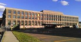
Springfield is called the Crossroads of New England because it is the major shipping nexus from New York City, Boston, Montreal and the Great Lakes (via Albany, New York). Much of the cargo heading from one of these places to another crosses through the City of Springfield. As a geographical trade center, Springfield has more advantages than just being equidistant to these other large trade centers—it sits beside the Connecticut River, is located near some of the most fertile farmland in the Northeast, and is served by numerous rail lines and Interstate Highways, including I-90 (Mass Pike) and I-91, which connect New Haven, Hartford, Holyoke, Northampton, and Vermont to Springfield. One of the few spurs of I-91 in Massachusetts, I-291, runs through Springfield, and provides a secondary connection between I-90 and I-91.
Rail
Springfield Union Station, originally opened in 1926 and re-opened in 2017, is served by Amtrak's Washington, D.C. to Vermont Vermonter; Chicago to Boston Lake Shore Limited, the New Haven–Springfield Shuttle, and Springfield to D.C./Virginia Northeast Regional. Amtrak relocated its operations into Union Station proper from their previous track side station building in June 2019. A high level train platform is under construction to improve the experience for rail passengers and is scheduled to be completed before the end of 2019.
CTRail's Hartford Line started operating from Union Station in June 2018, with Springfield as the northern terminus. Trains operate to New Haven, CT with multiple stops in Connecticut along the way.
The New Haven–Springfield Line was upgraded in conjunction with the launch of the Hartford Line service. The project received funding from the Commonwealth of Massachusetts, the Federal Government, and the State of Connecticut. Amtrak trains on the route between New Haven and Springfield reach speeds of 110 mph (177 km/h).
In 2011, Springfield Union Station started a $70 million renovation to become an intermodal transportation facility, allowing Peter Pan Bus, Greyhound Bus, and the PVTA to occupy a modern space next to the renovated Union Station.[149] It was completed in June 2017.
There are no major freight yards in Springfield proper, but Connecticut Southern Railroad and CSX serve CSX's West Springfield yard across the Connecticut River.
Bus
The Pioneer Valley Transit Authority (PVTA) is based in Springfield and uses Union Station as its Springfield hub, next to the Gothic arch that denotes the entrance to downtown Springfield. The PVTA operates nineteen bus routes from Union Station. The PVTA's Springfield service area includes Springfield, Holyoke, Chicopee, Westfield, West Springfield, Ludlow, Agawam, and East Longmeadow. With transfers, it is possible to travel into PVTA's northern service area, which includes Northampton, Amherst, and Easthampton.
Intercity bus service is provided by Peter Pan Bus Lines and Greyhound Lines, both of which operate from Union Station. They provide service to destinations across the northeast United States.
.png)
Air
Springfield is primarily served by Bradley International Airport, in Windsor Locks, Connecticut, 12 miles (19 km) south of downtown. It features over 100 daily departures to 30 destinations on nine airlines.[151] It is also the primary airport for Hartford.
Other regional airports serving Springfield include:
- Westfield-Barnes Regional Airport is 12 miles (19 km) from downtown Springfield in Westfield, Massachusetts. It is 1.5 miles (2.4 km) from the Massachusetts Turnpike.
- Westover Metropolitan Airport is 5 miles (8 km) from downtown Springfield. It is 3 miles (5 km) from the Massachusetts Turnpike.
- Logan International Airport in Boston is approximately 80 miles (130 km) northeast of Springfield.
Cycling and walking
Taken in its entirety, Springfield has a moderate Walk Score of 59,[152] however walkability varies between neighborhoods. Whereas the suburban neighborhood of Sixteen Acres is largely car-dependent with a score of 30, and Indian Orchard has a somewhat walkable rating of 54, the Metro Center area, with its grid central to stores, residences, and businesses, yields a Walk Score of 82.[153][154][155]
The city's Connecticut River Walk Park offers a largely uninterrupted bike route from the North to South End, and is part of a broader plan by the Pioneer Valley Planning Commission to create a continuous route alongside the Connecticut River from Agawam to Holyoke, with construction and planning ongoing.[156]
Water and sewer system
The Springfield Water and Sewer Commission (created in its current form in 1996) owns several reservoirs and aqueducts, as well as hydropower and sewage treatment stations. The city purchased the Springfield Aqueduct Company in 1872.[157]
.jpg)
Borden Brook Reservoir, located in the rural western Hampden County town of Blandford was completed in 1910. It feeds into the Cobble Mountain Reservoir (completed in 1931) located at the junction of the towns of Blandford, Granville and Russell. The Wild Cat Aqueduct carries water from the Cobble Mountain Reservoir to a hydroelectric generating station on the Granville–Russell border, at the Little River. Drinking water flows to the West Parish Water Filtration Plant in Westfield, and is then pumped to holding tanks at the top of Provin Mountain in Agawam.[158]
The 1875 Ludlow Reservoir, also known as Springfield Reservoir, is maintained as an emergency water supply; it is located in Ludlow and fed via the Broad Brook Canal.
SWSC provides retail water in Springfield and Ludlow; wholesale water to Agawam, East Longmeadow, and Longmeadow; partial or peak service to Southwick, Westfield, and West Springfield; and emergency service to Chicopee and Wilbraham.[158]
Sister cities


Notable people
- Creighton Abrams, U.S. Army general, Chief of Staff of the United States Army, and Commander of Operations during the Vietnam War
- Weston Adams, longtime president of the NHL's Boston Bruins
- Johnny Appleseed, American folk hero, spent his childhood and young adulthood in Springfield
- Joe Arpaio, "America's Toughest Sheriff", known for "tent city" prison in Maricopa County, Arizona
- Adele Addison, soprano, acclaimed in classical music during the 1950s–1960s
- Joel Asaph Allen, zoologist
- George Ashmun, founder of the U.S. Republican Party and Springfield lawyer
- Travis Best, National Basketball Association player
- Alfred Ely Beach, inventor of New York City's subway system
- Mary Agnes Dalrymple Bishop (1857–1934), American journalist, newspaper editor
- R. P. Blackmur, poet and literary critic
- Nina Blackwood, original MTV VJ and Sirius Satellite Radio DJ
- Ran Blake, jazz pianist
- Thomas Blanchard, inventor of lathe (1819), which led to technological advances known as interchangeable parts and assembly line manufacturing; also, inventor of first modern car—powered by steam (1825)
- Herbert Blomstedt, orchestra conductor of Danish National Symphony Orchestra, and symphony orchestras in San Francisco and Stockholm, Sweden
- Edward Boland, U.S. Congressman 1952–1989
- Cheryl Boone Isaacs, first African-American and third woman to become President of the Academy of Motion Picture Arts and Sciences
- Mary Ann Booth, American photomicroscopy pioneer, parasitologist, whose work on the bubonic plague and many other diseases was internationally regarded
- Chester Bowles, former Governor of Connecticut
- Samuel Bowles, journalist, founder of Springfield Republican, one of founders of United States Republican Party
- Lloyd Wheaton Bowers, lawyer and former U.S. Solicitor General
- Ron Brace, National Football League player
- Milton Bradley, inventor of parlor games and game-manufacturer
- Chuck Bresnahan, NFL coach
- John Brown, abolitionist
- Harold R. Bull, completed the weather report that enabled the D-Day launch during World War II
- Nick Buoniconti, NFL Hall of Famer
- Thornton Burgess, children's author, known for "Peter Cottontail"
- Chris Capuano, Major League Baseball pitcher
- Ruth Carter, Oscar award winning costumer designer for her work on Marvel's Black Panther
- John Cena, WWE wrestler
- Amzi Chapin, cabinet maker, singing-school teacher and shapenote composer
- Chester W. Chapin, railroad magnate
- Deacon Samuel Chapin, early settler of Springfield, 1642
- John A. Chapman (1965–2002), USAF Combat Controller, posthumously awarded the Medal of Honor
- Thornton Chase, first American convert to the Bahá'í Faith
- Yodelin' Slim Clark, singer
- Bobby Coleman, singer-songwriter
- Shamus Culhane, lead animator at Walt Disney Studios, who produced such classics as Snow White and the Seven Dwarfs
- Billy Curtis, actor, best known as a Munchkin in "The Wizard of Oz", and "Terror of Tinytown"
- Bill Danoff, member of Starland Vocal Band and wrote No. 1 hit "Afternoon Delight"
- Donald Davidson, philosopher, known for studies regarding communication
- Jim Douglas, Governor of Vermont from 2003 to 2010
- Vinny Del Negro, NBA player and head coach
- David W. Evans, professor of psychology and neuroscience, Bucknell University
- George Bowman Ferry, architect
- Theodore Foley, Roman Catholic priest, nominated for sainthood in 2008
- June Foray, voice actress for animated films
- Bertram Forer, psychologist, known for the Forer effect
- Carole Fredericks, French musician whose brother was Springfield blues great Taj Mahal
- John Garand, weapons inventor
- Theodor Seuss Geisel (a.k.a. Dr. Seuss), writer and illustrator best known for his children's books
- Frederick H. Gillett, Speaker of the United States House of Representatives from 1919 to 1925, United States Senator from 1925 to 1931
- Charles Goodyear, inventor of vulcanized rubber
- Mike Gravel, senator from Alaska
- Chester Harding, portrait painter during the 19th century
- Richard F. Heck, awarded the Nobel Prize in Chemistry in 2010
- Victor Heflin, football player
- Iris Holland, Massachusetts state legislator
- Elizur Holyoke, early explorer of Western Massachusetts, for whom Holyoke, Massachusetts and the Holyoke Range are named
- Joseph French Johnson, economist, wrote the inspirational "The Price of Success"
- Alan Kay, computer scientist
- Edward Kamuda, founder and president of Titanic Historical Society
- Derek Kellogg, LIU Brooklyn men's basketball head coach
- Peter King, sportswriter and TV commentator
- Stanley King, 11th president of Amherst College
- Bob Kudelski, professional hockey player
- Timothy Leary, writer, psychologist and advocate of psychedelic drug research and use
- Norman Leyden, conductor and clarinetist
- Edward Tsang Lu, astronaut
- Arthur MacArthur, Jr., Army general, father of Douglas MacArthur
- William Manchester, historian, author of The Death of a President and other renowned literary works
- Rabbit Maranville, professional baseball player, inducted into Baseball Hall of Fame in 1954
- Frank J. Matrango, state legislator
- Tim Mayotte, professional tennis player
- Linda J. Melconian, Public Servant, Educator, Lawyer
- Miles Morgan, hero of King Philip's War of 1675, a statue of Morgan stands in Springfield's Court Square
- Horace A. Moses, philanthropist and paper pioneer
- Jowell Muñoz of reggaeton duo Jowell & Randy
- James Naismith, inventor of basketball
- Tom Newberry, football player
- Lowell North, Olympic gold medalist in sailing
- Larry O'Brien, Postmaster General, Democratic National Committee chairman and Commissioner of the National Basketball Association
- Paul LaPalme, Major League Baseball pitcher
- Robert B. Parker, author of Spenser and Jesse Stone novels
- Joe Philbin, head coach of NFL Miami Dolphins
- Maude Gillette Phillips (1860–?), author, educator
- Eleanor Powell, actress and tap dancer
- William Pynchon, founder of City of Springfield; earlier founded Roxbury, Massachusetts; in 1649, wrote America's first banned book
- Caleb Rice, first Mayor of Springfield, President of MassMutual
- George Washington Rice, founder of MassMutual Life Insurance
- William Marsh Rice, founder of Rice University, Houston, Texas[162]
- Stephen Rivers (1955–2010), political activist and publicist.[163]
- Peter Robinson, actor and freak show performer
- Kurt Russell, actor
- Julia Sanderson, actress, vaudevillian, and namesake of Springfield's Julia Sanderson Theater (now The Paramount Theater)
- Joe Scibelli, Los Angeles Rams professional football player
- Mike Scully, writer and producer for The Simpsons
- Chloë Sevigny, actress
- Michael Shapiro, actor and voice actor
- Daniel Shays, leader of Shays' Rebellion
- John Shea, actor and director
- Eddie Shore, professional hockey player and owner
- Stass Shpanin, contemporary visual artist included in Guinness Book of World Records as Youngest Professional Artist in the World
- David Socha international soccer referee
- Bishop Talbert W. Swan, II: Prelate, Church Of God In Christ, Activist, Author
- Tommy Tallarico, video game music composer
- Antonio Thomas, professional wrestler
- Louise Hall Tharp, biographer
- George Tomasini, film editor known for work with Alfred Hitchcock
- Mike Trombley, former Major League Baseball pitcher
- Paige Turco, actress
- Lynn Vincent, author
- Benjamin Wade U.S. Senator from Ohio
- David Ames Wells, engineer and economist
- Daniel Baird Wesson, weapons inventor and founder of Smith & Wesson
- Maura West, Daytime Emmy award-winning soap opera actress
- James McNeill Whistler, painter
- Terence H. Winkless, film and television director
 Senior Airman John Chapman, recipient of the Medal of Honor
 Abolitionist John Brown in Springfield in 1846
 Dr. Seuss, Springfield author and illustrator
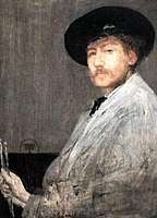 James McNeil Whistler, noted American painter, grew up in Springfield
 Taj Mahal, native Springfield musician
Notable musical artists include:
- The Acacia Strain, deathcore band
- Agoraphobic Nosebleed, grindcore band
- All That Remains, metalcore band
- Destrophy, Otep, Erik Tisinger, guitarist and bassist, from Springfield
- Killswitch Engage, metalcore band
- Eddie Fontaine, singer
- Carole Fredericks, singer
- Ashley Gearing, country music artist
- Taj Mahal, blues musician
- Tony MacAlpine, fusion musician
- Joe Morello, jazz drummer with the Dave Brubeck Quartet
- Mark Mulcahy musician
- Linda Perry, songwriter, formerly of 4 Non Blondes
- Shadows Fall, metalcore band
- Signs, reggaeton band
- Staind, alternative rock band
- Paul Weston, composer for Bing Crosby, Frank Sinatra, and others
- Wanita "D. Woods" Woodgette, hip hop artist
- D. Woods, member of group Danity Kane
- Phil Woods, jazz saxophonist with Quincy Jones, Steely Dan, Paul Simon, others
See also
Notes and references
Notes
- While both demonyms are listed in the Merriam-Webster Dictionary, there is some indication that Springfieldian is given some propriety:
"In at least two cases, the name of the resident depends on which state the town is in: Richmonder in Virginia but Richmondite in Indiana; Springfieldian in Massachusetts but Springfielder in Ohio."[11] - Combined statistical areas (CSAs) as defined by the US Census.
- Mean monthly maxima and minima (i.e. the expected highest and lowest temperature readings at any point during the year or given month) calculated based on data at said location from 1981 to 2010.
- Official records for Hartford kept at downtown from January 1905 to December 1948, Brainard Airport from January 1949 to December 1954, and at Bradley Int'l in Windsor Locks since January 1955.[39]
References
- "The City of Progress New City Library, Merrick Park, State Street Springfield, MA". Cardcow.com.
- "The City Of Progress, Winchester Square Springfield, MA". Cardcow.com.
- Denis Larionov & Alexander Zhulin. "Progressive Springfield, Massachusetts, by George Storrs Graves". Ebooksread.com.
- "Picturesque Springfield and West Springfield, Massachusetts". Internet Archive. Retrieved December 27, 2011.
- "Progressive Springfield, Massachusetts". Internet Archive. Retrieved December 27, 2011.
- "Picturesque Springfield and West Springfield, Massachusetts". Internet Archive. Retrieved December 27, 2011.
- The Price & Lee Co.'s Springfield Directory. Price & Lee Co. 1960. p. 22. Retrieved March 15, 2017.
- Industrial Directory and Shippers' Guide. New York Central Lines. 1921. p. 266. Retrieved March 15, 2017.
- "Population and Housing Unit Estimates". Retrieved May 21, 2020.
- "Geographic Identifiers: 2010 Census Summary File 1 (G001): Springfield, MA Metro Area". American Factfinder. U.S. Census Bureau. Archived from the original on February 13, 2020. Retrieved August 2, 2017.
- Brooke, Maxey (1983). "Everybody Comes From Somewhere". Word Ways. Butler University. 16 (3): 151–152.
- "Springfieldian". Merriam Webster English Dictionary (Online ed.). Springfield, MA: Merriam Webster, Inc. 2017. Retrieved May 11, 2017.
a native or resident of Springfield (such as Springfield in Illinois, Massachusetts, or Ohio): springfielder
- "Total Real Gross Domestic Product for Springfield, MA (MSA)". Federal Reserve Bank of St. Louis. Archived from the original on December 27, 2017. Retrieved December 27, 2017.
- "Find a County". National Association of Counties. Archived from the original on May 31, 2011. Retrieved June 7, 2011.
- "Population and Housing Unit Estimates". Retrieved June 9, 2018.
- Phaneuf, Wayne (April 6, 2010). "Abolitionist John Brown's years in Springfield Ma. transform his anti-slavery thoughts and actions". Archived from the original on April 19, 2019.
- "Resisting Slavery, Abolitionism & the Underground Railroad". Our Plural History—Springfield, MA. Springfield Technical Community College. 2009. Archived from the original on December 15, 2018.
- Springfield Armory National Historic Site—Springfield Armory National Historic Site. Nps.gov (2013-08-02). Retrieved on 2013-08-21.
- The Independent. "Pinpointing the Most Popular Sports in the World is not that easy". Academic.aucegypt.edu. Archived from the original on November 7, 2012. Retrieved May 24, 2012.
- "Western Massachusetts 2010–2011 Economic Review" (PDF). March 22, 2011. Archived from the original (PDF) on February 4, 2015. Retrieved October 16, 2014.
- Barrows, Charles Henry (1911). The History of Springfield in Massachusetts for the Young: Being also in some part the history of other towns and cities in the county of Hampden. Connecticut Valley Historical Society. pp. 46–48
- Green, Mason Arnold (1888). "Chapter II. 1638–1639". Springfield, 1636–1886: History of Town and City. C. A. Nichols & Co. p. 20.
- King, Moses (1885). King's Handbook of Springfield, Massachusetts. Franklin Press. p. 9. ISBN 9781152362826.
- "Find in a Library: The Encyclopedia of New England". worldcat.org. Retrieved October 16, 2014.
- "Firsts | Springfield 375". Springfield375.org. Archived from the original on May 21, 2013. Retrieved April 4, 2012.
- "New Museum of Springfield History to Open October 10—News". Springfield Museums. September 24, 2009. Retrieved April 4, 2012.
- Bianculli, Anthony J. (2002). Trains and Technology: the American Railroad in the Nineteenth Century. Vol. 2, Cars. Newark, Del. [u.a.]: University of Delaware Press. p. 52. ISBN 0-87413-730-6.
- Strahan, Derek (2017). Lost Springfield, Massachusetts. Charleston, SC: The History Press. pp. 70–71.
- "Springfield (Massachusetts)". Collier's New Encyclopedia. New York. 1921.
- "New Haven–Hartford–Springfield Rail Program". nhhsrail.com. Retrieved October 16, 2014.
- "MGM Springfield—Our Vision". Archived from the original on August 25, 2012. Retrieved October 16, 2014.
- "Springfield Redevelopment Authority: Union Station". www3.springfield-ma.gov. Archived from the original on October 18, 2014. Retrieved October 16, 2014.
- "US Gazetteer files: 2010, 2000, and 1990". United States Census Bureau. February 12, 2011. Retrieved April 23, 2011.
- "Geographic Identifiers: 2010 Census Summary File 1 (G001): Springfield city, Massachusetts". American Factfinder. U.S. Census Bureau. Archived from the original on February 13, 2020. Retrieved August 2, 2017.
- "Amenities | Choose Springfield, Massachusetts". Choosespringfieldmass.com. Archived from the original on March 24, 2012. Retrieved December 27, 2011.
- Tower, J.E.; Gardner, E.C. (1905). Springfield Present and Prospective: The City of Homes. Pond & Campbell. p. 86. Retrieved October 16, 2014.
- James Notchey. "Massachusetts Tornado Outbreak Summary—National Weather Service Forecast Office in Taunton, MA". Erh.noaa.gov.
- "Massachusetts News, Weather, Photos, Events—Western Mass News". Wggb.com. Archived from the original on October 2, 2011. Retrieved April 27, 2016.
- "Four dead in Springfield tornadoes | WTNH.com Connecticut". Wtnh.com. Archived from the original on June 3, 2011. Retrieved June 28, 2011.
- ThreadEx
- "NowData – NOAA Online Weather Data". National Oceanic and Atmospheric Administration. Retrieved February 22, 2018.
- "Station Name: CT HARTFORD BRADLEY INTL AP". National Oceanic and Atmospheric Administration. Retrieved March 13, 2014.
- "WMO Climate Normals for HARTFORD/BRADLEY INT'L ARPT CT 1961–1990". National Oceanic and Atmospheric Administration. Retrieved March 11, 2014.
- "Springfield, Massachusetts, USA - Monthly weather forecast and Climate data". Weather Atlas. Retrieved July 4, 2019.
- Piyawut Inthasorn (May 14, 2010). "Landscape Urbanism for the Highway city of Springfield North End". scholarworks.umass.edu. Retrieved July 12, 2017.
- David M. Ahronian (2009). "Making Connections—Envisioning Springfield's North End". scholarworks.umass.edu. Retrieved July 12, 2017.
- "Forest Park Heights Historic District" (PDF). May 1, 2006. Retrieved October 16, 2014.
- "Indian Orchard, 01151 | Choose Springfield, Massachusetts". Choosespringfieldmass.com. Archived from the original on March 22, 2012. Retrieved January 24, 2019.
- Archived January 22, 2009, at the Wayback Machine
- Steven Cecil (July 27, 2004). "OLD HILL NEIGHBORHOOD MASTER PLAN" (PDF). Retrieved October 16, 2014.
- "Ridgewood Historic District" (PDF). May 1, 2006. Retrieved October 16, 2014.
- "Lower Maple Historic District" (PDF). May 1, 2006. Retrieved October 16, 2014.
- "Maple Hill Historic District" (PDF). May 1, 2006. Retrieved October 16, 2014.
- United States Census Bureau. "CENSUS OF POPULATION AND HOUSING". Retrieved January 19, 2013.
- "1950 Census of Population" (PDF). 1: Number of Inhabitants. Bureau of the Census. 1952. Section 6, Pages 21-7 through 21-09, Massachusetts Table 4. Population of Urban Places of 10,000 or more from Earliest Census to 1920. Retrieved July 12, 2011. Cite journal requires
|journal=(help) - United States Census Bureau. "Table 3. Annual Estimates of the Resident Population for Incorporated Places in Massachusetts: April 1, 2010 to July 1, 2011 (SUB-EST2011-03-25)". Archived from the original on March 9, 2013. Retrieved January 19, 2013.
- Archived December 21, 2012, at the Wayback Machine
- American FactFinder . Factfinder2.census.gov. Retrieved on August 2, 2013.
- QuickFacts for Springfield city / Massachusetts / United States, United States Census Bureau. Accessed February 9, 2017.
- "Massachusetts—Race and Hispanic Origin for Selected Cities and Other Places: Earliest Census to 1990". U.S. Census Bureau. Archived from the original on August 12, 2012.
- "Race and Hispanic Origin for Selected Cities and Other Places: Earliest Census to 1990". U.S. Census Bureau. Archived from the original on August 12, 2012.
- From 15% sample
- "SELECTED ECONOMIC CHARACTERISTICS 2009–2013 American Community Survey 5-Year Estimates". U.S. Census Bureau. Archived from the original on January 17, 2015. Retrieved January 12, 2015.
- "ACS DEMOGRAPHIC AND HOUSING ESTIMATES 2009–2013 American Community Survey 5-Year Estimates". U.S. Census Bureau. Archived from the original on January 5, 2015. Retrieved January 12, 2015.
- "HOUSEHOLDS AND FAMILIES 2009–2013 American Community Survey 5-Year Estimates". U.S. Census Bureau. Archived from the original on February 12, 2020. Retrieved January 12, 2015.
- "Industry by Occupation for the Civilian Employed Population 16 Years and Over [Springfield, MA-CT Metropolitan NECTA]". US Census Bureau. 2016. Archived from the original on February 13, 2020. Retrieved October 9, 2018.
- "Fortune 500 Companies 2018: Who Made The List". Fortune. Meredith Corporation. Retrieved October 1, 2018.
- MA Executive Office of Labor and Workforce Development: Largest 200 Employers in Hampden County (2017). Retrieved on May 10, 2017.
- "Proposed Billion Dollar Bakeries Merger Vitally Concerns; Two Local Bakeries Already Linked Up with Big Combines". Springfield Sunday Republican. Springfield, Mass. January 17, 1926. p. 1.
- Jonathan Melle (November 10, 2007). "Jonathan Melle on Politics: Shitty Pignatelli—Top Down Politics of the BANAL! Also see Denis Guyer & Andrea Nuciforo & Carmen Massimiano". Jonathanmelleonpolitics.blogspot.com.
- Archived October 26, 2012, at the Wayback Machine
- Thomas, G. Scott (March 16, 2011). "America's top 100 high-tech centers".
- "American FactFinder". United States Census Bureau. Archived from the original on February 13, 2016. Retrieved April 14, 2012.
- Kinney, Jim (February 13, 2019). "Rail car maker CRRC MA to build warehouse at East Springfield factory". MassLive.
- "Baystate Medical Center—School of Medicine—Tufts University". Tufts.edu. Archived from the original on April 17, 2011. Retrieved April 3, 2011.
- "Contact Us". Merriam-Webster. Retrieved on October 27, 2009.
- "Peter Pan Bus Lines agrees on move to Springfield's Union Station". Masslive.com. Retrieved July 12, 2017.
- "Rolls-Royce in America". Rolls-Royce Foundation. Archived from the original on October 15, 2017. Retrieved October 15, 2017.
- "Phantom Gourmet: Red Rose In Springfield". Phantom Gourmet/CBS 4. Boston. Archived from the original on March 29, 2016.
- Frigo's—Springfield MA. Phantom Gourmet. April 16, 2015 – via Youtube.
- Chef Wayne's Big Mamou—Springfield MA. Phantom Gourmet. October 4, 2015 – via Youtube.
- Bellamy, Fran. "Nadim's Downtown offers best of both worlds for Springfield diners". The Republican. Springfield, Mass.
- Santana, Lucila. "Springfield's Puerto Rico Bakery and Restaurant owner Jorge Perez says basic business procedures keep business flourishing". El Pueblo Latino. Springfield, Mass. – via MassLive.
- Whitehead, Margaret (December 7, 2018). "The foodie guide to Springfield". Daily Hampshire Gazette. Northampton, Mass.
- Uhle, Frank (2001). "Friendly Ice Cream Corporation". International Directory of Company Histories.
- "The Naismith Memorial Basketball Hall of Fame: Enshrinement Tickets". Hoophall.com. Archived from the original on May 25, 2011.
- "Greater Springfield Convention and Visitors Bureau—Springfield Armory Big Band Concert". Archived from the original on June 11, 2011. Retrieved July 12, 2017.
- Goonan, Peter. "Grassroots group plans first-ever Springfield Pride Week". The Republican.
- "Welcome | Mattoon Street Arts Festival Springfield, Mass". Mattoonfestival.org.
- "Pioneer Valley Jewish Film Festival Welcome". Pvjff.org.
- Brian Steele; The Republican. "Holyoke St. Patrick's Parade 2011: 60th annual parade draws 400,000, attracts first-timers". masslive.com.
- "The World's Largest Pancake Breakfast". Spirit of Springfield. Archived from the original on July 8, 2011.
- Ashley Kohl. "Caribbean Festival in Springfield | MyMassAppeal.com". Wwlp.com. Archived from the original on September 27, 2011.
- See:
- Kinney, Jim. "Japanese consul general visits Springfield's George Walter Vincent Smith Art Museum collection of Japanese art". The Republican. Springfield, Mass. Archived from the original on March 22, 2019.
- Eugene C. Worden, ed. (1914). Seventh Year, Japan Society. New York.
- "Museums Host Japanese Consulate Ceremony". Springfield Museums. November 6, 2013. Archived from the original on August 19, 2016.
- "The Museums". Springfield Museums.
- "Titanic Historical Society". Titanic1.org. Archived from the original on May 22, 2011.
- "Best and Worst Cities for Dating". Yahoo! Real Estate. Archived from the original on March 14, 2012.
- Piyawut Inthasorn (May 14, 2010). "Landscape Urbanism for the Highway city of Springfield North End". scholarworks.umass.edu. Retrieved July 12, 2017.
- Michael McAuliffe; The Republican. "Study by Urban Land Institute envisions revitalized Springfield waterfront". masslive.com.
- "City of Springfield, Mass.: Riverfront". Springfieldcityhall.com. Archived from the original on July 3, 2008.
- "History | St. John's Congregational Church | Springfield, MA". Sjkb.org. June 22, 2010. Retrieved December 27, 2011.
- "Springfield Armory National Historic Site (U.S. National Park Service)". Nps.gov. Retrieved May 24, 2012.
- "Walking Tour to Visit Outdoor Sculpture by Saint-Gaudens—News". Springfield Museums. July 23, 2009.
- "Springfield's NBA Development League Team Unveils Name and Logo". NBA. Archived from the original on July 3, 2009.
- "MAAC Names MassMutual Center in Springfield Site for 2012–2014 MAAC Basketball Championships". Maacsports.com.
- Michael S. Gordon / The Republican. "Springfield's Pynchon Park, rarely accessible since 1976, reopens after renovations". masslive.com.
- "Pynchon Park". Projectballpark.org. September 11, 1966.
- Pair O' Dice City Roller Derby
- Paul Cassel. "WBZ and WBZA in the 20s and 30s". Hammondmuseumofradio.org.
- Ochsner, Jeffrey Karl (1982). H.H. Richardson: Complete Architectural Works. Cambridge, Massachusetts: MIT Press. p. 25. ISBN 978-0-262-65015-1.
- "City of Springfield, Mass.: Alphabetical Project Update List". Springfieldcityhall.com. September 9, 2010. Archived from the original on July 16, 2011. Retrieved May 13, 2011.
- "Green Cities". Bestplaces.net.
- "Springfield's monuments and memorials | masslive.com". Photos.masslive.com. May 29, 2011. Archived from the original on August 24, 2011.
- "Springfield, Massachusetts Neighborhoods on Walk Score". Walkscore.com. Retrieved December 27, 2011.
- "Weddings and Corporate Events at the Carriage House at the Barney Estate, Forest Park, Springfield, MA 01108". Barney Carriage House.
- "Springfield Schools Superintendent Daniel Warwick touts students' gains in academics, attendance, behavior |". masslive.com. Retrieved October 16, 2014.
- "History". Springfield Fire Department. Retrieved April 2, 2015.
- Lynn Browne (September 14, 2009). "Towards a More Prosperous Springfield, Massachusetts: Project Introduction and Motivation" (PDF). Retrieved October 16, 2014.
- "Springfield, Mass. Capital Assets: The Campanile". www3.springfield-ma.gov. Archived from the original on July 1, 2014. Retrieved October 16, 2014.
- Greenblatt, Alan (December 2018). "This Small New England City Was on the Verge of Bankruptcy. Now It's a Turnaround Success Story". Governing. Washington, DC: e.Republic.
- "Western Massachusetts communities deal with cleanup costs in wake of October snowstorm". masslive.com. Retrieved October 16, 2014.
- "Registration and Party Enrollment Statistics as of February 1, 2017" (PDF). Massachusetts Elections Division. Archived from the original (PDF) on January 19, 2018. Retrieved July 6, 2018.
- Turner, Maureen (December 8, 2011). "News—Where Were They on Election Day? Apathy is too simple a way of explaining why 78 percent of Springfield voters didn't make it to the polls in November". The Valley Advocate. Archived from the original on March 15, 2012. Retrieved May 22, 2019.
- "Council Makes History, President Fenton Promises Busy Year ...—Western Mass Politics & Insight". Wmasspi.com. January 6, 2014. Retrieved July 12, 2017.
- "Accela Meeting Portal". springfieldcityma.iqm2.com. Retrieved July 12, 2017.
- "In Springfield, a Whitfield of Dreams Comes True Mid-term ..." Western Mass Politics & Insight. Whitfield joined in mid-2018 after resignation of Thomas Ashe. September 25, 2018. Retrieved May 14, 2019.CS1 maint: others (link)
- "Wayback Machine" (PDF). Os.cqpress.com. April 12, 2015. Archived from the original on April 12, 2015. Retrieved July 12, 2017.CS1 maint: BOT: original-url status unknown (link)
- Resource Library | Urban Land Institute. Uli.org. Retrieved on July 15, 2013.
- "Springfield crime rates and statistics". NeighborhoodScout. August 15, 2010. Archived from the original on August 15, 2010. Retrieved February 5, 2019.
- "Springfield crime rates and statistics". NeighborhoodScout. January 30, 2019. Archived from the original on January 30, 2019.
- Williams, Michelle (June 8, 2015). "State awards $4.48 million to school turnaround efforts in Springfield, Worcester". MassLive.com. Advance Publications. Retrieved June 23, 2018.
- Catholic grade schools remade, The Republican, January 24, 2009
- Pioneer Valley Christian Academy. Retrieved April 22, 2010.
- "Massachusetts Academy". Retrieved April 27, 2016.
- "Academy Hill School". Academy Hill School. Retrieved July 12, 2017.
- "Western Massachusetts 2010–2011 Economic Review" (PDF). January 10, 2011. Archived from the original (PDF) on February 2, 2015. Retrieved October 16, 2014.
- "Court Square Springfield, Mass.: Home Page". Springfieldcityhall.com. July 13, 2011. Archived from the original on July 19, 2011.
- "After You Apply : Undergraduate Admissions : Prospective Students : Westfield State University". Wsc.ma.edu. Archived from the original on June 4, 2011.
- "Shays' Rebellion—About This Project". Shaysrebellion.stcc.edu.
- C.B. Tillinghast. The free public libraries of Massachusetts. 1st Report of the Free Public Library Commission of Massachusetts. Boston: Wright & Potter, 1891. Google books
- "Springfield City Library". Springfieldlibrary.org. Retrieved July 12, 2017.
- July 1, 2007, through June 30, 2008; cf. The FY2008 Municipal Pie: What's Your Share? Commonwealth of Massachusetts, Board of Library Commissioners. Boston: 2009. Available: Municipal Pie Reports Archived January 23, 2012, at the Wayback Machine. Retrieved August 4, 2010.
- July 1, 2008, through June 30, 2009; cf. Massachusetts Board of Library Commissioners (2011). "FY 2009 Municipal Pie Report". Archived from the original on January 23, 2012. Retrieved April 4, 2011.
- Springfield City Library (April 10, 2012). "Library Catalogs & Electronic Databases". Archived from the original on February 22, 2012. Retrieved May 15, 2012.
- "AfAm Point of View". AfAm Point of View. Retrieved July 12, 2017.
- "Springfield 375—Springfield's Official 375th Anniversary Celebration Site". July 21, 2013. Archived from the original on July 21, 2013. Retrieved July 12, 2017.
- Jim Kinney; The Republican. "Public radio station WFCR-FM plans move from Amherst to Springfield". masslive.com.
- Yonkunas, Rachel (December 27, 2018). "State leaders are hoping to expand state rail service beyond Springfield". WFSB Eyewitness News 3.
- "Springfield Redevelopment Authority: Springfield Union Station". Springfield-ma.gov. Retrieved July 12, 2017.
- "Calendar Year 2017 Passenger Numbers" (PDF). Bradley International Airport. February 2018. Retrieved February 25, 2018.
- "Destinations". Bradleyairport.com. April 5, 2010. Archived from the original on June 4, 2012.
- "Springfield". Walk Score. Walk Score. Retrieved October 28, 2019.
- "Sixteen Acres, Springfield". Walk Score. Walk Score. Retrieved October 28, 2019.
- "Indian Orchard, Springfield". Walk Score. Walk Score. Retrieved October 28, 2019.
- "Metro Center, Springfield". Walk Score. Walk Score. Retrieved October 28, 2019.
- "Home / Parks / Parks Facilities and Use / River Walk / More about River Walk". City of Springfield. Retrieved July 27, 2011.
- About the Commission | Springfield Water and Sewer Commission Archived October 5, 2013, at the Wayback Machine. Waterandsewer.org. Retrieved on July 15, 2013.
- Water System History | Springfield Water and Sewer Commission Archived May 9, 2013, at the Wayback Machine. Waterandsewer.org. Retrieved on July 15, 2013.
- Becker, Sy (July 12, 2018). "Mayor from Italy visits Springfield". WWLP 22 News.
- Springfield, Massachusetts and Takikawa City, Hokkaido. Massachusetts Hokkaido Association.
- "Mayor Sarno and Congressman Neal Welcome Toireasa Ferris, Kerry County Councilor for Tralee, Ireland". City of Springfield (Mass.). March 20, 2018.
- Randal L. Hall and Sylvia Stallings Morris, eds, William Marsh Rice and His Institute: Centennial Edition (College Station: Texas A&M University Press, 2012), p.1.
- Chmielewski, Dawn C. "Stephen M. Rivers dies at 55; Hollywood publicist and political activist", Los Angeles Times, June 9, 2010. Retrieved June 10, 2010.
Further reading
- King, Moses, ed. (1884). King's Handbook of Springfield: A Series of Monographs, Historical and Descriptive. Springfield, Mass.: J. D. Gill. OCLC 960063143.
- Swift, Esther M. (1969). West Springfield Massachusetts: A Town History. West Springfield Heritage Association. OCLC 69843.
- Atlas of Springfield City, Massachusetts. Boston, Massachusetts: Geo. H. Walker & Co. 1882.
External links
- City of Springfield, Massachusetts Official city website
- Greater Springfield Convention and Visitors Bureau
- Springfield Chamber of Commerce
- Historical Maps of Springfield from the Norman B. Leventhal Map Center at the Boston Public Library
- Springfield's Civil War monuments
| Topics |  | |
|---|---|---|
| Attractions |
| |
| Government | ||
| Neighborhoods | ||
| Sports | ||
| Transportation | ||
Places adjacent to Springfield, Massachusetts | ||||||||||
|---|---|---|---|---|---|---|---|---|---|---|
| ||||||||||
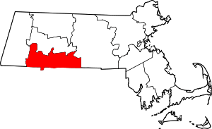
| Authority control |
|
|---|