Massabesic Lake
Massabesic Lake is a lake in southern New Hampshire, United States, covering about 2,560 acres (1,040 ha)[1] (equivalent to about 4 sq mi or 10 km2) within the city of Manchester and the town of Auburn. Because it provides drinking water for Manchester, swimming and water skiing are not allowed there.[2] Popular sports on the lake are sailing, fishing, and kayaking. The recreational trails along the lake provide beautiful views of the lake and the town of Auburn.
| Massabesic Lake | |
|---|---|
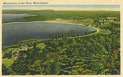 Massabesic Lake's easternmost point, about 1920 | |
| Location | Rockingham County and Hillsborough County, New Hampshire |
| Coordinates | 42°59′50″N 71°22′25″W |
| Primary inflows | Sucker Brook |
| Primary outflows | tributary of Cohas Brook |
| Basin countries | United States |
| Max. length | 5.6 miles (9.0 km) |
| Max. width | 1.3 miles (2.1 km) |
| Surface area | 2,560 acres (10.4 km2) |
| Average depth | 17 ft (5.2 m) |
| Max. depth | 50 ft (15 m) |
| Surface elevation | 251 feet (77 m) |
| Islands | Browns Island; Fletcher Island; Birch Island; Grape Islands; Loon Island; Picnic Island; numerous small islands |
| Settlements | Manchester; Auburn |
Besides flowing into the Manchester water system, the lake's water feeds Cohas Brook, leading to the Merrimack River. Massabesic is a Native American name meaning "place of much water" or "near the great brook."
The lake is classified as a cold- and warmwater fishery.[1]
See also
- List of lakes in New Hampshire
References
- "Massabesic Lake, Auburn, Manchester" (PDF). NH Fish & Game. Retrieved September 3, 2014.
- Posted Rules for Lake Massabesic
- Auburn, New Hampshire, by Carl Forsaith
External links
- "Lake Massabesic Watershed", Manchester Water Works website
- "Lake Massabesic Depth Contour Map", Manchester Water Works
This article is issued from Wikipedia. The text is licensed under Creative Commons - Attribution - Sharealike. Additional terms may apply for the media files.