Newton, Massachusetts
Newton is a suburban city in Middlesex County, Massachusetts, United States. It is approximately 7 miles (11 km) west of downtown Boston and is bordered by Boston's Brighton and West Roxbury neighborhoods to the east and south, respectively, and by the suburb of Brookline to the east, the suburbs of Watertown and Waltham to the north, and Weston, Wellesley and Needham to the west. Rather than having a single city center, Newton resembles a patchwork of thirteen villages. According to the 2010 U.S. Census, the population of Newton was 85,146, making it the eleventh largest city in the state.
Newton, Massachusetts | |
|---|---|
 City Hall | |
 Flag  Seal | |
| Nickname(s): "The Garden City" | |
| Motto(s): "Liberty and Union" | |
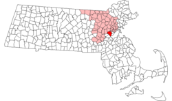 Location in Middlesex County, Massachusetts | |
 Newton, Massachusetts Location in the United States  Newton, Massachusetts Newton, Massachusetts (the United States)  Newton, Massachusetts Newton, Massachusetts (North America) | |
| Coordinates: 42°20′13″N 71°12′35″W | |
| Country | |
| State | Massachusetts |
| County | Middlesex |
| Settled | 1630 |
| Incorporated (Town) | 1681 |
| Incorporated (City) | 1874 |
| Government | |
| • Type | Mayor–council government |
| • Mayor | Ruthanne Fuller[1] |
| Area | |
| • Total | 18.2 sq mi (47.1 km2) |
| • Land | 18.1 sq mi (46.7 km2) |
| • Water | 0.2 sq mi (0.4 km2) |
| Elevation | 100 ft (30 m) |
| Population (2010) | |
| • Total | 85,146[2] |
| • Estimate (2019)[2] | 88,414 |
| Time zone | UTC−5 (Eastern) |
| • Summer (DST) | UTC−4 (Eastern) |
| ZIP Codes | 02458–02462, 02464–02468, 02459 |
| Area code(s) | 617/857 |
| FIPS code | 25-45560 |
| GNIS feature ID | 0617675 |
| Website | www.newtonma.gov |
History
Newton was settled in 1630 as part of "the newe towne", which was renamed Cambridge in 1638. Roxbury minister John Eliot convinced the Native American people of Nonantum, a sub-tribe of the Massachusett led by a sachem named Waban, to relocate to Natick in 1651, fearing that they would be exploited by colonists.[3] Newton was incorporated as a separate town, known as Cambridge Village, on December 15, 1681, then renamed Newtown in 1691, and finally Newton in 1766.[4] It became a city on January 5, 1874. Newton is known as The Garden City.
In Reflections in Bullough's Pond, Newton historian Diana Muir describes the early industries that developed in the late 18th and early 19th centuries in a series of mills built to take advantage of the water power available at Newton Upper Falls and Newton Lower Falls. Snuff, chocolate, glue, paper and other products were produced in these small mills but, according to Muir, the water power available in Newton was not sufficient to turn Newton into a manufacturing city, although it was, beginning in 1902, the home of the Stanley Motor Carriage Company, the maker of the Stanley Steamer.
Newton, according to Muir, became one of America's earliest commuter suburbs. The Boston and Worcester, one of America's earliest railroads, reached West Newton in 1834. Wealthy Bostonian businessmen took advantage of the new commuting opportunity offered by the railroad, building gracious homes on erstwhile farmland of West Newton hill and on Commonwealth street. Muir points out that these early commuters needed sufficient wealth to employ a groom and keep horses, to drive them from their hilltop homes to the station.
Further suburbanization came in waves. One wave began with the streetcar lines that made many parts of Newton accessible for commuters in the late nineteenth century. The next wave came in the 1920s when automobiles became affordable to a growing upper middle class. Even then, however, Oak Hill continued to be farmed, mostly market gardening, until the prosperity of the 1950s made all of Newton more densely settled.
The city has two symphony orchestras, the New Philharmonia Orchestra of Massachusetts and the Newton Symphony Orchestra.
Two of the 9/11 hijackers stayed in Newton the night before the attack. The hijackers of American Airlines Flight 11 spent their last night in Newton's Park Inn, an economy motel across the street from the Chestnut Hill Mall and within walking distance of The Atrium[5].
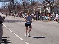
Each April on Patriots' Day, the Boston Marathon is run through the city, entering from Wellesley on Route 16 (Washington Street) where runners encounter the first of the four infamous Newton Hills. It then turns right onto Route 30 (Commonwealth Avenue) for the long haul into Boston. There are two more hills before reaching Centre Street, and then the fourth and most infamous of all, Heartbreak Hill, rises shortly after Centre Street. Residents and visitors line the race route along Washington Street and Commonwealth Avenue to cheer the runners.
Geography
Newton is a suburban city approximately seven miles from downtown Boston, in Middlesex County, Massachusetts, at 42°20′16″N 71°12′36″W (42.337713, −71.209936).[6] The city is bordered by Waltham and Watertown on the north, Needham and the West Roxbury neighborhood of Boston on the south, Wellesley and Weston on the west, and Brookline and the Brighton neighborhood of Boston on the east.
From Watertown to Waltham to Needham and Dedham, Newton is bounded by the Charles River. The Yankee Division Highway, designated Interstate 95 but known to the locals as Route 128, follows the Charles from Waltham to Dedham, creating a de facto land barrier. The portion of Needham which lies east of 128 and west of the Charles, known as the Needham Industrial Park has become part of a Newton commercial zone and contributes to its heavy traffic, though the tax revenue goes to Needham.
According to the United States Census Bureau, the city has a total area of 18.2 square miles (47.1 km2), of which 18.0 square miles (46.6 km2) is land and 0.2 square miles (0.5 km2) (0.82%) is water.
Topography
Newton has grown around a formation of seven hills. "The general features of Newton are not without interest. Seven principal elevations mark its surface, like the seven hills of ancient Rome, with the difference that the seven hills of Newton are much more distinct than the seven hills of Rome: Nonantum Hill, Waban Hill, Chestnut Hill, Bald Pate, Oak Hill, Institution Hill and Mount Ida."[7]
Villages
Rather than having a single city center, Newton is a patchwork of thirteen villages, many boasting small downtown areas of their own. The 13 villages are: Auburndale, Chestnut Hill, Newton Centre, Newton Corner, Newton Highlands, Newton Lower Falls, Newton Upper Falls (both on the Charles River, and both former small industrial sites), Newtonville, Nonantum (also called "The Lake"), Oak Hill, Thompsonville, Waban and West Newton. Oak Hill Park is a place within the village of Oak Hill that itself is shown as a separate and distinct village on some city maps (including a map dated 2010 on the official City of Newton website),[8] and Four Corners is also shown as a village on some city maps. Although most of the villages have a post office, they have no legal definition and no firmly defined borders. This village-based system often causes some confusion with addresses and for first time visitors.[9]
Climate
The record low temperature was −21 °F (−29 °C) in February 1934; the record high temperature was 101 °F (38 °C) in August 1975.[10]
| Climate data for Newton, Massachusetts | |||||||||||||
|---|---|---|---|---|---|---|---|---|---|---|---|---|---|
| Month | Jan | Feb | Mar | Apr | May | Jun | Jul | Aug | Sep | Oct | Nov | Dec | Year |
| Record high °F (°C) | 68 (20) |
68 (20) |
89 (32) |
94 (34) |
93 (34) |
99 (37) |
100 (38) |
101 (38) |
99 (37) |
88 (31) |
81 (27) |
74 (23) |
101 (38) |
| Average high °F (°C) | 34 (1) |
37 (3) |
44 (7) |
56 (13) |
66 (19) |
76 (24) |
82 (28) |
79 (26) |
72 (22) |
60 (16) |
50 (10) |
39 (4) |
58 (14) |
| Average low °F (°C) | 17 (−8) |
19 (−7) |
27 (−3) |
38 (3) |
48 (9) |
57 (14) |
63 (17) |
62 (17) |
55 (13) |
43 (6) |
34 (1) |
24 (−4) |
41 (5) |
| Record low °F (°C) | −14 (−26) |
−21 (−29) |
−5 (−21) |
6 (−14) |
27 (−3) |
36 (2) |
44 (7) |
39 (4) |
28 (−2) |
20 (−7) |
5 (−15) |
−19 (−28) |
−21 (−29) |
| Average precipitation inches (mm) | 4.35 (110) |
4.24 (108) |
5.58 (142) |
4.55 (116) |
4.11 (104) |
4.31 (109) |
4.02 (102) |
4.03 (102) |
4.06 (103) |
4.69 (119) |
4.76 (121) |
4.89 (124) |
53.59 (1,360) |
| Source: [10] | |||||||||||||
Demographics
| Historical population | ||
|---|---|---|
| Year | Pop. | ±% |
| 1790 | 1,360 | — |
| 1800 | 1,491 | +9.6% |
| 1810 | 1,709 | +14.6% |
| 1820 | 1,850 | +8.3% |
| 1830 | 2,376 | +28.4% |
| 1840 | 3,351 | +41.0% |
| 1850 | 5,258 | +56.9% |
| 1860 | 8,382 | +59.4% |
| 1870 | 12,825 | +53.0% |
| 1880 | 16,995 | +32.5% |
| 1890 | 24,379 | +43.4% |
| 1900 | 33,587 | +37.8% |
| 1910 | 39,806 | +18.5% |
| 1920 | 46,054 | +15.7% |
| 1930 | 65,276 | +41.7% |
| 1940 | 69,873 | +7.0% |
| 1950 | 81,994 | +17.3% |
| 1960 | 92,384 | +12.7% |
| 1970 | 91,263 | −1.2% |
| 1980 | 83,622 | −8.4% |
| 1990 | 82,585 | −1.2% |
| 2000 | 83,829 | +1.5% |
| 2010 | 85,146 | +1.6% |
| 2019 | 88,414 | +3.8% |
| * = population estimate. Source: United States Census records and Population Estimates Program data.[11][12][13][14][15][16][17][18][19][20][21] Source: | ||
As of the census[23] of 2010, there were 85,146 people, 32,648 households, and 20,499 families residing in the city. The population density was 4,643.6 people per square mile (1,793.2/km²). There were 32,112 housing units at an average density of 1,778.8 per square mile (686.9/km²). The racial makeup of the city was 79.6% White, 11.5% Asian, 2.5% African American, 0.07% Native American, 0.03% Pacific Islander, 0.71% from other races, and 1.46% from two or more races. Hispanic or Latino of any race were 4.1% of the population (0.7% Puerto Rican, 0.6% Mexican, 0.4% Colombian, 0.3% Guatemalan, 0.3% Argentine). (2010 Census Report: Census report Quickfacts.com)
Newton, along with neighboring Brookline, is known for its considerable Jewish and Asian populations. The Jewish population as of 2002 was estimated as roughly 28,002.[24]
There were 31,201 households out of which 31.1% had children under the age of 18 living with them, 55.2% were married couples living together, 8.0% had a female householder with no husband present, and 34.3% were non-families. 25.5% of all households were made up of individuals and 11.1% had someone living alone who was 65 years of age or older. As of the 2008 US Census, the average household size was 2.60 and the average family size was 3.11. In the city, the population was spread out with 21.2% under the age of 18, 10.3% from 18 to 24, 28.2% from 25 to 44, 25.2% from 45 to 64, and 15.1% who were 65 years of age or older. The median age was 39 years. For every 100 females, there were 86.8 males. For every 100 females age 18 and over, there were 82.7 males.
The median income for a household in the city was $107,696, and the median income for a family was $136,843. Males had a median income of $95,387 versus $60,520 for females. The per capita income for the city was $56,163. About 3.6% of families and 5.9% of the population were below the poverty line, including 5.2% of those under age 18 and 9.4% of those age 65 or over.[25]
As of 2015, 21.9% of the residents of Newton were born outside of the United States.[26]
Government

City
Newton has an elected strong mayor-council form of government. The council is called the City Council. The mayor is Ruthanne Fuller. Fuller is the first woman to be elected Mayor of Newton.
The elected officials are:
- Mayor: Ruthanne Fuller, the city's chief executive officer and appoints the Chief Administrative Officer.
- The City Council, Newton's legislative branch of municipal government, is made up of 24 members – sixteen Councilors-at-large and eight Ward Councilors. Councilors are elected every two years.
Note: Councilors for 2020 and 2021 are listed below. The first listed person in each ward is the Ward Councilor, while the other two are elected at large.
- Ward One: Maria Scibelli Greenberg, Alison Leary and Allan Ciccone Jr.;
- Ward Two: Emily Norton, Jake Auchincloss and Susan Albright;
- Ward Three: Julia Malakie, Andrea Kelley and Pamela A. Wright;
- Ward Four: Chris Markiewicz, Leonard J. Gentile and Joshua Krintzman;
- Ward Five: Bill Humphrey, Deborah Crossley and Andreae Downs;
- Ward Six: Brenda Noel, Alicia G. Bowman and Victoria L. Danberg;
- Ward Seven: R. Lisle Baker, Rebecca Walker-Grossman and Marc Laredo; and
- Ward Eight: Holly Ryan, Richard A. Lipof and David A. Kalis.
Newton also has a school committee which decides on the policies and budget for Newton Public Schools. It has nine voting members, consisting of the Mayor of Newton and eight at-large Ward representatives, who are elected by citizens.[27] In addition to these voting members, there are two non-voting student representatives; one from each high school.
School Committee members for 2020 and 2021 are listed below.
- Ward One: Bridget Ray-Canada;
- Ward Two: Margaret Albright;
- Ward Three: Anping Shen;
- Ward Four: Tamika Olszewski;
- Ward Five: Emily Prenner;
- Ward Six: Ruth Goldman;
- Ward Seven: Kathleen Burdette-Shields;
- Ward Eight: Matthew Miller.
The City of Newton Police Department is one of the most progressive departments in the state and has 139 sworn officers. The Newton Fire Department is fully paid and operates six engine companies, three ladder companies, and one rescue company from six stations.
County
Mismanagement of Middlesex County's public hospital in the mid-1990s left the county on the brink of insolvency, and in 1997 the Massachusetts legislature stepped in by assuming all assets and obligations of the county. The government of Middlesex County was officially abolished on July 11, 1997. The sheriff and some other regional officials with specific duties are still elected locally to perform duties within the county region, but there is no county council or commission. However, communities are now granted the right to form their own regional compacts for sharing services.
These are the remaining elected officers for Middlesex County:
- Clerk of Courts: Michael A. Sullivan[28]
- County Treasurer: Position eliminated
- District Attorney: Marian T. Ryan[29]
- Register of Deeds: Maria C. Curtatone[30]
- Register of Probate: Tara E. DeCristofaro[31]
- County Sheriff: Peter J. Koutoujian, Jr.[32]
State
- John J. Lawn, Democrat of Watertown: Tenth Middlesex District, includes Precincts 1 and 4 of Ward 1, Newton.[33]
- Kay S. Khan, Democrat of Newton: Eleventh Middlesex District, includes precincts 2 and 3 of Ward 1, All precincts in Wards 2, 3 and 4 and precinct 2 of Ward 7, Newton.[34]
- Ruth B. Balser, Democrat of Newton: Twelfth Middlesex District, includes all precincts in Wards 5 and 6, precincts 1, 3 and 4 of Ward 7; and all precincts in Ward 8, Newton.[35]
- Cynthia Stone Creem, Democrat of Newton: 1st Middlesex District and Norfolk, since 1998.[36]
National
Congress
- House of Representatives: Massachusetts's 4th congressional district: Joseph P. Kennedy III, Democrat
- Senate: Ed Markey, Democrat
- Senate: Elizabeth Warren, Democrat
| Voter Registration and Party Enrollment as of October 17, 2018[37] | |||||
|---|---|---|---|---|---|
| Party | Number of Voters | Percentage | |||
| Democratic | 25,517 | 42.30% | |||
| Republican | 4,110 | 6.81% | |||
| Unaffiliated | 30,183 | 50.03% | |||
| Minor Parties | 120 | 0.20% | |||
| Total | 60,323 | 100% | |||
Education
Public schools
Public education is provided by Newton Public Schools.
Elementary
- Angier Elementary School
- Bowen Elementary School
- Burr Elementary School
- Cabot Elementary School
- Countryside Elementary School
- Franklin Elementary School
- Horace Mann Elementary School
- Lincoln Eliot Elementary School
- Mason Rice Elementary School
- Memorial Spaulding Elementary School
- Peirce Elementary School
- Underwood Elementary School
- Ward Elementary School
- Williams Elementary School
- Zervas Elementary School
Middle schools
- Bigelow Middle School
- Brown Middle School
- Oak Hill Middle School
- F.A. Day Middle School
High schools
Private schools
- Fessenden School is a K–9-day and 5–9 boarding school for boys.[38]
- Jackson School is a private, Catholic elementary school sponsored by the Sisters of Saint Joseph of Boston.[39]
- Newton Country Day School[40]
- Solomon Schechter Day School of Greater Boston is a K–8 Conservative Jewish day school.[41]
- Newton Montessori School is a K-6 private elementary school.[42]
- Mount Alvernia High School is a private girls' school for grades 7–12.[43]
- Mount Alvernia Academy is an independent Catholic School for Preschool through Grade 6.[44]
Higher education
Colleges and universities located in Newton include:
- Boston College in Chestnut Hill
- Boston College Law School in Newton Centre
- Hebrew College in Newton Centre
- Lasell University in Auburndale
- Mount Ida Campus of UMass Amherst in Oak Hill, formerly Mount Ida College
- William James College, formerly Massachusetts School of Professional Psychology in Newton Upper Falls
Former colleges
Newton Junior College
Newton Junior College, operated by the Newton Public Schools, opened in 1946 to serve the needs of returning veterans who otherwise would not have been able to continue their education due to the overcrowding of colleges and universities at that time. It used the facilities of Newton High School (now Newton North High School) until its own adjacent campus was built. It closed in 1976 due to declining enrollment and increased costs.[45] The availability of such places as UMass Boston contributed to its demise. According to the city, its former campus is now "Claflin Park," a 25-unit multi-family development.
Others
Other former colleges include Aquinas College (1961–1999), Mount Alvernia College (1959–1973), Mount Ida College (1899–2018), and Newton College of the Sacred Heart (1946–1975). Andover Newton Theological School relocated to New Haven, CT( -2017) [45]
Hospitals
Newton-Wellesley Hospital is located at 2014 Washington Street in Newton. U.S. News & World Report ranks the hospital 13th best in the Boston metro area.
Media
Media
The city's community newspapers are The Newton TAB, a weekly print paper published by the Community Newspaper Company, and owned by Gatehouse Media. The Newton Patch covers daily local news out of Newton and offers a platform for locals to post opinion, events, news tips and blogs on the community online platform as well.[46] The Newton Voice. The Newton community is also served by its high school publications, including Newton North High School's Newtonite and Newton South High School's Lion's Roar and Denebola. The Boston Globe occasionally covers Newton.
Television
Residents of Newton have access to a state-of-the-art television studio and community media center, NewTV, located at 23 Needham Street in Newton Highlands. Newton is also home to NECN, a regional news network owned by NBC.
Radio
From 1968 to 2017, the studios and transmitter of WNTN AM-1550 were on Rumford Avenue in Auburndale.
Economy
Newton's largest employers include Boston College and Newton-Wellesley Hospital. Companies based in Newton include TechTarget, CyberArk and Upromise. Until July 2015, Newton was also home to the global headquarters of TripAdvisor, the world's largest travel site, reaching nearly 280 million unique monthly visitors.[47] TripAdvisor moved into a newly built headquarters in neighboring Needham.[48]
Income
Data is from the 2009–2013 American Community Survey 5-Year Estimates.[49][50][51]
| Rank | ZIP code (ZCTA) | Per capita income |
Median household income |
Median family income |
Population | Number of households |
|---|---|---|---|---|---|---|
| 1 | 02468 | $86,528 | $201,731 | $213,958 | 5,267 | 1,868 |
| 2 | 02465 | $75,857 | $139,763 | $163,898 | 11,673 | 4,251 |
| 3 | 02462 | $74,279 | $83,438 | $211,779 | 1,412 | 682 |
| 4 | 02459 | $71,128 | $133,801 | $173,613 | 18,339 | 6,694 |
| Newton | $63,872 | $119,148 | $154,787 | 86,241 | 31,295 | |
| 5 | 02460 | $61,686 | $102,276 | $139,917 | 9,046 | 3,625 |
| 6 | 02461 | $61,088 | $122,283 | $146,343 | 6,808 | 2,526 |
| 7 | 02458 | $59,071 | $95,216 | $132,207 | 11,602 | 4,791 |
| 8 | 02467 | $55,288 | $115,493 | $151,495 | 23,092 | 6,575 |
| 9 | 02464 | $51,744 | $81,771 | $83,816 | 2,947 | 1,337 |
| 10 | 02466 | $47,551 | $105,893 | $131,705 | 9,105 | 3,098 |
| Middlesex County | $42,861 | $82,090 | $104,032 | 1,522,533 | 581,120 | |
| Massachusetts | $35,763 | $66,866 | $84,900 | 6,605,058 | 2,530,147 | |
| United States | $28,155 | $53,046 | $64,719 | 311,536,594 | 115,610,216 | |
Transportation
Newton's proximity to Boston, along with its good public schools and safe and quiet neighborhoods, make it a very desirable community for those who commute to Boston or work in Newton's businesses and industries.
Newton is well-served by three modes of mass transit run by the MBTA: light rail, commuter rail, and bus service. The Green Line D branch, (also known as the Riverside branch) is a light rail line running through the center of the city that makes very frequent trips to downtown Boston, ranging from 10 to 30 minutes away. The Green Line B branch ends across from Boston College on Commonwealth Avenue, virtually at the border of Boston's Brighton neighborhood and the City of Newton (an area which encompasses an unincorporated suburban village referred to as Chestnut Hill). The MBTA Worcester commuter rail, serving the northern villages of Newton that are proximate to Waltham, offers less frequent service to Boston. It runs from every half-an-hour during peak times to every couple of hours otherwise. The northern villages are also served by frequent express buses that go to downtown Boston via the Massachusetts Turnpike as well as Waltham.
Newton Centre, which is centered around the Newton Centre MBTA station, has been lauded as an example of transit-oriented development.[52]
The Massachusetts Turnpike (Interstate 90), which basically follows the old Boston and Albany Railroad main line right-of-way, runs east and west through Newton, while Route 128 (Interstate 95) slices through the extreme western part of the city in the Lower Falls area. Route 30 (Commonwealth Avenue), Route 16 (Watertown Street west to West Newton, where it follows Washington Street west) and route 9 (Worcester Turnpike or Boylston Street) also run east and west through the city. Another major Boston (and Brookline) street, Beacon Street, runs west from the Boston city line to Washington Street west of the hospital, where it terminates at Washington Street.
There are no major north-south roads through Newton: every north-south street in Newton terminates within Newton at one end or the other. The only possible exception is Needham Street, which is north-south at the border between Newton and Needham, but it turns east and becomes Dedham Street, and when it reaches the Boston border, it goes south-east.
There are some north-south streets that are important to intra-Newton traveling. Centre Street runs south from the Watertown town line to Newton Highlands, where it becomes Winchester Street and terminates at Nahanton Street. Walnut Street runs south from Newtonville, where it starts at Crafts Street, down to Newton Highlands, where it ends at Dedham Street.[53]
Points of interest
- Crystal Lake is a 33-acre (130,000 m2) natural lake located in Newton Centre. Its shores, mostly lined with private homes, also host two small parks, a designated swimming area, and a bathhouse. The public is not allowed to swim outside of the small swimming area. Previously known as Wiswall's Pond, it became known as Crystal Lake sometime between 1855 and 1875. The name was given by a nineteenth-century commercial ice harvester that sold ice cut from the pond in winter.((cn))
- The Jackson Homestead, now the Newton History Museum at the Jackson Homestead, is best known for its history as a stop on the Underground Railroad. It was built in 1809 as a farmhouse designed in the Federal style, and is now a museum with paintings, costumes, photographs, manuscripts, maps and historical artifacts.
- Heartbreak Hill, notably challenging stretch of the Boston Marathon, on Commonwealth Avenue between Centre Street and Boston College.
- Newton is home to many exclusive golf courses such as Woodland Country Club, Charles River Country Club, and Brae Burn Country Club, which held the United States Open in 1919.
- City Stable and Garage, historic building
- The John A. Fenno House is a historic house at 171 Lowell Avenue, built c. 1854, and a rare local example of Gothic Revival styling.
- The House at 173-175 Ward Street is one of the city's few Federal style houses, built c. 1800,
- Echo Bridge is a notable 19th-century masonry arch bridge with views of the river and Hemlock Gorge in Hemlock Gorge Reservation just off Route 9 in Newton Upper Falls.
- Norumbega Park was located in Auburndale on the Charles River. Opening in 1897 as a trolley park, it was a popular amusement park through the 1950s before closing in 1963. Its Totem Pole Ballroom became a well-known dancing and entertainment venue for big bands touring during the 1940s. The park is now a popular dog-walking site with hills, meadows, woods, and access to the river.
- Chestnut Hill Reservoir is a very popular park with residents of Newton, Brookline, and the Brighton section of Boston. Although completely within the Boston city limits, it is directly contiguous to the Newton city limits. Designed by Frederick Law Olmsted, the designer of Central Park in New York City and the Emerald Necklace in Boston, the park offers beautiful views of the Boston skyline, and is framed by stately homes and the campus of Boston College. Although not generally used to supply water to Boston, the reservoir was temporarily brought back online on May 1, 2010, during a failure of a connecting pipe at the end of the MetroWest Water Supply Tunnel.
- Bullough's Pond is an old mill pond transformed into a landscape feature when Newton became a suburban community in the late nineteenth century. It has been the subject of two books, Reflections in Bullough's Pond: Economy and Ecosystem in New England, by Diana Muir, and Once Around Bullough's Pond: A Native American Epic, by Douglas Worth. It was long maintained by the city as an ice skating venue, but skating is no longer allowed. A scene from the 2008 remake of The Women was filmed there.
- The city of Newton has designated several roads in the city as "scenic". Along with this designation come regulations aimed at curbing tree removal and trimming along the roads, as well as stemming the removal of historic stone walls.[56] The city designated the following as scenic roads: Hobart Rd., Waban Ave., Sumner St., Chestnut St., Concord St., Dudley Rd., Fuller St., Hammond St., Valentine St., Lake Ave., Highland St., and Brookside Ave.[57]
- The First Baptist Church in Newton Centre, constructed in 1888, was designed by John Lyman Faxon in the Richardsonian Romanesque style pioneered by architect Henry Hobson Richardson.[58]
- The WHDH-TV tower is one of the tallest free-standing lattice towers in the United States.
Cemeteries
There are several cemeteries in Newton, three of which are owned by the City of Newton, while the rest are privately owned,[59] as follows:
- East Parish Burying Ground, called Centre Street Cemetery by the city, dates from 1664
- Newton Cemetery, 791 Walnut Street, Newton Centre, private, 155 acres (0.63 km2), dates from 1855
- West Parish Burying Ground (River Street Cemetery), West Newton, public
- St. Mary's Episcopal Church and Cemetery, 258 Concord Avenue, Newton Lower Falls, private
- South Burying Ground called Winchester Street Cemetery or Evergreen Cemetery by the city, public
Notable grave sites
- East Parish Burying Ground, aka Centre Street Cemetery
- William Jackson, politician, U.S. congressman
- Thomas Wiswall (1601–1683), prominent early citizen of the Massachusetts Bay Colony and Cambridge Village, Massachusetts
- John Fuller (1611–1698), one of the earliest settlers and largest landholders. Built first house in Newtonville.
- Newton Cemetery
- William Emerson Barrett, politician, U.S. congressman
- William Claflin, politician, Massachusetts governor and U.S. congressman
- Dominic DiMaggio, longtime Boston Red Sox centerfielder
- Louis K. Liggett, drug store magnate
- Samuel Leland Powers, politician, U.S. Congressman
- Alexander Hamilton Rice, politician, Massachusetts governor, U.S. congressman and Boston mayor
- Donald Ross, golf course architect[60]
- Morrie Schwartz, educator, Brandeis sociology professor
- Samuel Francis Smith, Baptist minister, author of "My Country, 'Tis of Thee"
- Francis Edgar Stanley, auto maker (the Stanley Steamer)
- Arnold Stang, actor and voice actor
- St. Mary's Episcopal Church and Cemetery
- Josiah Gardner Abbott, politician, judge, U.S. congressman[61]
- Lewis Golding Arnold, 1817–1871, Civil War general.[62]
Notable people
In popular culture
- The Fig Newton cookie is named after the city. In 1991, Newton and Nabisco hosted a celebration of the 100th anniversary of the Fig Newton. A 100-inch (250 cm) Fig Newton was served, and singer and guitarist Juice Newton performed.[63]
- William Landay's crime-drama novel Defending Jacob is set in Newton. The web television miniseries adaptation of the novel, starring Chris Evans as main character Andy Barber, was filmed in various locations of the city.[64]
- A portion of crime drama film Patriots Day, based on the events of the Boston Marathon bombing, was filmed at Lasell College in Newton on May 18, 2016.[65]
- Principal photography of the comedy film Sex Tape, starring Cameron Diaz and Jason Segel, took place in Newton on September 12, 2013.[66][67][68]
Sister cities
Newton is currently twinned with:

See also
- Crystal Lake and Pleasant Street Historic District
- List of Registered Historic Places in Newton, Massachusetts
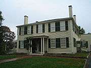
- Reginald A. Fessenden House, which is the only National Historic Landmark located in Newton.
- Silent Spring Institute
References
- Levin, Andy. "Ruthanne Fuller sworn in as Newton's mayor". Newton TAB. Retrieved January 2, 2018.
- "Population and Housing Unit Estimates". Retrieved May 21, 2020.
- McAdow, Ron (1992). The Charles River. Marlborough, Mass: Bliss Publishing Company, Inc. pp. 171–174. ISBN 0-9625144-1-1.
- Ritter, Priscilla R.; Thelma Fleishman (1982). Newton, Massachusetts 1679–1779: A Biographical Directory. New England Historic Genealogical Society.
- Spiegel, Der (April 1, 2007). Inside 9-11: What Really Happened. St. Martin's Publishing Group.
- "US Gazetteer files: 2010, 2000, and 1990". United States Census Bureau. February 12, 2011. Retrieved April 23, 2011.
- Smith, S.F. (1880). "Chapter 1: History of Newton". History of Newton, Massachusetts, Town and City, from its Earliest Settlement to the Present Time, 1630–1880. bostonbasinhills.org. The American Logotype Company. p. 13. Retrieved October 9, 2019.
- Newton's Geographic Information System: City of Newton, Massachusetts Archived February 22, 2012, at the Wayback Machine
- "The Villages of Newton, Mass". newtoncitizens.com. Retrieved February 11, 2016.
- "Monthly Averages for Newton, MA (02458)". The Weather Channel. Retrieved March 16, 2012.
- "Total Population (P1), 2010 Census Summary File 1". American FactFinder, All County Subdivisions within Massachusetts. United States Census Bureau. 2010.
- "Massachusetts by Place and County Subdivision - GCT-T1. Population Estimates". United States Census Bureau. Retrieved July 12, 2011.
- "1990 Census of Population, General Population Characteristics: Massachusetts" (PDF). US Census Bureau. December 1990. Table 76: General Characteristics of Persons, Households, and Families: 1990. 1990 CP-1-23. Retrieved July 12, 2011.
- "1980 Census of the Population, Number of Inhabitants: Massachusetts" (PDF). US Census Bureau. December 1981. Table 4. Populations of County Subdivisions: 1960 to 1980. PC80-1-A23. Retrieved July 12, 2011.
- "1950 Census of Population" (PDF). Bureau of the Census. 1952. Section 6, Pages 21-10 and 21-11, Massachusetts Table 6. Population of Counties by Minor Civil Divisions: 1930 to 1950. Retrieved July 12, 2011.
- "1920 Census of Population" (PDF). Bureau of the Census. Number of Inhabitants, by Counties and Minor Civil Divisions. Pages 21-5 through 21-7. Massachusetts Table 2. Population of Counties by Minor Civil Divisions: 1920, 1910, and 1920. Retrieved July 12, 2011.
- "1890 Census of the Population" (PDF). Department of the Interior, Census Office. Pages 179 through 182. Massachusetts Table 5. Population of States and Territories by Minor Civil Divisions: 1880 and 1890. Retrieved July 12, 2011.
- "1870 Census of the Population" (PDF). Department of the Interior, Census Office. 1872. Pages 217 through 220. Table IX. Population of Minor Civil Divisions, &c. Massachusetts. Retrieved July 12, 2011.
- "1860 Census" (PDF). Department of the Interior, Census Office. 1864. Pages 220 through 226. State of Massachusetts Table No. 3. Populations of Cities, Towns, &c. Retrieved July 12, 2011.
- "1850 Census" (PDF). Department of the Interior, Census Office. 1854. Pages 338 through 393. Populations of Cities, Towns, &c. Retrieved July 12, 2011.
- "1950 Census of Population" (PDF). 1: Number of Inhabitants. United States Census Bureau. 1952. Section 6, Pages 21–7 through 21-09, Massachusetts Table 4. Population of Urban Places of 10,000 or more from Earliest Census to 1920. Retrieved July 12, 2011. Cite journal requires
|journal=(help) - "Census of Population and Housing". United States Census Bureau. Retrieved June 4, 2015.
- "U.S. Census website". United States Census Bureau. Retrieved January 31, 2008.
- "Jewish Population in the United States, 2002" (PDF). Center for Judaic Studies and Contemporary Jewish Life4. p. 14. Archived from the original (PDF) on February 13, 2006.
- "2011–2015 American Community Survey 5-Year Estimates". Retrieved July 1, 2017.
- "QuickFacts Newton City, Massachusetts". United States Census Bureau. Retrieved January 3, 2017.
- "index". Newton.k12.ma.us. Archived from the original on February 11, 2013. Retrieved November 16, 2012.
- "Middlesex Superior Court Clerk's Office".
- Marian Ryan was appointed by Gov. Deval Patrick in April 2013 to fill the unexpired term of DA Gerry Leone, who resigned. See https://www.bostonglobe.com/metro/2013/04/23/marian-ryan-named-middlesex-governor-deval-patrick-will-hold-office-until-election/TY5BZY7POvFOyPFahy2M1M/story.html
- "Welcome to 20/20 Perfect Vision Land Records I2". www.masslandrecords.com.
- "Middlesex Probate and Family Court Division of the Massachusetts Court System – Main Page". Mass.gov. May 24, 2012. Retrieved November 16, 2012.
- "Welcome to the Middlesex Sheriff's Office". Middlesexsheriff.org. Retrieved November 16, 2012.
- John J. Lawn. 188th General Court of the Commonwealth of Massachusetts. Retrieved January 14, 2013.
- Kay S. Khan. 188th General Court of the Commonwealth of Massachusetts. Retrieved January 14, 2013.
- Ruth B. Balser. 188th General Court of the Commonwealth of Massachusetts. Retrieved January 14, 2013.
- Cynthia Stone Creem. 188th General Court of the Commonwealth of Massachusetts. Retrieved January 14, 2013.
- "Registration and Party Enrollment Statistics as of October 17, 2018" (PDF). Massachusetts Elections Division. Retrieved November 27, 2019.
- "Homepage – The Fessenden School". fessenden.org. Retrieved February 11, 2016.
- "Jackson School – Homepage". jacksonschool.org. Retrieved February 11, 2016.
- "Newton Country Day School -> Home". newtoncountryday.org. Retrieved February 11, 2016.
- "Solomon Schechter Day School: A Premier Jewish Independent School in Boston – Solomon Schechter Day School". ssdsboston.org. Retrieved February 11, 2016.
- "Newton Montessori School". Retrieved February 11, 2016.
- "Mount Alvernia High School". Retrieved February 11, 2016.
- "Mount Alvernia Academy". Retrieved February 11, 2016.
- "Massachusetts Closed Colleges". Closed College Consortium. Archived from the original on September 21, 2007. Retrieved October 23, 2007.
- https://patch.com/massachusetts/newton
- "Labor Market Information". lmi2.detma.org. February 7, 2013.
- "TripAdvisor hopes lavish new headquarters in Needham will boost hiring". betaboston.com. Retrieved February 11, 2016.
- "SELECTED ECONOMIC CHARACTERISTICS 2009–2013 American Community Survey 5-Year Estimates". United States Census Bureau. Archived from the original on January 17, 2015. Retrieved January 12, 2015.
- "ACS DEMOGRAPHIC AND HOUSING ESTIMATES 2009–2013 American Community Survey 5-Year Estimates". United States Census Bureau. Archived from the original on January 5, 2015. Retrieved January 12, 2015.
- "HOUSEHOLDS AND FAMILIES 2009–2013 American Community Survey 5-Year Estimates". United States Census Bureau. Archived from the original on February 12, 2020. Retrieved January 12, 2015.
- "Newton Centre, Massachusetts : UnSprawl Case Study : Terrain.org". terrain.org. Retrieved February 11, 2016.
- AAA Map of Boston, Massachusetts, including Arlington, ... Newton, etc, 2007, Heathrow, Florida: AAA
- "Auburndale Cove Picnic Areas & Building". City of Newton. Retrieved April 17, 2014.
- "Charles River Canoe & Kayak in Newton". Archived from the original on April 18, 2014. Retrieved April 17, 2014.
- Archived March 20, 2012, at the Wayback Machine
- Archived March 20, 2012, at the Wayback Machine
- Archived December 26, 2014, at the Wayback Machine
- Archived September 27, 2007, at the Wayback Machine
- "The Barclays: Plainfield architect Donald Ross' journey had humble beginnings in Boston". Retrieved July 24, 2016.
- Archived June 28, 2011, at the Wayback Machine
- "The Union Generals". Historic La Mott, PA. Archived from the original on October 26, 2012. Retrieved November 16, 2012.
- Barbara L. Fredricksen (March 21, 2003). "For Juice, it's been a sweet ride". St. Petersburg Times.
- Jenna Fisher, Patch Staff (March 21, 2019). . Patch.com.
- "'Patriots Day' films in Newton". Wicked Local Newton. May 18, 2016.
- Shanahan, Mark; Meredith Goldstein (September 11, 2013). "Cameron Diaz shooting 'Sex Tape' in Newton". The Boston Globe. Retrieved September 11, 2013.
- "Cameron Diaz, Jason Segel to shoot 'Sex Tape' in Newton". wickedlocal.com. September 9, 2013. Retrieved September 11, 2013.
- "'Sex Tape', starring Cameron Diaz and Jason Segel, is filming in Newton, MA this week". onlocationvacations.com. September 10, 2013. Retrieved September 11, 2013.
- "ArchiveGrid : San Donato, Italy, Newton's Sister City, 1996–2009". beta.worldcat.org. Retrieved May 27, 2017.
- "Newton-San Juan del Sur Sister City Project". Newton-San Juan del Sur Sister City Project. Retrieved May 27, 2017.
Further reading
- Directory of the town of Newton: containing a general directory of the citizens, and a business directory. 1871 Google books
External links
| Wikimedia Commons has media related to Newton, Massachusetts. |
| Wikivoyage has a travel guide for Newton. |
- City of Newton official website
- Newton Citizens (general info)
- Newton/Needham Chamber of Commerce
- WickedLocal:Newton (News from the Newton Tab newspaper)
- Newton Conservators (information about parks and conservation areas)
Municipalities and communities of Middlesex County, Massachusetts, United States | ||
|---|---|---|
| Cities | 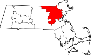 | |
| Towns |
| |
| CDPs | ||
| Other villages |
| |
| Authority control |
|
|---|