Hill, New Hampshire
Hill is a town in Merrimack County, New Hampshire, United States. The population was 1,089 at the 2010 census.[1] It is home to William Thomas State Forest.
Hill, New Hampshire | |
|---|---|
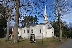 Hill Village Bible Church | |
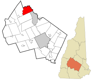 Location in Merrimack County and the state of New Hampshire | |
| Coordinates: 43°31′18″N 71°42′05″W | |
| Country | United States |
| State | New Hampshire |
| County | Merrimack |
| Incorporated | 1778 |
| Villages | Hill Hill Center Murray Hill |
| Government | |
| • Board of Selectmen | Robert Dupuis J. Michael Brady Thomas Seymour |
| Area | |
| • Total | 26.9 sq mi (69.6 km2) |
| • Land | 26.7 sq mi (69.2 km2) |
| • Water | 0.2 sq mi (0.4 km2) 0.60% |
| Elevation | 453 ft (138 m) |
| Population (2010) | |
| • Total | 1,089 |
| • Density | 40/sq mi (16/km2) |
| Time zone | UTC-5 (Eastern) |
| • Summer (DST) | UTC-4 (Eastern) |
| ZIP code | 03243 |
| Area code(s) | 603 |
| FIPS code | 33-35860 |
| GNIS feature ID | 0873624 |
| Website | www |
History
Originally granted as New Chester in 1753, the town took the name Hill in 1837 in honor of Isaac Hill,[2] governor of New Hampshire from 1836 to 1839. To accommodate the construction of the Franklin Falls Dam, the village of Hill was relocated in 1941.[3]
Geography
According to the United States Census Bureau, the town has a total area of 26.9 square miles (69.7 km2), of which 26.7 sq mi (69.2 km2) is land and 0.2 sq mi (0.5 km2) is water, comprising 0.60% of the town. The highest point in town is Dickinson Hill,[4] with an approximate elevation of 1,910 feet (580 m) above sea level. Hill lies fully within the Merrimack River watershed.[5]
Adjacent municipalities
- Bristol, New Hampshire (north)
- New Hampton, New Hampshire (northeast)
- Sanbornton, New Hampshire (east)
- Franklin, New Hampshire (southeast)
- Andover, New Hampshire (south)
- Danbury, New Hampshire (west)
- Alexandria, New Hampshire (northwest)
Demographics
| Historical population | |||
|---|---|---|---|
| Census | Pop. | %± | |
| 1870 | 620 | — | |
| 1880 | 667 | 7.6% | |
| 1890 | 548 | −17.8% | |
| 1900 | 603 | 10.0% | |
| 1910 | 556 | −7.8% | |
| 1920 | 500 | −10.1% | |
| 1930 | 468 | −6.4% | |
| 1940 | 498 | 6.4% | |
| 1950 | 310 | −37.8% | |
| 1960 | 396 | 27.7% | |
| 1970 | 450 | 13.6% | |
| 1980 | 736 | 63.6% | |
| 1990 | 814 | 10.6% | |
| 2000 | 992 | 21.9% | |
| 2010 | 1,089 | 9.8% | |
| Est. 2017 | 1,099 | [6] | 0.9% |
| U.S. Decennial Census[7] | |||
At the 2000 census there were 992 people, 382 households, and 271 families living in the town. The population density was 37.1 people per square mile (14.3/km²). There were 436 housing units at an average density of 16.3 per square mile (6.3/km²). The racial makeup of the town was 98.99% White, 0.10% African American, 0.10% Native American, 0.40% Asian, 0.10% Pacific Islander, and 0.30% from two or more races. Hispanic or Latino of any race were 0.20%.[8]
Of the 382 households 33.0% had children under the age of 18 living with them, 57.9% were married couples living together, 8.4% had a female householder with no husband present, and 28.8% were non-families. 21.2% of households were one person and 8.1% were one person aged 65 or older. The average household size was 2.60 and the average family size was 3.01.
The age distribution was 26.7% under the age of 18, 6.1% from 18 to 24, 31.3% from 25 to 44, 25.7% from 45 to 64, and 10.2% 65 or older. The median age was 39 years. For every 100 females, there were 102.4 males. For every 100 females age 18 and over, there were 100.8 males.
The median household income was $48,333 and the median family income was $50,000. Males had a median income of $32,120 versus $24,313 for females. The per capita income for the town was $21,004. About 2.9% of families and 4.2% of the population were below the poverty line, including 1.2% of those under age 18 and none of those age 65 or over.
Schools
Hill has one school, Jennie D. Blake Elementary School, which serves students in kindergarten through sixth grade. The school was named for Jennie Lind Dickerson Blake, a Hill resident who was born on July 16, 1878. As of 2017, 68 students were enrolled in the school.
References
- United States Census Bureau, U.S. Census website, 2010 Census figures. Retrieved March 23, 2011.
- Gannett, Henry (1905). The Origin of Certain Place Names in the United States. Govt. Print. Off. pp. 156.
- John F. Coggswell, "New Home Town". Saturday Evening Post, 14 Feb 1942, p. 22-23, 44, 46
- U.S. Board on Geographic Names, Geographic Names Information System
- Foster, Debra H.; Batorfalvy, Tatianna N.; Medalie, Laura (1995). Water Use in New Hampshire: An Activities Guide for Teachers. U.S. Department of the Interior and U.S. Geological Survey.
- "Annual Estimates of the Resident Population: April 1, 2010 to July 1, 2017 (PEPANNRES): Minor Civil Divisions – New Hampshire". Archived from the original on February 13, 2020. Retrieved November 15, 2018.
- "Census of Population and Housing". Census.gov. Retrieved June 4, 2016.
- "U.S. Census website". United States Census Bureau. Retrieved 2008-01-31.
External links
- Town of Hill official website
- New Hampshire Economic and Labor Market Information Bureau Profile
- Hill (N.H.: Town) Records, 1765-1880 at Dartmouth College Library
Places adjacent to Hill, New Hampshire | |
|---|---|
Municipalities and communities of Merrimack County, New Hampshire, United States | ||
|---|---|---|
| Cities | 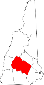 Map of New Hampshire highlighting Merrimack County | |
| Towns | ||
| CDPs | ||
| Other unincorporated communities | ||
| Footnotes | ‡This populated place also has portions in an adjacent county or counties | |
| Authority control |
|
|---|