Narragansett, Rhode Island
Narragansett is a town in Washington County, Rhode Island, United States. The population was 15,868 at the 2010 census. However, during the summer months the town's population more than doubles to near 34,000.[2] The town is colloquially known as "Gansett". The town of Narragansett occupies a narrow strip of land running along the eastern bank of the Pettaquamscutt River to the shore of Narragansett Bay. It was separated from South Kingstown in 1888, and incorporated as a town in 1901.
Narragansett, Rhode Island | |
|---|---|
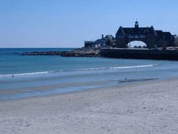 The Towers in Narragansett | |
 Location of Narragansett in Washington County, Rhode Island | |
| Coordinates: 41°26′4″N 71°27′45″W | |
| Country | United States |
| State | Rhode Island |
| County | Washington |
| Area | |
| • Total | 37.8 sq mi (97.8 km2) |
| • Land | 14.1 sq mi (36.6 km2) |
| • Water | 23.6 sq mi (61.2 km2) |
| Elevation | 20 ft (6 m) |
| Population (2010) | |
| • Total | 15,868 |
| • Density | 1,125.4/sq mi (433.6/km2) |
| Time zone | UTC-5 (Eastern (EST)) |
| • Summer (DST) | UTC-4 (EDT) |
| ZIP Codes | 02874 (Saunderstown), 02882 (Narragansett) |
| Area code(s) | 401 |
| FIPS code | 44-48340[1] |
| Website | www.narragansettri.gov |
For geographic and demographic information on the village of Narragansett Pier, which is part of Narragansett, see the article Narragansett Pier.
Geography
According to the United States Census Bureau, the town has a total area of 37.8 square miles (98 km2), of which, 14.1 square miles (37 km2) of it is land and 23.6 square miles (61 km2) of it (62.56%) is water.
The following villages and neighborhoods are wholly or partially located in Narragansett: Saunderstown (shared with North Kingstown), South Ferry, Bonnet Shores, Narragansett Pier, Point Judith, Galilee, Great Island, Salt Pond, Mettatuxet, and Jerusalem (shared with South Kingstown).
Climate
| Climate data for Narragansett, Rhode Island | |||||||||||||
|---|---|---|---|---|---|---|---|---|---|---|---|---|---|
| Month | Jan | Feb | Mar | Apr | May | Jun | Jul | Aug | Sep | Oct | Nov | Dec | Year |
| Record high °F (°C) | 66 (19) |
65 (18) |
79 (26) |
89 (32) |
91 (33) |
94 (34) |
98 (37) |
96 (36) |
93 (34) |
83 (28) |
74 (23) |
70 (21) |
98 (37) |
| Average high °F (°C) | 38 (3) |
40 (4) |
47 (8) |
58 (14) |
68 (20) |
77 (25) |
82 (28) |
81 (27) |
74 (23) |
64 (18) |
53 (12) |
43 (6) |
60 (16) |
| Average low °F (°C) | 22 (−6) |
22 (−6) |
29 (−2) |
38 (3) |
48 (9) |
58 (14) |
64 (18) |
63 (17) |
56 (13) |
45 (7) |
36 (2) |
27 (−3) |
42 (6) |
| Record low °F (°C) | −6 (−21) |
−6 (−21) |
3 (−16) |
19 (−7) |
31 (−1) |
41 (5) |
50 (10) |
49 (9) |
35 (2) |
27 (−3) |
15 (−9) |
4 (−16) |
−6 (−21) |
| Average precipitation inches (mm) | 3.66 (93) |
3.23 (82) |
4.52 (115) |
3.90 (99) |
3.54 (90) |
3.90 (99) |
3.66 (93) |
4.03 (102) |
3.90 (99) |
4.64 (118) |
3.78 (96) |
4.52 (115) |
47.28 (1,201) |
| Average snowfall inches (cm) | 7 (18) |
7 (18) |
3 (7.6) |
0 (0) |
0 (0) |
0 (0) |
0 (0) |
0 (0) |
0 (0) |
0.1 (0.25) |
1 (2.5) |
3 (7.6) |
21.1 (53.95) |
| Source: [3] | |||||||||||||
Demographics
| Historical population | |||
|---|---|---|---|
| Census | Pop. | %± | |
| 1890 | 1,408 | — | |
| 1900 | 1,523 | 8.2% | |
| 1910 | 1,250 | −17.9% | |
| 1920 | 993 | −20.6% | |
| 1930 | 1,258 | 26.7% | |
| 1940 | 1,560 | 24.0% | |
| 1950 | 2,288 | 46.7% | |
| 1960 | 3,444 | 50.5% | |
| 1970 | 7,138 | 107.3% | |
| 1980 | 12,088 | 69.3% | |
| 1990 | 14,985 | 24.0% | |
| 2000 | 16,361 | 9.2% | |
| 2010 | 15,868 | −3.0% | |
| Est. 2017 | 15,504 | [4] | −2.3% |
| U.S. Decennial Census[5][6] | |||
As of the census[1] of 2000, there were 16,361 people, 6,846 households, and 3,847 families residing in the town. The population density was 1,156.5 people per square mile (446.4/km²). There were 9,159 housing units at an average density of 647.4 per square mile (249.9/km²). The racial makeup of the town was 95.84% White, 0.75% African American, 0.90% Native American, 0.76% Asian, 0.02% Pacific Islander, 0.34% from other races, and 1.40% from two or more races. Hispanic or Latino of any race were 1.25% of the population.
There were 6,846 households out of which 22.0% had children under the age of 18 living with them, 44.6% were married couples living together, 8.7% had a female householder with no husband present, and 43.8% were non-families. Of all households 27.2% were made up of individuals and 9.0% had someone living alone who was 65 years of age or older. The average household size was 2.38 and the average family size was 2.86.
In the town, the population was spread out with 17.3% under the age of 18, 19.6% from 18 to 24, 25.0% from 25 to 44, 24.6% from 45 to 64, and 13.5% who were 65 years of age or older. The median age was 36 years. For every 100 females, there were 94.5 males. For every 100 females age 18 and over, there were 92.4 males.
The median income for a household in the town was $50,363, and the median income for a family was $67,571. Males had a median income of $45,436 versus $31,759 for females. The per capita income for the town was $28,194. About 4.9% of families and 16.0% of the population were below the poverty line, including 8.4% of those under age 18 and 5.0% of those age 65 or over. In 2010, Narragansett was estimated to have 2,743 people in poverty; college students represented 71% of that group, and in comparison, statewide college students make up only 13.7 percent of the total population in poverty. This large college factor, in a relatively small community has a profound impact on the overall poverty rate.[2]
From September through May the town is home to many students from the University of Rhode Island located in nearby Kingston.
Recreation
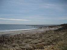

Narragansett is known for its summer recreation and beaches.[7] Fishermen's Memorial State Park, located near Galilee, contains a former military fort (Fort Greene) and a campground.
Three beaches in Narragansett that are most famous are:
- Narragansett Town Beach[8] is located in the center of Narragansett, though it charges a fee—whereas other local (state funded) beaches charge for parking only. Unlike state-funded beaches, it is self-sustaining and is not supported by the tax payers' money. There is a $10.00 charge to park ($15.00 on the weekends/holidays) and a daily $10.00 admission fee to enter onto the beach.
- Scarborough State Beach: The Scarborough Beach Complex comprises two separate areas, the North and South. Each has a pavilion, showers, 75 picnic tables, boardwalk and observation tower. There is a small fee for parking if a spot on nearby streets can not be found. Parking on nearby streets can result in vehicles being towed (especially during the summer months). This beach sits next to a local sewage treatment plant.
- Roger Wheeler State Beach[9] and Salty Brine State Beach[10] are both located in Point Judith, which is the southernmost point of Narragansett. Both beaches are protected by the breakwater that protects the port of Galilee. A new pavilion at Salty Brine State Beach opened in the summer of 2010, complete with concessions, and a wind turbine. The wind turbine was destroyed after a storm in March 2017.[11]
Education
Narragansett operates its own pre-K through 12 educational system with three schools: Narragansett Elementary School, Narragansett Pier Middle School, and Narragansett High School. The Narragansett High School principal, Mr. Daniel F. Warner, was voted the 2008 Principal of the Year. The South County Museum is located within the town. The Narragansett Bay Campus of the University of Rhode Island is located in Narragansett.
Economy
Top employers
According to Narragansett's 2012 Comprehensive Annual Financial Report,[12] the top employers in the city are:
| # | Employer | # of Employees |
|---|---|---|
| 1 | Town of Narragansett | 448 |
| 2 | University of Rhode Island Narragansett Bay Campus | 245 |
| 3 | Stop & Shop | 225 |
| 4 | The Dunes Club | 180 |
| 5 | VNS Home Health Service | 150 |
| 6 | Environmental Protection Agency | 160 |
| 7 | DeWal Industries | 120 |
| 8 | George's of Galilee | 100 |
| 9 | National Marine Fisheries Service | 70 |
Places of worship
- St. Thomas More Church (Roman Catholic)
- St. Veronica Chapel (Roman Catholic)
- St. Mary Star of the Sea Church (Roman Catholic)
- St. Peter By-the-Sea Church (Episcopal)
- Calvary Bible Church (Nondenominational)
- First Baptist Church of Narragansett
- South Ferry Church (Baptist, no regular services)
- Church of Jesus Christ of Latter-day Saint of Narragansett
- Generation Church (nondenominational)
- Congregation Beth David (Jewish conservative)
National Register of Historic Places
Thirteen different buildings and districts in Narragansett are listed on the National Register of Historic Places:[13]
- Central Street Historic District
- Druidsdream (1884)
- Dunmere (1883)
- Earlscourt Historic District
- Gardencourt (1888)
- Gladstone Springhouse and Bottling Plant (1899)
- Greene Inn (1887)
- Narragansett Baptist Church (1850)
- Narragansett Pier Life Saving Station (1888)
- Ocean Road Historic District
- Point Judith Lighthouse (1857)
- Towers Historic District
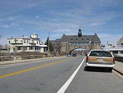
- The Towers (1883)
Notable people
- Karen Adams, television news anchor
- Andy Boss, auto racing driver
- Geoff Boss, auto racing driver
- Peter Boss, auto racing driver
- John Joseph Boylan, Roman Catholic bishop; died in Narragansett
- Ruth Clifford, silent film actress; lived in Narragasnett
- David Caprio, attorney and former state representative
- Frank Caprio, judge and television personality
- Frank T. Caprio, former state treasurer
- Roberta Dunbar, clubwoman, born Narragansett Pier
- Joe Faragalli, football player and coach; died in Narragansett
- John Gardner, farmer and Rhode Island delegate to the Continental Congress (1789)
- Harriet Lane, acting First Lady of the United States for her uncle James Buchanan; died in Narragansett
- Donald Lally, former state representative
- Ted Leo, indie rock musician; lives in Narragansett.[14]
- J. Howard McGrath, former United States Attorney General (1949-1952) and Governor of Rhode Island (1941-1945); died in Narragansett.
- Christopher Murney, actor
- Peter Pezzelli, novelist
- William Russell Sweet, painter and sculptor
- Jack Zilly, football player; died in Narragansett
Cultural allusions
- Narragansett is mentioned in Chapter LI of Theodore Dreiser's The Titan.
- Several episodes in the television cartoon show Family Guy, which takes place in Rhode Island, feature the Narragansett Beach, most notably A Fish out of Water.
- In the 1973 movie The Sting, the Narragansett horse race track is one of those mentioned in the background while performing the con for the mob boss Doyle Lonnegan (Robert Shaw); this track, while well known in the period, was actually in Pawtucket, RI.
- The American Rock Band Phish wrote a song in 1988 titled "Weekapaug Groove" after the southern shore of Narragansett.
- In the 1993 movie Coneheads, Prymatt Conehead, portrayed by Jane Curtin, receives a fake ID where it is mentioned she was born in Narragansett, RI.
- Several scenes from the 2000 movie Me, Myself & Irene, starring Jim Carrey, were filmed in the Great Island area of Narragansett.
See also
References
- "U.S. Census website". United States Census Bureau. Retrieved 2008-01-31.
- Lofgren, Bruce; Michael DeLuca (2012). "Narragansett Population Trends Report" (PDF). Town of Narragansett. p. 22. Archived from the original (PDF) on 26 September 2013. Retrieved 2 December 2012.
- MSN weather records and averages for Narragansett, RI
- "Annual Estimates of the Resident Population for Incorporated Places: April 1, 2010 to July 1, 2015". Archived from the original on June 2, 2016. Retrieved July 2, 2016.
- "Census of Population and Housing". Census.gov. Retrieved June 4, 2016.
- Snow, Edwin M. (1867). Report upon the Census of Rhode Island 1865. Providence, RI: Providence Press Company.
- "Narragansett Ri tourism,vacation rental,restaurants". Narragansett Ri tourism,vacation rental,restaurants. Retrieved 23 March 2018.
- "Narragansett Town Beach". narragansettri.com. Retrieved 23 March 2018.
- Roger Wheeler State Beach Archived 2010-03-25 at the Wayback Machine
- Salty Brine State Beach Archived 2010-03-25 at the Wayback Machine
- NEWS, CRYSTAL BUI, NBC 10. "Wind turbine at Narragansett beach collapses in storm". turnto10.com. Retrieved 23 March 2018.
- "Town of Narragansett CAFR". narragansettri.gov. Retrieved 23 March 2018.
- "National Register Information System". National Register of Historic Places. National Park Service. January 23, 2007.
- Duguay, Rob (8 December 2015). "Interview: Now Christmas collaborators, Aimee Mann and Ted Leo find common musical ground". Vanyaland. Retrieved 1 September 2016.
External links
| Wikisource has the text of the 1911 Encyclopædia Britannica article Narragansett. |
| Wikivoyage has a travel guide for Narragansett. |
Places adjacent to Narragansett, Rhode Island | ||||||||||
|---|---|---|---|---|---|---|---|---|---|---|
| ||||||||||
Municipalities and communities of Washington County, Rhode Island, United States | ||
|---|---|---|
| Towns | 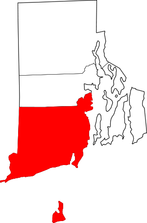 Map of Rhode Island highlighting Washington County | |
| CDPs | ||
| Other villages |
| |
| Indian reservation | ||
| Islands |  | |
|---|---|---|
| Major rivers | ||
| Cities & towns | ||
| Bridges | ||
Providence (capital) | ||
| Topics |
| |
| Society |
| |
| Regions | ||
| Cities | ||
| Towns |
| |
| Authority control |
|
|---|