Wayland, Massachusetts
Wayland is a town in Middlesex County, Massachusetts, United States. The population was 13,954 as of 2017. Wayland is part of the fifth congressional district of Massachusetts.
Wayland, Massachusetts | |
|---|---|
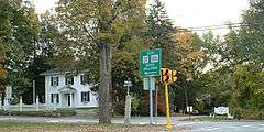
 First Parish in Wayland | |
 Seal | |
 Location in Middlesex County in Massachusetts | |
| Coordinates: 42°21′45″N 71°21′41″W[1] | |
| Country | United States |
| State | Massachusetts |
| County | Middlesex |
| Settled | 1638 |
| Incorporated | 1780 |
| Government | |
| • Type | Open town meeting |
| Area | |
| • Total | 15.9 sq mi (41.2 km2) |
| • Land | 15.2 sq mi (39.4 km2) |
| • Water | 0.7 sq mi (1.7 km2) |
| Elevation | 127 ft (39 m) |
| Population (2010) | |
| • Total | 13,444 |
| • Density | 850/sq mi (330/km2) |
| Time zone | UTC-5 (Eastern) |
| • Summer (DST) | UTC-4 (Eastern) |
| ZIP code | 01778 |
| Area code(s) | 508/774 |
| FIPS code | 25-73790 |
| GNIS feature ID | 0618243 |
| Website | http://www.wayland.ma.us/ |
Wayland was ranked number three on the list of "Best Public High Schools in Boston 2019"."[2] Wayland is ranked #6 on the list of "Best Suburbs to Live in Massachusetts" and is listed within the top ten towns in Massachusetts and top 100 towns in the United States as one of the "Suburbs With the Best Public Schools" and "Best Suburbs to Raise a Family in America."[3]
"Wayland High School has received an enormous amount of attention from the press. Featured in Life magazine, Time magazine, The Architectural Forum, The New York Times, and The Boston Globe, it was identified as a leader of the advancement of education."[4]
For geographic and demographic information on Cochituate, which is part of Wayland, please see the article Cochituate, Massachusetts.
History
Wayland was the first settlement of Sudbury Plantation in 1638. The Town of East Sudbury was incorporated on April 10, 1780, on land east of the Sudbury River that had formerly been part of Sudbury. On March 11, 1835, East Sudbury became Wayland, a farming community, presumably in honor of Dr. Francis Wayland, who was president of Brown University and a friend of East Sudbury's Judge Edward Mellen. Both Wayland and Mellen became benefactors of the town's library, the first free public library in the state.[5]
The Wayland Free Public Library was established in 1848 and is arguably the first in Massachusetts[6] The building was rebuilt in 1900,[6] and is a landmark in the town of Wayland.
In 2010, Boston Duck Tours was asked to help transport flood victims in Wayland. Torrential rains had left Pelham Island area of Wayland isolated and the Ducks were brought in to ferry people in and out of their neighborhood until the waters receded.[7]
The Wayland display server protocol is named after the town.
Geography
According to the United States Census Bureau, the town has a total area of 15.9 square miles (41 km2), of which 15.2 square miles (39 km2) is land and 0.7 square miles (1.8 km2), or 4.21%, is water. Wayland borders Lincoln, Sudbury, Weston, Framingham, and Natick.
Places adjacent to Wayland, Massachusetts | ||||||||||
|---|---|---|---|---|---|---|---|---|---|---|
| ||||||||||
Demographics
| Historical population | ||
|---|---|---|
| Year | Pop. | ±% |
| 1850 | 1,115 | — |
| 1860 | 1,188 | +6.5% |
| 1870 | 1,240 | +4.4% |
| 1880 | 1,962 | +58.2% |
| 1890 | 2,060 | +5.0% |
| 1900 | 2,303 | +11.8% |
| 1910 | 2,206 | −4.2% |
| 1920 | 1,935 | −12.3% |
| 1930 | 2,937 | +51.8% |
| 1940 | 3,505 | +19.3% |
| 1950 | 4,407 | +25.7% |
| 1960 | 10,444 | +137.0% |
| 1970 | 13,461 | +28.9% |
| 1980 | 12,170 | −9.6% |
| 1990 | 11,874 | −2.4% |
| 2000 | 13,100 | +10.3% |
| 2010 | 13,444 | +2.6% |
| * = population estimate. Source: United States Census records and Population Estimates Program data.[8][9][10][11][12][13][14][15][16][17] | ||
As of the census[18] of 2010, there were 13,444 people, 4,808 households, and 3,676 families residing in the town. The population density was 859.9 people per square mile (332.1/km²). There were 5,021 housing units at an average density of 310.8 per square mile (120.0/km²). The racial makeup of the town was 87.2% White, 0.9% African American, 0.0% Native American, 9.9% Asian, 0.0% Pacific Islander, 0.4% from other races, and 1.6% from two or more races. Hispanic or Latino of any race were 2.4% of the population.
As of 2000, there were 4,625 households out of which 41.4% had children under the age of 18 living with them, 71.5% were married couples living together, 7.1% had a female householder with no husband present, and 19.5% were non-families. 16.1% of all households were made up of individuals and 7.6% had someone living alone who was 65 years of age or older. The average household size was 2.80 and the average family size was 3.15.
In the town, the population was spread out with 28.7% under the age of 18, 3.4% from 18 to 24, 24.7% from 25 to 44, 29.0% from 45 to 64, and 14.3% who were 65 years of age or older. The median age was 41 years. For every 100 females, there were 93.0 males. For every 100 females age 18 and over, there were 87.6 males.
The median income for a household in the town was $121,036, and the median income for a family was $204,033.47. Males had a median income of $136,344 versus $60,875 for females. The per capita income for the town was $75,144. About 2.1% of families and 2.5% of the population were below the poverty line, including 1.9% of those under age 18 and 2.7% of those age 65 or over.
Education

- Claypit Hill School
- Happy Hollow School
- Loker School
- Wayland High School
- Wayland Middle School
Notable residents
- Sammy Adams, rapper
- Robert Anastas, former hockey coach and teacher who founded SADD chapter at Wayland High School following the 1981 deaths of two students in drunk driving accidents
- Joshua Bekenstein, co-chairman of Bain Capital
- Amar Bose, founder of Bose Corporation, a company that specializes in high-quality sound systems
- Lydia Maria Child, 19th-century American abolitionist, novelist, journalist, author of "Over the River and Through the Woods"
- Glenn Cooper Internationally best-selling thriller writer and film producer
- Gerard Cosloy, recording industry executive. Manager of Homestead Records, Co-founder of Matador Records, Owner of 12XU Records.
- Archibald Cox, legal scholar, Special Prosecutor of the Watergate Scandal involving President Nixon's Administration
- Jae Crowder, NBA player
- Ricky Davis, NBA player
- David Hackett Fischer, Brandeis Professor of History and author
- Tom Hamilton, bass player for Aerosmith
- Josiah Johnson Hawes, pioneering 19th-century photographer
- Beatrice Herford, actress
- Ted Johnson, NFL player
- Thomas Kiefer, rower in the 1984 Summer Olympics
- Joyce Kulhawik, arts and entertainment anchor for WBZ-TV News in Boston
- Daniel Lopatin, experimental musician better known as Oneohtrix Point Never
- Walter McCarty, NBA player and coach
- Allen Morgan, founder and first executive director of Sudbury Valley Trustees
- Johnny Most, the radio voice of the Boston Celtics
- Tim Murphy, head coach of the Harvard football team
- Alvaro Pascual-Leone, noted neuroscientist
- Jonathan Papelbon, MLB player
- Samuel Parris, Reverend and Salem Witch Trials magistrate, buried in an unmarked grave in North Cemetery
- Peter Rowan, bluegrass musician
- Harold Russell, Academy Award winner for his role as a disabled World War II vet in 1946's The Best Years of Our Lives
- Alberto Salazar, marathon runner
- Taylor Schilling, actress and star of the NBC hospital drama Mercy as well as the 2012 movie The Lucky One and the Netflix original drama-comedy series Orange is the New Black.
- Dwight Schofield, professional hockey player for Montreal Canadiens,Washington Capitals,Winnipeg Jets and St. Louis Blues.
- Tom Scholz, guitarist for 1970s rock group Boston; their debut album was recorded in his basement in Wayland.
- Edmund Sears, 1800s Unitarian parish minister, author who wrote a number of theological works influential to his contemporary liberal Protestants, famous for penning the words to "It Came Upon the Midnight Clear".
- Mary Sears, Oceanographer
- Sarah Sewall, lecturer
- Ryan Sypek, actor and star of the TV series Wildfire
- Steven Tyler, member of Aerosmith, who held the first and only rock concert in the Wayland High School field house before the band became known worldwide
- Michael VanRooyen
- Gladys Widdiss, tribal historian and potter, President of the Aquinnah Wampanoag of Gay Head from 1978 until 1987[19]
See also
References
- "Wayland". Geographic Names Information System. United States Geological Survey. Retrieved June 18, 2020.
- scraper, I'm a. "The Best Public High Schools in Greater Boston". Boston Magazine. Retrieved 2019-11-13.
- "2019 Wayland Best Places Rankings". Niche. Retrieved 2019-11-13.
- "Wayland High School", Wikipedia, 2019-11-01, retrieved 2019-11-13
- Town of Wayland website Archived June 10, 2010, at the Wayback Machine
- http://waylandlibrary.org/about-us/history/
- Martine Powers (2010-04-01). "A Boston icon rides to the rescue in flooded Wayland - Local News Updates - MetroDesk - The Boston Globe". Boston.com. Retrieved 2012-05-06.
- "Total Population (P1), 2010 Census Summary File 1". American FactFinder, All County Subdivisions within Massachusetts. United States Census Bureau. 2010.
- "Massachusetts by Place and County Subdivision - GCT-T1. Population Estimates". United States Census Bureau. Retrieved July 12, 2011.
- "1990 Census of Population, General Population Characteristics: Massachusetts" (PDF). US Census Bureau. December 1990. Table 76: General Characteristics of Persons, Households, and Families: 1990. 1990 CP-1-23. Retrieved July 12, 2011.
- "1980 Census of the Population, Number of Inhabitants: Massachusetts" (PDF). US Census Bureau. December 1981. Table 4. Populations of County Subdivisions: 1960 to 1980. PC80-1-A23. Retrieved July 12, 2011.
- "1950 Census of Population" (PDF). Bureau of the Census. 1952. Section 6, Pages 21-10 and 21-11, Massachusetts Table 6. Population of Counties by Minor Civil Divisions: 1930 to 1950. Retrieved July 12, 2011.
- "1920 Census of Population" (PDF). Bureau of the Census. Number of Inhabitants, by Counties and Minor Civil Divisions. Pages 21-5 through 21-7. Massachusetts Table 2. Population of Counties by Minor Civil Divisions: 1920, 1910, and 1920. Retrieved July 12, 2011.
- "1890 Census of the Population" (PDF). Department of the Interior, Census Office. Pages 179 through 182. Massachusetts Table 5. Population of States and Territories by Minor Civil Divisions: 1880 and 1890. Retrieved July 12, 2011.
- "1870 Census of the Population" (PDF). Department of the Interior, Census Office. 1872. Pages 217 through 220. Table IX. Population of Minor Civil Divisions, &c. Massachusetts. Retrieved July 12, 2011.
- "1860 Census" (PDF). Department of the Interior, Census Office. 1864. Pages 220 through 226. State of Massachusetts Table No. 3. Populations of Cities, Towns, &c. Retrieved July 12, 2011.
- "1850 Census" (PDF). Department of the Interior, Census Office. 1854. Pages 338 through 393. Populations of Cities, Towns, &c. Retrieved July 12, 2011.
- "U.S. Census website". United States Census Bureau. Retrieved 2008-01-31.
- Méras., Phyllis (2012-06-15). "Gladys Widdiss Dies at 97, Was Widely Respected Tribal Elder". Vineyard Guardian. Retrieved 2012-07-02.
Further reading
- 1871 Atlas of Massachusetts. by Wall & Gray. Map of Massachusetts. Map of Middlesex County.
- History of Middlesex County, Massachusetts, Volume 1 (A-H), Volume 2 (L-W) compiled by Samuel Adams Drake, published 1879-1880. 572 and 505 pages. Wayland article by Rev. Josiah H. Temple in volume 2 pages 506-511.
External links
| Wikimedia Commons has media related to Wayland, Massachusetts. |
| Wikivoyage has a travel guide for Wayland. |
Municipalities and communities of Middlesex County, Massachusetts, United States | ||
|---|---|---|
| Cities | 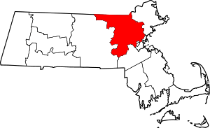 | |
| Towns |
| |
| CDPs | ||
| Other villages |
| |
| Authority control |
|
|---|