Harrison County, Missouri
Harrison County is a county located in the northwest portion of the U.S. state of Missouri. As of the 2010 census, the population was 8,957.[1] Its county seat is Bethany.[2] The county was organized February 14, 1845 and named for U.S. Representative Albert G. Harrison of Missouri.[3]
Harrison County | |
|---|---|
 Harrison County Courthouse in Bethany | |
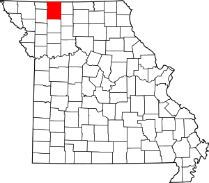 Location within the U.S. state of Missouri | |
 Missouri's location within the U.S. | |
| Coordinates: 40°21′N 93°59′W | |
| Country | |
| State | |
| Founded | February 14, 1845 |
| Named for | Albert G. Harrison |
| Seat | Bethany |
| Largest city | Bethany |
| Area | |
| • Total | 726 sq mi (1,880 km2) |
| • Land | 723 sq mi (1,870 km2) |
| • Water | 3.9 sq mi (10 km2) 0.5% |
| Population (2010) | |
| • Total | 8,957 |
| • Estimate (2018) | 8,414 |
| • Density | 12/sq mi (4.8/km2) |
| Time zone | UTC−6 (Central) |
| • Summer (DST) | UTC−5 (CDT) |
| Congressional district | 6th |
Geography
According to the U.S. Census Bureau, the county has a total area of 726 square miles (1,880 km2), of which 723 square miles (1,870 km2) is land and 3.9 square miles (10 km2) (0.5%) is water.[4]
Adjacent counties
- Ringgold County, Iowa (north)
- Decatur County, Iowa (northeast)
- Mercer County (east)
- Grundy County (southeast)
- Daviess County (south)
- Gentry County (southwest)
- Worth County (northwest)
Demographics
| Historical population | |||
|---|---|---|---|
| Census | Pop. | %± | |
| 1850 | 2,447 | — | |
| 1860 | 10,601 | 333.2% | |
| 1870 | 14,635 | 38.1% | |
| 1880 | 20,304 | 38.7% | |
| 1890 | 21,033 | 3.6% | |
| 1900 | 24,398 | 16.0% | |
| 1910 | 20,466 | −16.1% | |
| 1920 | 19,719 | −3.6% | |
| 1930 | 17,233 | −12.6% | |
| 1940 | 16,525 | −4.1% | |
| 1950 | 14,107 | −14.6% | |
| 1960 | 11,603 | −17.8% | |
| 1970 | 10,257 | −11.6% | |
| 1980 | 9,890 | −3.6% | |
| 1990 | 8,469 | −14.4% | |
| 2000 | 8,850 | 4.5% | |
| 2010 | 8,957 | 1.2% | |
| Est. 2018 | 8,414 | [5] | −6.1% |
| U.S. Decennial Census[6] 1790-1960[7] 1900-1990[8] 1990-2000[9] 2010-2015[1] | |||
As of the 2010 census, there were 8,957 people, 3,669 households and 2,461 families residing in the county. The population density was 12 people per square mile (5/km²). There were 4,407 housing units at an average density of 6 per square mile (2/km²). The racial makeup of the county was 97.55% White, 0.36% Native American, 0.33% Black or African American, 0.20% Asian, 0.10% Pacific Islander, 0.52% from other races and 0.93% from two or more races. Approximately 1.57% of the population were Hispanic or Latino of any race.
There were 3,669 households out of which 29.79% had children under the age of 18 living with them, 54.51% were married couples living together, 8.29% had a female householder with no husband present and 32.92% were non-families. 28.26% of all households were made up of individuals and 14.31% had someone living alone who was 65 years of age or older. The average household size was 2.40 and the average family size was 2.93.
In the county, the population was spread out with 24.80% under the age of 18, 7.18% from 18 to 24, 20.88% from 25 to 44, 26.44% from 45 to 64 and 20.70% who were 65 years of age or older. The median age was 42.6 years. For every 100 females there were 98.47 males. For every 100 females age 18 and over, there were 93.79 males.
The median income for a household in the county was $35,000 and the median income for a family was $47,788. Males had a median income of $33,105 versus $25,388 for females. The per capita income for the county was $18,967. About 10.3% of families and 15.1% of the population were below the poverty line, including 18.9% of those under age 18 and 13.8% of those age 65 or over.
Religion
According to the Association of Religion Data Archives County Membership Report (2010), evangelical Protestantism is the most common religion among adherents in Harrison County, although 37.69% of the population does not claim any religion. The most predominant denominations among residents in Harrison County who adhere to a religion are Southern Baptists (44.11%), United Methodists (10.77%) and Disciples of Christ (10.76%).
Education
Public schools
- Cainsville R-I School District - Cainsville
- Cainsville Elementary School (PK-06)
- Cainsville High School (07-12)
- Gilman City R-IV School District - Gilman City
- Gilman City Elementary School (PK-06)
- Gilman City High School (07-12)
- North Harrison County R-III School District - Eagleville
- North Harrison County Elementary School (PK-05)
- North Harrison County High School (06-12)
- Ridgeway R-V School District - Ridgeway
- Ridgeway Elementary School (PK-06)
- Ridgeway High School (07-12)
- South Harrison County R-II School District - Bethany
- South Harrison County Early Childhood Educational Center (PK)
- South Harrison County Elementary School (K-06)
- South Harrison County High School (07-12)
Private schools
- Zadie Creek School - Eagleville (02-09) - Amish
Public libraries
- Bethany Public Library[10]
Politics
Local
The Republican Party controls politics at the local level in Harrison County. Republicans hold all but one of the elected positions in the county.
| Harrison County, Missouri | ||||
|---|---|---|---|---|
| Elected countywide officials | ||||
| Assessor | Lila Mae Craig | Republican | ||
| Circuit Clerk | C. Sherece Eivins | Republican | ||
| County Clerk | Jackie Deskins | Republican | ||
| Collector | Cheryl Coleman | Republican | ||
| Commissioner (Presiding) |
Jack W. Hodge | Republican | ||
| Commissioner (District 1) |
Roger D. Gibson | Republican | ||
| Commissioner (District 2) |
George Bowles | Republican | ||
| Coroner | Jeremy Eivins | Republican | ||
| Prosecuting Attorney | R. Cristine Stallings | Democratic | ||
| Public Administrator | Kimberly King | Republican | ||
| Recorder | C. Sherece Eivins | Republican | ||
| Sheriff | Trevor Place | Republican | ||
| Surveyor | Edgar Lawrence | Republican | ||
| Treasurer | Cheryl Coleman | Republican | ||
State
| Year | Republican | Democratic | Third Parties |
|---|---|---|---|
| 2016 | 67.50% 2,473 | 29.50% 1,081 | 3.00 110 |
| 2012 | 56.78% 2,072 | 39.82% 1,453 | 3.40% 124 |
| 2008 | 54.06 % 2,090 | 43.87% 1,696 | 2.07% 80 |
| 2004 | 63.53% 2,556 | 35.22% 1,417 | 1.25% 50 |
| 2000 | 60.16% 2,307 | 37.29% 1,430 | 2.55% 98 |
| 1996 | 39.36% 1,472 | 58.82% 2,200 | 1.82% 68 |
Harrison County is a part of Missouri's 2nd District in the Missouri House of Representatives and is represented by J. Eggleston (R-Maysville).
| Party | Candidate | Votes | % | ± | |
|---|---|---|---|---|---|
| Republican | J. Eggleston | 3,282 | 100.00% | +23.37 | |
| Party | Candidate | Votes | % | ± | |
|---|---|---|---|---|---|
| Republican | J. Eggleston | 1,767 | 76.63% | -9.63 | |
| Democratic | Mike Waltemath | 539 | 23.37% | +23.37 | |
| Party | Candidate | Votes | % | ± | |
|---|---|---|---|---|---|
| Republican | Casey Guernsey | 3,151 | 86.26% | ||
| Independent | Jim Nash | 502 | 13.74% | ||
Harrison County is a part of Missouri’s 12th District in the Missouri Senate and is currently represented by Dan Hegeman (R-Cosby).
| Party | Candidate | Votes | % | ± | |
|---|---|---|---|---|---|
| Republican | Dan Hegeman | 2,051 | 100.00 | ||
Federal
| Party | Candidate | Votes | % | ± | |
|---|---|---|---|---|---|
| Republican | Roy Blunt | 2,415 | 65.89% | +17.69 | |
| Democratic | Jason Kander | 1,053 | 28.73% | -14.33 | |
| Libertarian | Jonathan Dine | 88 | 2.40% | -6.33 | |
| Green | Johnathan McFarland | 37 | 1.01% | +1.01 | |
| Constitution | Fred Ryman | 72 | 1.96% | +1.96 | |
| Party | Candidate | Votes | % | ± | |
|---|---|---|---|---|---|
| Republican | Todd Akin | 1,744 | 48.20% | ||
| Democratic | Claire McCaskill | 1,558 | 43.06% | ||
| Libertarian | Jonathan Dine | 316 | 8.73% | ||
Harrison County is included in Missouri’s 6th Congressional District and is currently represented by Sam Graves (R-Tarkio) in the U.S. House of Representatives.
| Party | Candidate | Votes | % | ± | |
|---|---|---|---|---|---|
| Republican | Sam Graves | 2,940 | 80.84% | +1.73 | |
| Democratic | David M. Blackwell | 578 | 15.89% | -0.32 | |
| Libertarian | Russ Lee Monchil | 81 | 2.23% | -2.45 | |
| Green | Mike Diel | 38 | 1.04% | +1.04 | |
| Party | Candidate | Votes | % | ± | |
|---|---|---|---|---|---|
| Republican | Sam Graves | 1,859 | 79.11% | +0.99 | |
| Democratic | Bill Hedge | 381 | 16.21% | -3.12 | |
| Libertarian | Russ Lee Monchil | 110 | 4.68% | +2.13 | |
| Party | Candidate | Votes | % | ± | |
|---|---|---|---|---|---|
| Republican | San Graves | 2,850 | 78.12% | ||
| Democratic | Kyle Yarber | 705 | 19.33% | ||
| Libertarian | Russ Lee Monchil | 93 | 2.55% | ||
Political culture
Harrison County is often carried by Republican candidates. The last time a Democratic candidate has won the county was in 1992 by Bill Clinton: however, the victory was of a margin of .7%.
| Year | Republican | Democratic | Third parties |
|---|---|---|---|
| 2016 | 80.4% 2,965 | 15.6% 574 | 4.1% 150 |
| 2012 | 71.0% 2,624 | 26.6% 984 | 2.4% 87 |
| 2008 | 64.2% 2,512 | 32.9% 1,287 | 3.0% 116 |
| 2004 | 67.4% 2,729 | 31.6% 1,279 | 1.0% 40 |
| 2000 | 63.9% 2,552 | 33.3% 1,328 | 2.8% 111 |
| 1996 | 44.8% 1,737 | 42.0% 1,628 | 13.3% 515 |
| 1992 | 37.0% 1,563 | 37.7% 1,590 | 25.3% 1,069 |
| 1988 | 55.9% 2,271 | 43.7% 1,776 | 0.4% 16 |
| 1984 | 63.3% 2,844 | 36.7% 1,649 | |
| 1980 | 58.7% 2,734 | 37.2% 1,732 | 4.1% 189 |
| 1976 | 51.5% 2,478 | 47.9% 2,304 | 0.6% 31 |
| 1972 | 72.1% 3,574 | 27.9% 1,383 | |
| 1968 | 59.6% 3,092 | 32.5% 1,688 | 7.9% 412 |
| 1964 | 47.4% 2,516 | 52.6% 2,787 | |
| 1960 | 65.4% 4,166 | 34.6% 2,200 | |
| 1956 | 62.2% 4,141 | 37.8% 2,518 | |
| 1952 | 69.5% 5,191 | 30.3% 2,261 | 0.2% 13 |
| 1948 | 56.0% 3,646 | 43.8% 2,854 | 0.2% 13 |
| 1944 | 62.2% 4,330 | 37.7% 2,623 | 0.2% 11 |
| 1940 | 61.4% 5,304 | 38.5% 3,325 | 0.1% 7 |
| 1936 | 55.2% 4,888 | 44.5% 3,942 | 0.3% 22 |
| 1932 | 42.1% 2,476 | 57.4% 3,376 | 0.5% 31 |
| 1928 | 67.4% 4,818 | 32.4% 2,319 | 0.2% 16 |
| 1924 | 58.2% 4,247 | 38.3% 2,792 | 3.6% 261 |
| 1920 | 66.6% 5,151 | 32.3% 2,502 | 1.1% 87 |
| 1916 | 53.9% 2,741 | 43.3% 2,205 | 2.8% 143 |
| 1912 | 40.5% 2,081 | 38.6% 1,985 | 20.9% 1,074 |
| 1908 | 58.4% 2,842 | 39.8% 1,938 | 1.8% 86 |
| 1904 | 63.0% 3,014 | 33.3% 1,596 | 3.7% 177 |
| 1900 | 56.3% 3,083 | 40.3% 2,209 | 3.4% 188 |
| 1896 | 53.0% 2,956 | 46.3% 2,582 | 0.7% 39 |
| 1892 | 52.8% 2,474 | 34.8% 1,630 | 12.4% 579 |
| 1888 | 56.2% 2,418 | 40.0% 1,722 | 3.7% 161 |
At the presidential level, Harrison County is reliably Republican. George W. Bush carried the county easily in 2000 and 2004. Bill Clinton was the last Democratic presidential nominee to carry Harrison County in 1992. Like many of the rural counties throughout Missouri, Harrison County strongly favored John McCain over Barack Obama in 2008.
Like most rural areas throughout northwest Missouri, voters in Harrison County generally adhere to socially and culturally conservative principles which tend to influence their Republican leanings. In 2004, Missourians voted on a constitutional amendment to define marriage as the union between a man and a woman—it overwhelmingly won in Harrison County with 81% of the vote. The initiative passed the state with 71% support from voters. In 2006, Missourians voted on a constitutional amendment to fund and legalize embryonic stem cell research in the state—it failed in Harrison County with 56% voting against the measure. The initiative narrowly passed the state with 51% of support from voters as Missouri became one of the first states in the nation to approve embryonic stem cell research. Despite Harrison County's longstanding tradition of supporting socially conservative platforms, voters in the county have a penchant for advancing populist causes like increasing the minimum wage. In 2006, Missourians voted on a proposition (Proposition B) to increase the minimum wage in the state to $6.50 an hour—it passed Harrison County with 61% of the vote. The proposition strongly passed every single county in Missouri with 79% voting in favor. (During the same election, voters in five other states also strongly approved increases in the minimum wage.)
Missouri presidential preference primaries
2012
In the 2012 Missouri Republican Presidential Primary, voters in Harrison County supported former U.S. Senator Rick Santorum (R-Pennsylvania), who finished first in the state at large, but ultimately lost the nomination to former Governor Mitt Romney (R-Massachusetts). Delegates were chosen at a county caucus that ultimately selected an uncommitted delegation.
2008
- Former U.S. Senator Hillary Clinton (D-New York) received more votes, a total of 436, than any candidate from either party in Harrison County during the 2008 presidential primary.
| Harrison County, Missouri | |
|---|---|
| 2008 Republican primary in Missouri | |
| John McCain | 288 (32.65%) |
| Mike Huckabee | 277 (31.41%) |
| Mitt Romney | 207 (23.47%) |
| Ron Paul | 93 (10.54%) |
| Harrison County, Missouri | |
|---|---|
| 2008 Democratic primary in Missouri | |
| Hillary Clinton | 436 (60.81%) |
| Barack Obama | 249 (34.73%) |
| John Edwards (withdrawn) | 24 (3.35%) |
Communities
Cities
- Bethany (county seat)
- Cainsville
- Gilman City
- New Hampton
- Ridgeway
Villages
Unincorporated communities
Townships
Source[12]
- Adams
- Bethany
- Butler
- Clay
- Colfax
- Cypress
- Dallas
- Fox Creek
- Grant
- Hamilton
- Jefferson
- Lincoln
- Madison
- Marion
- Sherman
- Sugar Creek
- Trail Creek
- Union
- Washington
- White Oak
Notable people
- Babe Adams - MLB pitcher (1906-1926)
- Leonard Boswell - Politician
- Frank Buckles - Last surviving American veteran of World War I
- Jesse N. Funk - World War I Medal of Honor recipient
- Beulah Poynter - Actress, playwright and author
See also
- National Register of Historic Places listings in Harrison County, Missouri
References
- "State & County QuickFacts". United States Census Bureau. Archived from the original on June 7, 2011. Retrieved September 9, 2013.
- "Find a County". National Association of Counties. Retrieved 2011-06-07.
- Eaton, David Wolfe (1916). How Missouri Counties, Towns and Streams Were Named. The State Historical Society of Missouri. p. 171.
- "2010 Census Gazetteer Files". United States Census Bureau. August 22, 2012. Archived from the original on October 21, 2013. Retrieved November 16, 2014.
- "Population and Housing Unit Estimates". Retrieved November 20, 2019.
- "U.S. Decennial Census". United States Census Bureau. Retrieved November 16, 2014.
- "Historical Census Browser". University of Virginia Library. Retrieved November 16, 2014.
- "Population of Counties by Decennial Census: 1900 to 1990". United States Census Bureau. Retrieved November 16, 2014.
- "Census 2000 PHC-T-4. Ranking Tables for Counties: 1990 and 2000" (PDF). United States Census Bureau. Retrieved November 16, 2014.
- Breeding, Marshall. "Bethany Public Library". Libraries.org. Retrieved May 8, 2017.
- Leip, David. "Dave Leip's Atlas of U.S. Presidential Elections". uselectionatlas.org. Retrieved 2018-03-25.
- USGenWeb Project, Harrison County, Missouri
Further reading
- Wanamaker, George W. History of Harrison County, Missouri (1921) online
External links
- Digitized 1930 Plat Book of Harrison County from University of Missouri Division of Special Collections, Archives, and Rare Books
- Harrison County Sheriff's Office
Places adjacent to Harrison County, Missouri | ||||||||||
|---|---|---|---|---|---|---|---|---|---|---|
| ||||||||||
Municipalities and communities of Harrison County, Missouri, United States | ||
|---|---|---|
| Cities | Map of Missouri highlighting Harrison County | |
| Villages | ||
| Townships | ||
| Unincorporated communities | ||
| Footnotes | ‡This populated place also has portions in an adjacent county or counties | |

| Authority control |
|
|---|