Holt County, Missouri
Holt County is a county located in the northwestern portion of the U.S. state of Missouri. As of the 2010 census, the population was 4,912.[1] Its county seat is Oregon.[2] The county was organized February 15, 1841. Originally named Nodaway County, it was soon renamed for David Rice Holt (1803–1840), a Missouri state legislator from Platte County.[3][4][5]
Holt County | |
|---|---|
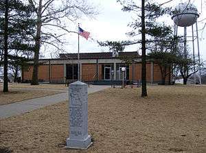 Holt County Courthouse in Oregon | |
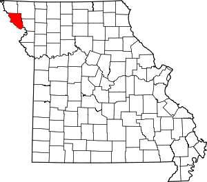 Location within the U.S. state of Missouri | |
 Missouri's location within the U.S. | |
| Coordinates: 40°05′N 95°13′W | |
| Country | |
| State | |
| Founded | February 15, 1841 |
| Named for | David Rice Holt |
| Seat | Oregon |
| Largest city | Mound City |
| Area | |
| • Total | 470 sq mi (1,200 km2) |
| • Land | 463 sq mi (1,200 km2) |
| • Water | 7.7 sq mi (20 km2) 1.6% |
| Population (2010) | |
| • Total | 4,912 |
| • Estimate (2018) | 4,404 |
| • Density | 10/sq mi (4.0/km2) |
| Time zone | UTC−6 (Central) |
| • Summer (DST) | UTC−5 (CDT) |
| Congressional district | 6th |
| Website | holtcounty |
History
The History of Holt County, Missouri from the Time of the Platte Purchase through 1916 and The History of Holt and Atchison Counties, Missouri (published 1882) are available online.[6][7]
In 1972, the Holt County Historical Society was established.[8]
Holt County was impacted by the 2019 Midwestern U.S. floods. About 30,000 acres (12,140 hectares) of the 95,000 acres (38,445 hectares) that flooded in spring 2019 were still underwater in late October. Some of the floodwater was expected to freeze in place over the winter.[9]
Geography
According to the U.S. Census Bureau, the county has a total area of 470 square miles (1,200 km2), of which 463 square miles (1,200 km2) is land and 7.7 square miles (20 km2) (1.6%) is water.[10]
Adjacent counties
- Atchison County (north)
- Nodaway County (northeast)
- Andrew County (southeast)
- Doniphan County, Kansas (south)
- Brown County, Kansas (southwest)
- Richardson County, Nebraska (west)
- Nemaha County, Nebraska (northwest)
Demographics
| Historical population | |||
|---|---|---|---|
| Census | Pop. | %± | |
| 1850 | 3,957 | — | |
| 1860 | 6,550 | 65.5% | |
| 1870 | 11,652 | 77.9% | |
| 1880 | 15,509 | 33.1% | |
| 1890 | 15,469 | −0.3% | |
| 1900 | 17,083 | 10.4% | |
| 1910 | 14,539 | −14.9% | |
| 1920 | 14,084 | −3.1% | |
| 1930 | 12,720 | −9.7% | |
| 1940 | 12,476 | −1.9% | |
| 1950 | 9,833 | −21.2% | |
| 1960 | 7,885 | −19.8% | |
| 1970 | 6,654 | −15.6% | |
| 1980 | 6,882 | 3.4% | |
| 1990 | 6,034 | −12.3% | |
| 2000 | 5,351 | −11.3% | |
| 2010 | 4,912 | −8.2% | |
| Est. 2018 | 4,404 | [11] | −10.3% |
| U.S. Decennial Census[12] 1790-1960[13] 1900-1990[14] 1990-2000[15] 2010-2015[1] | |||
As of the census[16] of 2000, there were 5,351 people, 2,237 households, and 1,503 families residing in the county. The population density was 12 people per square mile (4/km²). There were 2,931 housing units at an average density of 6 per square mile (2/km²). The racial makeup of the county was 98.47% White, 0.11% Black or African American, 0.47% Native American, 0.07% Asian, 0.02% Pacific Islander, 0.11% from other races, and 0.75% from two or more races. Approximately 0.39% of the population were Hispanic or Latino of any race.
There were 2,237 households out of which 28.20% had children under the age of 18 living with them, 57.30% were married couples living together, 6.10% had a female householder with no husband present, and 32.80% were non-families. 29.70% of all households were made up of individuals and 16.70% had someone living alone who was 65 years of age or older. The average household size was 2.35 and the average family size was 2.91.
In the county, the population was spread out with 23.80% under the age of 18, 6.50% from 18 to 24, 24.40% from 25 to 44, 23.90% from 45 to 64, and 21.50% who were 65 years of age or older. The median age was 42 years. For every 100 females there were 97.70 males. For every 100 females age 18 and over, there were 92.80 males.
The median income for a household in the county was $29,461, and the median income for a family was $35,685. Males had a median income of $26,966 versus $17,846 for females. The per capita income for the county was $15,876. About 10.50% of families and 13.00% of the population were below the poverty line, including 15.90% of those under age 18 and 11.90% of those age 65 or over.
Education
Public schools
- Craig R-III School District – Craig
- Craig Elementary School (K-06)
- Craig High School (07-12)
- Mound City R-II School District – Mound City
- Mound City Elementary School (PK-04)
- Mound City Middle School (05-08)
- Mound City High School (09-12)
- South Holt County R-I School District – Oregon
- South Holt County Elementary School (K-06)
- South Holt County High School (07-12)
Politics
Local
The Republican Party predominantly controls politics at the local level in Holt County. Republicans hold all but one of the elected positions in the county.
| Holt County, Missouri | ||||
|---|---|---|---|---|
| Elected countywide officials | ||||
| Assessor | LaDonna Jones | Republican | ||
| Circuit Clerk | Vicki Book | Republican | ||
| County Clerk | Angie Gamache | Republican | ||
| Collector | Donna Cotton | Republican | ||
| Commissioner (Presiding) |
Mark Sitherwood | Republican | ||
| Commissioner (District 1) |
Carla Markt | Republican | ||
| Commissioner (District 2) |
David Carroll | Republican | ||
| Coroner | Susan Lentz | Republican | ||
| Prosecuting Attorney | Robert Shepherd | Republican | ||
| Public Administrator | Brian Buck | Republican | ||
| Recorder | Vicki Book | Republican | ||
| Sheriff | Dave McClain | Republican | ||
| Surveyor | Joshua Cook | Republican | ||
| Treasurer | Gay Quick | Republican | ||
State
| Year | Republican | Democratic | Third Parties |
|---|---|---|---|
| 2016 | 64.66% 1,515 | 32.14% 753 | 3.20% 75 |
| 2012 | 56.40% 1,296 | 41.60% 956 | 2.00% 46 |
| 2008 | 55.75% 1,440 | 40.53% 1,047 | 3.72% 96 |
| 2004 | 66.34% 1,776 | 32.61% 873 | 1.05% 28 |
| 2000 | 59.14% 1,563 | 39.01% 1,031 | 1.85% 49 |
| 1996 | 36.65% 1,040 | 61.63% 1,749 | 1.73% 49 |
All of Holt County is a part of Missouri’s 1st District in the Missouri House of Representatives and is represented by Allen Andrews (R-Grant City).
| Party | Candidate | Votes | % | ± | |
|---|---|---|---|---|---|
| Republican | Allen Andrews | 2,133 | 100.00% | +14.61 | |
| Party | Candidate | Votes | % | ± | |
|---|---|---|---|---|---|
| Republican | Allen Andrews | 1,075 | 85.39% | -14.61 | |
| Democratic | Robert L. Ritterbusch | 184 | 14.61% | +14.61 | |
| Party | Candidate | Votes | % | ± | |
|---|---|---|---|---|---|
| Republican | Mike Thomson | 2,152 | 100.00% | ||
All of Holt County is a part of Missouri’s 12th District in the Missouri Senate and is currently represented by Dan Hegeman (R-Cosby).
| Party | Candidate | Votes | % | ± | |
|---|---|---|---|---|---|
| Republican | Dan Hageman | 1,120 | 100.00% | ||
Federal
| Party | Candidate | Votes | % | ± | |
|---|---|---|---|---|---|
| Republican | Roy Blunt | 1,614 | 69.18% | +17.84 | |
| Democratic | Jason Kander | 629 | 26.96% | -15.16 | |
| Libertarian | Jonathan Dine | 54 | 2.31% | -4.23 | |
| Green | Johnathan McFarland | 23 | 0.99% | +0.99 | |
| Constitution | Fred Ryman | 13 | 0.56% | +0.56 | |
| Party | Candidate | Votes | % | ± | |
|---|---|---|---|---|---|
| Republican | Todd Akin | 1,139 | 51.34% | ||
| Democratic | Claire McCaskill | 959 | 42.12% | ||
| Libertarian | Jonathan Dine | 149 | 6.54% | ||
All of Holt County is included in Missouri’s 6th Congressional District and is currently represented by Sam Graves (R-Tarkio) in the U.S. House of Representatives.
| Party | Candidate | Votes | % | ± | |
|---|---|---|---|---|---|
| Republican | Sam Graves | 1,921 | 82.98% | +5.11 | |
| Democratic | David M. Blackwell | 331 | 14.30% | -3.46 | |
| Libertarian | Russ Lee Monchil | 44 | 1.90% | -2.46 | |
| Green | Mike Diel | 19 | 0.82% | +0.82 | |
| Party | Candidate | Votes | % | ± | |
|---|---|---|---|---|---|
| Republican | Sam Graves | 982 | 77.87% | -3.20 | |
| Democratic | Bill Hedge | 224 | 17.76% | +0.53 | |
| Libertarian | Russ Lee Monchil | 55 | 4.36% | +2.66 | |
| Party | Candidate | Votes | % | ± | |
|---|---|---|---|---|---|
| Republican | Sam Graves | 1,863 | 81.07% | ||
| Democratic | Kyle Yarber | 396 | 17.23% | ||
| Libertarian | Russ Lee Monchil | 39 | 1.70% | ||
| Year | Republican | Democratic | Third parties |
|---|---|---|---|
| 2016 | 81.8% 1,926 | 14.7% 347 | 3.5% 82 |
| 2012 | 74.7% 1,725 | 23.9% 551 | 1.5% 34 |
| 2008 | 68.1% 1,794 | 30.5% 802 | 1.4% 37 |
| 2004 | 69.3% 1,864 | 30.1% 811 | 0.6% 16 |
| 2000 | 65.3% 1,738 | 32.7% 871 | 2.0% 53 |
| 1996 | 47.2% 1,323 | 40.8% 1,144 | 12.1% 339 |
| 1992 | 39.5% 1,202 | 34.5% 1,050 | 26.0% 792 |
| 1988 | 55.5% 1,583 | 44.1% 1,258 | 0.3% 9 |
| 1984 | 67.0% 2,087 | 33.0% 1,026 | |
| 1980 | 62.5% 1,993 | 35.1% 1,119 | 2.5% 78 |
| 1976 | 53.6% 1,777 | 46.1% 1,529 | 0.4% 12 |
| 1972 | 71.8% 2,578 | 28.2% 1,011 | |
| 1968 | 56.1% 2,031 | 33.4% 1,211 | 10.5% 379 |
| 1964 | 48.0% 1,726 | 52.0% 1,871 | |
| 1960 | 63.7% 2,720 | 36.3% 1,551 | |
| 1956 | 62.8% 2,888 | 37.2% 1,713 | |
| 1952 | 69.7% 3,476 | 29.8% 1,487 | 0.4% 22 |
| 1948 | 56.1% 2,607 | 43.9% 2,040 | 0.1% 4 |
| 1944 | 63.7% 3,152 | 36.1% 1,785 | 0.2% 9 |
| 1940 | 58.2% 3,739 | 41.7% 2,677 | 0.1% 6 |
| 1936 | 52.5% 3,409 | 47.3% 3,076 | 0.2% 14 |
| 1932 | 41.8% 2,253 | 57.8% 3,117 | 0.4% 24 |
| 1928 | 66.6% 3,845 | 33.2% 1,919 | 0.2% 12 |
| 1924 | 58.0% 3,316 | 39.4% 2,255 | 2.6% 148 |
| 1920 | 63.4% 4,153 | 35.5% 2,329 | 1.1% 74 |
| 1916 | 55.0% 2,030 | 43.8% 1,615 | 1.2% 45 |
| 1912 | 41.2% 1,522 | 41.1% 1,519 | 17.6% 651 |
| 1908 | 57.6% 2,246 | 40.9% 1,596 | 1.4% 56 |
| 1904 | 61.5% 2,208 | 35.6% 1,277 | 3.0% 107 |
| 1900 | 54.9% 2,292 | 42.3% 1,765 | 2.8% 117 |
| 1896 | 53.4% 2,397 | 45.4% 2,036 | 1.2% 52 |
| 1892 | 51.6% 1,899 | 38.8% 1,427 | 9.7% 356 |
| 1888 | 54.0% 1,831 | 42.3% 1,433 | 3.8% 127 |
Missouri presidential preference primary (2008)
- Former U.S. Senator and current U.S. Secretary of State Hillary Clinton (D-New York) received more votes, a total of 283, than any candidate from either party in Holt County during the 2008 presidential primary.
| Holt County, Missouri | |
|---|---|
| 2008 Republican primary in Missouri | |
| John McCain | 190 (29.83%) |
| Mike Huckabee | 194 (30.46%) |
| Mitt Romney | 201 (31.55%) |
| Ron Paul | 34 (5.34%) |
| Holt County, Missouri | |
|---|---|
| 2008 Democratic primary in Missouri | |
| Hillary Clinton | 283 (57.99%) |
| Barack Obama | 185 (37.91%) |
| John Edwards (withdrawn) | 16 (3.28%) |
Points of interest
- Squaw Creek National Wildlife Refuge
- Big Lake State Park on Big Lake
- St. John's Evangelical Lutheran Church (Corning, Missouri)
Communities
Cities
- Craig
- Forest City
- Maitland
- Mound City
- Oregon (county seat)
Notable people
- Frank McGrath - actor, born in Mound City in 1903
- Roger Wehrli - NFL athlete inducted into the Hall of Fame, born in New Point
- Charles C. Moore - 13th Governor of Idaho; born in Holt County.[20]
See also
- National Register of Historic Places listings in Holt County, Missouri
References
- "State & County QuickFacts". United States Census Bureau. Archived from the original on July 13, 2011. Retrieved September 9, 2013.
- "Find a County". National Association of Counties. Archived from the original on 2011-05-31. Retrieved 2011-06-07.
- "Disappearing Missouri Names". The Kansas City Star. March 19, 1911. p. 15. Retrieved August 15, 2014 – via Newspapers.com.

- Eaton, David Wolfe (1916). How Missouri Counties, Towns and Streams Were Named. The State Historical Society of Missouri. pp. 173.
- Gannett, Henry (1905). The Origin of Certain Place Names in the United States. Govt. Print. Off. pp. 159.
- "History of Holt County, Missouri. Missouri County Histories". Missouri Digital Heritage. Retrieved 2019-11-13.
- National Historical Company (1882). The history of Holt and Atchison counties, Missouri : containing a history of these counties, their cities, towns, etc., etc. : biographical sketches of their citizens, general and local statistics, portraits of early settlers and prominent men, history of Missouri, map of Holt and Atchison counties, etc. Harold B. Lee Library. St. Joseph, MO : National Historical Co.
- "Home". The Holt County Missouri Historical Society. Retrieved 2019-11-13.
- Associated Press (October 28, 2019). "Prolonged Missouri River flooding could last all winter". KSDK. Retrieved 2019-11-13.
- "2010 Census Gazetteer Files". United States Census Bureau. August 22, 2012. Archived from the original on October 21, 2013. Retrieved November 16, 2014.
- "Population and Housing Unit Estimates". Retrieved November 20, 2019.
- "U.S. Decennial Census". United States Census Bureau. Retrieved November 16, 2014.
- "Historical Census Browser". University of Virginia Library. Retrieved November 16, 2014.
- "Population of Counties by Decennial Census: 1900 to 1990". United States Census Bureau. Retrieved November 16, 2014.
- "Census 2000 PHC-T-4. Ranking Tables for Counties: 1990 and 2000" (PDF). United States Census Bureau. Retrieved November 16, 2014.
- "U.S. Census website". United States Census Bureau. Retrieved 2008-01-31.
- Breeding, Marshall. "Mound City Public Library". Libraries.org. Retrieved May 8, 2017.
- Breeding, Marshall. "Oregon Public Library". Libraries.org. Retrieved May 8, 2017.
- Leip, David. "Dave Leip's Atlas of U.S. Presidential Elections". uselectionatlas.org. Retrieved 2018-03-25.
- "Idaho Governor Charles Calvin Moore". National Governors Association. Retrieved September 19, 2012.
External links
- Digitized 1930 Plat Book of Holt County from University of Missouri Division of Special Collections, Archives, and Rare Books
- "Holt County, Missouri Place Names, 1928-1945". The State Historical Society of Missouri. Retrieved 2019-11-13.
Places adjacent to Holt County, Missouri | |
|---|---|
Municipalities and communities of Holt County, Missouri, United States | ||
|---|---|---|
| Cities | Map of Missouri highlighting Holt County | |
| Villages | ||
| Townships | ||
| Unincorporated communities | ||
| Ghost towns | ||

| Authority control |
|
|---|