Johnson County, Missouri
Johnson County is a county located in western portion of the U.S. state of Missouri. As of the 2010 census, the population was 52,595 with a 2018 estimate of 53,652.[1][2] Its county seat is Warrensburg.[3] The county was formed December 13, 1834 from Lafayette County and named for Vice President Richard M. Johnson.[4]
Johnson County | |
|---|---|
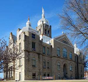 Johnson County Courthouse in Warrensburg | |
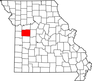 Location within the U.S. state of Missouri | |
 Missouri's location within the U.S. | |
| Coordinates: 38°45′N 93°49′W | |
| Country | |
| State | |
| Founded | December 13, 1834 |
| Named for | Richard M. Johnson |
| Seat | Warrensburg |
| Largest city | Warrensburg |
| Area | |
| • Total | 833 sq mi (2,160 km2) |
| • Land | 829 sq mi (2,150 km2) |
| • Water | 3.9 sq mi (10 km2) 0.5% |
| Population (2010) | |
| • Total | 52,595 |
| • Estimate (2018) | 53,652 |
| • Density | 63/sq mi (24/km2) |
| Time zone | UTC−6 (Central) |
| • Summer (DST) | UTC−5 (CDT) |
| Congressional district | 4th |
| Website | www |
Johnson County comprises the Warrensburg Micropolitan Statistical Area, which is also included in the Kansas City-Overland Park-Kansas City, MO-KS Combined Statistical Area.
Geography
According to the U.S. Census Bureau, the county has a total area of 833 square miles (2,160 km2), of which 829 square miles (2,150 km2) is land and 3.9 square miles (10 km2) (0.5%) is water.[5]
Adjacent counties
- Lafayette County (north)
- Pettis County (east)
- Henry County (south)
- Cass County (west)
- Jackson County (northwest)
Demographics
| Historical population | |||
|---|---|---|---|
| Census | Pop. | %± | |
| 1840 | 4,471 | — | |
| 1850 | 7,464 | 66.9% | |
| 1860 | 14,614 | 95.8% | |
| 1870 | 24,648 | 68.7% | |
| 1880 | 28,172 | 14.3% | |
| 1890 | 28,132 | −0.1% | |
| 1900 | 27,843 | −1.0% | |
| 1910 | 26,297 | −5.6% | |
| 1920 | 24,899 | −5.3% | |
| 1930 | 22,413 | −10.0% | |
| 1940 | 21,617 | −3.6% | |
| 1950 | 20,716 | −4.2% | |
| 1960 | 28,981 | 39.9% | |
| 1970 | 34,172 | 17.9% | |
| 1980 | 39,059 | 14.3% | |
| 1990 | 42,514 | 8.8% | |
| 2000 | 48,258 | 13.5% | |
| 2010 | 52,595 | 9.0% | |
| Est. 2018 | 53,652 | [6] | 2.0% |
| U.S. Decennial Census[7] 1790-1960[8] 1900-1990[9] 1990-2000[10] 2010-2015[2] | |||
As of the census[11] of 2000, there were 48,258 people, 17,410 households, and 11,821 families residing in the county. The population density was 58 people per square mile (22/km²). There were 18,886 housing units at an average density of 23 per square mile (9/km²). The racial makeup of the county was 90.12% White, 4.33% Black or African American, 0.65% Native American, 1.43% Asian, 0.13% Pacific Islander, 1.29% from other races, and 2.05% from two or more races. Approximately 2.92% of the population were Hispanic or Latino of any race.
There were 17,410 households out of which 35.10% had children under the age of 18 living with them, 55.90% were married couples living together, 8.50% had a female householder with no husband present, and 32.10% were non-families. 22.70% of all households were made up of individuals and 7.10% had someone living alone who was 65 years of age or older. The average household size was 2.58 and the average family size was 3.07.
In the county, the population was spread out with 25.10% under the age of 18, 20.20% from 18 to 24, 27.60% from 25 to 44, 17.80% from 45 to 64, and 9.30% who were 65 years of age or older. The median age was 28 years. For every 100 females there were 101.90 males. For every 100 females age 18 and over, there were 100.40 males.
The median income for a household in the county was $35,391, and the median income for a family was $43,050. Males had a median income of $28,901 versus $21,376 for females. The per capita income for the county was $16,037. About 9.50% of families and 14.90% of the population were below the poverty line, including 15.20% of those under age 18 and 10.80% of those age 65 or over.
Education
Public schools
- Chilhowee R-IV School District – Chilhowee
- Chilhowee Elementary School (P–6)
- Chilhowee High School (7–12)
- Holden R-III School District – Holden
- Holden Elementary School (P–5)
- Holden Intermediate School (3–5)
- Holden Middle School (6–8)
- Holden High School (9–12)
- Johnson County R-VII School District – Centerview
- Crest Ridge Elementary School (P–5)
- Crest Ridge Middle School (6–8)
- Crest Ridge High School (9–12)
- Kingsville R-I School District – Kingsville
- Kingsville Elementary School (K–6)
- Kingsville High School (7–12)
- Knob Noster R-VIII School District – Knob Noster
- Knob Noster Elementary School (P–5)
- Whiteman Air Force Base Elementary School (P–5) – Whiteman
- Knob Noster Middle School (6–8)
- Knob Noster High School (9–12)
- Leeton R-X School District – Leeton
- Leeton Elementary School (P–5)
- Leeton Middle School (6–8)
- Leeton High School (9–12)
- Warrensburg R-VI School District – Warrensburg
- Reese Early Childhood Education Center
- Maple Grove Elementary School (P–2)
- Ridge View Elementary School (P–2)
- Martin Warren Elementary School (3–5)
- Sterling Elementary School (3–5)
- Warrensburg Middle School (6–8)
- Warrensburg High School (9–12)
- Warrensburg Area Career Center
Private schools
- Johnson County Christian Academy – Centerview (K–9) – Nondenominational Christian
Post-secondary
- University of Central Missouri – Warrensburg – A public, four-year university
Politics
Local
The Republican Party predominantly controls politics at the local level in Johnson County. Republicans hold all but two of the elected positions in the county.
| Johnson County, Missouri | ||||
|---|---|---|---|---|
| Elected countywide officials | ||||
| Assessor | Mark Reynolds | Republican | ||
| Circuit Clerk | Stephanie Elkins | Democratic | ||
| County Clerk | Diane Thompson | Republican | ||
| Collector | Ruthane Small | Democratic | ||
| Commissioner (Presiding) |
William H. Gabel | Republican | ||
| Commissioner (District 1) |
John Marr | Republican | ||
| Commissioner (District 2) |
Charles Kavanaugh | Republican | ||
| Coroner | Clark Holdren | Republican | ||
| Prosecuting Attorney | Rob Russell | Republican | ||
| Public Administrator | Nancy Jo Jennings | Republican | ||
| Recorder | Stormy Taylor | Republican | ||
| Sheriff | Scott Munsterman | Republican | ||
| Surveyor | Sam King | Republican | ||
| Treasurer | Heather Reynolds | Republican | ||
State
| Year | Republican | Democratic | Third Parties |
|---|---|---|---|
| 2016 | 56.88% 12,040 | 39.38% 8,335 | 3.74% 793 |
| 2012 | 45.67% 9,484 | 50.22% 10,428 | 4.11% 853 |
| 2008 | 43.29% 9,367 | 53.88% 11,658 | 2.82% 613 |
| 2004 | 53.54% 10,767 | 44.55% 8,958 | 1.91% 384 |
| 2000 | 49.27% 8,219 | 47.75% 7,964 | 2.98% 497 |
| 1996 | 34.65% 5,024 | 62.63% 9,082 | 2.72% 394 |
Johnson County is divided into four legislative districts in the Missouri House of Representatives, all of which are held by Republicans.
- District 51 — Dean Dohrman (R-La Monte). Consists of the eastern half of the city of Warrensburg.
| Party | Candidate | Votes | % | ± | |
|---|---|---|---|---|---|
| Republican | Dean Dohrman | 3,713 | 67.39% | +13.82 | |
| Democratic | John Cozort | 1,797 | 32.61% | -7.99 | |
| Party | Candidate | Votes | % | ± | |
|---|---|---|---|---|---|
| Republican | Dean Dohrman | 1,792 | 53.57% | +4.43 | |
| Democratic | Gary L. Grigsby | 1,358 | 40.60% | -5.70 | |
| Libertarian | Bill Wayne | 195 | 5.83% | +1.27 | |
| Party | Candidate | Votes | % | ± | |
|---|---|---|---|---|---|
| Republican | Dean Dohrman | 2,611 | 49.14% | ||
| Democratic | Gary L. Grigsby | 2,460 | 46.30% | ||
| Libertarian | Bill Wayne | 242 | 4.56% | ||
- District 52 — Nathan Beard (R-Sedalia). Consists of the community of Knob Noster, and Whiteman Air Force Base.
| Party | Candidate | Votes | % | ± | |
|---|---|---|---|---|---|
| Republican | Nathan Beard | 1,189 | 69.74% | -30.26 | |
| Democratic | Kyle Garner | 516 | 30.26% | +30.26 | |
| Party | Candidate | Votes | % | ± | |
|---|---|---|---|---|---|
| Republican | Nathan Beard | 711 | 100.00% | +34.18 | |
| Party | Candidate | Votes | % | ± | |
|---|---|---|---|---|---|
| Republican | Stanley Cox | 986 | 65.82% | ||
| Democratic | Phyllis Sue Domann | 512 | 34.18% | ||
- District 53 — Glen Kolkmeyer (R-Odessa). Consists of the northern section of the county.
| Party | Candidate | Votes | % | ± | |
|---|---|---|---|---|---|
| Republican | Glen Kolkmeyer | 582 | 100.00% | +34.36 | |
| Party | Candidate | Votes | % | ± | |
|---|---|---|---|---|---|
| Republican | Glen Kolkmeyer | 235 | 65.64% | +5.33 | |
| Democratic | Henry Grubb | 123 | 34.36% | -5.33 | |
| Party | Candidate | Votes | % | ± | |
|---|---|---|---|---|---|
| Republican | Glen Kolkmeyer | 383 | 60.31% | ||
| Democratic | Holmes Osborne | 252 | 39.69% | ||
- District 54 — Dan Houx (R- Warrensburg). Consists of western half of the city of Warrensburg and the communities of Centerview, Chilhowee, Holden, Kingsville, La Tour, and Leeton.
| Party | Candidate | Votes | % | ± | |
|---|---|---|---|---|---|
| Republican | Dan Houx | 8,316 | 65.41% | -12.70 | |
| Democratic | Bob Gregory | 3,549 | 27.92% | +27.92 | |
| Libertarian | Steve Daugherty | 848 | 6.67% | +6.67 | |
| Party | Candidate | Votes | % | ± | |
|---|---|---|---|---|---|
| Republican | Denny Hoskins | 5,279 | 78.11% | +17.44 | |
| Constitution | Daniel Plemons | 1,479 | 21.89% | +21.89 | |
| Party | Candidate | Votes | % | ± | |
|---|---|---|---|---|---|
| Republican | Denny Hoskins | 7,753 | 60.67% | ||
| Democratic | Nancy Maxwell | 3,885 | 30.40% | ||
| Independent | Eddie Osborne | 1,140 | 8.92% | ||
All of Johnson County is a part of Missouri’s 21st District in the Missouri Senate and is currently represented by Denny Hoskins (R-Warrensburg).
| Party | Candidate | Votes | % | ± | |
|---|---|---|---|---|---|
| Republican | Denny Hoskins | 14,641 | 70.46% | -2.70 | |
| Democratic | ElGene Ver Dught | 5,028 | 24.20% | +1.64 | |
| Libertarian | Bill Wayne | 1,110 | 5.34% | +1.07 | |
| Party | Candidate | Votes | % | ± | |
|---|---|---|---|---|---|
| Republican | David Pearce | 14,983 | 73.16% | ||
| Democratic | ElGene Ver Dught | 4,621 | 22.56% | ||
| Libertarian | Steven Hedrick | 875 | 4.27% | ||
Federal
| Party | Candidate | Votes | % | ± | |
|---|---|---|---|---|---|
| Republican | Roy Blunt | 11,611 | 54.88% | +13.41 | |
| Democratic | Jason Kander | 8,315 | 39.30% | -9.80 | |
| Libertarian | Jonathan Dine | 714 | 3.37% | -6.06 | |
| Green | Johnathan McFarland | 268 | 1.27% | +1.27 | |
| Constitution | Fred Ryman | 248 | 1.17% | +1.17 | |
| Party | Candidate | Votes | % | ± | |
|---|---|---|---|---|---|
| Republican | Todd Akin | 8,613 | 41.47% | ||
| Democratic | Claire McCaskill | 10,197 | 49.10% | ||
| Libertarian | Jonathan Dine | 1,959 | 9.43% | ||
All of Johnson County is included in Missouri’s 4th Congressional District and is currently represented by Vicky Hartzler (R-Harrisonville) in the U.S. House of Representatives.
| Party | Candidate | Votes | % | ± | |
|---|---|---|---|---|---|
| Republican | Vicky Hartzler | 14,102 | 67.63% | -0.14 | |
| Democratic | Gordon Christensen | 5,584 | 26.78% | +1.05 | |
| Libertarian | Mark Bliss | 1,167 | 5.59% | -0.91 | |
| Party | Candidate | Votes | % | ± | |
|---|---|---|---|---|---|
| Republican | Vicky Hartzler | 7,770 | 67.77% | +7.59 | |
| Democratic | Nate Irvin | 2,950 | 25.73% | -9.05 | |
| Libertarian | Herschel L. Young | 745 | 6.50% | +2.48 | |
| Party | Candidate | Votes | % | ± | |
|---|---|---|---|---|---|
| Republican | Vicky Hartzler | 12,356 | 60.18% | ||
| Democratic | Teresa Hensley | 7,140 | 34.78% | ||
| Libertarian | Thomas Holbrook | 825 | 4.02% | ||
| Constitution | Greg Cowan | 209 | 1.02% | ||
Political culture
Johnson is a solidly Republican county. The last Democrat to carry Johnson county was Bill Clinton in 1992.
| Year | Republican | Democratic | Third parties |
|---|---|---|---|
| 2016 | 64.2% 13,719 | 27.8% 5,930 | 8.0% 1,713 |
| 2012 | 60.7% 12,763 | 36.5% 7,667 | 2.8% 591 |
| 2008 | 55.2% 12,183 | 42.9% 9,480 | 1.9% 417 |
| 2004 | 60.6% 12,257 | 38.5% 7,790 | 0.9% 189 |
| 2000 | 55.6% 9,339 | 41.3% 6,926 | 3.1% 522 |
| 1996 | 43.1% 6,276 | 42.7% 6,220 | 14.3% 2,078 |
| 1992 | 33.1% 5,032 | 36.5% 5,546 | 30.4% 4,625 |
| 1988 | 58.1% 7,512 | 41.6% 5,373 | 0.3% 36 |
| 1984 | 66.5% 8,413 | 33.5% 4,238 | |
| 1980 | 51.2% 6,449 | 43.2% 5,441 | 5.5% 695 |
| 1976 | 49.1% 5,513 | 49.5% 5,551 | 1.4% 156 |
| 1972 | 70.4% 7,228 | 29.6% 3,044 | |
| 1968 | 51.8% 4,834 | 37.3% 3,484 | 10.9% 1,018 |
| 1964 | 40.4% 4,348 | 59.6% 6,412 | |
| 1960 | 59.7% 6,970 | 40.3% 4,712 | |
| 1956 | 59.3% 6,599 | 40.7% 4,530 | |
| 1952 | 61.8% 6,990 | 38.0% 4,294 | 0.2% 23 |
| 1948 | 50.0% 4,903 | 49.9% 4,888 | 0.1% 14 |
| 1944 | 57.3% 5,949 | 42.6% 4,419 | 0.1% 10 |
| 1940 | 54.2% 6,468 | 45.6% 5,441 | 0.2% 19 |
| 1936 | 47.9% 5,797 | 52.0% 6,294 | 0.2% 22 |
| 1932 | 38.4% 4,088 | 60.9% 6,481 | 0.7% 76 |
| 1928 | 61.9% 7,032 | 38.0% 4,316 | 0.2% 19 |
| 1924 | 47.7% 5,248 | 50.2% 5,526 | 2.1% 232 |
| 1920 | 50.7% 5,700 | 48.4% 5,444 | 1.0% 108 |
| 1916 | 43.8% 2,966 | 54.7% 3,701 | 1.5% 100 |
| 1912 | 27.0% 1,772 | 52.9% 3,468 | 20.1% 1,319 |
| 1908 | 45.4% 2,997 | 52.8% 3,483 | 1.7% 115 |
| 1904 | 46.6% 2,989 | 51.1% 3,277 | 2.4% 153 |
| 1900 | 44.8% 3,051 | 53.0% 3,612 | 2.2% 153 |
| 1896 | 42.9% 3,219 | 56.5% 4,240 | 0.6% 48 |
| 1892 | 41.3% 2,667 | 48.1% 3,109 | 10.6% 685 |
| 1888 | 46.3% 2,895 | 50.9% 3,183 | 2.7% 171 |
Missouri presidential preference primary (2008)
- Former U.S. Senator Hillary Clinton (D-New York) received more votes, a total of 2,548, than any candidate from either party in Johnson County during the 2008 presidential primary.
| Johnson County, Missouri | |
|---|---|
| 2008 Republican primary in Missouri | |
| John McCain | 1,558 (36.22%) |
| Mike Huckabee | 1,303 (30.30%) |
| Mitt Romney | 1,149 (26.71%) |
| Ron Paul | 204 (4.74%) |
| Johnson County, Missouri | |
|---|---|
| 2008 Democratic primary in Missouri | |
| Hillary Clinton | 2,548 (53.22%) |
| Barack Obama | 2,062 (43.07%) |
| John Edwards (withdrawn) | 147 (3.07%) |
Communities
Cities
- Chilhowee
- Kingsville
- Knob Noster
- Leeton
- Warrensburg (county seat)
Villages
Census-designated places
Other unincorporated places
See also
- List of counties in Missouri
- Missouri census statistical areas
- National Register of Historic Places listings in Johnson County, Missouri
References
- https://www.census.gov/quickfacts/johnsoncountymissouri
- "State & County QuickFacts". United States Census Bureau. Archived from the original on June 21, 2011. Retrieved September 9, 2013.
- "Find a County". National Association of Counties. Archived from the original on 2011-05-31. Retrieved 2011-06-07.
- Gannett, Henry (1905). The Origin of Certain Place Names in the United States. Govt. Print. Off. pp. 169.
- "2010 Census Gazetteer Files". United States Census Bureau. August 22, 2012. Archived from the original on October 21, 2013. Retrieved November 16, 2014.
- "Population and Housing Unit Estimates". Retrieved November 20, 2019.
- "U.S. Decennial Census". United States Census Bureau. Retrieved November 16, 2014.
- "Historical Census Browser". University of Virginia Library. Retrieved November 16, 2014.
- "Population of Counties by Decennial Census: 1900 to 1990". United States Census Bureau. Retrieved November 16, 2014.
- "Census 2000 PHC-T-4. Ranking Tables for Counties: 1990 and 2000" (PDF). United States Census Bureau. Retrieved November 16, 2014.
- "U.S. Census website". United States Census Bureau. Retrieved 2008-01-31.
- Breeding, Marshall. "Holden Public Library". Libraries.org. Retrieved May 8, 2017.
- Breeding, Marshall. "Trails Regional Library". Libraries.org. Retrieved May 8, 2017.
- Leip, David. "Dave Leip's Atlas of U.S. Presidential Elections". uselectionatlas.org. Retrieved 2018-03-25.
Further reading
- Cockrell, Ewing. History of Johnson County, Missouri (1918) online
External links
- Digitized 1930 Plat Book of Johnson County from University of Missouri Division of Special Collections, Archives, and Rare Books
Places adjacent to Johnson County, Missouri | ||||||||||
|---|---|---|---|---|---|---|---|---|---|---|
| ||||||||||
Municipalities and communities of Johnson County, Missouri, United States | ||
|---|---|---|
| Cities | Map of Missouri highlighting Johnson County | |
| Townships | ||
| CDPs | ||
| Unincorporated communities | ||
| Footnotes | ‡This populated place also has portions in an adjacent county or counties | |

| Authority control |
|
|---|