Lewis County, Missouri
Lewis County is a county located in the northeastern portion of the U.S. state of Missouri. As of the 2010 census, the population was 10,211.[1] Its county seat is Monticello.[2] The county was organized January 2, 1833 and named for Meriwether Lewis, the explorer and Governor of the Louisiana Territory.[3]
Lewis County | |
|---|---|
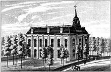
 Lewis County Courthouse in Monticello | |
 Location within the U.S. state of Missouri | |
 Missouri's location within the U.S. | |
| Coordinates: 40°05′N 91°44′W | |
| Country | |
| State | |
| Founded | January 2, 1833 |
| Named for | Meriwether Lewis |
| Seat | Monticello |
| Largest city | Canton |
| Area | |
| • Total | 511 sq mi (1,320 km2) |
| • Land | 505 sq mi (1,310 km2) |
| • Water | 5.8 sq mi (15 km2) 1.1% |
| Population (2010) | |
| • Total | 10,211 |
| • Estimate (2018) | 9,855 |
| • Density | 20/sq mi (7.7/km2) |
| Time zone | UTC−6 (Central) |
| • Summer (DST) | UTC−5 (CDT) |
| Congressional district | 6th |
| Website | lewiscountymo |
Lewis County is part of the Quincy, IL–MO Micropolitan Statistical Area.
Geography
According to the U.S. Census Bureau, the county has a total area of 511 square miles (1,320 km2), of which 505 square miles (1,310 km2) is land and 5.8 square miles (15 km2) (1.1%) is water.[4]
Adjacent counties
- Clark County (north)
- Hancock County, Illinois (northeast)
- Adams County, Illinois (southeast)
- Marion County (south)
- Shelby County (southwest)
- Knox County (west)
Demographics
| Historical population | |||
|---|---|---|---|
| Census | Pop. | %± | |
| 1840 | 6,040 | — | |
| 1850 | 6,578 | 8.9% | |
| 1860 | 12,286 | 86.8% | |
| 1870 | 15,114 | 23.0% | |
| 1880 | 15,925 | 5.4% | |
| 1890 | 15,935 | 0.1% | |
| 1900 | 16,724 | 5.0% | |
| 1910 | 15,514 | −7.2% | |
| 1920 | 13,465 | −13.2% | |
| 1930 | 12,093 | −10.2% | |
| 1940 | 11,490 | −5.0% | |
| 1950 | 10,733 | −6.6% | |
| 1960 | 10,984 | 2.3% | |
| 1970 | 10,993 | 0.1% | |
| 1980 | 10,901 | −0.8% | |
| 1990 | 10,233 | −6.1% | |
| 2000 | 10,494 | 2.6% | |
| 2010 | 10,211 | −2.7% | |
| Est. 2018 | 9,855 | [5] | −3.5% |
| U.S. Decennial Census[6] 1790-1960[7] 1900-1990[8] 1990-2000[9] 2010-2015[1] | |||
As of the census[10] of 2010, there were 10,211 people, 3,956 households, and 2,709 families residing in the county. The population density was 21 people per square mile. The racial makeup of the county was 95.92% White, 2.53% Black or African American, 0.16% Native American, 0.20% Asian, 0.02% Pacific Islander, 0.44% from other races, and 0.73% from two or more races. Approximately 0.73% of the population were Hispanic or Latino of any race. 34.9% were of German, 18.3% American, 11.2% English and 10.8% Irish ancestry.
The average household size was 2.46 and the average family size was 3.00. In the county, the population was spread out with 25.00% under the age of 18, 12.90% from 18 to 24, 24.60% from 25 to 44, 21.40% from 45 to 64, and 16.10% who were 65 years of age or older and 51% of female population. The median age was 36 years.
Median income for a household in the county was $30,651, and the median income for a family was $35,740. Males had a median income of $27,778 versus $19,679 for females. The per capita income for the county was $14,746. 16.10% of the population and 10.70% of families were below the poverty line.
Education
Public schools
- Canton R-V School District – Canton
- Canton Elementary School (PK-06)
- Canton High School (07-12)
- Lewis County C-1 School District – Ewing
- Highland Elementary School (K-06)
- Highland Junior-Senior High School (07-12)
Private schools
- Cedar Falls School – Canton (K-12) – Nonsectarian
Post-secondary
- Culver-Stockton College Culver-Stockton College – Canton – A private, four-year Christian Church (Disciples of Christ) university.
Politics
Local
| Lewis County, Missouri | ||||
|---|---|---|---|---|
| Elected countywide officials | ||||
| Assessor | Tammy Logsdon | Republican | ||
| Circuit Clerk | Jan E. Geisendorfer | Democratic | ||
| County Clerk | *Chris Flanagan | Democratic | ||
| Collector | Denise Goodwin | Democratic | ||
| Commissioner (Presiding) |
Wayne Murphy, Jr. | Republican | ||
| Commissioner (District 1) |
Deanne Whiston | Republican | ||
| Commissioner (District 2) |
Travis Fleer | Republican | ||
| Coroner | Larry Arnold | Democratic | ||
| Prosecuting Attorney | Jules V. (Jake) DeCoster | Democratic | ||
| Public Administrator | Luke Barton | Republican | ||
| Recorder | Amy Parrish | Democratic | ||
| Sheriff | David T. Parrish | Democratic | ||
| Surveyor | Carson W. Lay | Republican | ||
| Treasurer | Bonnie Roberson | Republican | ||
Chris Flanagan was appointed to the position of County Clerk by Governor Jay Nixon. The office had previously been held by Regina Dredge.
State
| Year | Republican | Democratic | Third Parties |
|---|---|---|---|
| 2016 | 63.53% 2,815 | 33.65% 1,491 | 2.82% 125 |
| 2012 | 48.24% 2,046 | 49.54% 2,101 | 2.22% 94 |
| 2008 | 56.79% 2,533 | 41.05% 1,831 | 2.16% 96 |
| 2004 | 67.03% 3,084 | 31.32% 1,441 | 1.65% 76 |
| 2000 | 50.03% 2,224 | 48.46% 2,154 | 1.51% 67 |
| 1996 | 22.77% 948 | 75.23% 3,132 | 1.99% 83 |
All of Lewis County is included in Missouri’s 4th District in the Missouri House of Representatives and is represented by Craig Redmon (R-Canton).
| Party | Candidate | Votes | % | ± | |
|---|---|---|---|---|---|
| Republican | Craig Redmon | 3.998 | 100.00% | ||
| Party | Candidate | Votes | % | ± | |
|---|---|---|---|---|---|
| Republican | Craig Redmon | 2,450 | 100.00% | ||
| Party | Candidate | Votes | % | ± | |
|---|---|---|---|---|---|
| Republican | Craig Redmon | 3,869 | 100.00% | ||
All of Lewis County is a part of Missouri’s 18th District in the Missouri Senate and is currently represented by Brian Munzlinger (R-Williamstown).
| Party | Candidate | Votes | % | ± | |
|---|---|---|---|---|---|
| Republican | Brian Munzlinger | 2,363 | 100.00% | ||
Federal
| Party | Candidate | Votes | % | ± | |
|---|---|---|---|---|---|
| Republican | Roy Blunt | 2,732 | 61.84% | +14.89 | |
| Democratic | Jason Kander | 1,472 | 33.32% | -16.25 | |
| Libertarian | Jonathan Dine | 98 | 2.22% | -1.26 | |
| Green | Johnathan McFarland | 60 | 1.36% | +1.36 | |
| Constitution | Fred Ryman | 56 | 1.27% | +1.27 | |
| Party | Candidate | Votes | % | ± | |
|---|---|---|---|---|---|
| Republican | Todd Akin | 1,982 | 46.95% | ||
| Democratic | Claire McCaskill | 2,093 | 49.57% | ||
| Libertarian | Jonathan Dine | 147 | 3.48% | ||
All of Lewis County is included in Missouri’s 6th Congressional District and is currently represented by Sam Graves (R-Tarkio) in the U.S. House of Representatives.
| Party | Candidate | Votes | % | ± | |
|---|---|---|---|---|---|
| Republican | Sam Graves | 3,270 | 75.82% | +4.72 | |
| Democratic | David M. Blackwell | 899 | 20.84% | -5.49 | |
| Libertarian | Russ Lee Monchil | 88 | 2.04% | -0.53 | |
| Green | Mike Diel | 56 | 1.30% | +1.30 | |
| Party | Candidate | Votes | % | ± | |
|---|---|---|---|---|---|
| Republican | Sam Graves | 1,822 | 71.10% | +7.09 | |
| Democratic | Bill Hedge | 697 | 26.33% | -7.28 | |
| Libertarian | Russ Lee Monchil | 68 | 2.57% | +0.20 | |
| Party | Candidate | Votes | % | ± | |
|---|---|---|---|---|---|
| Republican | Sam Graves | 2,588 | 64.01% | ||
| Democratic | Kyle Yarber | 1,359 | 33.61% | ||
| Libertarian | Russ Lee Monchil | 96 | 2.37% | ||
| Year | Republican | Democratic | Third parties |
|---|---|---|---|
| 2016 | 74.6% 3,344 | 20.9% 934 | 4.5% 202 |
| 2012 | 62.6% 2,677 | 35.2% 1,508 | 2.2% 94 |
| 2008 | 57.6% 2,594 | 40.8% 1,837 | 1.6% 71 |
| 2004 | 61.6% 2,862 | 37.8% 1,754 | 0.6% 28 |
| 2000 | 53.3% 2,388 | 45.1% 2,023 | 1.6% 73 |
| 1996 | 34.8% 1,453 | 49.1% 2,050 | 16.1% 673 |
| 1992 | 32.0% 1,461 | 48.1% 2,196 | 19.8% 905 |
| 1988 | 42.2% 1,803 | 57.6% 2,460 | 0.2% 10 |
| 1984 | 55.2% 2,438 | 44.8% 1,977 | |
| 1980 | 49.1% 2,350 | 48.3% 2,314 | 2.6% 125 |
| 1976 | 44.1% 1,983 | 55.3% 2,486 | 0.6% 28 |
| 1972 | 61.8% 2,738 | 38.2% 1,695 | |
| 1968 | 43.9% 2,038 | 44.5% 2,067 | 11.6% 537 |
| 1964 | 27.4% 1,239 | 72.6% 3,281 | |
| 1960 | 48.4% 2,560 | 51.6% 2,726 | |
| 1956 | 45.8% 2,301 | 54.3% 2,728 | |
| 1952 | 45.4% 2,416 | 54.4% 2,896 | 0.2% 8 |
| 1948 | 33.1% 1,564 | 66.7% 3,155 | 0.3% 12 |
| 1944 | 40.7% 1,988 | 59.1% 2,883 | 0.2% 11 |
| 1940 | 40.9% 2,428 | 58.6% 3,484 | 0.5% 30 |
| 1936 | 33.8% 1,994 | 65.4% 3,859 | 0.9% 50 |
| 1932 | 26.1% 1,341 | 72.8% 3,746 | 1.1% 56 |
| 1928 | 48.6% 2,741 | 51.0% 2,882 | 0.4% 23 |
| 1924 | 39.5% 2,416 | 56.9% 3,481 | 3.7% 223 |
| 1920 | 43.9% 2,810 | 55.3% 3,542 | 0.8% 53 |
| 1916 | 37.3% 1,429 | 61.5% 2,357 | 1.2% 47 |
| 1912 | 26.7% 1,004 | 62.3% 2,340 | 11.0% 414 |
| 1908 | 36.9% 1,473 | 61.1% 2,439 | 2.0% 81 |
| 1904 | 39.1% 1,467 | 58.7% 2,202 | 2.3% 85 |
| 1900 | 35.1% 1,442 | 62.8% 2,583 | 2.1% 87 |
| 1896 | 37.3% 1,581 | 61.9% 2,624 | 0.9% 36 |
| 1892 | 35.5% 1,322 | 59.6% 2,220 | 4.9% 183 |
| 1888 | 38.1% 1,412 | 61.3% 2,268 | 0.6% 23 |
Missouri presidential preference primary (2008)
- Former U.S. Senator Hillary Clinton (D-New York) received more votes, a total of 619, than any candidate from either party in Lewis County during the 2008 presidential primary.
| Lewis County, Missouri | |
|---|---|
| 2008 Republican primary in Missouri | |
| John McCain | 279 (34.23%) |
| Mike Huckabee | 286 (35.09%) |
| Mitt Romney | 197 (24.17%) |
| Ron Paul | 32 (3.93%) |
| Lewis County, Missouri | |
|---|---|
| 2008 Democratic primary in Missouri | |
| Hillary Clinton | 619 (53.50%) |
| Barack Obama | 476 (41.14%) |
| John Edwards (withdrawn) | 44 (3.80%) |
| Uncommitted | 11 (0.95%) |
Communities
- Canton
- Durham
- Ewing
- La Belle
- La Grange
- Lewistown
- Maywood
- Monticello (county seat)
- Steffenville
- Williamstown
References
- "State & County QuickFacts". United States Census Bureau. Archived from the original on June 7, 2011. Retrieved September 10, 2013.
- "Find a County". National Association of Counties. Retrieved 2011-06-07.
- Eaton, David Wolfe (1916). How Missouri Counties, Towns and Streams Were Named. The State Historical Society of Missouri. pp. 185.
- "2010 Census Gazetteer Files". United States Census Bureau. August 22, 2012. Archived from the original on September 13, 2014. Retrieved November 16, 2014.
- "Population and Housing Unit Estimates". Retrieved November 18, 2019.
- "U.S. Decennial Census". United States Census Bureau. Retrieved November 16, 2014.
- "Historical Census Browser". University of Virginia Library. Retrieved November 16, 2014.
- "Population of Counties by Decennial Census: 1900 to 1990". United States Census Bureau. Retrieved November 16, 2014.
- "Census 2000 PHC-T-4. Ranking Tables for Counties: 1990 and 2000" (PDF). United States Census Bureau. Retrieved November 16, 2014.
- "U.S. Census website". United States Census Bureau. Retrieved 2008-01-31.
- Breeding, Marshall. "Canton Public Library". Libraries.org. Retrieved May 8, 2017.
- Breeding, Marshall. "Labelle Branch Library". Libraries.org. Retrieved May 8, 2017.
- Breeding, Marshall. "Lagrange Branch Library". Libraries.org. Retrieved May 8, 2017.
- Leip, David. "Dave Leip's Atlas of U.S. Presidential Elections". uselectionatlas.org. Retrieved 2018-03-25.
External links
- Lewis County website (provided by University of Missouri Extension)
- Digitized 1930 Plat Book of Lewis County from University of Missouri Division of Special Collections, Archives, and Rare Books
Places adjacent to Lewis County, Missouri | ||||||||||
|---|---|---|---|---|---|---|---|---|---|---|
| ||||||||||
Municipalities and communities of Lewis County, Missouri, United States | ||
|---|---|---|
| Cities | Map of Missouri highlighting Lewis County | |
| Village | ||
| Townships | ||
| Unincorporated communities | ||
| Ghost town | ||

| Authority control |
|
|---|