Monroe County, Missouri
Monroe County is a county in northeast Missouri. As of the 2010 census, the population was 8,840.[1] Its county seat is Paris.[2] It is the birthplace of Mark Twain.
Monroe County | |
|---|---|
 The Monroe County Courthouse in Paris | |
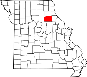 Location within the U.S. state of Missouri | |
 Missouri's location within the U.S. | |
| Coordinates: 39°30′N 92°00′W | |
| Country | |
| State | |
| Founded | January 6, 1831 |
| Named for | James Monroe |
| Seat | Paris |
| Largest city | Monroe City |
| Area | |
| • Total | 670 sq mi (1,700 km2) |
| • Land | 648 sq mi (1,680 km2) |
| • Water | 23 sq mi (60 km2) 3.4% |
| Population (2010) | |
| • Total | 8,840 |
| • Estimate (2018) | 8,664 |
| • Density | 13/sq mi (5.1/km2) |
| Time zone | UTC−6 (Central) |
| • Summer (DST) | UTC−5 (CDT) |
| Congressional district | 6th |
| Website | www |
History
The county was organized January 6, 1831[3] and named for James Monroe, the fifth President of the United States.[4]
Monroe County was one of several along the Missouri River settled by migrants from the Upper South, especially Kentucky and Tennessee. They brought slaves and slaveholding traditions with them and quickly started cultivating crops similar to those in Middle Tennessee and Kentucky: hemp and tobacco. They also brought characteristic antebellum architecture and culture. The county was at the heart of what was called Little Dixie.[5]
Geography
According to the U.S. Census Bureau, the county has a total area of 670 square miles (1,700 km2), of which 648 square miles (1,680 km2) is land and 23 square miles (60 km2) (3.4%) is water.[6]
Adjacent counties
- Shelby County (north)
- Marion County (northeast)
- Ralls County (east)
- Audrain County (south)
- Randolph County (west)
Major highways
Demographics
| Historical population | |||
|---|---|---|---|
| Census | Pop. | %± | |
| 1840 | 9,505 | — | |
| 1850 | 10,541 | 10.9% | |
| 1860 | 14,785 | 40.3% | |
| 1870 | 17,149 | 16.0% | |
| 1880 | 19,071 | 11.2% | |
| 1890 | 20,790 | 9.0% | |
| 1900 | 19,716 | −5.2% | |
| 1910 | 18,304 | −7.2% | |
| 1920 | 16,414 | −10.3% | |
| 1930 | 13,466 | −18.0% | |
| 1940 | 13,195 | −2.0% | |
| 1950 | 11,314 | −14.3% | |
| 1960 | 10,688 | −5.5% | |
| 1970 | 9,542 | −10.7% | |
| 1980 | 9,716 | 1.8% | |
| 1990 | 9,104 | −6.3% | |
| 2000 | 9,311 | 2.3% | |
| 2010 | 8,840 | −5.1% | |
| Est. 2018 | 8,664 | [7] | −2.0% |
| U.S. Decennial Census[8] 1790-1960[9] 1900-1990[10] 1990-2000[11] 2010-2015[1] | |||
As of the census[12] of 2010, there were 8,840 people, 3,656 households, and 2,566 families residing in the county. The population density was 14 inhabitants per square mile (5.4/km2). There were 4,565 housing units at an average density of 7 per square mile (2.7/km2). The racial makeup of the county was 94.66% White, 3.83% Black or African American, 0.41% Native American, 0.12% Asian, 0.03% Pacific Islander, 0.16% from other races, and 0.78% from two or more races. Approximately 0.56% of the population were Hispanic or Latino of any race. 24.7% were of German, 23.2% American, 14.2% English and 11.8% Irish ancestry.
There were 3,656 households out of which 31.60% had children under the age of 18 living with them, 59.10% were married couples living together, 7.70% had a female householder with no husband present, and 29.80% were non-families. 26.50% of all households were made up of individuals and 12.90% had someone living alone who was 65 years of age or older. The average household size was 2.50 and the average family size was 3.02.
In the county, the population was spread out with 25.90% under the age of 18, 7.30% from 18 to 24, 25.00% from 25 to 44, 24.20% from 45 to 64, and 17.60% who were 65 years of age or older. The median age was 39 years. For every 100 females there were 96.40 males. For every 100 females age 18 and over, there were 93.10 males.
The median income for a household in the county was $30,871, and the median income for a family was $36,895. Males had a median income of $26,534 versus $20,440 for females. The per capita income for the county was $14,695. About 8.30% of families and 11.90% of the population were below the poverty line, including 14.00% of those under age 18 and 10.30% of those age 65 or over.
Government and politics
Local
The Democratic Party used to control politics at the local, state and federal levels in Monroe County. Democrats still hold all but three of the elected positions in the county; however, starting in 2006, in federal and state elections, Republican candidates have won more contested races in the November general elections than their Democrat foes in Monroe County.
Monroe County voters have selected Republican candidates over Democrats in 11 straight general election races for U.S. congress (1998-2018), the last eight U.S. Senate races (2000-2018 ), five continuous presidential contests (2000-2016), three of four gubernatorial elections, four of six state senate races. Three straight state auditor races (2010-2018). In 2014, for the first time in history, a GOP candidate for the state house of representatives, Jim Hansen, defeated a Democrat in a contested general election. In 2016, for the first time in history, Ron Staggs, a Republican, was elected to a county office when he defeated a Democrat opponent for western commissioner. In 2018 two Republicans were elected to county offices: Talley Kendrick, the first Republican to run unopposed in a general election won as prosecuting attorney, and Lori Decker won a contested election for recorder.
In the 2008 general election, notwithstanding the secretary of state’s race, for the first time in history, Monroe Countians gave a plurality to every Republican candidate for federal and state offices, on the ballot, that had a Democrat opponent. Four years later, in the 2012 election, Republican candidates won six of eight state-wide state and federal races, and one was lost by five votes out of more than 4,000 cast. In November 2016, 2018 every Republican for federal and state office, on the county ballot, defeated their Democrat opponent.
In the April 2016 presidential primary, Republicans out voted Democrats more than 3-to-1, 1,600 votes in the GOP primary compared to 495 in the Democrat, and more Republican votes than Democrat were cast in the 2020 presidential primary. In 2016’s August primary, Republicans out voted Democrats 895 to 698; in the 2018 August primary, Republicans out voted Democrats 1,621 votes to 854.
| Monroe County, Missouri | ||||
|---|---|---|---|---|
| Elected countywide officials | ||||
| Assessor | Angela Baker | Democratic | ||
| Circuit Clerk | Heather D. Wheeler | Democratic | ||
| County Clerk | Christine Buie | Democratic | ||
| Collector | Chrissy Graupman | Democratic | ||
| Commissioner (Presiding) |
Michael Minor | Democratic | ||
| Commissioner (District 1) |
Mike Whelan | Democratic | ||
| Commissioner (District 2) |
Ron Staggs | Republican | ||
| Coroner | James K. Reinhard | Democratic | ||
| Prosecuting Attorney | Talley Kendrick | Republican | ||
| Public Administrator | Marguerite Jones | Democratic | ||
| Recorder | Lori Decker | Republican | ||
| Sheriff | J. David Hoffman | Democratic | ||
| Surveyor | Zach Cooper | Democratic | ||
| Treasurer | Shelia Jurgesmyer | Democratic | ||
State
| Year | Republican | Democratic | Third Parties |
|---|---|---|---|
| 2016 | 64.44% 2,659 | 33.13% 1,367 | 2.42% 100 |
| 2012 | 48.55% 1,948 | 48.68% 1,953 | 2.77% 111 |
| 2008 | 56.97% 2,459 | 41.94% 1,810 | 1.09% 47 |
| 2004 | 60.00% 2,576 | 38.90% 1,670 | 1.10% 47 |
| 2000 | 44.08% 1,801 | 54.19% 2,214 | 1.73% 71 |
| 1996 | 27.51% 1,053 | 70.72% 2,707 | 1.78% 68 |
Monroe County is divided into two representative districts in the Missouri House of Representatives, both represented by Republicans.
- District 5 — Lindell F. Shumake (R-Hannibal). Consists of Monroe City and the northern part of the county.
| Party | Candidate | Votes | % | ± | |
|---|---|---|---|---|---|
| Republican | Lindell F. Shumake | 782 | 74.33% | +5.35 | |
| Democratic | O. C. Latta | 270 | 25.67% | -5.35 | |
| Party | Candidate | Votes | % | ± | |
|---|---|---|---|---|---|
| Republican | Lindell F. Shumake | 367 | 68.98% | +27.93 | |
| Democratic | C. Leroy Deichman | 165 | 31.02% | -27.93 | |
| Party | Candidate | Votes | % | ± | |
|---|---|---|---|---|---|
| Republican | Lindell F. Shumake | 429 | 41.05% | ||
| Democratic | Tom Shively | 616 | 58.95% | ||
- District 40 – Jim Hansen (R-Frankford). Consists of the communities of Florida, Holliday, Madison, Paris, Santa Fe, and Stoutsville.
| Party | Candidate | Votes | % | ± | |
|---|---|---|---|---|---|
| Republican | Jim Hansen | 2,598 | 100.00% | +27.01 | |
| Party | Candidate | Votes | % | ± | |
|---|---|---|---|---|---|
| Republican | Jim Hansen | 1,208 | 72.99% | +36.82 | |
| Democratic | Lowell Jackson | 447 | 27.01% | -36.82 | |
| Party | Candidate | Votes | % | ± | |
|---|---|---|---|---|---|
| Republican | Jim Hansen | 1,080 | 36.17% | ||
| Democratic | Paul Quinn | 1,906 | 63.83% | ||
Monroe County is a part of Missouri’s 10th District in the Missouri Senate and is currently represented by Jeanie Riddle (R-Fulton).
| Party | Candidate | Votes | % | ± | |
|---|---|---|---|---|---|
| Republican | Jeanie Riddle | 1,599 | 71.55% | ||
| Democratic | Ed Schieffer | 620 | 28.45% | ||
Federal
| Party | Candidate | Votes | % | ± | |
|---|---|---|---|---|---|
| Republican | Roy Blunt | 2,584 | 62.89% | +15.00 | |
| Democratic | Jason Kander | 1,330 | 32.39% | -14.77 | |
| Libertarian | Jonathan Dine | 105 | 2.55% | -2.40 | |
| Green | Johnathan McFarland | 48 | 1.69% | +1.69 | |
| Constitution | Fred Ryman | 42 | 1.02% | +1.02 | |
| Party | Candidate | Votes | % | ± | |
|---|---|---|---|---|---|
| Republican | Todd Akin | 1,917 | 47.89% | ||
| Democratic | Claire McCaskill | 1,888 | 47.16% | ||
| Libertarian | Jonathan Dine | 198 | 4.95% | ||
Monroe County is included in Missouri's 6th congressional district and is currently represented by Sam Graves (R-Tarkio) in the U.S. House of Representatives.
| Party | Candidate | Votes | % | ± | |
|---|---|---|---|---|---|
| Republican | Sam Graves | 2,955 | 74.15% | +0.82 | |
| Democratic | David M. Blackwell | 899 | 22.56% | -1.81 | |
| Libertarian | Russ Lee Monchil | 94 | 2.36% | +0.06 | |
| Green | Mike Diel | 37 | 0.93% | +0.93 | |
| Party | Candidate | Votes | % | ± | |
|---|---|---|---|---|---|
| Republican | Sam Graves | 1,592 | 73.33% | +10.41 | |
| Democratic | Bill Hedge | 529 | 24.37% | -10.38 | |
| Libertarian | Russ Lee Monchil | 50 | 2.30% | +0.02 | |
| Party | Candidate | Votes | % | ± | |
|---|---|---|---|---|---|
| Republican | Sam Graves | 2,410 | 62.92% | ||
| Democratic | Kyle Yarber | 1,331 | 34.75% | ||
| Libertarian | Russ Lee Monchil | 89 | 2.32% | ||
Political culture
Monroe County was one of only two jurisdictions in Missouri to be carried by Democrat George McGovern in the 1972 presidential election against incumbent Republican President Richard Nixon, the other being the city of St. Louis. Monroe County was first carried by a Republican in 1976 by John Danforth in the U.S. Senate race. In 1984, Ronald Reagan became the first Republican candidate for president to win the county. Since 2000, the county has voted Republican in federal and state elections.
| Year | Republican | Democratic | Third parties |
|---|---|---|---|
| 2016 | 76.0% 3,159 | 20.5% 853 | 3.5% 144 |
| 2012 | 63.2% 2,564 | 34.5% 1,398 | 2.3% 95 |
| 2008 | 58.7% 2,533 | 39.5% 1,703 | 1.8% 78 |
| 2004 | 61.1% 2,632 | 38.2% 1,647 | 0.7% 28 |
| 2000 | 53.1% 2,175 | 45.4% 1,860 | 1.4% 59 |
| 1996 | 34.8% 1,333 | 50.6% 1,938 | 14.6% 560 |
| 1992 | 27.5% 1,153 | 49.2% 2,060 | 23.3% 974 |
| 1988 | 38.4% 1,542 | 61.3% 2,461 | 0.3% 11 |
| 1984 | 52.1% 2,163 | 47.9% 1,992 | |
| 1980 | 44.5% 2,026 | 53.7% 2,445 | 1.8% 84 |
| 1976 | 34.1% 1,585 | 65.4% 3,039 | 0.6% 26 |
| 1972 | 48.2% 2,141 | 51.8% 2,299 | |
| 1968 | 29.1% 1,349 | 59.8% 2,776 | 11.1% 516 |
| 1964 | 18.5% 928 | 81.6% 4,103 | |
| 1960 | 27.5% 1,519 | 72.5% 4,011 | |
| 1956 | 23.2% 1,331 | 76.8% 4,412 | |
| 1952 | 23.8% 1,488 | 76.1% 4,760 | 0.2% 11 |
| 1948 | 14.5% 809 | 85.4% 4,769 | 0.1% 7 |
| 1944 | 18.0% 1,098 | 81.9% 5,000 | 0.1% 8 |
| 1940 | 16.6% 1,200 | 83.2% 6,018 | 0.2% 13 |
| 1936 | 12.8% 939 | 86.9% 6,376 | 0.3% 25 |
| 1932 | 21.5% 1,714 | 77.9% 6,210 | 0.6% 44 |
| 1928 | 21.7% 1,378 | 78.0% 4,957 | 0.3% 19 |
| 1924 | 16.5% 1,141 | 81.0% 5,597 | 2.5% 172 |
| 1920 | 18.4% 1,406 | 80.4% 6,136 | 1.2% 93 |
| 1916 | 16.2% 742 | 81.6% 3,738 | 2.2% 101 |
| 1912 | 13.0% 583 | 80.2% 3,586 | 6.7% 301 |
| 1908 | 18.6% 871 | 80.6% 3,772 | 0.8% 38 |
| 1904 | 18.2% 790 | 80.2% 3,487 | 1.7% 72 |
| 1900 | 16.3% 795 | 82.4% 4,016 | 1.4% 66 |
| 1896 | 16.9% 892 | 82.7% 4,379 | 0.4% 23 |
| 1892 | 16.6% 787 | 81.3% 3,863 | 2.1% 100 |
| 1888 | 20.1% 983 | 79.2% 3,873 | 0.8% 37 |
Missouri presidential preference primary (2016)
In the April 2016 presidential primary, Republicans out voted Democrats more than 3-to-1, 1,600 votes in the GOP primary compared to 495 in the Democrat. In 2016's August primary, Republicans outvoted Democrats 895 to 698.
| Monroe County, Missouri | |
|---|---|
| 2008 Republican primary in Missouri | |
| John McCain | 221 (27.59%) |
| Mike Huckabee | 300 (37.45%) |
| Mitt Romney | 231 (28.84%) |
| Ron Paul | 32 (4.00%) |
| Monroe County, Missouri | |
|---|---|
| 2008 Democratic primary in Missouri | |
| Hillary Clinton | 590 (52.73%) |
| Barack Obama | 444 (39.68%) |
| John Edwards (withdrawn) | 68 (6.08%) |
| Uncommitted | 9 (0.80%) |
Education
Public schools
- Holliday C-2 School District – Holliday
- Holliday Elementary School (K-08)
- Madison C-3 School District – Madison
- Madison Elementary School (PK-06)
- Madison High School (07-12)
- Middle Grove C-1 School District – Madison
- Middle Grove Elementary School (K-08)
- Monroe City R-I School District – Monroe City
- Monroe City Elementary School (PK-04)
- Monroe City Middle School (05-08)
- Monroe City High School (09-12)
- Paris R-II School District – Paris
- Paris Elementary School (PK-06)
- Paris Junior High School (07-08)
- Paris High School (09-12)
Private schools
- Holy Rosary School – Monroe City (K-09) – Roman Catholic
- Foundation for Life Christian School – Paris (PK-12) – Nondenominational Christian
Public libraries
- Monroe City Public Library[14]
Cities and towns
- Florida
- Holliday
- Madison
- Middle Grove
- Monroe City (partly in Marion County and a small part in Ralls County)
- Paris (county seat)
- Santa Fe
- Stoutsville
Notable people
- Mark Twain, American author and humorist, was born in Monroe County. The Mark Twain Birthplace State Historic Site in Mark Twain State Park commemorates this occasion.[15]
- Xenophon Overton Pindall, member of the Arkansas House of Representatives, Arkansas State Senate and Acting Governor of the U.S. state of Arkansas[16]
- Eli C. D. Shortridge, third Governor of North Dakota from 1893 to 1895' raised in Monroe County.[17]
References
- "State & County QuickFacts". United States Census Bureau. Archived from the original on June 7, 2011. Retrieved September 10, 2013.
- "Find a County". National Association of Counties. Retrieved 2011-06-07.
- Smiley, W. L. (1876). An illustrated historical atlas of Monroe County, Missouri, 1876. Philadelphia: Edwards Brothers. p. 8. Archived from the original on 2016-03-12. Retrieved 2014-11-25.
- Gannett, Henry (1905). The Origin of Certain Place Names in the United States. U.S. Government Printing Office. p. 212.
- The Story of Little Dixie, Missouri, Missouri Division, Sons of Confederate Veterans Archived 2012-07-17 at the Wayback Machine, accessed 3 June 2008
- "2010 Census Gazetteer Files". United States Census Bureau. August 22, 2012. Archived from the original on October 21, 2013. Retrieved November 16, 2014.
- "Population and Housing Unit Estimates". Retrieved November 15, 2019.
- "U.S. Decennial Census". United States Census Bureau. Retrieved November 16, 2014.
- "Historical Census Browser". University of Virginia Library. Retrieved November 16, 2014.
- "Population of Counties by Decennial Census: 1900 to 1990". United States Census Bureau. Retrieved November 16, 2014.
- "Census 2000 PHC-T-4. Ranking Tables for Counties: 1990 and 2000" (PDF). United States Census Bureau. Retrieved November 16, 2014.
- "U.S. Census website". United States Census Bureau. Retrieved 2008-01-31.
- Leip, David. "Dave Leip's Atlas of U.S. Presidential Elections". uselectionatlas.org. Retrieved 2018-03-25.
- Breeding, Marshall. "Monroe City Public Library". Libraries.org. Retrieved May 8, 2017.
- "Mark Twain Birthplace State Historical Site". Missouri State Parks. Retrieved August 18, 2012.
- "Arkansas Governor Xenophon Overton Pindall". National Governors Association. Retrieved August 18, 2012.
- "North Dakota Governor Eli C. D. Shortridge". National Governors Association. Retrieved September 29, 2012.
External links
- Digitized 1930 Plat Book of Monroe County from University of Missouri Division of Special Collections, Archives, and Rare Books
- Monroe County Sheriff's Office
Places adjacent to Monroe County, Missouri | ||||||||||
|---|---|---|---|---|---|---|---|---|---|---|
| ||||||||||
Municipalities and communities of Monroe County, Missouri, United States | ||
|---|---|---|
| Cities | Map of Missouri highlighting Monroe County | |
| Villages | ||
| Townships | ||
| Unincorporated communities | ||
| Footnotes | ‡This populated place also has portions in an adjacent county or counties | |

| Authority control |
|
|---|