Dallas County, Missouri
Dallas County is a county located in the U.S. state of Missouri. As of the 2010 census, the population was 16,777.[1] Its county seat is Buffalo.[2] The county was organized in 1842 as Niangua County and then renamed in 1844 for George M. Dallas, who served as Vice President under James K. Polk.[3][4]
Dallas County | |
|---|---|
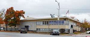 Dallas County Courthouse in Buffalo | |
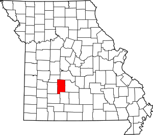 Location within the U.S. state of Missouri | |
 Missouri's location within the U.S. | |
| Coordinates: 37°40′N 93°01′W | |
| Country | |
| State | |
| Founded | December 10, 1844 |
| Named for | George M. Dallas |
| Seat | Buffalo |
| Largest city | Buffalo |
| Area | |
| • Total | 543 sq mi (1,410 km2) |
| • Land | 541 sq mi (1,400 km2) |
| • Water | 2.1 sq mi (5 km2) 0.4% |
| Population (2010) | |
| • Total | 16,777 |
| • Estimate (2018) | 16,762 |
| • Density | 31/sq mi (12/km2) |
| Time zone | UTC−6 (Central) |
| • Summer (DST) | UTC−5 (CDT) |
| Congressional district | 4th |
Dallas County is part of the Springfield, MO Metropolitan Statistical Area.
Geography
According to the U.S. Census Bureau, the county has a total area of 543 square miles (1,410 km2), of which 541 square miles (1,400 km2) is land and 2.1 square miles (5.4 km2) (0.4%) is water.[5]
Adjacent counties
- Camden County (north)
- Laclede County (east)
- Webster County (south)
- Greene County (southwest)
- Polk County (west)
- Hickory County (northwest)
Demographics
| Historical population | |||
|---|---|---|---|
| Census | Pop. | %± | |
| 1850 | 3,648 | — | |
| 1860 | 5,892 | 61.5% | |
| 1870 | 8,383 | 42.3% | |
| 1880 | 9,263 | 10.5% | |
| 1890 | 12,647 | 36.5% | |
| 1900 | 13,903 | 9.9% | |
| 1910 | 13,181 | −5.2% | |
| 1920 | 12,033 | −8.7% | |
| 1930 | 10,541 | −12.4% | |
| 1940 | 11,523 | 9.3% | |
| 1950 | 10,392 | −9.8% | |
| 1960 | 9,314 | −10.4% | |
| 1970 | 10,054 | 7.9% | |
| 1980 | 12,096 | 20.3% | |
| 1990 | 12,646 | 4.5% | |
| 2000 | 15,661 | 23.8% | |
| 2010 | 16,777 | 7.1% | |
| Est. 2018 | 16,762 | −0.1% | |
| U.S. Decennial Census[6] 1790-1960[7] 1900-1990[8] 1990-2000[9] 2010-2015[1] 2018[10] | |||
As of the census[11] of 2000, there were 15,661 people, 6,030 households, and 4,383 families residing in the county. The population density was 29 people per square mile (11/km²). There were 6,914 housing units at an average density of 13 per square mile (5/km²). The racial makeup of the county was 97.45% White, 0.12% Black or African American, 0.76% Native American, 0.07% Asian, 0.03% Pacific Islander, 0.20% from other races, and 1.37% from two or more races. Approximately 0.94% of the population were Hispanic or Latino of any race. 3.57% percent reported speaking Pennsylvania German or German at home. Dallas County is the county with the largest concentration of Kauffman Amish Mennonites, who have preserved Pennsylvania German as their every day language and an old form of Standard German for church. They had 950 adherents in Dallas County in 2010.[12]
There were 6,030 households out of which 32.90% had children under the age of 18 living with them, 60.80% were married couples living together, 8.40% had a female householder with no husband present, and 27.30% were non-families. 23.70% of all households were made up of individuals and 11.60% had someone living alone who was 65 years of age or older. The average household size was 2.57 and the average family size was 3.04.
In the county, the population was spread out with 27.50% under the age of 18, 7.40% from 18 to 24, 26.40% from 25 to 44, 23.50% from 45 to 64, and 15.20% who were 65 years of age or older. The median age was 38 years. For every 100 females, there were 98.30 males. For every 100 females age 18 and over, there were 95.70 males.
The median income for a household in the county was $27,346, and the median income for a family was $33,500. Males had a median income of $26,438 versus $17,569 for females. The per capita income for the county was $15,106. About 14.20% of families and 17.90% of the population were below the poverty line, including 25.40% of those under age 18 and 18.50% of those age 65 or over.
Education
Politics
Local
The Republican Party predominantly controls politics at the local level in Dallas County. Republicans hold all of the elected positions in the county.
| Dallas County, Missouri | ||||
|---|---|---|---|---|
| Elected countywide officials | ||||
| Assessor | Sue Doty | Republican | ||
| Circuit Clerk | Susan Potter | Republican | ||
| County Clerk | Pam Louderbaugh | Republican | ||
| Collector | Sheryl Ferrell | Republican | ||
| Commissioner (Presiding) |
Kevin D. Sharpe | Republican | ||
| Commissioner (District 1) |
Pete Barclay | Republican | ||
| Commissioner (District 2) |
Owen Kjar | Republican | ||
| Coroner | Lamont Swanson | Republican | ||
| Prosecuting Attorney | Jonathan Barker | Republican | ||
| Public Administrator | Carol Johnson | Republican | ||
| Recorder | Stacy Satterfield | Republican | ||
| Sheriff | Scott Rice | Republican | ||
| Surveyor | Greg Maynard | Republican | ||
| Treasurer | Becky Schofield | Republican | ||
State
| Year | Republican | Democratic | Third Parties |
|---|---|---|---|
| 2016 | 66.67% 4,943 | 29.82% 2,211 | 3.51% 260 |
| 2012 | 53.42% 3,882 | 43.32% 3,148 | 3.26% 237 |
| 2008 | 41.92% 3,212 | 54.46% 4,173 | 3.61% 277 |
| 2004 | 65.01% 4,708 | 33.43% 2,421 | 1.56% 113 |
| 2000 | 55.16% 3,429 | 42.99% 2,672 | 1.85% 115 |
| 1996 | 54.60% 3,083 | 41.80% 2,360 | 3.60% 203 |
All of Dallas County is a part of Missouri’s 129th District in the Missouri House of Representatives and is represented by Sandy Crawford (R-Buffalo).
| Party | Candidate | Votes | % | ± | |
|---|---|---|---|---|---|
| Republican | Sandy Crawford | 6,375 | 87.97% | +5.72 | |
| Independent | Charles Mantranga | 872 | 12.03% | +12.03 | |
| Party | Candidate | Votes | % | ± | |
|---|---|---|---|---|---|
| Republican | Sandy Crawford | 3,003 | 82.25% | +5.34 | |
| Democratic | John L. Wilson | 648 | 17.75% | -5.34 | |
| Party | Candidate | Votes | % | ± | |
|---|---|---|---|---|---|
| Republican | Sandy Crawford | 5,523 | 76.91% | ||
| Democratic | John L. Wilson | 1,658 | 23.09% | ||
All of Dallas County is a part of Missouri’s 28th District in the Missouri Senate. The seat is currently vacant. The previous incumbent, Mike Parson, was elected Lieutenant Governor in 2016.
| Party | Candidate | Votes | % | ± | |
|---|---|---|---|---|---|
| Republican | Mike Parson | 3,132 | 100.00% | ||
Federal
| Party | Candidate | Votes | % | ± | |
|---|---|---|---|---|---|
| Republican | Roy Blunt | 5,101 | 68.67% | +19.84 | |
| Democratic | Jason Kander | 1,980 | 26.66% | -16.03 | |
| Libertarian | Jonathan Dine | 182 | 2.45% | -6.03 | |
| Green | Johnathan McFarland | 87 | 1.17% | +1.17 | |
| Constitution | Fred Ryman | 78 | 1.05% | +1.05 | |
| Party | Candidate | Votes | % | ± | |
|---|---|---|---|---|---|
| Republican | Todd Akin | 3,514 | 48.83% | ||
| Democratic | Claire McCaskill | 3,072 | 42.69% | ||
| Libertarian | Jonathan Dine | 610 | 8.48% | ||
All of Dallas County is included in Missouri's 4th Congressional District and is currently represented by Vicky Hartzler (R-Harrisonville) in the U.S. House of Representatives.
| Party | Candidate | Votes | % | ± | |
|---|---|---|---|---|---|
| Republican | Vicky Hartzler | 5,804 | 79.53% | +0.87 | |
| Democratic | Gordon Christensen | 1,192 | 16.33% | +0.21 | |
| Libertarian | Mark Bliss | 302 | 4.14% | -0.92 | |
| Party | Candidate | Votes | % | ± | |
|---|---|---|---|---|---|
| Republican | Vicky Hartzler | 2,875 | 78.66% | +7.03 | |
| Democratic | Nate Irvin | 589 | 16.12% | -7.69 | |
| Libertarian | Herschel L. Young | 185 | 5.06% | +2.38 | |
| Write-in | Greg A. Cowan | 6 | 0.16% | +0.16 | |
| Party | Candidate | Votes | % | ± | |
|---|---|---|---|---|---|
| Republican | Vicky Hartzler | 5,133 | 71.63% | ||
| Democratic | Teresa Hensley | 1,706 | 23.81% | ||
| Libertarian | Thomas Holbrook | 192 | 2.68% | ||
| Constitution | Greg A. Cowan | 135 | 1.88% | ||
Political culture
| Year | Republican | Democratic | Third parties |
|---|---|---|---|
| 2016 | 79.1% 5,895 | 17.1% 1,272 | 3.8% 286 |
| 2012 | 68.6% 4,992 | 29.2% 2,122 | 2.3% 165 |
| 2008 | 63.7% 4,895 | 34.6% 2,656 | 1.7% 132 |
| 2004 | 66.0% 4,788 | 33.2% 2,407 | 0.9% 64 |
| 2000 | 59.9% 3,723 | 37.2% 2,311 | 3.0% 185 |
| 1996 | 45.0% 2,554 | 40.1% 2,277 | 14.9% 843 |
| 1992 | 35.0% 2,116 | 41.9% 2,533 | 23.2% 1,402 |
| 1988 | 55.6% 2,898 | 44.0% 2,293 | 0.5% 26 |
| 1984 | 65.3% 3,577 | 34.7% 1,902 | |
| 1980 | 60.6% 3,297 | 37.0% 2,011 | 2.4% 130 |
| 1976 | 49.5% 2,430 | 50.0% 2,453 | 0.6% 27 |
| 1972 | 74.2% 3,120 | 25.8% 1,085 | |
| 1968 | 62.5% 2,835 | 27.3% 1,237 | 10.3% 465 |
| 1964 | 53.4% 2,268 | 46.7% 1,983 | |
| 1960 | 70.4% 3,522 | 29.6% 1,482 | |
| 1956 | 65.1% 2,987 | 34.9% 1,600 | |
| 1952 | 73.2% 3,459 | 26.6% 1,258 | 0.2% 9 |
| 1948 | 62.7% 2,695 | 37.0% 1,590 | 0.3% 11 |
| 1944 | 75.1% 3,232 | 24.7% 1,064 | 0.2% 10 |
| 1940 | 71.0% 3,859 | 28.8% 1,566 | 0.2% 10 |
| 1936 | 63.5% 3,066 | 36.2% 1,749 | 0.3% 13 |
| 1932 | 47.3% 1,958 | 51.8% 2,143 | 0.9% 35 |
| 1928 | 74.9% 2,835 | 24.6% 931 | 0.5% 17 |
| 1924 | 61.0% 2,188 | 36.4% 1,304 | 2.6% 93 |
| 1920 | 69.9% 2,665 | 28.9% 1,100 | 1.2% 46 |
| 1916 | 56.9% 1,428 | 40.7% 1,022 | 2.4% 59 |
| 1912 | 43.0% 1,051 | 35.6% 870 | 21.4% 522 |
| 1908 | 62.0% 1,609 | 36.8% 955 | 1.3% 33 |
| 1904 | 64.8% 1,711 | 30.2% 797 | 5.0% 132 |
| 1900 | 53.6% 1,506 | 44.0% 1,238 | 2.4% 68 |
| 1896 | 48.8% 1,466 | 50.7% 1,525 | 0.5% 16 |
| 1892 | 49.8% 1,174 | 24.8% 586 | 25.4% 599 |
| 1888 | 49.4% 1,169 | 29.8% 706 | 20.8% 493 |
Missouri presidential preference primary (2008)
- Former U.S. Senator Hillary Clinton (D-New York) received more votes, a total of 1,157, than any candidate from either party in Dallas County during the 2008 presidential primary. She narrowly edged out former Governor Mike Huckabee (R-Arkansas) by four votes.
| Dallas County, Missouri | |
|---|---|
| 2008 Republican primary in Missouri | |
| John McCain | 751 (30.39%) |
| Mike Huckabee | 1,153 (46.66%) |
| Mitt Romney | 428 (17.32%) |
| Ron Paul | 105 (4.25%) |
| Dallas County, Missouri | |
|---|---|
| 2008 Democratic primary in Missouri | |
| Hillary Clinton | 1,157 (63.75%) |
| Barack Obama | 581 (32.01%) |
| John Edwards (withdrawn) | 55 (3.03%) |
Communities
Village
Census-designated place
Other unincorporated places
Notable People
- Gary Lee Davis - Hollywood stunt actor
- Roy Meeker - professional baseball player
- Jack Shewmaker - Former President and COO of Walmart
See also
- National Register of Historic Places listings in Dallas County, Missouri
References
- "State & County QuickFacts". United States Census Bureau. Archived from the original on June 7, 2011. Retrieved September 8, 2013.
- "Find a County". National Association of Counties. Archived from the original on May 31, 2011. Retrieved 2011-06-07.
- "Disappearing Missouri Names". The Kansas City Star. March 19, 1911. p. 15. Retrieved August 15, 2014 – via Newspapers.com.

- Eaton, David Wolfe (1916). How Missouri Counties, Towns and Streams Were Named. The State Historical Society of Missouri. p. 283.
- "2010 Census Gazetteer Files". United States Census Bureau. August 22, 2012. Archived from the original on October 21, 2013. Retrieved November 15, 2014.
- "U.S. Decennial Census". United States Census Bureau. Retrieved November 15, 2014.
- "Historical Census Browser". University of Virginia Library. Retrieved November 15, 2014.
- "Population of Counties by Decennial Census: 1900 to 1990". United States Census Bureau. Retrieved November 15, 2014.
- "Census 2000 PHC-T-4. Ranking Tables for Counties: 1990 and 2000" (PDF). United States Census Bureau. Retrieved November 15, 2014.
- "QuickFacts. DallasCounty, Missouri". United States Census Bureau. Retrieved July 21, 2019.
- "U.S. Census website". United States Census Bureau. Retrieved 2011-05-14.
- Tampico Amish Mennonite Counties (2010) at the Association of Religion Data Archives.
- "County Results - State of Missouri - 2016 General Election - November 8, 2016 - Official Results". Missouri Secretary of State. December 12, 2016. Retrieved April 28, 2017.
- Leip, David. "Dave Leip's Atlas of U.S. Presidential Elections". uselectionatlas.org. Retrieved 2018-03-25.
Further reading
- History of Laclede, Camden, Dallas, Webster, Wright, Texas, Pulaski, Phelps, and Dent counties, Missouri (1889) full text
External links
- Digitized 1930 Plat Book of Dallas County from University of Missouri Division of Special Collections, Archives, and Rare Books
Places adjacent to Dallas County, Missouri | ||||||||||
|---|---|---|---|---|---|---|---|---|---|---|
| ||||||||||
Municipalities and communities of Dallas County, Missouri, United States | ||
|---|---|---|
| Cities | Map of Missouri highlighting Dallas County | |
| Village | ||
| Townships | ||
| CDP | ||
| Other unincorporated communities | ||
| Ghost towns | ||
| Footnotes | ‡This populated place also has portions in an adjacent county or counties | |

| Authority control |
|
|---|