Cole County, Missouri
Cole County is a county in the central part of the U.S. state of Missouri. As of the 2010 census, the population was 75,990.[1] Its county seat and largest city is Jefferson City, the state capital.[2] The county was organized November 16, 1820 and named after pioneer Captain Stephen Cole, an Indian fighter and pioneer settler, who built Cole's Fort in Boonville.[3]
Cole County | |
|---|---|
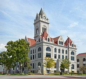 Cole County Courthouse in Jefferson City | |
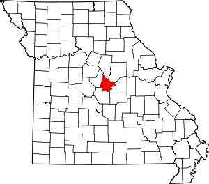 Location within the U.S. state of Missouri | |
 Missouri's location within the U.S. | |
| Coordinates: 38°31′N 92°17′W | |
| Country | |
| State | |
| Founded | 1820 |
| Named for | Stephen Cole |
| Seat | Jefferson City |
| Largest city | Jefferson City |
| Area | |
| • Total | 402 sq mi (1,040 km2) |
| • Land | 394 sq mi (1,020 km2) |
| • Water | 8.2 sq mi (21 km2) 2.0% |
| Population (2010) | |
| • Total | 75,990 |
| • Estimate (2018) | 76,796 |
| • Density | 190/sq mi (73/km2) |
| Time zone | UTC−6 (Central) |
| • Summer (DST) | UTC−5 (CDT) |
| Congressional district | 3rd |
| Website | www |
Cole County is in the Jefferson City, MO Metropolitan Statistical Area. It is south of the Missouri River.
In 2010, the center of the population of Missouri was in Cole County, near the village of Wardsville.[4]
Geography
According to the U.S. Census Bureau, the county has a total area of 402 square miles (1,040 km2), of which 394 square miles (1,020 km2) is land and 8.2 square miles (21 km2) (2.0%) is water.[5] It is the third-smallest county in Missouri by area.
Adjacent counties
- Boone County (north)
- Callaway County (northeast)
- Osage County (southeast)
- Miller County (southwest)
- Moniteau County (northwest)
Demographics
| Historical population | |||
|---|---|---|---|
| Census | Pop. | %± | |
| 1830 | 3,023 | — | |
| 1840 | 9,286 | 207.2% | |
| 1850 | 6,696 | −27.9% | |
| 1860 | 9,697 | 44.8% | |
| 1870 | 10,292 | 6.1% | |
| 1880 | 15,515 | 50.7% | |
| 1890 | 17,281 | 11.4% | |
| 1900 | 20,578 | 19.1% | |
| 1910 | 21,957 | 6.7% | |
| 1920 | 24,680 | 12.4% | |
| 1930 | 30,848 | 25.0% | |
| 1940 | 34,912 | 13.2% | |
| 1950 | 35,464 | 1.6% | |
| 1960 | 40,761 | 14.9% | |
| 1970 | 46,228 | 13.4% | |
| 1980 | 56,663 | 22.6% | |
| 1990 | 63,579 | 12.2% | |
| 2000 | 71,397 | 12.3% | |
| 2010 | 75,990 | 6.4% | |
| Est. 2018 | 76,796 | [6] | 1.1% |
| U.S. Decennial Census[7] 1790-1960[8] 1900-1990[9] 1990-2000[10] 2010-2015[1] | |||
As of the census[11] of 2000, there were 71,397 people, 27,040 households, and 17,927 families residing in the county. The population density was 182 people per square mile (70/km²). There were 28,915 housing units at an average density of 74 per square mile (29/km²). The racial makeup of the county was 87.06% White, 9.92% Black or African American, 0.33% Native American, 0.88% Asian, 0.04% Pacific Islander, 0.54% from other races, and 1.23% from two or more races. Approximately 1.28% of the population were Hispanic or Latino of any race. 40.1% were of German, 13.6% American, 7.8% English and 6.9% Irish ancestry.
There were 27,040 households out of which 33.60% had children under the age of 18 living with them, 53.00% were married couples living together, 10.00% had a female householder with no husband present, and 33.70% were non-families. 28.70% of all households were made up of individuals and 9.30% had someone living alone who was 65 years of age or older. The average household size was 2.43 and the average family size was 3.00.
In the county, the population was spread out with 24.20% under the age of 18, 9.80% from 18 to 24, 32.30% from 25 to 44, 22.40% from 45 to 64, and 11.30% who were 65 years of age or older. The median age was 36 years. For every 100 females, there were 105.60 males. For every 100 females age 18 and over, there were 106.50 males.
The median income for a household in the county was $42,924, and the median income for a family was $53,416. Males had a median income of $33,769 versus $25,189 for females. The per capita income for the county was $20,739. About 5.80% of families and 8.70% of the population were below the poverty line, including 11.50% of those under age 18 and 7.30% of those age 65 or over.
Government and infrastructure
The Missouri Department of Corrections (MDOC) operates the Jefferson City Correctional Center in Jefferson City.[12][13] The current JCCC was opened on September 15, 2004, replacing the Missouri State Penitentiary in Jefferson City.[12]
Education
Public schools
- Blair Oaks R-II School District – Jefferson City
- Blair Oaks Elementary School (K-04)
- Blair Oaks Middle School (05-08)
- Blair Oaks High School (09-12)
- Cole County R-I School District – Russellville
- Cole County R-I Elementary School (PK-05)
- Cole County R-I Middle School (06-08)
- Russellville High School (09-12)
- Cole County R-V School District – Eugene
- Eugene Elementary School (PK-06)
- Eugene High School (07-12)
- Jefferson City Public School District – Jefferson City
- Southwest Early Childhood Education Center (PK)
- Southwest Elementary School (K-05)
- Callaway Hills Elementary School (K-05) – Holts Summit
- South Elementary School (K-05)
- Thorpe J. Gordon Elementary School (K-05)
- East Elementary School (K-05)
- North Elementary School (K-05) – Holts Summit
- Cedar Hill Elementary School (K-05)
- West Elementary School (K-05)
- Moreau Heights Elementary School (K-05)
- Belair Elementary School (K-05)
- Pioneer Trail Elementary School (K-05)
- Clarence Lawson Elementary School (PK-05)
- Thomas Jefferson Middle School (06-08)
- Lewis & Clark Middle School (06-08)
- Simonsen Ninth Grade Center (09)
- Jefferson City High School (09-12)
Private schools
- Central Baptist Christian Academy – Jefferson City (K-12) – Baptist (Emphasis on Special Education)
- Concord Christian School – Jefferson City (K-06) – Baptist
- Immaculate Conception School – Jefferson City (K-09) – Roman Catholic
- Immanuel Lutheran School – Jefferson City (K-09) – Lutheran
- Kids in Montessori School – Jefferson City (K-02) – Nonsectarian
- Lighthouse Preparatory Academy – Jefferson City (06-12) – Nonsectarian
- Moreau Montessori School – Jefferson City (PK-05) – Nonsectarian
- St. Francis Xavier School – Taos (K-09) – Roman Catholic
- St. Joseph Cathedral School – Jefferson City (PK-08) – Roman Catholic
- St. Martin School – St. Martins (K-09) – Roman Catholic
- St. Peter Interparish School – Jefferson City (K-09) – Roman Catholic
- St. Stanislaus Catholic School – Wardsville (K-09) – Roman Catholic
- Trinity Lutheran School – Jefferson City (PK-09) – Lutheran
- [www.stthomasapostleschool.net/ St. Thomas The Apostle School] – Saint Thomas (K-09) – Roman Catholic
- Calvary Lutheran High School – Jefferson City (09-12) – Lutheran
- Helias Catholic High School – Jefferson City (09-12) – Roman Catholic
Post-secondary education
- Lincoln University – Jefferson City – A public, four-year historically black university.
Public libraries
- Missouri River Regional Library[14]
Politics
Local
The Republican Party predominantly controls politics at the local level in Cole County. Republicans hold all but one of the elected positions in the county. The only county-wide office held by a Democrat is that of Circuit Judge, currently held by Judge Patricia Joyce.
| Cole County, Missouri | ||||
|---|---|---|---|---|
| Elected countywide officials | ||||
| Assessor | Chris Estes | Republican | ||
| Circuit Clerk | Dawnel P. Davidson | Republican | ||
| County Clerk | Steve Korsmeyer | Republican | ||
| Collector | Larry Vincent | Republican | ||
| Commissioner (Presiding) |
Sam Bushman | Republican | ||
| Commissioner (District 1) |
Jeff Hoelscher | Republican | ||
| Commissioner (District 2) |
Kris Scheperle | Republican | ||
| Coroner | Carl R. Doerhoff | Independent | ||
| Prosecuting Attorney | William Locke Thompson | Republican | ||
| Public Administrator | Joseph Kuensting | Republican | ||
| Recorder | Ralph Bray | Republican | ||
| Sheriff | Gary Wheeler | Republican | ||
| Treasurer | Eric Peters | Republican | ||
State
| Year | Republican | Democratic | Third Parties |
|---|---|---|---|
| 2016 | 55.58% 20,872 | 42.09% 15,806 | 2.33% 877 |
| 2012 | 51.85% 19,099 | 45.64% 16,810 | 2.51% 926 |
| 2008 | 49.87% 19,285 | 48.98% 18,941 | 1.15% 447 |
| 2004 | 63.13% 23,147 | 36.08% 13,229 | 0.80% 292 |
| 2000 | 51.14% 16,673 | 47.23% 15,397 | 1.63% 532 |
| 1996 | 33.77% 9,902 | 63.80% 18,708 | 2.43% 713 |
Cole County is divided into five legislative districts in the Missouri House of Representatives, all of which elected Republicans (one is currently vacant).
- District 49 — Travis Fitzwater (R-Holts Summit). Consists of a small unincorporated area of the county just west of the city of Jefferson City.
| Party | Candidate | Votes | % | ± | |
|---|---|---|---|---|---|
| Republican | Travis Fitzwater | 918 | 100.00% | +35.66 | |
| Party | Candidate | Votes | % | ± | |
|---|---|---|---|---|---|
| Republican | Travis Fitzwater | 442 | 64.34% | -5.57 | |
| Democratic | Gracia Yancey Backer | 245 | 35.66% | +5.57 | |
| Party | Candidate | Votes | % | ± | |
|---|---|---|---|---|---|
| Republican | Jeanie Riddle | 704 | 69.91% | ||
| Democratic | Pam Murray | 303 | 30.09% | ||
- District 50 — (Currently vacant). Consists of unincorporated areas in the northwest corner of the county.
| Party | Candidate | Votes | % | ± | |
|---|---|---|---|---|---|
| Republican | Caleb Jones | 684 | 100.00% | ||
| Party | Candidate | Votes | % | ± | |
|---|---|---|---|---|---|
| Republican | Caleb Jones | 426 | 100.00% | 0.00 | |
| Party | Candidate | Votes | % | ± | |
|---|---|---|---|---|---|
| Republican | Caleb Jones | 611 | 100.00% | ||
- District 59 — Mike Bernskoetter (R-Jefferson City). Consists of the communities of Centertown, Eugene, Lohman, Russellville, St. Martins, Taos, and Wardsville.
| Party | Candidate | Votes | % | ± | |
|---|---|---|---|---|---|
| Republican | Mike Bernskoetter | 14,923 | 100.00% | ||
| Party | Candidate | Votes | % | ± | |
|---|---|---|---|---|---|
| Republican | Mike Bernskoetter | 8,396 | 88.59% | +7.84 | |
| Constitution | Michael Eberle | 1,081 | 11.41% | +11.41 | |
| Party | Candidate | Votes | % | ± | |
|---|---|---|---|---|---|
| Republican | Mike Bernskoetter | 12,604 | 80.75% | ||
| Democratic | Vonnieta Trickey | 3,005 | 19.25% | ||
- District 60 — Jay Barnes (R-Jefferson City) Consists of the city of Jefferson City.
| Party | Candidate | Votes | % | ± | |
|---|---|---|---|---|---|
| Republican | Jason (Jay) Barnes | 11,139 | 64.24% | -35.76 | |
| Democratic | Kevin Nelson | 6,202 | 35.76% | ||
| Party | Candidate | Votes | % | ± | |
|---|---|---|---|---|---|
| Republican | Jason (Jay) Barnes | 9,041 | 100.00% | -39.89 | |
| Party | Candidate | Votes | % | ± | |
|---|---|---|---|---|---|
| Republican | Jason (Jay) Barnes | 10,674 | 60.11% | ||
| Democratic | Thomas Minihan | 7.084 | 39.89% | ||
| Party | Candidate | Votes | % | ± | |
|---|---|---|---|---|---|
| Republican | Tom Hurst | 991 | 100.00% | ||
| Party | Candidate | Votes | % | ± | |
|---|---|---|---|---|---|
| Republican | Tom Hurst | 592 | 100.00% | -25.51 | |
| Party | Candidate | Votes | % | ± | |
|---|---|---|---|---|---|
| Republican | Tom Hurst | 765 | 74.49% | ||
| Democratic | Greg Stratman | 262 | 25.51% | ||
Cole County is a part of Missouri’s 6th District in the Missouri Senate and is currently represented by Mike Kehoe (R-Jefferson City).
| Party | Candidate | Votes | % | ± | |
|---|---|---|---|---|---|
| Republican | Mike Kehoe | 17,157 | 75.64% | ||
| Democratic | Mollie Kristen Freebairn | 5,526 | 24.36% | ||
Federal
| Party | Candidate | Votes | % | ± | |
|---|---|---|---|---|---|
| Republican | Roy Blunt | 21,940 | 58.54% | +6.77 | |
| Democratic | Jason Kander | 14,216 | 37.93% | -4.19 | |
| Libertarian | Jonathan Dine | 800 | 2.13% | -3.98 | |
| Green | Johnathan McFarland | 311 | 0.83% | +0.83 | |
| Constitution | Fred Ryman | 206 | 0.55% | +0.55 | |
| Write-in | Patrick Lee | 3 | 0.01% | +0.01 | |
| Party | Candidate | Votes | % | ± | |
|---|---|---|---|---|---|
| Republican | Todd Akin | 18,918 | 51.77 | ||
| Democratic | Claire McCaskill | 15,394 | 42.12 | ||
| Libertarian | Jonathan Dine | 2,233 | 6.11 | ||
All of Cole County is included in Missouri's 3rd congressional district and is currently represented by Blaine Luetkemeyer (R-Saint Elizabeth) in the U.S. House of Representatives.
| Party | Candidate | Votes | % | ± | |
|---|---|---|---|---|---|
| Republican | Blaine Luetkemeyer | 26,481 | 71.61% | -0.51 | |
| Democratic | Kevin Miller | 9,368 | 25.33% | +1.19 | |
| Libertarian | Dan Hogan | 815 | 2.20% | -1.54 | |
| Constitution | Doanita Simmons | 314 | 0.85% | +0.85 | |
| Party | Candidate | Votes | % | ± | |
|---|---|---|---|---|---|
| Republican | Blaine Luetkemeyer | 16,401 | 72.12% | +1.77 | |
| Democratic | Courtney Denton | 5,491 | 24.14% | -3.10 | |
| Libertarian | Steven Hedrick | 851 | 3.74% | +1.33 | |
| Write-in | Harold Davis | 1 | >0.00% | ||
| Party | Candidate | Votes | % | ± | |
|---|---|---|---|---|---|
| Republican | Blaine Luetkemeyer | 25,576 | 70.35% | ||
| Democratic | Eric C. Mayer | 9,901 | 27.24% | ||
| Libertarian | Steven Wilson | 877 | 2.41% | ||
Political culture
| Year | Republican | Democratic | Third parties |
|---|---|---|---|
| 2016 | 65.4% 24,616 | 29.0% 10,913 | 5.7% 2,127 |
| 2012 | 65.9% 24,490 | 32.3% 12,005 | 1.9% 695 |
| 2008 | 62.8% 24,385 | 36.0% 13,959 | 1.3% 490 |
| 2004 | 67.4% 24,752 | 32.0% 11,753 | 0.5% 196 |
| 2000 | 61.5% 20,167 | 36.8% 12,056 | 1.7% 552 |
| 1996 | 55.0% 16,140 | 37.0% 10,857 | 8.0% 2,345 |
| 1992 | 48.8% 15,270 | 32.6% 10,201 | 18.6% 5,833 |
| 1988 | 68.2% 18,023 | 31.6% 8,359 | 0.2% 59 |
| 1984 | 75.2% 20,366 | 24.8% 6,702 | |
| 1980 | 62.0% 16,373 | 34.9% 9,210 | 3.2% 840 |
| 1976 | 63.9% 14,370 | 35.3% 7,949 | 0.8% 184 |
| 1972 | 77.8% 16,685 | 22.2% 4,754 | |
| 1968 | 60.6% 11,575 | 31.0% 5,916 | 8.5% 1,625 |
| 1964 | 55.3% 10,068 | 44.7% 8,127 | |
| 1960 | 53.4% 9,763 | 46.6% 8,532 | |
| 1956 | 55.8% 9,323 | 44.2% 7,388 | |
| 1952 | 56.4% 9,700 | 43.6% 7,507 | 0.0% 3 |
| 1948 | 46.6% 6,909 | 53.2% 7,891 | 0.2% 25 |
| 1944 | 50.8% 7,364 | 49.2% 7,139 | 0.0% 4 |
| 1940 | 48.2% 7,664 | 51.7% 8,219 | 0.1% 9 |
| 1936 | 40.9% 6,180 | 58.5% 8,831 | 0.6% 95 |
| 1932 | 38.3% 5,636 | 61.6% 9,068 | 0.2% 27 |
| 1928 | 50.5% 6,637 | 49.4% 6,481 | 0.1% 15 |
| 1924 | 52.5% 6,205 | 42.6% 5,033 | 4.9% 583 |
| 1920 | 58.3% 5,878 | 41.3% 4,167 | 0.4% 36 |
| 1916 | 48.2% 2,746 | 51.1% 2,915 | 0.7% 42 |
| 1912 | 43.2% 2,103 | 50.3% 2,447 | 6.5% 316 |
| 1908 | 48.6% 2,402 | 50.4% 2,494 | 1.0% 48 |
| 1904 | 47.5% 2,081 | 51.2% 2,244 | 1.3% 58 |
| 1900 | 47.8% 2,157 | 51.5% 2,320 | 0.7% 32 |
| 1896 | 47.5% 2,033 | 51.4% 2,198 | 1.1% 46 |
| 1892 | 47.8% 1,752 | 50.3% 1,844 | 1.9% 68 |
| 1888 | 48.1% 1,708 | 51.4% 1,824 | 0.5% 17 |
Missouri presidential preference primary (2008)
- Former U.S. Senator and current President Barack Obama (D-Illinois) received more votes, a total of 4,642, than any candidate from either party in Cole County during the 2008 presidential primary. Cole County was one of only six counties (including the independent city of St. Louis) that backed Obama in Missouri.
| Cole County, Missouri | |
|---|---|
| 2008 Republican primary in Missouri | |
| John McCain | 2,982 (28.74%) |
| Mike Huckabee | 3,247 (31.30%) |
| Mitt Romney | 3,729 (35.95%) |
| Ron Paul | 227 (2.19%) |
| Cole County, Missouri | |
|---|---|
| 2008 Democratic primary in Missouri | |
| Hillary Clinton | 4,089 (45.07%) |
| Barack Obama | 4,642 (51.16%) |
| John Edwards (withdrawn) | 264 (2.91%) |
| Uncommitted | {{{uncommitted}}} |
Communities
Cities
- Jefferson City (county seat)
- Lohman
- Russellville
- St. Martins
- St. Thomas
- Taos
Villages
Unincorporated communities
References
- "State & County QuickFacts". United States Census Bureau. Retrieved September 7, 2013.
- "Find a County". National Association of Counties. Archived from the original on 2011-05-31. Retrieved 2011-06-07.
- Eaton, David Wolfe (1916). How Missouri Counties, Towns and Streams Were Named. The State Historical Society of Missouri. pp. 278.
- "Centers of Population by State:2010". United States Census Bureau. Archived from the original on January 3, 2014. Retrieved March 27, 2014.
- "2010 Census Gazetteer Files". United States Census Bureau. August 22, 2012. Archived from the original on October 21, 2013. Retrieved November 14, 2014.
- "Population and Housing Unit Estimates". Retrieved November 29, 2019.
- "U.S. Decennial Census". United States Census Bureau. Retrieved November 14, 2014.
- "Historical Census Browser". University of Virginia Library. Retrieved November 14, 2014.
- "Population of Counties by Decennial Census: 1900 to 1990". United States Census Bureau. Retrieved November 14, 2014.
- "Census 2000 PHC-T-4. Ranking Tables for Counties: 1990 and 2000" (PDF). United States Census Bureau. Retrieved November 14, 2014.
- "U.S. Census website". United States Census Bureau. Retrieved 2011-05-14.
- "Jefferson City Correctional Center." Missouri Department of Corrections. May 7, 2006. Retrieved on September 18, 2010.
- "MidMoGIS Mapping Website Archived 2011-07-18 at the Wayback Machine." City of Jefferson. Retrieved on September 18, 2010.
- Breeding, Marshall. "Missouri River Regional Library". Libraries.org. Retrieved May 8, 2017.
- "Cole County, Missouri, General Election". Cole County Clerk. November 8, 2016. Retrieved April 15, 2017.
- "Cole County, Missouri, General Election". Cole County Clerk. November 7, 2014. Retrieved April 8, 2016.
- "Cole County, Missouri, General Election". Cole County Clerk. November 8, 2012. Retrieved April 8, 2016.
- Leip, David. "Dave Leip's Atlas of U.S. Presidential Elections". uselectionatlas.org. Retrieved 2018-03-24.
Further reading
- History of Cole, Moniteau, Morgan, Benton, Miller, Maries and Osage counties, Missouri : from the earliest time to the present, including a department devoted to the preservation of sundry personal, business,professional and the private records; besides a valuable fund of notes, original observations, etc. etc. (1889) online
External links
- Cole County government's website
- Missouri River Regional Library
- Digitized 1930 Plat Book of Cole County from University of Missouri Division of Special Collections, Archives, and Rare Books
Places adjacent to Cole County, Missouri | ||||||||||
|---|---|---|---|---|---|---|---|---|---|---|
| ||||||||||
Municipalities and communities of Cole County, Missouri, United States | ||
|---|---|---|
| Cities | Map of Missouri highlighting Cole County | |
| Villages | ||
| Townships | ||
| Unincorporated communities | ||
| Ghost towns | ||
| Footnotes | ‡This populated place also has portions in an adjacent county or counties | |

| Authority control |
|
|---|